close
-
Layers w
- Weather Layers
- Pro
- Pro
- Pro
- Pro
- Pro
- Pro
- More Layers
- Pro
- Pro
- Pro
- Pro
-
Upgrade to

3D
Trail Conditions
- Unknown
- Snow Groomed
- Snow Packed
- Snow Covered
- Snow Cover Partial
- Freeze/thaw Cycle
- Icy
- Prevalent Mud
- Wet
- Variable
- Ideal
- Dry
- Very Dry
Trail Flow (Ridden Direction)
Trailforks scans users ridelogs to determine the most popular direction each trail is ridden. A good flowing trail network will have most trails flowing in a single direction according to their intension.
The colour categories are based on what percentage of riders are riding a trail in its intended direction.
The colour categories are based on what percentage of riders are riding a trail in its intended direction.
- > 96%
- > 90%
- > 80%
- > 70%
- > 50%
- < 50%
- bi-directional trail
- no data
Trail Last Ridden
Trailforks scans ridelogs to determine the last time a trail was ridden.
- < 2 days
- < 1 week
- < 2 weeks
- < 1 month
- < 6 months
- > 6 months
Trail Ridden Direction
The intended direction a trail should be ridden.
- Downhill Only
- Downhill Primary
- Both Directions
- Uphill Primary
- Uphill Only
- One Direction
Contribute Details
Colors indicate trail is missing specified detail.
- Description
- Photos
- Description & Photos
- Videos
Trail Popularity ?
Trailforks scans ridelogs to determine which trails are ridden the most in the last 9 months.
Trails are compared with nearby trails in the same city region with a possible 25 colour shades.
Think of this as a heatmap, more rides = more kinetic energy = warmer colors.
- most popular
- popular
- less popular
- not popular
ATV/ORV/OHV Filter
Max Vehicle Width
inches
US Cell Coverage
Legend

Radar Time
Activity Recordings
Trailforks uses anonymized public activity data.
?
Activity Recordings
Trailforks uses anonymized public activity data.
?
Personal Heatmap
▶
Activity Types
all
/
none
▶
Options
2
Date range
month
–
Winter Trails
Warning
A routing network for winter maps does not exist. Selecting trails using the winter trails layer has been disabled.
Missing Trails
Most Popular
Least Popular
Trails are colored based on popularity. The more popular a trail is, the more red. Less popular trails trend towards green.
Jump Magnitude Heatmap
Heatmap of where riders jump on trails. Zoom in to see individual jumps, click circles to view jump details.
BC Backroad Status
![map legend]()
Service Road Atlas is a free to use, community-driven service for viewing and creating reports on the numerous back-country service roads around B.C. and Alberta.

Slope Aspect
Direction the slope faces
Trails Deemphasized
Trails are shown in grey.
Only show trails with no bike usage.
Suggested Layers
Based on selected activity type
Save the current map location and zoom level as your default home location whenever this page is loaded.
SavePopular Trail Networks
view all areas »
No description for Monterey County has been added yet!
Login or register to submit one.
Activities Click to view
- Mountain Bike
341 trails
- E-Bike
135 trails
- Horse
116 trails
- Hike
545 trails
- Trail Running
542 trails
- ATV/ORV/OHV
5 trails
Stats
- Avg Trail Rating
- Trails (view details)
- 547
- Trails Mountain Bike
- 341
- Trails E-Bike
- 135
- Trails Gravel Bike
- 2
- Trails Adaptive Bike
- 2
- Trails Horse
- 116
- Trails Hike
- 545
- Trails Trail Running
- 542
- Trails Dirtbike/Moto
- 3
- Trails ATV/ORV/OHV
- 5
- Trails Snowmobile
- 1
- Trails Snowshoe
- 1
- Trails Backcountry Ski
- 1
- Trails Nordic Ski
- 1
- Total Distance
- 630 miles
- Total Descent
- 134,769 ft
- Total Vertical
- 4,903 ft
- Highest Trailhead
- 4,905 ft
- Reports
- 2,709
- Photos
- 2,220
- Ridden Counter
- 138,167
Articles
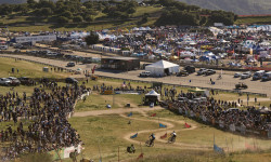
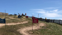
The Man Behind the Berms: Kyle Strait on Crafting Sea Otter’s Dual Slalom
Mar 7, 2025 from pinkbike.com
A look into the art, science, and challenges of building a track that works for everyone—from weekend warriors to world-class pros.
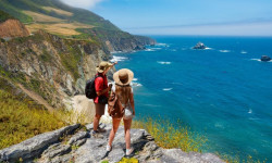
Wanna Hike in California? These Are the 13 Most Stunning Trails.
Jul 18, 2024 from outsideonline.com
A longtime Golden State hiker reveals her dream list of the most beautiful, must-see routes in California
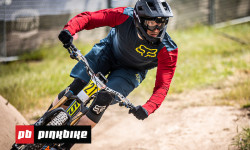
The Privateer: Back on Track at The First Enduro Race of the Season
Jul 4, 2019 from pinkbike.com
Adam heads to California for the first enduro race of the season at the Sea Otter Classic and then makes his way to Santa Cruz to ride with local...
Sub Regions
- Big Sur (10)
- Carmel Valley (12)
- Carmel-By-The-Sea (1)
- Greenfield (3)
- King City (2)
- Marina (104)
- Happy Trails (100)
- Monterey (180)
- Fort Ord National Monument (128)
- Laguna Seca (8)
- Toro Regional Park (32)
- Pacific Grove (11)
- Plaskett (7)
- Prewitt Ridge (5)
- Salinas (1)
- Seaside (1)
- Soledad (1)
Popular Monterey County Mountain Biking Trails
• 95 ★ 3.6 • 4,973 ft • 130 ft • 1,802 •
CYCLIST NOTES: This trail is normally ridden top to bottom but can be ridden in either direction. The upper section is a great example of grasslands of Fort Ord and is alive with flowers in the Spring (March to May). This is one of the...
• 100 ★ 3.9 • 5,131 ft • 79 ft • 1,721 •
Start out at with a gradual climb up into a grassy field between the trees. Drop down the hill and wind around through some Oaks and then Manzanita as you reach a knoll with a view. Cut across the hillside and climb a little more before...
• 100 ★ 3.7 • 1 mile • 22 ft • 1,636 •
CYCLIST NOTES: Drop off Lookout Ridge Rd and look out for loose gravel as you take the first right into the trees. From there is flows nicely down switching from wooded to manzanita and back as you descend toward Jacks Rd. Watch the...
• 100 ★ 4.3 • 3,583 ft • 0 ft • 1,476 •
This is a trail between the north section of Fort Ord National Monument and the south. This trail is HEAVILY used in both directions. It's fun and flowing but watch for uphill traffic. It starts in the Manzanita off and transitions to...
• 85 ★ 4.1 • 5,222 ft • 20 ft • 1,432 •
The top of the trail is through manzanita along an sandstone ridge (some of the rock has a reddish tint). Halfway down you'll transition from a machine built trail to a hand built trail as well as from brush to Oaks. Wind down through...
• 90 ★ 4.1 • 4,424 ft • 36 ft • 1,378 •
CYCLIST NOTES: This trail starts from "The Rock" and cuts along the hillside through the manzanita and then drops into the swale (valley) and winds through oaks. After winding through oaks a bit you will do a little climbing and then...
• 95 ★ 3.3 • 3,327 ft • 155 ft • 1,324 •
CYCLIST NOTES: This is a fun and flowing trail. Some of the turns are a bit sandy. NOTE: This is a popular trail for hikers/runners coming from the Creekside Trail Head. NATIONAL MONUMENT NOTES: This BLM managed trail is open from dawn...
• 95 ★ 3.8 • 1 mile • 325 ft • 1,269 •
CYCLIST NOTES: This is the north half of an important trail between the two main sections of the Fort Ord National Monument. It is both a nice gradual climb and a fun descent with some nice views, fun flowing sections and some sandy...
Monterey County Mountain Bike Routes
★ 5.0 • 28 miles • 2,918 ft • 21 • Loop •
A tour of most of the top singletrack at Fort Ord National Monument, including north, south, and central...
★ 3.5 • 8 miles • 774 ft • 7 •
Extremely fun beginner loop without any crazy long climbing, and hits some of the most fun trails in Fort...
15 miles • 2,074 ft • 531 • Loop •
This is a fun tour of the various trails connected to the parking lot, and a great introduction to Fort...
★ 4.0 • 10 miles • 1,168 ft • 10 • Loop •
Loop route that showcases much of the terrain at Fort Ord.
28 miles • 2,927 ft • 21 • Loop •
A tour of most of the top singletrack at Fort Ord National Monument, including north, south, and central...
16 miles • 1,286 ft • 9 • Loop •
A loop in Fort Order that includes a nice downhill of trail 50 and 82. There is a nice climb up trail 49...
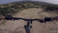
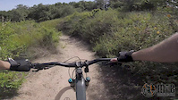
Photos of Monterey County Mountain Bike
Videos of Monterey County Mountain Bike
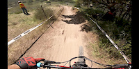
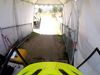
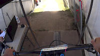
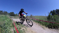
trail: Sea Otter Classic DH Course
0:24 |
2787 |
Jun 1, 2019
trail: Sea Otter Classic DH Course
3:42 |
608 |
May 30, 2019
trail: Trail 47
5:25 |
500 |
May 29, 2019
0:06 |
398 |
May 10, 2019
trail: Sea Otter Classic DH Course
2:47 |
878 |
Jul 15, 2018
trail: Sea Otter Classic DH Course
3:12 |
373 |
May 8, 2018
trail: Sea Otter Classic DH Course
4:10 |
150 |
Apr 25, 2018
trail: Sea Otter Classic DH Course
3:55 |
150 |
Apr 23, 2018
Recent Trail Reports
Activity Feed
| username | action | type | title | date |
|---|---|---|---|---|
| DrewO7HPG8 | comment | trail | activity #97439438 | Jun 20, 2026 @ 3:55pm 20 hours |
| LxXj9Q | wishlist | region | activity #97321584 | Jun 19, 2026 @ 8:55am 2 days |
| Biker6969haha | comment | trail | activity #97290242 | Jun 18, 2026 @ 7:01pm 3 days |
| LxXj9Q | wishlist | region | activity #97278766 | Jun 18, 2026 @ 3:20pm 3 days |
| jw314 | wishlist | route | activity #97256737 | Jun 18, 2026 @ 9:14am Jun 18, 2026 |
Recent Comments
| username | type | title | comment | date |
|---|---|---|---|---|
| trail | would be awesome if you could see the trail | Jun 20, 2026 @ 3:55pm 20 hours | ||
| trail | This trail needs to be legal ASAP, one of the... | Jun 18, 2026 @ 7:01pm 3 days | ||
| trail | This shouldn’t be marked as a mountain bike... | Jun 17, 2026 @ 6:49pm Jun 17, 2026 | ||
| trail | overgrowth made this awesome trail terrible | Jun 11, 2026 @ 9:59pm Jun 11, 2026 | ||
| trail | From Bushie flat. This is guttedit out.... | Jun 11, 2026 @ 2:16pm Jun 11, 2026 |
Local Badges
-

10 Green Trails6 awarded -

Big Ride 30k405 awarded -

Epic Ride 50k295 awarded -
Epic Ride 50k169 awarded -

Descent 10k Badge0 awarded -

Descent 100k Badge0 awarded
Bike & Skill Parks
| name | type | city | rating |
|---|---|---|---|
| Marina Pump Track | skill park | Marina | |
| Skills Zone | skill park | Monterey | |
| Kids' Zone | skill park | Monterey | |
| Dirt Jumps | skill park | Salinas | |
| Clear Creek SVRA | skill park | King City |
Upcoming Local Events
Activity Type Stats
| activitytype | trails | distance | descent | descent distance | total vertical | rating | global rank | state rank | photos | reports | routes | ridelogs |
|---|---|---|---|---|---|---|---|---|---|---|---|---|
| Mountain Bike | 341 | 341 miles | 66,004 ft | 169 miles | 4,879 ft | 2,178 | 2,687 | 68 | 79,948 | |||
| E-Bike | 135 | 148 miles | 24,639 ft | 78 miles | 3,763 ft | 26 | 2,348 | 10 | 9,110 | |||
| Gravel Bike | 2 | 7 | 2 | 459 | ||||||||
| Adaptive Bike | 2 | 5 | 29 | |||||||||
| Horse | 116 | 155 miles | 31,194 ft | 71 miles | 4,849 ft | 621 | 3 | 3 | ||||
| Hike | 545 | 615 miles | 126,089 ft | 272 miles | 4,905 ft | 17 | 2,674 | 3 | 9,609 | |||
| Trail Running | 542 | 612 miles | 125,705 ft | 270 miles | 4,905 ft | 1 | 2,672 | 4 | 4,917 | |||
| Dirtbike/Moto | 3 | 18 miles | 4,216 ft | 8 miles | 3,255 ft | 525 | 15 | |||||
| ATV/ORV/OHV | 5 | 55 miles | 11,293 ft | 26 miles | 4,787 ft | 531 | 2 | 18 | ||||
| Snowmobile | 1 | 14 miles | 3,596 ft | 6 miles | 3,255 ft | 1 | 10 | |||||
| Snowshoe | 1 | 14 miles | 3,596 ft | 6 miles | 3,255 ft | 5 | 6 | |||||
| Backcountry Ski | 1 | 14 miles | 3,596 ft | 6 miles | 3,255 ft | 5 | 6 | |||||
| Nordic Ski | 1 | 14 miles | 3,596 ft | 6 miles | 3,255 ft | 1 | 3 |
Frequently Asked Questions About Monterey County
▼
What are the best places to ride in Monterey County?
Monterey County has 19 areas to explore for mountain biking. The top rated areas are:
▼
What are the highest rated mountain biking trails in Monterey County?
The highest rated mountain biking trails in Monterey County are:
- Pipeline (4.5/5)
- Airplane (4.4/5)
- Mark's Canyon (4.4/5)
- Head Knocker (4.4/5)
- Trail C-49 (4.3/5)
▼
What is the best time of the year to ride in Monterey County?
Based on ride log data, the most popular months to ride in Monterey County are:
- July (528 activities)
- October (479 activities)
- April (469 activities)
▼
What is the longest trail in Monterey County?
The longest trail in Monterey County is South Coast Road at 26.9 miles. View all trails sorted by distance.
Activities
Trails
Points of Interest
- Campground Camping
- Big Pines Rustic Campsite Camping
- Pine Creek Campsite Camping
- Comings Rustic Campsite Camping
- Comings Cabin
- Mount Carmel Summit
- Devils Peak Summit
- Skinner Ridge Viewpoint
- Apple Tree Rustic Campsite Camping
- Turner Creek Rustic Camp Camping
- Junipero Serra Peak (5,873 ft)
- Pinyon Peak (5,256 ft)
- San Benito Mountain (5,240 ft)
- By brenthillier
 NSMBA TRAILFORKS & contributors
 - Admins: jpmcghee, sanfret, brianpetry, MORCA, SOC
- #7918 - 11,356 views
- monterey county activity log | embed map of Monterey County mountain bike trails | monterey county mountain biking points of interest polygons
Downloading of trail gps tracks in kml & gpx formats is enabled for Monterey County.
You must login to download files.