close
-
Layers w
- Weather Layers
- Pro
- Pro
- Pro
- Pro
- Pro
- Pro
- More Layers
- Pro
- Pro
- Pro
- Pro
-
Upgrade to

3D
Trail Conditions
- Unknown
- Snow Groomed
- Snow Packed
- Snow Covered
- Snow Cover Partial
- Freeze/thaw Cycle
- Icy
- Prevalent Mud
- Wet
- Variable
- Ideal
- Dry
- Very Dry
Trail Flow (Ridden Direction)
Trailforks scans users ridelogs to determine the most popular direction each trail is ridden. A good flowing trail network will have most trails flowing in a single direction according to their intension.
The colour categories are based on what percentage of riders are riding a trail in its intended direction.
The colour categories are based on what percentage of riders are riding a trail in its intended direction.
- > 96%
- > 90%
- > 80%
- > 70%
- > 50%
- < 50%
- bi-directional trail
- no data
Trail Last Ridden
Trailforks scans ridelogs to determine the last time a trail was ridden.
- < 2 days
- < 1 week
- < 2 weeks
- < 1 month
- < 6 months
- > 6 months
Trail Ridden Direction
The intended direction a trail should be ridden.
- Downhill Only
- Downhill Primary
- Both Directions
- Uphill Primary
- Uphill Only
- One Direction
Contribute Details
Colors indicate trail is missing specified detail.
- Description
- Photos
- Description & Photos
- Videos
Trail Popularity ?
Trailforks scans ridelogs to determine which trails are ridden the most in the last 9 months.
Trails are compared with nearby trails in the same city region with a possible 25 colour shades.
Think of this as a heatmap, more rides = more kinetic energy = warmer colors.
- most popular
- popular
- less popular
- not popular
ATV/ORV/OHV Filter
Max Vehicle Width
inches
US Cell Coverage
Legend

Radar Time
Activity Recordings
Trailforks uses anonymized public activity data.
?
Activity Recordings
Trailforks uses anonymized public activity data.
?
Personal Heatmap
▶
Activity Types
all
/
none
▶
Options
2
Date range
month
–
Winter Trails
Warning
A routing network for winter maps does not exist. Selecting trails using the winter trails layer has been disabled.
Missing Trails
Most Popular
Least Popular
Trails are colored based on popularity. The more popular a trail is, the more red. Less popular trails trend towards green.
Jump Magnitude Heatmap
Heatmap of where riders jump on trails. Zoom in to see individual jumps, click circles to view jump details.
BC Backroad Status
![map legend]()
Service Road Atlas is a free to use, community-driven service for viewing and creating reports on the numerous back-country service roads around B.C. and Alberta.

Slope Aspect
Direction the slope faces
Trails Deemphasized
Trails are shown in grey.
Only show trails with no bike usage.
Suggested Layers
Based on selected activity type
Save the current map location and zoom level as your default home location whenever this page is loaded.
Save
No description for Moore Mountain has been added yet!
Login or register to submit one.
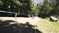
 google parking directions
google parking directions Access Info:
Moore Park Tennis Court Parking lot or the Cypress Ave Parking Lot
Activities Click to view
- Mountain Bike
79 trails
- E-Bike
6 trails
- Hike
79 trails
- Trail Running
79 trails
Region Details
- 8
- 2
- 29
- 28
- 9
- 3
Region Status
Open as of 1 dayStats
- Avg Trail Rating
- Trails (view details)
- 79
- Trails Mountain Bike
- 79
- Trails E-Bike
- 6
- Trails Hike
- 79
- Trails Trail Running
- 79
- Total Distance
- 41 miles
- Total Descent
- 7,497 ft
- Total Vertical
- 935 ft
- Highest Trailhead
- 4,989 ft
- Reports
- 605
- Photos
- 238
- Ridden Counter
- 7,324
Popular Moore Mountain Mountain Biking Trails
• 100 ★ 4.2 • 3,896 ft • 14 ft • 212 •
Fairly simple trail when riding down hill. A few squeeze points and rock gardens can make it a little tricky. Nice climb going up, just keep your head up for people coming down!
• 100 ★ 5.0 • 3,233 ft • 88 ft • 191 •
Popular green difficulty singletrack. This mountain bike primary trail can be used both directions and has a moderate overall physical rating with a 88 ft green climb. On average it takes 4 minutes to complete this trail.
• 95 ★ 5.0 • 1,076 ft • 0 ft • 169 •
Short, fast, and flowy. Several opportunities for air if you're into that sort of thing.
• 90 ★ 4.7 • 2,125 ft • 15 ft • 158 •
Fun technical flow, look out for pedal grabbing rocks.
• 85 ★ 5.0 • 2,999 ft • 74 ft • 152 •
Popular green difficulty singletrack. This mountain bike primary trail can be used both directions and has a easy overall physical rating with a 74 ft green climb. On average it takes 4 minutes to complete this trail.
Moore Mountain Mountain Bike Routes
9 miles • 1,090 ft • 12 • Loop •
Beginning at the Link River TH, follow the gravel briefly, then take a right and climb up trail with the...
★ 2.0 • 11 miles • 1,414 ft • 50 • Loop •
10 mile loop taking in some of the hardest sections of trail in the park. Options to ride (harder) or...
★ 3.0 • 4 miles • 556 ft • 23 • Loop •
A good introduction to some of the easier trails in the Moore park area with plenty of options for adding...
7 miles • 999 ft • 11 • Loop •
This route features some of the best intermediate descents that Moore Mountain has to offer.
5 miles • 634 ft • 27 • Loop •
Great Green Loop from the front side parking lot. Takes in some really fun flowy green trail with some...
• 12 miles • 1,572 ft • 14 •
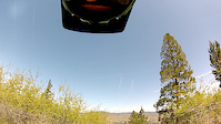
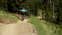
Photos of Moore Mountain Mountain Bike
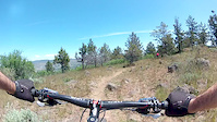
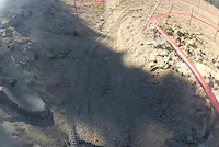
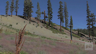
Videos of Moore Mountain Mountain Bike
trail: Tunnel of Love
0:42 |
147 |
May 26, 2015
trail: Buzzard
2:12 |
148 |
May 26, 2015

trail: Junker
22:49 |
332 |
Apr 26, 2015

trail: Enduro
2:16 |
6569 |
May 23, 2014
trail: Enduro
4:15 |
479 |
Sep 9, 2013
trail: Enduro
4:36 |
6687 |
Sep 9, 2013
trail: Enduro
3:33 |
13309 |
Jul 27, 2013
trail: Enduro
2:52 |
15807 |
Jun 23, 2013
Recent Trail Reports
| status | trail | date | condition | info | user |
|---|---|---|---|---|---|
| Upper Endo | Jun 16, 2026 @ 3:37pm (America/Los_Angeles) 1 day | Unknown | OG_MTB_831 | ||
| Eulana | May 24, 2026 @ 5:41pm (America/Boise) May 24, 2026 | Ideal | RsinFyter | ||
| Hayride | Mar 17, 2026 @ 6:26pm (America/Los_Angeles) Mar 17, 2026 | Ideal | Jasoncoatney | ||
| Jasper's | Mar 17, 2026 @ 6:26pm (America/Los_Angeles) Mar 17, 2026 | Ideal | Jasoncoatney | ||
| Moore Park Loop Road 3 | Mar 17, 2026 @ 6:26pm (America/Los_Angeles) Mar 17, 2026 | Ideal | Jasoncoatney | ||
| Jules | Mar 12, 2026 @ 1:45pm (America/Los_Angeles) Mar 12, 2026 | Ideal | everettw | ||
| Big Sky | Nov 8, 2025 @ 12:58pm (America/Los_Angeles) Nov 8, 2025 | Wet | Jasoncoatney | ||
| Bike Park Access | Oct 12, 2025 @ 3:53pm (America/Los_Angeles) Oct 12, 2025 | Ideal | Jasoncoatney | ||
| Klamath Ridgeview Tr | Apr 13, 2025 @ 6:26pm Apr 13, 2025 | Wet | cyd | ||
| Autobahn | Mar 29, 2025 @ 3:01pm Mar 29, 2025 | Dry | Jasoncoatney |
Activity Feed
| username | action | type | title | date |
|---|---|---|---|---|
| OG_MTB_831 | add | report | activity #97141962 | Jun 16, 2026 @ 3:37pm 1 day |
| Lancecorpsman13 | vote | trail | activity #96754472 | Jun 11, 2026 @ 12:13pm Jun 11, 2026 |
| Lancecorpsman13 | comment | trail | activity #96754464 | Jun 11, 2026 @ 12:13pm Jun 11, 2026 |
| everettw | vote | trail | activity #96295125 | Jun 5, 2026 @ 7:41am Jun 5, 2026 |
| ipYU4F | wishlist | trail | activity #95991985 | May 31, 2026 @ 6:10pm May 31, 2026 |
Recent Comments
| username | type | title | comment | date |
|---|---|---|---|---|
| trail | NOT an “aggressive” DH trail. More of an... | Jun 11, 2026 @ 12:13pm Jun 11, 2026 | ||
| trail | Whoever built this is such a stud | Apr 5, 2026 @ 8:55am Apr 5, 2026 | ||
| trail | Sick trail! Tight and techy, but steep enough... | Oct 18, 2025 @ 3:11pm Oct 18, 2025 | ||
| report | Lower Enduro is not private, but is... | Apr 16, 2025 @ 12:41pm Apr 16, 2025 | ||
| trail | Upper section is kinda twisty rock gardens, a... | Aug 27, 2021 @ 7:34pm Aug 27, 2021 |
Nearby Areas
| name | distance | ||||
|---|---|---|---|---|---|
| Hogsback | 1 | 5.5 km | |||
| Spence Mountain | 11 | 19 | 11 | 13 km | |
| Keno | 3 | 2 | 13.3 km | ||
| Brown Mountain | 12 | 5 | 27.6 km |
Local Badges
-

Completionist0 awarded
Bike & Skill Parks
| name | type | city | rating |
|---|---|---|---|
| Moore Park Bike Skills Area | skill park | Klamath Falls |
Activity Type Stats
| activitytype | trails | distance | descent | descent distance | total vertical | rating | global rank | state rank | photos | reports | routes | ridelogs |
|---|---|---|---|---|---|---|---|---|---|---|---|---|
| Mountain Bike | 79 | 41 miles | 7,497 ft | 18 miles | 935 ft | #1,159 | #402 | 240 | 604 | 5 | 7,125 | |
| E-Bike | 6 | 3,202 ft | 105 ft | 2,129 ft | 105 ft | #7,176 | #2,080 | 429 | 1 | 617 | ||
| Hike | 79 | 41 miles | 7,497 ft | 18 miles | 935 ft | #3,983 | #1,411 | 593 | 818 | |||
| Trail Running | 79 | 41 miles | 7,497 ft | 18 miles | 935 ft | #2,997 | #775 | 594 | 1,048 |
Frequently Asked Questions About Moore Mountain
▼
What are the highest rated mountain biking trails in Moore Mountain?
The highest rated mountain biking trails in Moore Mountain are:
- Junker (4.3/5)
- Sunrise Trail (4.3/5)
- Klamath Ridgeview Trail (4.3/5)
- Blueberry (4.2/5)
- Southie (4.2/5)
▼
What is the best time of the year to ride in Moore Mountain?
Based on ride log data, the most popular months to ride in Moore Mountain are:
- July (110 activities)
- October (90 activities)
- August (88 activities)
▼
Where can I park to ride in Moore Mountain?
There are 2 parking locations listed in Moore Mountain. The most popular parking spots are:
▼
What is the longest trail in Moore Mountain?
The longest trail in Moore Mountain is Skillet Handle Gravel at 5.2 miles. View all trails sorted by distance.
Activities
Trails
Points of Interest
- By ACLakey
 & contributors
 - Admins: KTA
- #3363 - 18,709 views
- moore mountain activity log | embed map of Moore Mountain mountain bike trails | moore mountain mountain biking points of interest
Downloading of trail gps tracks in kml & gpx formats is enabled for Moore Mountain.
You must login to download files.