close
-
Layers w
- Weather Layers
- Pro
- Pro
- Pro
- Pro
- Pro
- Pro
- More Layers
- Pro
- Pro
- Pro
- Pro
-
Upgrade to

3D
Trail Conditions
- Unknown
- Snow Groomed
- Snow Packed
- Snow Covered
- Snow Cover Partial
- Freeze/thaw Cycle
- Icy
- Prevalent Mud
- Wet
- Variable
- Ideal
- Dry
- Very Dry
Trail Flow (Ridden Direction)
Trailforks scans users ridelogs to determine the most popular direction each trail is ridden. A good flowing trail network will have most trails flowing in a single direction according to their intension.
The colour categories are based on what percentage of riders are riding a trail in its intended direction.
The colour categories are based on what percentage of riders are riding a trail in its intended direction.
- > 96%
- > 90%
- > 80%
- > 70%
- > 50%
- < 50%
- bi-directional trail
- no data
Trail Last Ridden
Trailforks scans ridelogs to determine the last time a trail was ridden.
- < 2 days
- < 1 week
- < 2 weeks
- < 1 month
- < 6 months
- > 6 months
Trail Ridden Direction
The intended direction a trail should be ridden.
- Downhill Only
- Downhill Primary
- Both Directions
- Uphill Primary
- Uphill Only
- One Direction
Contribute Details
Colors indicate trail is missing specified detail.
- Description
- Photos
- Description & Photos
- Videos
Trail Popularity ?
Trailforks scans ridelogs to determine which trails are ridden the most in the last 9 months.
Trails are compared with nearby trails in the same city region with a possible 25 colour shades.
Think of this as a heatmap, more rides = more kinetic energy = warmer colors.
- most popular
- popular
- less popular
- not popular
ATV/ORV/OHV Filter
Max Vehicle Width
inches
US Cell Coverage
Legend

Radar Time
Activity Recordings
Trailforks uses anonymized public activity data.
?
Activity Recordings
Trailforks uses anonymized public activity data.
?
Personal Heatmap
▶
Activity Types
all
/
none
▶
Options
2
Date range
month
–
Winter Trails
Warning
A routing network for winter maps does not exist. Selecting trails using the winter trails layer has been disabled.
Missing Trails
Most Popular
Least Popular
Trails are colored based on popularity. The more popular a trail is, the more red. Less popular trails trend towards green.
Jump Magnitude Heatmap
Heatmap of where riders jump on trails. Zoom in to see individual jumps, click circles to view jump details.
BC Backroad Status
![map legend]()
Service Road Atlas is a free to use, community-driven service for viewing and creating reports on the numerous back-country service roads around B.C. and Alberta.

Slope Aspect
Direction the slope faces
Trails Deemphasized
Trails are shown in grey.
Only show trails with no bike usage.
Suggested Layers
Based on selected activity type
Save the current map location and zoom level as your default home location whenever this page is loaded.
Save
No description for Moose Jaw has been added yet!
Login or register to submit one.
Activities Click to view
- Mountain Bike
89 trails
- E-Bike
55 trails
- Gravel Bike
0 trails
- Adaptive Bike
0 trails
- Winter Fat Bike
0 trails
- Hike
83 trails
- Trail Running
83 trails
- Snowshoe
24 trails
Region Details
- 6
- 2
- 28
- 37
- 16
Region Status
Open as of May 2, 2026Local Trail Association
Stats
- Avg Trail Rating
- Trails (view details)
- 89
- Trails Mountain Bike
- 89
- Trails E-Bike
- 55
- Trails Hike
- 83
- Trails Trail Running
- 83
- Trails Snowshoe
- 24
- Trails Nordic Ski
- 1
- Total Distance
- 49 miles
- Total Descent
- 5,271 ft
- Total Vertical
- 297 ft
- Highest Trailhead
- 1,955 ft
- Reports
- 1,447
- Photos
- 128
- Ridden Counter
- 12,929
Sub Regions
-
Buffalo Pound Provincial Park
- 2
- 12
- 26
- 12
-
Wakamow Valley Trails
- 6
- 8
- 1
Popular Moose Jaw Mountain Biking Trails
• 100 ★ 4.5 • 2,313 ft • 172 ft • 409 •
Super mellow flow trail great for beginners but it's still fun for advanced riders. The trail has several rollers and bermed corners. The rollers can use as booters if you aren't ripping too fast. Getting air on them while going fast...
• 100 ★ 4.2 • 2,070 ft • 0 ft • 381 •
This is an amazing run to continually repeat and challenge yourself on. is a tight, twisty trail with several challenges. While mainly a downhill trail travel is in both directions and the trail is a challenging technical climb, but...
• 85 ★ 4.0 • 1 mile • 149 ft • 338 •
Beaver Loop is a classic BP trail. Great for people just getting into the sport with some fun corners on the south side. The north side is mostly open double track road with a couple of shorter, moderately steep climbs. The south side...
• 95 ★ 4.7 • 1,660 ft • 160 ft • 334 •
Highly rated popular blue difficulty singletrack. This mountain bike primary trail can be used uphill primary and has a hard overall physical rating with a 160 ft black diamond climb. Trail visibility is always easy to follow. On average it takes 4 minutes to complete this trail.
• 100 ★ 2.0 • 476 ft • 23 ft • 323 •
Popular green difficulty other. This mountain bike primary trail can be used both directions. On average it takes 1 minutes to complete this trail.
• 95 ★ 0.0 • 1,864 ft • 92 ft • 319 •
Popular green difficulty doubletrack. This mountain bike primary trail can be used uphill primary and has a moderate overall physical rating with a 92 ft green climb. On average it takes 4 minutes to complete this trail.
• 90 ★ 4.2 • 1 mile • 152 ft • 302 •
Highly rated popular blue difficulty singletrack. This mountain bike primary trail can be used both directions and has a moderate overall physical rating with a 152 ft blue climb. It features bridge. On average it takes 12 minutes to complete this trail.
Moose Jaw Mountain Bike Routes
Green Pole Loop Featured
★ 5.0 • 1 mile • 101 ft • 1 •
Follow the green poles for some winter fatbiking and snowshoeing. These trails are groomed regularly.
Red Pole Loop Featured
★ 5.0 • 1 mile • 143 ft • 3 •
Follow the red poles. This route is groomed in the winter for fatbiking.
Maverick/Boat Launch Winter Loop Featured
★ 5.0 • 3 miles • 346 ft • 3 • Out & Back •
Super fun winter route that is groomed and connects Maple Vale to the the trailhead.
★ 4.0 • 4 miles • 382 ft • 6 • Loop •
This is Stage 15 - Tour du Buffalo Pound
★ 5.0 • 16 miles • 1,801 ft • 30 •
Potential 25kM endurance loop for the 2017 Prairie Summit Run-It
12 miles • 1,838 ft • 19 • Loop •
This 2 hour route links virtually all of the trails in the core area.
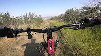
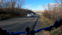
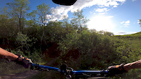
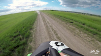
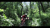
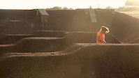
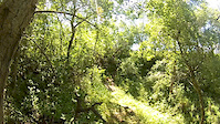
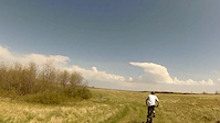
Photos of Moose Jaw Mountain Bike
Videos of Moose Jaw Mountain Bike
trail: Upside Down
0:44 |
55 |
Aug 22, 2024
trail: Lower Joe's Loop
5:05 |
170 |
Oct 11, 2020
trail: Weeping Fee
2:10 |
207 |
Jun 4, 2020
trail: Heaven
4:25 |
412 |
Jun 28, 2018
trail: Jackpot
2:24 |
524 |
Jun 26, 2017
2:55 |
6905 |
Aug 4, 2016
trail: Jackpot
0:14 |
567 |
Jul 17, 2014
trail: Jackpot
3:53 |
290 |
Jun 25, 2014
Recent Trail Reports
| status | trail | date | condition | info | user |
|---|---|---|---|---|---|
| Connor Park | May 2, 2026 @ 9:46am (America/Regina) May 2, 2026 | Variable | plitz34 | ||
| Gup's Trail | Aug 22, 2025 @ 10:42am Aug 22, 2025 | Ideal | ta-da | ||
| Third Floor Connection Prairie | Aug 22, 2025 @ 10:42am Aug 22, 2025 | Unknown | ta-da | ||
| Bum Rap | Aug 22, 2025 @ 10:42am Aug 22, 2025 | Dry | ta-da | ||
| Jackpot | Aug 22, 2025 @ 10:42am Aug 22, 2025 | Ideal | ta-da | ||
| Heaven | Aug 22, 2025 @ 10:42am Aug 22, 2025 | Ideal | ta-da | ||
| to top of Roots | Aug 22, 2025 @ 10:42am Aug 22, 2025 | Snow Cover Partial | ta-da | ||
| Roots | Aug 22, 2025 @ 10:42am Aug 22, 2025 | Variable | ta-da | ||
| Beaver Loop | Apr 27, 2025 @ 6:03pm Apr 27, 2025 | Ideal | TorreyP8Thmz | ||
| Lower Chalet | Apr 25, 2025 @ 9:32am Apr 25, 2025 | Ideal | garretw |
Activity Feed
| username | action | type | title | date |
|---|---|---|---|---|
| Beaulieu5248 | wishlist | route | activity #96433298 | Jun 6, 2026 @ 11:51pm Jun 6, 2026 |
| BradenQZDVem | wishlist | region | activity #95148903 | May 20, 2026 @ 6:52pm May 20, 2026 |
| William4kYmho | wishlist | region | activity #94272953 | May 8, 2026 @ 11:58am May 8, 2026 |
| plitz34 | add | report | activity #93872801 | May 2, 2026 @ 10:05am May 2, 2026 |
| 2NOcSf | wishlist | trail | activity #88757079 | Feb 11, 2026 @ 4:58pm Feb 11, 2026 |
Recent Comments
| username | type | title | comment | date |
|---|---|---|---|---|
| trail | Might be my favourite 100m of trail at BP. | Mar 7, 2024 @ 1:49pm Mar 7, 2024 | ||
| trail | This is labeled as a black diamond on the... | Sep 2, 2023 @ 4:03pm Sep 2, 2023 | ||
| trail | Grooming done. May need a weed trimmer job. ... | Aug 29, 2023 @ 8:51pm Aug 29, 2023 | ||
| trail | Trail maintenance completed in one narrow... | Aug 12, 2023 @ 5:32pm Aug 12, 2023 | ||
| trail | One of my favorite trails at BP | Feb 9, 2023 @ 1:35pm Feb 9, 2023 |
Local Badges
-

10 Green Trails135 awarded -

10 Blue Trails195 awarded -

Epic Ride Climb 2k7 awarded -

Climbing 10k Badge57 awarded -

Climbing 100k Badge3 awarded -

Epic Ride Descent 2k7 awarded
Bike & Skill Parks
| name | type | city | rating |
|---|---|---|---|
| Moose Jaw Police Association Bike Skills Park | skill park | Moose Jaw |
Local Trail Supporters
- Buffalo Pound PP
Activity Type Stats
| activitytype | trails | distance | descent | descent distance | total vertical | rating | global rank | state rank | photos | reports | routes | ridelogs |
|---|---|---|---|---|---|---|---|---|---|---|---|---|
| Mountain Bike | 89 | 49 miles | 5,272 ft | 20 miles | 295 ft | #986 | #2 | 128 | 1,447 | 61 | 12,676 | |
| E-Bike | 55 | 29 miles | 4,157 ft | 13 miles | 295 ft | #2,974 | 1,255 | 30 | 626 | |||
| Hike | 83 | 48 miles | 5,052 ft | 19 miles | 295 ft | #4,155 | #6 | 1,445 | 4 | 295 | ||
| Trail Running | 83 | 48 miles | 5,052 ft | 19 miles | 295 ft | #3,585 | #4 | 1,445 | 7 | 225 | ||
| Snowshoe | 24 | 11 miles | 1,490 ft | 5 miles | 289 ft | #771 | #5 | 150 | 2 | 54 | ||
| Nordic Ski | 1 | 1,079 ft | 69 ft | 90 | 18 |
Frequently Asked Questions About Moose Jaw
▼
What are the best places to ride in Moose Jaw?
Moose Jaw has 3 areas to explore for mountain biking. The top rated areas are:
▼
What are the highest rated mountain biking trails in Moose Jaw?
The highest rated mountain biking trails in Moose Jaw are:
- 1/4 Mile (4.3/5)
- Heaven (4.3/5)
- Upside Down (4.2/5)
- C'ya! (4.1/5)
- Jackpot (4.1/5)
▼
What is the best time of the year to ride in Moose Jaw?
Based on ride log data, the most popular months to ride in Moose Jaw are:
- July (283 activities)
- August (182 activities)
- June (167 activities)
▼
Where can I park to ride in Moose Jaw?
There are 2 parking locations listed in Moose Jaw. The most popular parking spots are:
Activities
Trails
- By robwalcer
 MJP MJP & contributors
 - Admins: SaskParks, Bould170, tgullacher, Shishking, MJP
- #4938 - 11,618 views
- moose jaw activity log | embed map of Moose Jaw mountain bike trails | moose jaw mountain biking points of interest
Downloading of trail gps tracks in kml & gpx formats is enabled for Moose Jaw.
You must login to download files.