close
-
Layers w
- Weather Layers
- Pro
- Pro
- Pro
- Pro
- Pro
- Pro
- More Layers
- Pro
- Pro
- Pro
- Pro
-
Upgrade to

3D
Trail Conditions
- Unknown
- Snow Groomed
- Snow Packed
- Snow Covered
- Snow Cover Partial
- Freeze/thaw Cycle
- Icy
- Prevalent Mud
- Wet
- Variable
- Ideal
- Dry
- Very Dry
Trail Flow (Ridden Direction)
Trailforks scans users ridelogs to determine the most popular direction each trail is ridden. A good flowing trail network will have most trails flowing in a single direction according to their intension.
The colour categories are based on what percentage of riders are riding a trail in its intended direction.
The colour categories are based on what percentage of riders are riding a trail in its intended direction.
- > 96%
- > 90%
- > 80%
- > 70%
- > 50%
- < 50%
- bi-directional trail
- no data
Trail Last Ridden
Trailforks scans ridelogs to determine the last time a trail was ridden.
- < 2 days
- < 1 week
- < 2 weeks
- < 1 month
- < 6 months
- > 6 months
Trail Ridden Direction
The intended direction a trail should be ridden.
- Downhill Only
- Downhill Primary
- Both Directions
- Uphill Primary
- Uphill Only
- One Direction
Contribute Details
Colors indicate trail is missing specified detail.
- Description
- Photos
- Description & Photos
- Videos
Trail Popularity ?
Trailforks scans ridelogs to determine which trails are ridden the most in the last 9 months.
Trails are compared with nearby trails in the same city region with a possible 25 colour shades.
Think of this as a heatmap, more rides = more kinetic energy = warmer colors.
- most popular
- popular
- less popular
- not popular
ATV/ORV/OHV Filter
Max Vehicle Width
inches
US Cell Coverage
Legend

Radar Time
Activity Recordings
Trailforks uses anonymized public activity data.
?
Activity Recordings
Trailforks uses anonymized public activity data.
?
Personal Heatmap
▶
Activity Types
all
/
none
▶
Options
2
Date range
month
–
Winter Trails
Warning
A routing network for winter maps does not exist. Selecting trails using the winter trails layer has been disabled.
Missing Trails
Most Popular
Least Popular
Trails are colored based on popularity. The more popular a trail is, the more red. Less popular trails trend towards green.
Jump Magnitude Heatmap
Heatmap of where riders jump on trails. Zoom in to see individual jumps, click circles to view jump details.
BC Backroad Status
![map legend]()
Service Road Atlas is a free to use, community-driven service for viewing and creating reports on the numerous back-country service roads around B.C. and Alberta.

Slope Aspect
Direction the slope faces
Trails Deemphasized
Trails are shown in grey.
Only show trails with no bike usage.
Suggested Layers
Based on selected activity type
Save the current map location and zoom level as your default home location whenever this page is loaded.
Save
No description for Moosehead Junction Trails has been added yet!
Login or register to submit one.
 google parking directions
Primary Trail Type: Cross-Country
Land Status: State Forest
Land Manager: State of Maine
google parking directions Region Supporters & Maintainers
![Moosehead Outdoor Alliance]()
Moosehead Outdoor AllianceBuilder
Activities Click to view
- Mountain Bike
27 trails
- E-Bike
24 trails
- Hike
21 trails
- Trail Running
25 trails
Region Details
- 1
- 13
- 9
- 3
- 1
Region Status
Open as of Jun 22, 2026Local Trail Association
Stats
- Avg Trail Rating
- Trails (view details)
- 28
- Trails Mountain Bike
- 27
- Trails E-Bike
- 24
- Trails Hike
- 21
- Trails Trail Running
- 25
- Trails Dirtbike/Moto
- 1
- Trails ATV/ORV/OHV
- 2
- Trails Snowmobile
- 2
- Trails Snowshoe
- 2
- Trails Backcountry Ski
- 1
- Total Distance
- 13 miles
- Total Descent Distance
- 5 miles
- Total Descent
- 1,730 ft
- Total Vertical
- 1,011 ft
- Highest Trailhead
- 2,050 ft
- Reports
- 212
- Photos
- 16
- Ridden Counter
- 1,460
Popular Moosehead Junction Trails Trails
• 100 ★ 4.0 • 1 mile • 327 ft • 102 •
is the primary climbing route to the Moosehead Junction Zone 2 trails.
• 90 ★ 4.0 • 2,762 ft • 24 ft • 82 •
Popular black diamond difficulty singletrack. This mountain bike primary trail can be used downhill only and has a hard overall physical rating with a 24 ft black diamond climb. It features berm, drop, jump, gap jump, rock garden and wallride. Trail visibility is always easy to follow. On average it takes 37 minutes to complete this trail.
• 100 ★ 3.7 • 2,185 ft • 0 ft • 81 •
Popular blue difficulty singletrack. This mountain bike primary trail can be used downhill only. It features berm, jump and rock garden. Trail visibility is always easy to follow.
• 75 ★ 3.0 • 1,627 ft • 19 ft • 73 •
Popular green difficulty family friendly singletrack. This mountain bike primary trail can be used one direction and has a easy overall physical rating with a 19 ft green climb. Trail visibility is always easy to follow. On average it takes 2 minutes to complete this trail.
• 85 ★ 2.5 • 1,050 ft • 0 ft • 73 •
Popular blue difficulty singletrack. This mountain bike primary trail can be used both directions. Trail visibility is always easy to follow. On average it takes 1 minutes to complete this trail.
• 90 ★ 3.7 • 2,146 ft • 0 ft • 70 •
Popular black diamond difficulty singletrack. This mountain bike primary trail can be used downhill only. It features berm, drop, jump, rock face, rock garden and wallride. Trail visibility is always easy to follow.
• 80 ★ 3.0 • 3,927 ft • 29 ft • 70 •
Popular blue difficulty singletrack. This mountain bike primary trail can be used both directions and has a easy overall physical rating with a 29 ft green climb. It features bridge. Trail visibility is always easy to follow. On average it takes 9 minutes to complete this trail.
• 85 ★ 3.7 • 899 ft • 0 ft • 68 •
Stay high left on and you'll enter a narrow chute that banks left at the bottom in to a nice tabletop.
Mountain Bike Routes
★ 4.0 • 7 miles • 356 ft • 10 • Loop •
If you are looking for a 1-2 hour ride from downtown Greenville for beginner/intermediate trails with some...
6 miles • 274 ft • 10 • Loop •
This is our recommended 1-2 hour beginner/intermediate ride departing from Gravel Pit Pond. On this ride...
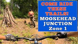
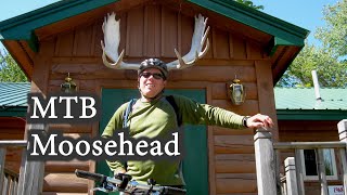
Photos of Moosehead Junction Trails Mountain Bike
Videos of Moosehead Junction Trails Mountain Bike
trail: Turn Table
10:06 |
135 |
Jul 12, 2025 , Greenville
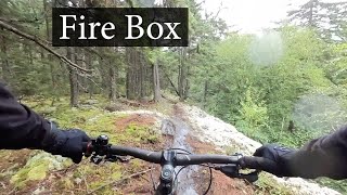
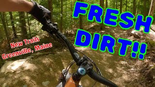
trail: Firebox
4:29 |
314 |
Aug 30, 2024 , Greenville

trail: Stoker
4:05 |
153 |
Aug 26, 2024 , Greenville
trail: Night Train
11:10 |
166 |
Aug 12, 2024 , Greenville
trail: Bootlegger
0:31 |
149 |
Aug 9, 2024 , Greenville
trail: Back Haul
16:12 |
113 |
Aug 6, 2024 , Greenville
trail: Conductor Trail
3:28 |
216 |
Sep 13, 2023 , Greenville
Recent Trail Reports
| status | trail | date | condition | info | user |
|---|---|---|---|---|---|
| Turn Table | Jun 22, 2026 @ 8:47am (America/Moncton) Jun 22, 2026 | Ideal | Brownbear3333 | ||
| Night Train | Jun 22, 2026 @ 8:47am (America/Moncton) Jun 22, 2026 | Ideal | Brownbear3333 | ||
| Wipe the Clock | Jun 22, 2026 @ 8:47am (America/Moncton) Jun 22, 2026 | Wet | Brownbear3333 | ||
| Stoker | Jun 22, 2026 @ 8:47am (America/Moncton) Jun 22, 2026 | Wet | Brownbear3333 | ||
| Runaway Train | Jun 22, 2026 @ 8:47am (America/Moncton) Jun 22, 2026 | Wet | Brownbear3333 | ||
| Nexus | Jun 22, 2026 @ 8:47am (America/Moncton) Jun 22, 2026 | Ideal | Brownbear3333 | ||
| Bootlegger Extension | Jun 22, 2026 @ 8:47am (America/Moncton) Jun 22, 2026 | Wet | Brownbear3333 | ||
| Bootlegger | Jun 22, 2026 @ 8:47am (America/Moncton) Jun 22, 2026 | Ideal | Brownbear3333 | ||
| Wiggins Xing | May 20, 2026 @ 9:54pm (America/New_York) May 20, 2026 | Ideal | Rfolsomjr PCME NEMBA | ||
| Reclaim | May 20, 2026 @ 9:54pm (America/New_York) May 20, 2026 | Ideal | Rfolsomjr PCME NEMBA |
Activity Feed
| username | action | type | title | date |
|---|---|---|---|---|
| Brownbear3333 | add | report | activity #97587499 and 7 more | Jun 22, 2026 @ 3:11pm 3 days |
| jbourne02 | comment | trail | activity #96862852 | Jun 13, 2026 @ 4:39am Jun 13, 2026 |
| tybikes14 | add | poi | activity #96072115 | Jun 2, 2026 @ 3:39am Jun 2, 2026 |
| AVw5vE | wishlist | trail | activity #95928399 | May 31, 2026 @ 5:11am May 31, 2026 |
| Antjh2 | add | poi | activity #95709794 | May 28, 2026 @ 8:39am May 28, 2026 |
Recent Comments
| username | type | title | comment | date |
|---|---|---|---|---|
| trail | D | Jun 13, 2026 @ 4:39am Jun 13, 2026 | ||
| trail | Well made. | Sep 29, 2024 @ 10:35am Sep 29, 2024 | ||
| trail | If you have always dreamed of riding British... | Aug 26, 2024 @ 5:34pm Aug 26, 2024 |
Nearby Areas
| name | distance | ||||
|---|---|---|---|---|---|
| Blue Ridge-Rum Pond | 2 | 7.3 km | |||
| Lily Bay State Park | 1 | 2 | 8.6 km | ||
| 7 Ponds Preserve | 6 | 9.8 km | |||
| Appalachian Mountain Club 100 Mile Wilderness Conservation Area | 5 | 12.4 km | |||
| Mount Kineo State Park | 18.3 km |
Local Badges
-

Completionist0 awarded
Local Trail Supporters
- Maine Trail Builders
![Moosehead Outdoor Alliance]()
Activity Type Stats
| activitytype | trails | distance | descent | descent distance | total vertical | rating | global rank | state rank | photos | reports | routes | ridelogs |
|---|---|---|---|---|---|---|---|---|---|---|---|---|
| Mountain Bike | 27 | 12 miles | 1,729 ft | 5 miles | 410 ft | #7,453 | #2,868 | 17 | 209 | 2 | 347 | |
| E-Bike | 24 | 11 miles | 1,663 ft | 5 miles | 410 ft | #6,473 | #1,840 | 194 | 2 | 11 | ||
| Hike | 21 | 10 miles | 719 ft | 3 miles | 1,010 ft | 175 | 9 | |||||
| Trail Running | 25 | 12 miles | 1,352 ft | 4 miles | 1,010 ft | #9,766 | #3,554 | 205 | 2 | |||
| Dirtbike/Moto | 1 | 4,790 ft | 69 ft | 1,706 ft | 59 ft | 62 | ||||||
| ATV/ORV/OHV | 2 | 2 miles | 79 ft | 2,064 ft | 62 ft | 62 | 1 | |||||
| Snowmobile | 2 | 2 miles | 79 ft | 2,064 ft | 62 ft | 28 | ||||||
| Snowshoe | 2 | 4,820 ft | 46 ft | 797 ft | 43 ft | 29 | ||||||
| Backcountry Ski | 1 | 791 ft | 13 ft | 387 ft | 16 ft | 28 |
Frequently Asked Questions About Moosehead Junction Trails
▼
What are the highest rated mountain biking trails in Moosehead Junction Trails?
The highest rated mountain biking trails in Moosehead Junction Trails are:
- Bootlegger Extension (4.1/5)
- Runaway Train (4.1/5)
- Coupler (4.1/5)
- Bootlegger (4/5)
- Blast Pipe (4/5)
▼
Where can I park to ride in Moosehead Junction Trails?
There are 4 parking locations listed in Moosehead Junction Trails. The most popular parking spots are:
- Moosehead Trailhead Parking
- Parkering
- Parking - Little Moose Public Land
- Little Moose Mountian Trailhead
▼
What is the longest trail in Moosehead Junction Trails?
The longest trail in Moosehead Junction Trails is Bootlegger at 1.3 miles. View all trails sorted by distance.
▼
What are the best & highest rated hiking trails in Moosehead Junction Trails?
The best hiking trails in Moosehead Junction Trails are: View all hiking trails sorted by popularity score.
Activities
Trails
- Hard trails in Moosehead Junction Trails
- Easy trails in Moosehead Junction Trails
- Favorite trails in Moosehead Junction Trails
- Most ridden trails in Moosehead Junction Trails
- Singletrack in Moosehead Junction Trails
- Viewpoint trails in Moosehead Junction Trails
- Trails with technical features in Moosehead Junction Trails
- Race routes in Moosehead Junction Trails
Points of Interest
- By WillieJacobsz
 Trailforks SBP SWW & contributors
 - Admins: PCME NEMBA
- #57574 - 5,049 views
- moosehead junction trails activity log | embed map of Moosehead Junction Trails mountain bike trails | moosehead junction trails mountain biking points of interest
Downloading of trail gps tracks in kml & gpx formats is enabled for Moosehead Junction Trails.
You must login to download files.