close
-
Layers w
- Weather Layers
- Pro
- Pro
- Pro
- Pro
- Pro
- Pro
- More Layers
- Pro
- Pro
- Pro
- Pro
-
Upgrade to

3D
Trail Conditions
- Unknown
- Snow Groomed
- Snow Packed
- Snow Covered
- Snow Cover Partial
- Freeze/thaw Cycle
- Icy
- Prevalent Mud
- Wet
- Variable
- Ideal
- Dry
- Very Dry
Trail Flow (Ridden Direction)
Trailforks scans users ridelogs to determine the most popular direction each trail is ridden. A good flowing trail network will have most trails flowing in a single direction according to their intension.
The colour categories are based on what percentage of riders are riding a trail in its intended direction.
The colour categories are based on what percentage of riders are riding a trail in its intended direction.
- > 96%
- > 90%
- > 80%
- > 70%
- > 50%
- < 50%
- bi-directional trail
- no data
Trail Last Ridden
Trailforks scans ridelogs to determine the last time a trail was ridden.
- < 2 days
- < 1 week
- < 2 weeks
- < 1 month
- < 6 months
- > 6 months
Trail Ridden Direction
The intended direction a trail should be ridden.
- Downhill Only
- Downhill Primary
- Both Directions
- Uphill Primary
- Uphill Only
- One Direction
Contribute Details
Colors indicate trail is missing specified detail.
- Description
- Photos
- Description & Photos
- Videos
Trail Popularity ?
Trailforks scans ridelogs to determine which trails are ridden the most in the last 9 months.
Trails are compared with nearby trails in the same city region with a possible 25 colour shades.
Think of this as a heatmap, more rides = more kinetic energy = warmer colors.
- most popular
- popular
- less popular
- not popular
ATV/ORV/OHV Filter
Max Vehicle Width
inches
US Cell Coverage
Legend

Radar Time
Activity Recordings
Trailforks uses anonymized public activity data.
?
Activity Recordings
Trailforks uses anonymized public activity data.
?
Personal Heatmap
▶
Activity Types
all
/
none
▶
Options
2
Date range
month
–
Winter Trails
Warning
A routing network for winter maps does not exist. Selecting trails using the winter trails layer has been disabled.
Missing Trails
Most Popular
Least Popular
Trails are colored based on popularity. The more popular a trail is, the more red. Less popular trails trend towards green.
Jump Magnitude Heatmap
Heatmap of where riders jump on trails. Zoom in to see individual jumps, click circles to view jump details.
BC Backroad Status
![map legend]()
Service Road Atlas is a free to use, community-driven service for viewing and creating reports on the numerous back-country service roads around B.C. and Alberta.

Slope Aspect
Direction the slope faces
Trails Deemphasized
Trails are shown in grey.
Only show trails with no bike usage.
Suggested Layers
Based on selected activity type
Save the current map location and zoom level as your default home location whenever this page is loaded.
SavePopular Trail Networks
view all areas »This region is Unsanctioned, Ride at your own Risk!
No description for Moravskoslezský has been added yet! Login or register to submit one.AKA: Moravia-Silesia
This region uses the Uk/Euro style trail grading system.
Region Details
- 20
- 18
- 49
- 16
- 6
- 2
Stats
- Avg Trail Rating
- Trails (view details)
- 121
- Trails Mountain Bike
- 122
- Trails E-Bike
- 45
- Trails Horse
- 3
- Trails Hike
- 84
- Trails Trail Running
- 79
- Trails Dirtbike/Moto
- 3
- Trails ATV/ORV/OHV
- 1
- Trails Snowshoe
- 2
- Trails Downhill Ski
- 8
- Trails Backcountry Ski
- 2
- Trails Nordic Ski
- 3
- Total Distance
- 137 miles
- Total Descent
- 51,238 ft
- Total Vertical
- 3,550 ft
- Highest Trailhead
- 4,253 ft
- Reports
- 271
- Photos
- 234
- Ridden Counter
- 6,013
Articles
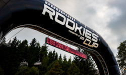
Race Report: Rookies Cup Season Final in Koprivna, Czech Republic
Sep 11, 2025 from pinkbike.com
The Rookies Cup is the place for future stars to cut their teeth and build their racecraft, and this year's finale didn't disappoint.
Sub Regions
- Beskydy - Lysohorská část (1)
- Beskydy - Radhošťská část sever (10)
- Bruntál (14)
- Bikepark Kopřivná (8)
- Vrbno (4)
- Frýdek-Místek (48)
- Frýdlant nad Ostravicí (4)
- Hukvaldy (8)
- Javorový vrch (13)
- Mosty u Jablunkova (4)
- Ostravice (1)
- Singletrail Nad Borovím (3)
- Žukov Enduro Trails (1)
- Nový Jičín (43)
- Čertovy stezky (15)
- HEIBIKEPARK (5)
- Veřovické vrchy (17)
- Opava (1)
- Ostrava (9)
- Bílá (0)
- Single Trails Bílá (3)
Popular Moravskoslezský Mountain Biking Trails
• 95 ★ 4.3 • 2 miles • 43 ft • 541 •
Popular blue difficulty singletrack. This mountain bike primary trail can be used downhill only. On average it takes 6 minutes to complete this trail.
• 100 ★ 4.4 • 5,046 ft • 0 ft • 468 •
Popular red difficulty singletrack. This mountain bike primary trail can be used downhill only. On average it takes 7 minutes to complete this trail.
• 90 ★ 4.5 • 1,886 ft • 0 ft • 422 •
Popular proline difficulty mixed. This mountain bike primary trail can be used downhill only and has a moderate overall physical rating. It features berm, bridge, drop, jump, gap jump and ladder bridge. On average it takes 4 minutes to complete this trail.
• 80 ★ 4.5 • 4,022 ft • 0 ft • 335 •
Popular black difficulty singletrack. This mountain bike primary trail can be used downhill only and has a hard overall physical rating. It features berm, drop, jump, gap jump and rock garden. Trail visibility is always easy to follow. On average it takes 8 minutes to complete this trail.
• 65 ★ 4.0 • 3,816 ft • 2 ft • 262 •
Moderately popular black difficulty singletrack. This mountain bike primary trail can be used downhill only and has a hard overall physical rating. It features berm, drop, gap jump and rock garden. Trail visibility is always easy to follow. On average it takes 7 minutes to complete this trail.
• 75 ★ 0.0 • 1 mile • 2 ft • 229 •
Natural line with some nice features like a wooden carousel, you can also drop, or a rock face with different lines to go down.
• 60 ★ 0.0 • 4,111 ft • 0 ft • 150 •
Moderately popular blue difficulty singletrack. This mountain bike primary trail can be used downhill only. On average it takes 22 minutes to complete this trail.
• 100 ★ 3.5 • 2 miles • 70 ft • 126 •
3 km, downhill trail accessable by service road or cableway in Ski Areál Bílá.
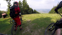
Moravskoslezský Mountain Bike Routes
Photos of Moravskoslezský Mountain Bike
Videos of Moravskoslezský Mountain Bike

trail: Brušperk jumps
0:12 |
20 |
Feb 20, 2025
trail: Kopřivná
0:10 |
44 |
Aug 3, 2024

trail: Spicy Freeride
4:40 |
77 |
Jul 19, 2023
trail: Kopřivná
0:13 |
54 |
Sep 13, 2022

trail: Spicy Freeride
0:37 |
7862 |
Apr 29, 2021
trail: Javorový
7:30 |
157 |
Aug 15, 2018
trail: Javorový
5:00 |
121 |
Aug 12, 2018
trail: Javorový
6:26 |
146 |
Aug 10, 2018
Recent Trail Reports
Activity Feed
| username | action | type | title | date |
|---|---|---|---|---|
| waseksk8 | wishlist | trail | activity #96756559 and 2 more | Jun 11, 2026 @ 12:49pm Jun 11, 2026 |
| waseksk8 | add | photo | activity #96724393 and 3 more | Jun 11, 2026 @ 2:01am Jun 11, 2026 |
| waseksk8 | ridden | trail | activity #96551934 | Jun 8, 2026 @ 11:07am Jun 8, 2026 |
| deviz | add | report | activity #96527663 and 2 more | Jun 8, 2026 @ 2:49am Jun 8, 2026 |
| pekko | add | report | activity #96492542 | Jun 7, 2026 @ 1:20pm Jun 7, 2026 |
Recent Comments
| username | type | title | comment | date |
|---|---|---|---|---|
| trail | Pěkný trail. Na závěr dva skoky | Aug 22, 2025 @ 10:08am Aug 22, 2025 | ||
| trail | Hmmm maybe this one not same blue grade like... | Aug 20, 2024 @ 2:43am Aug 20, 2024 | ||
| trail | Ale hele proc je to tu prosrany? Pan kopac to... | Mar 9, 2024 @ 11:07am Mar 9, 2024 | ||
| trail | Somewhat disappointing trail. The initial... | Jun 5, 2023 @ 3:57am Jun 5, 2023 | ||
| trail | This is not a black trail, red ok. | Jun 12, 2022 @ 6:11am Jun 12, 2022 |
Local Badges
-

Epic Ride 50k1,019 awarded -

Epic Ride Descent 2k317 awarded -

Top 10 Trails0 awarded -
Top 10 Trails0 awarded -

Descent 10k Badge34 awarded -
Epic Ride 50k422 awarded
Bike & Skill Parks
| name | type | city | rating |
|---|---|---|---|
| Pumptrack Staříč | skill park | Frýdek-Místek |
Local Mountain Biking Directory
-
MADE FOR TRAILS - WHYTE BIKES
![MADE FOR TRAILS - WHYTE BIKES]()
-
Elitebikes.czBike Shop
-
MIKEBIKEBike Shop
Activity Type Stats
| activitytype | trails | distance | descent | descent distance | total vertical | rating | global rank | state rank | photos | reports | routes | ridelogs |
|---|---|---|---|---|---|---|---|---|---|---|---|---|
| Mountain Bike | 121 | 136 miles | 49,921 ft | 84 miles | 3,550 ft | 247 | 397 | 3 | 25,724 | |||
| E-Bike | 45 | 40 miles | 11,286 ft | 23 miles | 3,550 ft | 323 | 1 | 989 | ||||
| Horse | 3 | 5 miles | 233 ft | 1 mile | 1,188 ft | 46 | ||||||
| Hike | 84 | 110 miles | 40,614 ft | 69 miles | 3,550 ft | 370 | 2,637 | |||||
| Trail Running | 79 | 109 miles | 39,665 ft | 68 miles | 3,550 ft | 370 | 397 | |||||
| Dirtbike/Moto | 3 | 46 | 1 | |||||||||
| ATV/ORV/OHV | 1 | 46 | ||||||||||
| Snowshoe | 2 | 3 | 1 | |||||||||
| Downhill Ski | 8 | 3 miles | 1,791 ft | 3 miles | 2,559 ft | 3 | 392 | |||||
| Backcountry Ski | 2 | 3 | 335 | |||||||||
| Nordic Ski | 3 | 3 | 315 |
Activities
Trails
- By brenthillier
 NSMBA TRAILFORKS & contributors
 - Admins: ČeMBA, ČeMBA, ČeMBA, ČeMBA, ČeMBA, ČeMBA, ČeMBA, ČeMBA, ČeMBA, ČeMBA
- #9752 - 6,014 views
- moravskoslezský activity log | embed map of Moravskoslezský mountain bike trails | moravskoslezský mountain biking points of interest
Downloading of trail gps tracks in kml & gpx formats is enabled for Moravskoslezský.
You must login to download files.