close
-
Layers w
- Weather Layers
- Pro
- Pro
- Pro
- Pro
- Pro
- Pro
- More Layers
- Pro
- Pro
- Pro
- Pro
-
Upgrade to

3D
Trail Conditions
- Unknown
- Snow Groomed
- Snow Packed
- Snow Covered
- Snow Cover Partial
- Freeze/thaw Cycle
- Icy
- Prevalent Mud
- Wet
- Variable
- Ideal
- Dry
- Very Dry
Trail Flow (Ridden Direction)
Trailforks scans users ridelogs to determine the most popular direction each trail is ridden. A good flowing trail network will have most trails flowing in a single direction according to their intension.
The colour categories are based on what percentage of riders are riding a trail in its intended direction.
The colour categories are based on what percentage of riders are riding a trail in its intended direction.
- > 96%
- > 90%
- > 80%
- > 70%
- > 50%
- < 50%
- bi-directional trail
- no data
Trail Last Ridden
Trailforks scans ridelogs to determine the last time a trail was ridden.
- < 2 days
- < 1 week
- < 2 weeks
- < 1 month
- < 6 months
- > 6 months
Trail Ridden Direction
The intended direction a trail should be ridden.
- Downhill Only
- Downhill Primary
- Both Directions
- Uphill Primary
- Uphill Only
- One Direction
Contribute Details
Colors indicate trail is missing specified detail.
- Description
- Photos
- Description & Photos
- Videos
Trail Popularity ?
Trailforks scans ridelogs to determine which trails are ridden the most in the last 9 months.
Trails are compared with nearby trails in the same city region with a possible 25 colour shades.
Think of this as a heatmap, more rides = more kinetic energy = warmer colors.
- most popular
- popular
- less popular
- not popular
ATV/ORV/OHV Filter
Max Vehicle Width
inches
US Cell Coverage
Legend

Radar Time
Activity Recordings
Trailforks uses anonymized public activity data.
?
Activity Recordings
Trailforks uses anonymized public activity data.
?
Personal Heatmap
▶
Activity Types
all
/
none
▶
Options
2
Date range
month
–
Winter Trails
Warning
A routing network for winter maps does not exist. Selecting trails using the winter trails layer has been disabled.
Missing Trails
Most Popular
Least Popular
Trails are colored based on popularity. The more popular a trail is, the more red. Less popular trails trend towards green.
Jump Magnitude Heatmap
Heatmap of where riders jump on trails. Zoom in to see individual jumps, click circles to view jump details.
BC Backroad Status
![map legend]()
Service Road Atlas is a free to use, community-driven service for viewing and creating reports on the numerous back-country service roads around B.C. and Alberta.

Slope Aspect
Direction the slope faces
Trails Deemphasized
Trails are shown in grey.
Only show trails with no bike usage.
Suggested Layers
Based on selected activity type
Save the current map location and zoom level as your default home location whenever this page is loaded.
Save
No description for Morisset has been added yet!
Login or register to submit one.
AKA: Westlakes
Activities Click to view
- Mountain Bike
140 trails
- E-Bike
96 trails
- Gravel Bike
0 trails
- Adaptive Bike
1 trails
- Winter Fat Bike
0 trails
- Hike
77 trails
- Trail Running
78 trails
- Dirtbike/Moto
3 trails
Region Details
- 54
- 3
- 28
- 49
- 3
- 1
Region Status
Open as of Jun 3, 2026Stats
- Avg Trail Rating
- Trails (view details)
- 140
- Trails Mountain Bike
- 142
- Trails E-Bike
- 96
- Trails Adaptive Bike
- 1
- Trails Hike
- 77
- Trails Trail Running
- 78
- Trails Dirtbike/Moto
- 3
- Total Distance
- 92 miles
- Total Descent
- 11,330 ft
- Total Vertical
- 1,281 ft
- Highest Trailhead
- 1,284 ft
- Reports
- 690
- Photos
- 205
- Ridden Counter
- 23,201
Articles

Video: 60 Seconds of Jack Moir Fine Tuning His Race Speed
Oct 23, 2020 from pinkbike.com
It was a short season and Jack Moir came in hot.
Sub Regions
-
Awaba Mountain Bike Park
- 1
- 10
- 15
- 1
- 1
-
Cooranbong
- 2
- 2
-
Morisset Peninsula
- 3
- 4
- 1
-
Myuna/Awaba Bushland
-
Rathmines Bushland
- 2
- 8
- 9
- 3
-
Wangi Bushland
- 1
- 2
-
Wyee Point
- 5
- 23
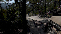
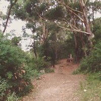
Popular Morisset Mountain Biking Trails
• 85 ★ 4.4 • 951 ft • 67 ft • 1,158 •
This is the b-line track up Camelback which is not as harsh on the legs but has some tight to make you work for it.
• 85 ★ 4.5 • 653 ft • 0 ft • 987 •
This short but fast section of trail acts as the top part of the Watagan (Blue) loop and takes off from the trail just before it turns up .
• 50 ★ 4.2 • 2,743 ft • 25 ft • 729 •
Moderately popular blue difficulty singletrack. This mountain bike primary trail can be used downhill only and has a moderate overall physical rating. It features berm, bridge, jump, ladder bridge and roller coaster. Adaptive MTB rating: amtb black. Trail visibility is always easy to follow. On average it takes 3 minutes to complete this trail.
• 95 ★ 5.0 • 2,008 ft • 2 ft • 701 •
Popular blue difficulty singletrack. This mountain bike primary trail can be used downhill only. It features bridge and jump. Trail visibility is always easy to follow. On average it takes 1 minutes to complete this trail.
• 30 ★ 4.0 • 292 ft • 13 ft • 701 •
Less popular blue difficulty singletrack. This mountain bike primary trail can be used downhill only and has a moderate overall physical rating. It features bridge and jump. Adaptive MTB rating: amtb black. Trail visibility is always easy to follow. On average it takes 2 minutes to complete this trail.
• 80 ★ 3.5 • 1,056 ft • 161 ft • 654 •
runs from the turn off to with a long steady climb before connecting back up with
• 65 ★ 4.0 • 3,481 ft • 43 ft • 611 •
Moderately popular green difficulty singletrack. This mountain bike primary trail can be used one direction and has a easy overall physical rating with a 43 ft green climb. Adaptive MTB rating: amtb green. Trail visibility is always easy to follow. On average it takes 8 minutes to complete this trail.
Morisset Mountain Bike Routes
Awaba Loop Featured
★ 4.7 • 7 miles • 995 ft • 17 • Loop •
The Red Loop covers all the trails at Awaba with the exception of the downhill and Development Trails. The...
★ 5.0 • 3 miles • 503 ft • 6 • Loop •
The Yellow Loop is the shortest loop in the Awaba Mtb Park. Less physically demanding than continuing on...
★ 5.0 • 8 miles • 805 ft • 12 • Loop •
This loops gives you a good ride to see most of what each zone has on offer in Rathmines. There's a few...
★ 5.0 • 5 miles • 686 ft • 13 • Loop •
The loop is a the mid-length marked section of trail at Awaba. It turns back toward the starting carpark...
4 miles • 661 ft • 14 • Loop •
This is an easy loop for beginners and children alike. Designed to give riders a taste of the trails...
3 miles • 138 ft • 10 •
Fun loop with a range of features including jumps, rock gardens, skinnys, teeter-totters and much more
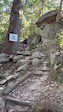
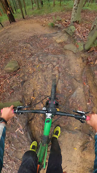
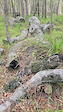
Photos of Morisset Mountain Bike
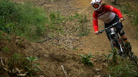
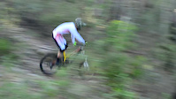
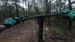
Videos of Morisset Mountain Bike
trail: Monkey
0:05 |
21 |
Apr 18, 2026
trail: Monkey
0:10 |
23 |
Mar 9, 2026
trail: Lumberjack
0:24 |
4 |
Feb 13, 2026
trail: Christmas
2:39 |
6571 |
Dec 23, 2017
trail: Christmas
3:07 |
772 |
Dec 19, 2015
trail: Fire Station
0:15 |
147 |
Feb 19, 2014
trail: Discovery
0:07 |
902 |
Nov 29, 2013
trail: Faulk Line
3:37 |
59 |
Jan 12, 2026 , Morisset
Current Trail Warnings
| status | trail | date | condition | user | info |
|---|---|---|---|---|---|
| Pinball | Jun 3, 2026 @ 8:10pm (Australia/Sydney) Jun 3, 2026 | Ideal | DOCWHO | This is a Blast, but the Lower Burns are... |
Recent Trail Reports
Activity Feed
| username | action | type | title | date |
|---|---|---|---|---|
| DOCWHO | ridden | trail | activity #96570129 and 1 more | Jun 8, 2026 @ 4:16pm Jun 8, 2026 |
| DOCWHO | vote | trail | activity #96570124 and 1 more | Jun 8, 2026 @ 4:16pm Jun 8, 2026 |
| DOCWHO | add | trail | activity #96554085 and 1 more | Jun 8, 2026 @ 11:38am Jun 8, 2026 |
| DOCWHO | add | poi | activity #96554062 and 1 more | Jun 8, 2026 @ 11:37am Jun 8, 2026 |
| DOCWHO | add | poi | activity #96532888 | Jun 8, 2026 @ 5:32am Jun 8, 2026 |
Recent Comments
| username | type | title | comment | date |
|---|---|---|---|---|
| trail | Trail really needs clearing where the Lantana... | May 5, 2026 @ 1:00am May 5, 2026 | ||
| report | This one I find is better to ride the opposite... | Mar 21, 2026 @ 10:42pm Mar 21, 2026 | ||
| report | There's a whole little community living in... | Mar 21, 2026 @ 10:36pm Mar 21, 2026 | ||
| trail | Great jump line, lots of tabletops with room... | Jun 29, 2025 @ 2:17am Jun 29, 2025 | ||
| trail | Speedy line | Jun 29, 2025 @ 2:16am Jun 29, 2025 |
Local Badges
-

Completionist0 awarded -

10 Blue Trails581 awarded -

Epic Mountain Bike Climb 2k73 awarded -

Climbing 10k Badge41 awarded -

Mountain Biking 100k Badge1 awarded -
Completionist0 awarded
Bike & Skill Parks
| name | type | city | rating |
|---|---|---|---|
| Awaba Mountain Bike Park | bike park | Morisset | |
| Pump.Jump.Repeat. | skill park | Morisset |
Activity Type Stats
| activitytype | trails | distance | descent | descent distance | total vertical | rating | global rank | state rank | photos | reports | routes | ridelogs |
|---|---|---|---|---|---|---|---|---|---|---|---|---|
| Mountain Bike | 140 | 86 miles | 10,240 ft | 38 miles | 1,283 ft | #1,087 | #62 | 199 | 690 | 9 | 12,476 | |
| E-Bike | 96 | 51 miles | 6,804 ft | 23 miles | 1,283 ft | #1,896 | #98 | 4 | 511 | 2 | 2,255 | |
| Adaptive Bike | 1 | #341 | #171 | 28 | ||||||||
| Hike | 77 | 50 miles | 5,266 ft | 23 miles | 1,283 ft | #3,755 | #105 | 1 | 519 | 249 | ||
| Trail Running | 78 | 54 miles | 5,358 ft | 24 miles | 1,283 ft | #3,095 | #90 | 523 | 1 | 422 | ||
| Dirtbike/Moto | 3 | 2 miles | 194 ft | 3,842 ft | 102 ft | #787 | #38 | 100 | 25 |
Frequently Asked Questions About Morisset
▼
What are the best places to ride in Morisset?
Morisset has 7 areas to explore for mountain biking. The top rated areas are:
▼
What are the highest rated mountain biking trails in Morisset?
The highest rated mountain biking trails in Morisset are:
- Rollercoaster (4.3/5)
- Lantana Land (4.3/5)
- Trailer Park Girls Go (4.2/5)
- Awaba Loop Start (4.2/5)
- Biraban (4.2/5)
▼
What is the best time of the year to ride in Morisset?
Based on ride log data, the most popular months to ride in Morisset are:
- August (73 activities)
- April (72 activities)
- June (72 activities)
▼
Where can I park to ride in Morisset?
There are 6 parking locations listed in Morisset. The most popular parking spots are: View all parking and trailhead locations on the map to plan your visit.
Activities
Trails
- By Addzz
 TRAILFORKS NEMTB & contributors
 - Admins: stuartrichardson, HMBA
- #16625 - 5,304 views
- morisset activity log | embed map of Morisset mountain bike trails | morisset mountain biking points of interest polygons
Downloading of trail gps tracks in kml & gpx formats is enabled for Morisset.
You must login to download files.