close
-
Layers w
- Weather Layers
- Pro
- Pro
- Pro
- Pro
- Pro
- Pro
- More Layers
- Pro
- Pro
- Pro
- Pro
-
Upgrade to

3D
Trail Conditions
- Unknown
- Snow Groomed
- Snow Packed
- Snow Covered
- Snow Cover Partial
- Freeze/thaw Cycle
- Icy
- Prevalent Mud
- Wet
- Variable
- Ideal
- Dry
- Very Dry
Trail Flow (Ridden Direction)
Trailforks scans users ridelogs to determine the most popular direction each trail is ridden. A good flowing trail network will have most trails flowing in a single direction according to their intension.
The colour categories are based on what percentage of riders are riding a trail in its intended direction.
The colour categories are based on what percentage of riders are riding a trail in its intended direction.
- > 96%
- > 90%
- > 80%
- > 70%
- > 50%
- < 50%
- bi-directional trail
- no data
Trail Last Ridden
Trailforks scans ridelogs to determine the last time a trail was ridden.
- < 2 days
- < 1 week
- < 2 weeks
- < 1 month
- < 6 months
- > 6 months
Trail Ridden Direction
The intended direction a trail should be ridden.
- Downhill Only
- Downhill Primary
- Both Directions
- Uphill Primary
- Uphill Only
- One Direction
Contribute Details
Colors indicate trail is missing specified detail.
- Description
- Photos
- Description & Photos
- Videos
Trail Popularity ?
Trailforks scans ridelogs to determine which trails are ridden the most in the last 9 months.
Trails are compared with nearby trails in the same city region with a possible 25 colour shades.
Think of this as a heatmap, more rides = more kinetic energy = warmer colors.
- most popular
- popular
- less popular
- not popular
ATV/ORV/OHV Filter
Max Vehicle Width
inches
US Cell Coverage
Legend

Radar Time
Activity Recordings
Trailforks uses anonymized public activity data.
?
Activity Recordings
Trailforks uses anonymized public activity data.
?
Personal Heatmap
▶
Activity Types
all
/
none
▶
Options
2
Date range
month
–
Winter Trails
Warning
A routing network for winter maps does not exist. Selecting trails using the winter trails layer has been disabled.
Missing Trails
Most Popular
Least Popular
Trails are colored based on popularity. The more popular a trail is, the more red. Less popular trails trend towards green.
Jump Magnitude Heatmap
Heatmap of where riders jump on trails. Zoom in to see individual jumps, click circles to view jump details.
BC Backroad Status
![map legend]()
Service Road Atlas is a free to use, community-driven service for viewing and creating reports on the numerous back-country service roads around B.C. and Alberta.

Slope Aspect
Direction the slope faces
Trails Deemphasized
Trails are shown in grey.
Only show trails with no bike usage.
Suggested Layers
Based on selected activity type
Save the current map location and zoom level as your default home location whenever this page is loaded.
Save
No description for Mosbach has been added yet!
Login or register to submit one.
This region uses the Uk/Euro style trail grading system.
Activities Click to view
- Mountain Bike
15 trails
- E-Bike
15 trails
- Adaptive Bike
0 trails
- Hike
9 trails
- Trail Running
6 trails
Region Details
- 1
- 10
- 3
- 1
Region Status
Open as of Jun 15, 2026Stats
- Avg Trail Rating
- Trails (view details)
- 15
- Trails Mountain Bike
- 15
- Trails E-Bike
- 15
- Trails Horse
- 1
- Trails Hike
- 9
- Trails Trail Running
- 6
- Trails Dirtbike/Moto
- 2
- Total Distance
- 10 miles
- Total Descent Distance
- 6 miles
- Total Descent
- 2,506 ft
- Total Vertical
- 595 ft
- Highest Trailhead
- 1,114 ft
- Reports
- 67
- Photos
- 19
- Ridden Counter
- 977
Sub Regions
-
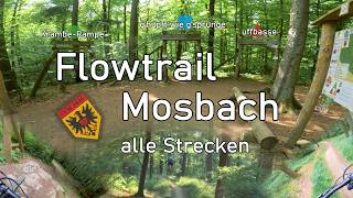
Flowtrail Mosbach
- 2
- 1
- 1
Popular Mosbach Mountain Biking Trails
• 95 ★ 5.0 • 1 mile • 3 ft • 170 •
Flowige Jumpline mit vielen Anliegern und Tables, alle Sprünge sind abrollbar. Länge: 2km mit 130 Tiefenmeter
• 75 ★ 4.8 • 4,045 ft • 7 ft • 151 •
Immer noch ein Flowtrail mit geshapten Anliegern und Sprüngen, allerdings etwas rougher und anspruchsvoller als die beiden anderen Trails, mit teilweise größeren Sprüngen. Länge: 1,3km mit 115 Tiefenmeter
• 80 ★ 4.4 • 2 miles • 15 ft • 137 •
Einfacher Trail für Einsteiger oder zum Aufwärmen. Anlieger, Tables, kleine Sprünge. Länge: 2,6km mit 130 Tiefenmeter
• 35 ★ 3.0 • 2,690 ft • 4 ft • 8 •
Less popular green difficulty singletrack. This multi-use trail can be used downhill primary. On average it takes 2 minutes to complete this trail.
• 55 ★ 3.0 • 2,871 ft • 13 ft • 5 •
Moderately popular green difficulty singletrack. This multi-use trail can be used downhill primary with a 13 ft green climb. Trail visibility is always easy to follow. On average it takes 2 minutes to complete this trail.
• 60 ★ 4.0 • 1,217 ft • 3 ft • 5 •
Abfahrt am Felsenpfad. Kleinere Bäume quer, und ein Felsengartenstück bei dem man kurz vor Ende nochmal aufpassen muss. (Geht links runter vor dem großen umgefallenen Baum)
• 70 ★ 0.0 • 1,316 ft • 7 ft • 5 • • hike
Eine schöne Trailverbindung von der Binare Höhe in Richtung Reichenbuch. So können mit ein paar Schotterwegen die asphaltierten Straßen umgangen werden um zur Abfahrt zum Neckargeracher-Waldsee zu kommen. Ein schöner Flowtrail....
• 50 ★ 0.0 • 1 mile • 109 ft • 5 •
Achtung der Teil südlich vom Schreckhof ist sehr mit Wanderern belebt.
Photos of Mosbach Mountain Bike
Videos of Mosbach Mountain Bike
youtuber
![Endlich mal zum Flowtrail Mosbach geschafft!...]()
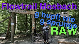
trail: G'Hupft wie G'Sprunge
18:04 |
34 |
May 30, 2026 , Mosbach
trail: G'Hupft wie G'Sprunge
4:34 |
45 |
Aug 20, 2025 , Mosbach
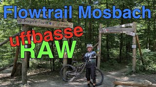
trail: Uffbasse
2:51 |
50 |
Aug 18, 2025 , Mosbach
youtuber
![Back in FLOWSBACH with @JayRidesTrails //...]()
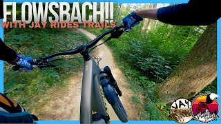
trail: G'Hupft wie G'Sprunge
4:14 |
71 |
Jul 19, 2025 , Mosbach
trail: Uffbasse
0:35 |
54 |
Jul 9, 2025 , Mosbach
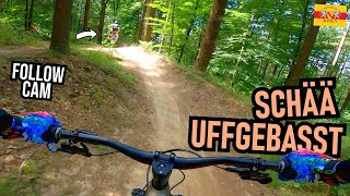
youtuber
![FLOWTRAIL MOSBACH Flutscht wieder: G'Hupft wie...]()
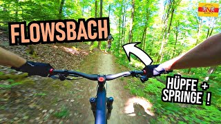
trail: G'Hupft wie G'Sprunge
6:37 |
83 |
May 23, 2025 , Mosbach
youtuber
![FLOWTRAIL MOSBACH Saison-Abschluss: G'Hupft...]()
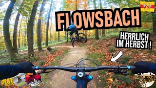
trail: G'Hupft wie G'Sprunge
8:42 |
138 |
Nov 22, 2024 , Mosbach
Recent Trail Reports
| status | trail | date | condition | info | user |
|---|---|---|---|---|---|
| Krambe-Rampe | Jun 15, 2026 @ 1:32pm (Europe/Busingen) Jun 15, 2026 | Ideal | fanbau | ||
| Uffbasse | Jun 1, 2026 @ 11:02am (Europe/Busingen) Jun 1, 2026 | Ideal | JJOOEEHUNT | ||
| G'Hupft wie G'Sprunge | Jun 1, 2026 @ 11:02am (Europe/Busingen) Jun 1, 2026 | Variable | JJOOEEHUNT | ||
| Nuffzus | Jun 1, 2026 @ 11:02am (Europe/Busingen) Jun 1, 2026 | Variable | JJOOEEHUNT | ||
| Uphill Flow Trails | Jun 1, 2026 @ 11:02am (Europe/Busingen) Jun 1, 2026 | Variable | JJOOEEHUNT | ||
| Haubensteinpfad | May 29, 2022 @ 9:44pm May 29, 2022 | Ideal | Freischneider | ||
| Solbergtrail | May 29, 2022 @ 9:44pm May 29, 2022 | Ideal | Freischneider | ||
| Geistereiche-Trail | May 29, 2022 @ 9:43pm May 29, 2022 | Ideal | Freischneider |
Activity Feed
| username | action | type | title | date |
|---|---|---|---|---|
| fanbau | add | report | activity #97045492 | Jun 15, 2026 @ 9:06am Jun 15, 2026 |
| stubbz | wishlist | region | activity #96530803 | Jun 8, 2026 @ 4:37am Jun 8, 2026 |
| MichaeltoAau5 | add | photo | activity #96398588 | Jun 6, 2026 @ 12:45pm Jun 6, 2026 |
| MichaeltoAau5 | vote | trail | activity #96398143 and 1 more | Jun 6, 2026 @ 12:39pm Jun 6, 2026 |
| MichaeltoAau5 | ridden | trail | activity #96398068 | Jun 6, 2026 @ 12:38pm Jun 6, 2026 |
Recent Comments
| username | type | title | comment | date |
|---|---|---|---|---|
| trail | Trail not rideable - not to be found | May 16, 2026 @ 1:24am May 16, 2026 | ||
| trail | Stabil! | May 2, 2026 @ 8:26am May 2, 2026 | ||
| trail | Stabil! | May 2, 2026 @ 8:14am May 2, 2026 | ||
| trail | Wirklich einfacher Anfänger Flowtrail –... | Jun 2, 2025 @ 1:15am Jun 2, 2025 | ||
| trail | Sehr geile Flow-Line. Macht super Spaß,... | Jun 2, 2025 @ 1:07am Jun 2, 2025 |
Local Badges
-

Epic Mountain Bike Climb 2k0 awarded -

Climbing 10k Badge2 awarded -

Mountain Biking 100k Badge0 awarded -

Epic Ride Descent 2k0 awarded -

Descent 10k Badge2 awarded -

Descent 100k Badge0 awarded
Bike & Skill Parks
| name | type | city | rating |
|---|---|---|---|
| Schefflenz motocross | skill park | Mosbach |
Activity Type Stats
| activitytype | trails | distance | descent | descent distance | total vertical | rating | global rank | state rank | photos | reports | routes | ridelogs |
|---|---|---|---|---|---|---|---|---|---|---|---|---|
| Mountain Bike | 15 | 10 miles | 2,507 ft | 6 miles | 597 ft | #5,804 | #158 | 19 | 67 | 640 | ||
| E-Bike | 15 | 10 miles | 2,507 ft | 6 miles | 597 ft | #4,886 | #152 | 67 | 273 | |||
| Horse | 1 | 1,316 ft | 46 ft | 679 ft | 52 ft | |||||||
| Hike | 9 | 6 miles | 1,112 ft | 3 miles | 597 ft | #9,149 | #195 | 48 | 15 | |||
| Trail Running | 6 | 3 miles | 344 ft | 5,095 ft | 535 ft | #9,777 | #250 | 48 | 2 | |||
| Dirtbike/Moto | 2 | 3,491 ft | 46 ft | 709 ft | 387 ft |
Frequently Asked Questions About Mosbach
▼
What are the best places to ride in Mosbach?
Mosbach has 1 areas to explore for mountain biking. The top rated areas are:
▼
What are the highest rated mountain biking trails in Mosbach?
The highest rated mountain biking trails in Mosbach are:
- G'Hupft wie G'Sprunge (4.6/5)
- Uffbasse (4.4/5)
- Krambe-Rampe (4.2/5)
- Felsenpfad (4/5)
- Solbergtrail (3.8/5)
▼
What is the best time of the year to ride in Mosbach?
Based on ride log data, the most popular months to ride in Mosbach are:
- July (17 activities)
- August (11 activities)
- June (5 activities)
▼
Where can I park to ride in Mosbach?
Check the Mosbach trail map for trailhead and parking information. Community members regularly update access and parking details for trails in the area.
- By MosRider & contributors
- Admins: HDRiders, Sasse82, sp00n82, martywis
- #37215 - 2,115 views
- mosbach activity log | embed map of Mosbach mountain bike trails |
Downloading of trail gps tracks in kml & gpx formats is enabled for Mosbach.
You must login to download files.