close
-
Layers w
- Weather Layers
- Pro
- Pro
- Pro
- Pro
- Pro
- Pro
- More Layers
- Pro
- Pro
- Pro
- Pro
-
Upgrade to

3D
Trail Conditions
- Unknown
- Snow Groomed
- Snow Packed
- Snow Covered
- Snow Cover Partial
- Freeze/thaw Cycle
- Icy
- Prevalent Mud
- Wet
- Variable
- Ideal
- Dry
- Very Dry
Trail Flow (Ridden Direction)
Trailforks scans users ridelogs to determine the most popular direction each trail is ridden. A good flowing trail network will have most trails flowing in a single direction according to their intension.
The colour categories are based on what percentage of riders are riding a trail in its intended direction.
The colour categories are based on what percentage of riders are riding a trail in its intended direction.
- > 96%
- > 90%
- > 80%
- > 70%
- > 50%
- < 50%
- bi-directional trail
- no data
Trail Last Ridden
Trailforks scans ridelogs to determine the last time a trail was ridden.
- < 2 days
- < 1 week
- < 2 weeks
- < 1 month
- < 6 months
- > 6 months
Trail Ridden Direction
The intended direction a trail should be ridden.
- Downhill Only
- Downhill Primary
- Both Directions
- Uphill Primary
- Uphill Only
- One Direction
Contribute Details
Colors indicate trail is missing specified detail.
- Description
- Photos
- Description & Photos
- Videos
Trail Popularity ?
Trailforks scans ridelogs to determine which trails are ridden the most in the last 9 months.
Trails are compared with nearby trails in the same city region with a possible 25 colour shades.
Think of this as a heatmap, more rides = more kinetic energy = warmer colors.
- most popular
- popular
- less popular
- not popular
ATV/ORV/OHV Filter
Max Vehicle Width
inches
US Cell Coverage
Legend

Radar Time
Activity Recordings
Trailforks uses anonymized public activity data.
?
Activity Recordings
Trailforks uses anonymized public activity data.
?
Personal Heatmap
▶
Activity Types
all
/
none
▶
Options
2
Date range
month
–
Winter Trails
Warning
A routing network for winter maps does not exist. Selecting trails using the winter trails layer has been disabled.
Missing Trails
Most Popular
Least Popular
Trails are colored based on popularity. The more popular a trail is, the more red. Less popular trails trend towards green.
Jump Magnitude Heatmap
Heatmap of where riders jump on trails. Zoom in to see individual jumps, click circles to view jump details.
BC Backroad Status
![map legend]()
Service Road Atlas is a free to use, community-driven service for viewing and creating reports on the numerous back-country service roads around B.C. and Alberta.

Slope Aspect
Direction the slope faces
Trails Deemphasized
Trails are shown in grey.
Only show trails with no bike usage.
Suggested Layers
Based on selected activity type
Save the current map location and zoom level as your default home location whenever this page is loaded.
Save
No description for Motril has been added yet!
Login or register to submit one.
This region uses the Uk/Euro style trail grading system.
Activities Click to view
- Mountain Bike
133 trails
- E-Bike
133 trails
- Adaptive Bike
- Hike
136 trails
- Trail Running
136 trails
Region Details
- 22
- 5
- 73
- 30
Region Status
Caution as of Apr 10, 2026Stats
- Avg Trail Rating
- Trails (view details)
- 133
- Trails Mountain Bike
- 133
- Trails E-Bike
- 133
- Trails Hike
- 136
- Trails Trail Running
- 136
- Total Distance
- 106 miles
- Total Descent
- 39,492 ft
- Total Vertical
- 7,325 ft
- Highest Trailhead
- 7,675 ft
- Reports
- 189
- Photos
- 23
- Ridden Counter
- 2,405
Sub Regions
-
Bullarenga
- 2
- 44
- 14
-
El Conjuro
- 11
- 6
-
Velez de Benaudalla
- 3
- 14
- 9
Popular Motril Mountain Biking Trails
• 100 ★ 4.5 • 2 miles • 9 ft • 106 •
Popular blue difficulty singletrack. This multi-use trail can be used downhill primary. On average it takes 12 minutes to complete this trail.
• 100 ★ 5.0 • 3,904 ft • 0 ft • 100 •
Popular blue difficulty singletrack. This multi-use trail can be used downhill only. It features berm, rock garden and roller coaster. Trail visibility is always easy to follow. On average it takes 5 minutes to complete this trail.
• 100 ★ 5.0 • 955 ft • 0 ft • 75 •
Popular blue difficulty singletrack. This multi-use trail can be used downhill primary and has a moderate overall physical rating with a 0 ft blue climb. Trail visibility is sometimes hard to follow. On average it takes minutes to complete this trail.
• 100 ★ 5.0 • 2,126 ft • 0 ft • 67 •
Popular red difficulty singletrack. This multi-use trail can be used downhill primary and has a moderate overall physical rating with a 0 ft blue climb. Trail visibility is always easy to follow.
• 100 ★ 5.0 • 1,355 ft • 0 ft • 62 •
Popular red difficulty singletrack. This multi-use trail can be used downhill primary and has a moderate overall physical rating with a 0 ft blue climb. Trail visibility is always easy to follow. On average it takes minutes to complete this trail.
• 95 ★ 4.5 • 1,552 ft • 23 ft • 60 •
Popular blue difficulty singletrack. This multi-use trail can be used downhill primary and has a moderate overall physical rating with a 23 ft blue climb. Trail visibility is sometimes hard to follow. On average it takes 4 minutes to complete this trail.
• 85 ★ 5.0 • 2 miles • 0 ft • 59 •
Popular blue difficulty singletrack. This multi-use trail can be used downhill only and has a moderate overall physical rating. It features berm, drop and jump. On average it takes 19 minutes to complete this trail.
• 95 ★ 5.0 • 1,841 ft • 0 ft • 58 •
Popular red difficulty singletrack. This multi-use trail can be used both directions and has a moderate overall physical rating with a 0 ft blue climb. Trail visibility is sometimes hard to follow. On average it takes 2 minutes to complete this trail.
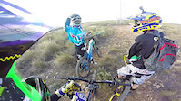
Photos of Motril Mountain Bike
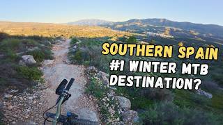
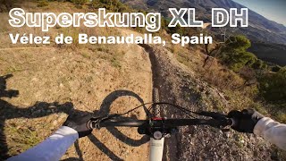
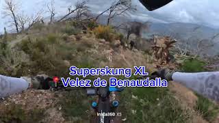
Videos of Motril Mountain Bike

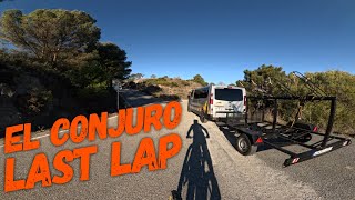
trail: Conjuro-Garnatilla
3:40 |
152 |
Aug 1, 2021
trail: Canal
0:16 |
105 |
Dec 30, 2017
youtuber
![Some very good tracks in Andalucia Spain]()
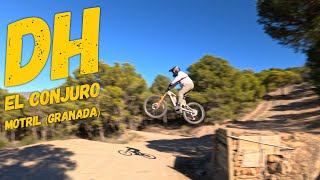
trail: Superskung XL
8:59 |
35 |
Apr 7, 2026 , Motril
trail: Superskung XL
5:59 |
29 |
Jan 8, 2026 , Motril
trail: Superskung XL
7:16 |
46 |
Dec 19, 2025 , Motril
youtuber
![♂️⛰ El Conjuro - Garnatilla | Motril...]()
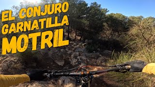
trail: Conjuro-Garnatilla
10:05 |
133 |
Jan 27, 2025 , Motril
Recent Trail Reports
| status | trail | date | condition | info | user |
|---|---|---|---|---|---|
| El Poyeton | Apr 10, 2026 @ 11:04am (Europe/Madrid) Apr 10, 2026 | Unknown | AnderIXXX4H | ||
| 48 Curvas | Apr 5, 2026 @ 10:33am (Europe/Gibraltar) Apr 5, 2026 | Very Dry | TRUSTwfZQWW | ||
| King 2 | Feb 24, 2026 @ 2:23pm (Europe/Madrid) Feb 24, 2026 | Wet | Benjadh3 | ||
| Moby Dick | Feb 23, 2026 @ 8:52am (Europe/Madrid) Feb 22, 2026 | Ideal | MalagaRider | ||
| Superskung XL | Feb 20, 2026 @ 8:57pm (Europe/Madrid) Feb 20, 2026 | Ideal | josillescas | ||
| Los Caballos | Jan 7, 2026 @ 8:10pm (Europe/Madrid) Jan 7, 2026 | Unknown | ramend99 | ||
| Canal | Jan 3, 2026 @ 12:10pm (Europe/Madrid) Jan 3, 2026 | Ideal | ErikITjofo | ||
| Ancestral | Dec 1, 2025 @ 11:10am (Europe/Madrid) Dec 1, 2025 | Ideal | MalagaRider | ||
| Conjuro 10 | Oct 13, 2025 @ 1:48pm (Europe/Madrid) Oct 13, 2025 | Dry | MalagaRider | ||
| Fuente del Madroño | Mar 15, 2025 @ 9:41am Mar 15, 2025 | Dry | UO1ijw |
Activity Feed
| username | action | type | title | date |
|---|---|---|---|---|
| CristianYkfgId | ridden | trail | activity #95879192 | May 30, 2026 @ 12:43pm May 30, 2026 |
| TRUSTwfZQWW | add | photo | activity #94148310 and 4 more | May 6, 2026 @ 5:03am May 6, 2026 |
| 5EJuYJ | wishlist | trail | activity #92327081 | Apr 10, 2026 @ 9:48am Apr 10, 2026 |
| AnderIXXX4H | add | report | activity #92307400 | Apr 10, 2026 @ 2:04am Apr 10, 2026 |
| trailforks | add | video | activity #92164205 | Apr 7, 2026 @ 10:00pm Apr 7, 2026 |
Recent Comments
| username | type | title | comment | date |
|---|---|---|---|---|
| trail | Lo hice sólo hasta el giro cerrado de 180º... | Apr 5, 2026 @ 1:12am Apr 5, 2026 | ||
| trail | Sendero 100% ciclable pero con mucho sube-baja... | Mar 31, 2026 @ 3:43am Mar 31, 2026 | ||
| trail | Sendero con mucho sube baja, bastante pedaleo... | Mar 31, 2026 @ 3:39am Mar 31, 2026 | ||
| trail | Bajada limpia desde la parte mas superior, no... | Dec 1, 2025 @ 2:15am Dec 1, 2025 | ||
| trail | Esta cortado en algunos tramos por árboles... | Nov 9, 2025 @ 1:49pm Nov 9, 2025 |
Local Badges
-

Completionist0 awarded -

Epic Mountain Bike Climb 2k303 awarded -

Climbing 10k Badge42 awarded -

Mountain Biking 100k Badge5 awarded -

Epic Ride Descent 2k303 awarded -

Descent 10k Badge52 awarded
Bike & Skill Parks
| name | type | city | rating |
|---|---|---|---|
| Salobreña motocross | skill park | Motril |
Activity Type Stats
| activitytype | trails | distance | descent | descent distance | total vertical | rating | global rank | state rank | photos | reports | routes | ridelogs |
|---|---|---|---|---|---|---|---|---|---|---|---|---|
| Mountain Bike | 133 | 102 miles | 37,982 ft | 56 miles | 5,262 ft | #1,854 | #165 | 22 | 190 | 1 | 4,175 | |
| E-Bike | 133 | 102 miles | 37,982 ft | 56 miles | 5,262 ft | #1,099 | #235 | 1 | 143 | 716 | ||
| Hike | 136 | 106 miles | 39,491 ft | 59 miles | 7,326 ft | #1,710 | #181 | 190 | 6 | 144 | ||
| Trail Running | 136 | 106 miles | 39,491 ft | 59 miles | 7,326 ft | #1,275 | #172 | 190 | 2 | 33 |
Frequently Asked Questions About Motril
▼
What are the best places to ride in Motril?
Motril has 3 areas to explore for mountain biking. The top rated areas are:
▼
What are the highest rated mountain biking trails in Motril?
The highest rated mountain biking trails in Motril are:
- Conjuro-Garnatilla (4.4/5)
- Conjuro 2 (4.3/5)
- La Llanada (4.3/5)
- Moby Dick (4.3/5)
- Conjuro 6 (4.2/5)
▼
What is the best time of the year to ride in Motril?
Based on ride log data, the most popular months to ride in Motril are:
- October (16 activities)
- January (5 activities)
- February (4 activities)
▼
Where can I park to ride in Motril?
There are 1 parking locations listed in Motril. The most popular parking spots are:
Activities
- By Gullich
 & contributors
 - Admins: AMG, juanx
- #49364 - 2,667 views
- motril activity log | embed map of Motril mountain bike trails | motril mountain biking points of interest
Downloading of trail gps tracks in kml & gpx formats is enabled for Motril.
You must login to download files.