close
-
Layers w
- Weather Layers
- Pro
- Pro
- Pro
- Pro
- Pro
- Pro
- More Layers
- Pro
- Pro
- Pro
- Pro
-
Upgrade to

3D
Trail Conditions
- Unknown
- Snow Groomed
- Snow Packed
- Snow Covered
- Snow Cover Partial
- Freeze/thaw Cycle
- Icy
- Prevalent Mud
- Wet
- Variable
- Ideal
- Dry
- Very Dry
Trail Flow (Ridden Direction)
Trailforks scans users ridelogs to determine the most popular direction each trail is ridden. A good flowing trail network will have most trails flowing in a single direction according to their intension.
The colour categories are based on what percentage of riders are riding a trail in its intended direction.
The colour categories are based on what percentage of riders are riding a trail in its intended direction.
- > 96%
- > 90%
- > 80%
- > 70%
- > 50%
- < 50%
- bi-directional trail
- no data
Trail Last Ridden
Trailforks scans ridelogs to determine the last time a trail was ridden.
- < 2 days
- < 1 week
- < 2 weeks
- < 1 month
- < 6 months
- > 6 months
Trail Ridden Direction
The intended direction a trail should be ridden.
- Downhill Only
- Downhill Primary
- Both Directions
- Uphill Primary
- Uphill Only
- One Direction
Contribute Details
Colors indicate trail is missing specified detail.
- Description
- Photos
- Description & Photos
- Videos
Trail Popularity ?
Trailforks scans ridelogs to determine which trails are ridden the most in the last 9 months.
Trails are compared with nearby trails in the same city region with a possible 25 colour shades.
Think of this as a heatmap, more rides = more kinetic energy = warmer colors.
- most popular
- popular
- less popular
- not popular
ATV/ORV/OHV Filter
Max Vehicle Width
inches
US Cell Coverage
Legend

Radar Time
Activity Recordings
Trailforks uses anonymized public activity data.
?
Activity Recordings
Trailforks uses anonymized public activity data.
?
Personal Heatmap
▶
Activity Types
all
/
none
▶
Options
2
Date range
month
–
Winter Trails
Warning
A routing network for winter maps does not exist. Selecting trails using the winter trails layer has been disabled.
Missing Trails
Most Popular
Least Popular
Trails are colored based on popularity. The more popular a trail is, the more red. Less popular trails trend towards green.
Jump Magnitude Heatmap
Heatmap of where riders jump on trails. Zoom in to see individual jumps, click circles to view jump details.
BC Backroad Status
![map legend]()
Service Road Atlas is a free to use, community-driven service for viewing and creating reports on the numerous back-country service roads around B.C. and Alberta.

Slope Aspect
Direction the slope faces
Trails Deemphasized
Trails are shown in grey.
Only show trails with no bike usage.
Suggested Layers
Based on selected activity type
Save the current map location and zoom level as your default home location whenever this page is loaded.
SaveMount Agamenticus is a fantastic area geared toward the more skilled rider. While there are doubletracks that provide a little mellower experience, most of the trails found at Agamenticus at the very least contain some rock gardens, and most of them have a mix of steep, punchy climbs with rocky problems on both ascents and descents. Agamenticus is a great place to go if you like technical rocky challenges and climbing.
Porcupine is a longer climb with some rocky problems, and Third Hill provides a really nice combination of steeps and rocks, both up and down. Ledge has some nice tight switchbacks. For folks looking to challenge themselves, get over to Incline for a super steep uphill grind, Goosefoot for some more interesting rocky challenges, and Sweet Fern to really get your blood pumping.
Ring is a good loop with mixed terrain and nice variety, and for some short, fun skill tests, make sure you hit up Chestnut Oak and Rocky Road. Ridge trail is also a beautiful piece of singletrack that on the southern end contains some scary rocky steeps.
Primary Trail Type: Cross-Country
AKA: Mount A
 google parking directions
Links
Activities Click to view
- Mountain Bike
30 trails
- Hike
35 trails
- Trail Running
35 trails
- Dirtbike/Moto
4 trails
- ATV/ORV/OHV
4 trails
Stats
- Avg Trail Rating
- Trails (view details)
- 30
- Trails Mountain Bike
- 30
- Trails Hike
- 35
- Trails Trail Running
- 35
- Trails Dirtbike/Moto
- 4
- Trails ATV/ORV/OHV
- 4
- Total Distance
- 21 miles
- Total Descent
- 4,292 ft
- Total Vertical
- 501 ft
- Highest Trailhead
- 687 ft
- Reports
- 329
- Photos
- 46
- Ridden Counter
- 7,417
Popular Mount Agamenticus Mountain Biking Trails
• 90 ★ 4.4 • 1,654 ft • 46 ft • 432 •
Highly rated popular black diamond difficulty singletrack. This mountain bike primary trail can be used both directions and has a moderate overall physical rating with a 46 ft black diamond climb. It features bridge. On average it takes 4 minutes to complete this trail.
• 90 ★ 4.6 • 908 ft • 0 ft • 362 •
Although it's possible to climb this trail, is best done as a descent and features several rock faces. The rock faces are neither very steep or exposed and have easy B lines. However due to the rock faces, in wet conditions this trail...
• 70 ★ 5.0 • 4,868 ft • 253 ft • 343 •
Popular blue difficulty singletrack. This mountain bike primary trail can be used both directions. On average it takes 11 minutes to complete this trail.
• 85 ★ 3.8 • 3,148 ft • 5 ft • 338 •
Popular black diamond difficulty singletrack. This mountain bike primary trail can be used both directions and has a hard overall physical rating with a 5 ft black diamond climb. On average it takes 7 minutes to complete this trail.
• 80 ★ 4.0 • 681 ft • 5 ft • 302 •
Popular blue difficulty singletrack. This mountain bike primary trail can be used uphill primary. On average it takes 1 minutes to complete this trail.
• 35 ★ 3.6 • 4,636 ft • 243 ft • 295 •
Less popular blue difficulty singletrack. This multi-use trail can be used both directions and has a moderate overall physical rating with a 243 ft black diamond climb. On average it takes 14 minutes to complete this trail.
• 40 ★ 4.0 • 1,218 ft • 2 ft • 292 •
is a tough, short trail from Porcupine to . On the way up, it's fairly steep and techy with a plethora of rocks. Downhill is just a plain good time.
Mount Agamenticus Mountain Bike Routes
★ 5.0 • 8 miles • 988 ft • 6 • Loop •
Good way to hit the best trails of second and you can go up mt A. as well and come down to make it to all...
★ 3.7 • 7 miles • 401 ft • 0 • Loop •
Mount Agamenticus Lower pond loop. Small parking area at the end of Middle Pond Rd. Start on the Orange...
7 miles • 244 ft • 0 •
This is a great route except for the part next to Folly Pond, mostly bike pushing there.
• 9 miles • 524 ft • 5 •
• 16 miles • 1,577 ft • 2 •
• 2 miles • 287 ft • 2 •
Photos of Mount Agamenticus Mountain Bike
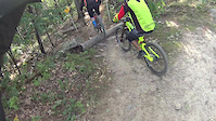
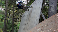
Videos of Mount Agamenticus Mountain Bike
trail: Hidden
2:35 |
190 |
Sep 25, 2017
trail: Sweet Fern
0:56 |
387 |
Nov 26, 2015

trail: Wheel
0:54 |
89 |
Jun 9, 2014

trail: Wheel
0:54 |
85 |
Jun 9, 2014
trail: Ledge
6:02 |
693 |
Jan 18, 2014

trail: NOTCH
2:24 |
12031 |
May 15, 2013
0:46 |
548 |
Apr 28, 2013

trail: Fisher
3:31 |
369 |
Jun 28, 2012
Recent Trail Reports
| status | trail | date | condition | info | user |
|---|---|---|---|---|---|
| Ridge | Nov 19, 2025 @ 8:17pm (America/New_York) Nov 19, 2025 | Ideal | SarahnFQpKJ | ||
| Fisher | Oct 25, 2025 @ 12:49pm (America/New_York) Oct 25, 2025 | Ideal | cray21 | ||
| Third Hill | May 30, 2025 @ 9:41am May 30, 2025 | Ideal | jjfoody97 | ||
| Sweet Fern | May 30, 2025 @ 9:37am May 30, 2025 | Dry | jjfoody97 | ||
| Ledge | Aug 8, 2024 @ 4:41am Aug 8, 2024 | Ideal | Tavenator | ||
| Wheel | Aug 8, 2024 @ 4:41am Aug 8, 2024 | Ideal | Tavenator | ||
| Cedar | Dec 9, 2023 @ 7:18am Dec 9, 2023 | Icy | HardRockMom | ||
| Norman Mill | Dec 9, 2023 @ 7:18am Dec 9, 2023 | Icy | HardRockMom | ||
| Chestnut Oak | Apr 13, 2023 @ 5:22am Apr 13, 2023 | Variable | ferioli | ||
| Porcupine-Ridge Connector | Apr 13, 2023 @ 5:22am Apr 13, 2023 | Ideal | ferioli |
Activity Feed
| username | action | type | title | date |
|---|---|---|---|---|
| SalmaA | add | photo | activity #94902193 | May 17, 2026 @ 7:46am May 17, 2026 |
| mrjayne10 | ridden | trail | activity #92025914 | Apr 5, 2026 @ 8:25pm Apr 5, 2026 |
| trailforks | add | video | activity #89326625 | Feb 21, 2026 @ 6:47pm Feb 21, 2026 |
| SarahnFQpKJ | add | report | activity #84419021 | Nov 19, 2025 @ 5:17pm Nov 19, 2025 |
| cray21 | add | report | activity #83002311 | Oct 25, 2025 @ 11:52am Oct 25, 2025 |
Recent Comments
| username | type | title | comment | date |
|---|---|---|---|---|
| trail | Walked this trail recently, but imagined what... | Oct 19, 2025 @ 11:32am Oct 19, 2025 | ||
| trail | Chunky black diamond double track, if that’s... | Aug 11, 2025 @ 8:08pm Aug 11, 2025 | ||
| trail | Love this trail if you connect it from ridge,... | Sep 4, 2024 @ 6:19pm Sep 4, 2024 | ||
| trail | Chunky chunky chunky, few fun drops but this... | Sep 4, 2024 @ 6:15pm Sep 4, 2024 | ||
| trail | Amazing trail! Connect it from going down... | Sep 4, 2024 @ 6:12pm Sep 4, 2024 |
Nearby Areas
| name | distance | ||||
|---|---|---|---|---|---|
| Kittery-York Water District (KYWD) | 11 | 2 | 1 | 3 km | |
| Orris Falls Conservation Area | 6 | 3.7 km | |||
| Tatnic Woods Preserve | 4 km | ||||
| Lafcadio's Woods Preserve | 4 | 6.6 km | |||
| Fuller Forest - York Land Trust | 4 | 6.7 km |
Local Badges
-

Completionist0 awarded
Activity Type Stats
| activitytype | trails | distance | descent | descent distance | total vertical | rating | global rank | state rank | photos | reports | routes | ridelogs |
|---|---|---|---|---|---|---|---|---|---|---|---|---|
| Mountain Bike | 30 | 21 miles | 4,291 ft | 9 miles | 502 ft | #3,928 | #1,377 | 44 | 328 | 3 | 3,561 | |
| Hike | 35 | 21 miles | 4,291 ft | 9 miles | 502 ft | #6,787 | #2,470 | 233 | 1 | 529 | ||
| Trail Running | 35 | 21 miles | 4,291 ft | 9 miles | 502 ft | #6,780 | #2,199 | 1 | 233 | 1 | 142 | |
| Dirtbike/Moto | 4 | 8 miles | 1,476 ft | 4 miles | 180 ft | #859 | #360 | 18 | ||||
| ATV/ORV/OHV | 4 | 8 miles | 1,476 ft | 4 miles | 180 ft | #542 | #221 | 18 | 2 |
Frequently Asked Questions About Mount Agamenticus
▼
What are the highest rated mountain biking trails in Mount Agamenticus?
The highest rated mountain biking trails in Mount Agamenticus are:
- Sweet Fern (4.3/5)
- Ring W (4.3/5)
- Porcupine (4.2/5)
- Ledge (4.2/5)
- Chestnut Oak (4.2/5)
▼
What is the best time of the year to ride in Mount Agamenticus?
Based on ride log data, the most popular months to ride in Mount Agamenticus are:
- August (78 activities)
- July (67 activities)
- September (64 activities)
▼
Where can I park to ride in Mount Agamenticus?
▼
What is the longest trail in Mount Agamenticus?
The longest trail in Mount Agamenticus is Norman Mill at 2.5 miles. View all trails sorted by distance.
Activities
Trails
Points of Interest
- By GoRideYoBike
 & contributors
 - Admins: GP NEMBA
- #6623 - 19,046 views
- mount agamenticus activity log | embed map of Mount Agamenticus mountain bike trails | mount agamenticus mountain biking points of interest
Downloading of trail gps tracks in kml & gpx formats is enabled for Mount Agamenticus.
You must login to download files.