close
-
Layers w
- Weather Layers
- Pro
- Pro
- Pro
- Pro
- Pro
- Pro
- More Layers
- Pro
- Pro
- Pro
- Pro
-
Upgrade to

3D
Trail Conditions
- Unknown
- Snow Groomed
- Snow Packed
- Snow Covered
- Snow Cover Partial
- Freeze/thaw Cycle
- Icy
- Prevalent Mud
- Wet
- Variable
- Ideal
- Dry
- Very Dry
Trail Flow (Ridden Direction)
Trailforks scans users ridelogs to determine the most popular direction each trail is ridden. A good flowing trail network will have most trails flowing in a single direction according to their intension.
The colour categories are based on what percentage of riders are riding a trail in its intended direction.
The colour categories are based on what percentage of riders are riding a trail in its intended direction.
- > 96%
- > 90%
- > 80%
- > 70%
- > 50%
- < 50%
- bi-directional trail
- no data
Trail Last Ridden
Trailforks scans ridelogs to determine the last time a trail was ridden.
- < 2 days
- < 1 week
- < 2 weeks
- < 1 month
- < 6 months
- > 6 months
Trail Ridden Direction
The intended direction a trail should be ridden.
- Downhill Only
- Downhill Primary
- Both Directions
- Uphill Primary
- Uphill Only
- One Direction
Contribute Details
Colors indicate trail is missing specified detail.
- Description
- Photos
- Description & Photos
- Videos
Trail Popularity ?
Trailforks scans ridelogs to determine which trails are ridden the most in the last 9 months.
Trails are compared with nearby trails in the same city region with a possible 25 colour shades.
Think of this as a heatmap, more rides = more kinetic energy = warmer colors.
- most popular
- popular
- less popular
- not popular
ATV/ORV/OHV Filter
Max Vehicle Width
inches
US Cell Coverage
Legend

Radar Time
Activity Recordings
Trailforks uses anonymized public activity data.
?
Activity Recordings
Trailforks uses anonymized public activity data.
?
Personal Heatmap
▶
Activity Types
all
/
none
▶
Options
2
Date range
month
–
Winter Trails
Warning
A routing network for winter maps does not exist. Selecting trails using the winter trails layer has been disabled.
Missing Trails
Most Popular
Least Popular
Trails are colored based on popularity. The more popular a trail is, the more red. Less popular trails trend towards green.
Jump Magnitude Heatmap
Heatmap of where riders jump on trails. Zoom in to see individual jumps, click circles to view jump details.
BC Backroad Status
![map legend]()
Service Road Atlas is a free to use, community-driven service for viewing and creating reports on the numerous back-country service roads around B.C. and Alberta.

Slope Aspect
Direction the slope faces
Trails Deemphasized
Trails are shown in grey.
Only show trails with no bike usage.
Suggested Layers
Based on selected activity type
Save the current map location and zoom level as your default home location whenever this page is loaded.
Save
No description for Mount Laguna has been added yet!
Login or register to submit one.
Activities Click to view
- Mountain Bike
51 trails
- E-Bike
7 trails
- Gravel Bike
0 trails
- Adaptive Bike
0 trails
- Winter Fat Bike
0 trails
- Horse
7 trails
- Hike
67 trails
- Trail Running
67 trails
Region Details
- 8
- 15
- 21
- 2
Region Status
Open as of Jun 1, 2026Stats
- Avg Trail Rating
- Trails (view details)
- 53
- Trails Mountain Bike
- 51
- Trails E-Bike
- 7
- Trails Horse
- 7
- Trails Hike
- 67
- Trails Trail Running
- 67
- Total Distance
- 111 miles
- Total Descent
- 16,921 ft
- Total Vertical
- 2,529 ft
- Highest Trailhead
- 6,218 ft
- Reports
- 1,148
- Photos
- 1,097
- Ridden Counter
- 13,928
Sub Regions
-
Cleveland National Forest (San Diego County)
- 15
- 21
- 2
Popular Mount Laguna Mountain Biking Trails
• 80 ★ 4.3 • 7 miles • 531 ft • 1,403 •
Instant classic, fun and fast with rowdy sections. This is a very popular trail for outdoor enthusiasts. It can be ridden in either direction. Whichever direction is selected, only the most capable riders will be able to remain in the...
• 100 ★ 3.9 • 2 miles • 9 ft • 1,361 •
The US Forest Service is considering limiting traffic to mountain bikes only on the in the Laguna Mountains. The 2.2 mile trail, located in Cleveland National Forest east of San Diego, would be limited to downhill traffic, to allow...
• 85 ★ 4.0 • 2,953 ft • 4 ft • 939 •
This trail will allow you to bypass the trail head for at Penny Pines. You drop in from the and flow down a fun singletrack to meet up with the Main trail.
• 100 ★ 3.7 • 4,879 ft • 51 ft • 836 •
After about another mile, intersects with in the Meadows at “Water-of-the-Woods,” a small pond brimming with flowering water lilies and ducks during the spring and early summer. During the winter, when ice appears, pine cones rest...
• 95 ★ 3.6 • 2 miles • 35 ft • 826 •
This trail is a popular, easy, singletrack trail that follows the western side of the Mount Laguna meadow and pond. It is a very popular trail frequented by hikers, families, walkers, cyclists, backpackers, runners, bird watchers and...
• 85 ★ 3.5 • 1 mile • 0 ft • 721 •
is one of my favorite sections of trail out here. You will do just a short bit of climbing before the trail turns downhill with lots of twisting flowing fun. On a clear day you will be treated to some great views of the the Cuyamaca...
• 50 ★ 4.1 • 3 miles • 208 ft • 636 •
Noble Canyon is actually three rides in one; a descent from alpine meadows, through oak forests, to the dry desert. Starting from the Penny Pines trailhead on Sunrise Highway, Noble Canyon starts out fairly smooth with a slight climb....
• 80 ★ 3.0 • 3,503 ft • 114 ft • 560 •
is a moderately trafficked trail located near Mount Laguna, CA that features a small seasonal creek and is good for all skill levels. The trail is primarily used for hiking, horses, and mountain biking and is accessible year-round. This...
Mount Laguna Mountain Bike Routes
Wondering Where the Lions Are Featured
★ 4.2 • 18 miles • 1,689 ft • 14 • Loop •
In Bruce Cockburn's wonderful , he sings about wondering where the lions are, which you may wonder...
The Iliad Featured
★ 5.0 • 17 miles • 1,233 ft • 6 • Shuttled •
Homer's epic poem begins the tale of Odysseus, about whom an entire later saga is told. In a way, that's a...
★ 4.7 • 17 miles • 2,968 ft • 3 • Loop •
Great clockwise loop heads up Pine Canyon Road to and then Noble Canyon. Remote area so come prepared....
★ 5.0 • 111 miles • 7,111 ft • 26 • Point to Point •
A wonderful 3 day / 2 night bikepacking adventure through remote areas of San Diego County. We are...
★ 4.0 • 16 miles • 1,430 ft • 8 • Loop •
Free parking, a scenic ride around the lake, challenging yet enjoyable climbing, great single track, and...
★ 4.0 • 13 miles • 2,290 ft • 1 • Loop •
Ever wonder what constitutes Enduro Riding? Well, wonder no more because here is the recipe: 1. Remove...
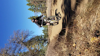
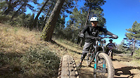
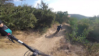
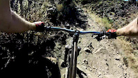
Photos of Mount Laguna Mountain Bike
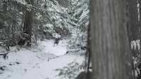
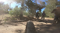
Videos of Mount Laguna Mountain Bike
trail: Big Laguna Trail
0:15 |
133 |
Dec 3, 2018
trail: Noble Canyon Trail
0:39 |
414 |
Nov 12, 2018

trail: Noble Canyon Trail
2:20 |
98 |
Jul 6, 2018
trail: Gatos Ravine Trail
3:00 |
122 |
Jul 6, 2018
trail: Noble Canyon Trail
0:51 |
97 |
Jul 6, 2018

trail: Noble Canyon Trail
0:00 |
101 |
May 24, 2018
trail: Filaree Flat Spur
7:39 |
225 |
Dec 18, 2017
trail: Noble Canyon Trail
0:28 |
324 |
Nov 24, 2017
Recent Trail Reports
| status | trail | date | condition | info | user |
|---|---|---|---|---|---|
| Indian Creek Trail | Jun 1, 2026 @ 12:32pm (America/Los_Angeles) Jun 1, 2026 | Ideal | rideagainsthemachine | ||
| Wooded Hill Road | May 6, 2026 @ 9:09am (America/Tijuana) May 6, 2026 | Ideal | paterjo | ||
| Redtail Roost Loop | May 6, 2026 @ 9:09am (America/Tijuana) May 6, 2026 | Ideal | paterjo | ||
| Filaree Flat Spur | May 6, 2026 @ 9:09am (America/Tijuana) May 6, 2026 | Ideal | paterjo | ||
| Water of the Woods | May 6, 2026 @ 9:09am (America/Tijuana) May 6, 2026 | Ideal | paterjo | ||
| Meadow Spur | May 6, 2026 @ 9:09am (America/Tijuana) May 6, 2026 | Ideal | paterjo | ||
| Noble Canyon Access | May 6, 2026 @ 9:09am (America/Tijuana) May 6, 2026 | Ideal | paterjo | ||
| Gatos Ravine Trail | May 6, 2026 @ 9:09am (America/Tijuana) May 6, 2026 | Ideal | paterjo | ||
| Escondido Ravine Road | May 6, 2026 @ 9:09am (America/Tijuana) May 6, 2026 | Ideal | paterjo | ||
| Thing Valley | May 6, 2026 @ 9:09am (America/Tijuana) May 6, 2026 | Ideal | paterjo |
Activity Feed
| username | action | type | title | date |
|---|---|---|---|---|
| ev-dog | update | trail | activity #97073595 and 9 more | Jun 15, 2026 @ 4:41pm Jun 15, 2026 |
| Augusto1971 | wishlist | route | activity #96665887 | Jun 10, 2026 @ 5:26am Jun 10, 2026 |
| ridetime4 | rsvp | event | activity #96595416 | Jun 9, 2026 @ 4:10am Jun 9, 2026 |
| Burt6SlPhh | wishlist | route | activity #96545334 | Jun 8, 2026 @ 9:33am Jun 8, 2026 |
| wznsI0 | wishlist | trail | activity #96477272 | Jun 7, 2026 @ 10:38am Jun 7, 2026 |
Recent Comments
| username | type | title | comment | date |
|---|---|---|---|---|
| trail | I usually support SDMBA… but what they did... | Apr 8, 2026 @ 11:01am Apr 8, 2026 | ||
| trail | Overall pretty disappointed. If you like... | Mar 29, 2026 @ 11:50am Mar 29, 2026 | ||
| trail | Trail is running great, some cool new options... | Mar 9, 2026 @ 6:45pm Mar 9, 2026 | ||
| trail | SDMBA just changed the trail at the cattle... | Jan 3, 2026 @ 2:54pm Jan 3, 2026 | ||
| trail | Not gravel anymore. Asphalt now. Great... | Dec 13, 2025 @ 7:18pm Dec 13, 2025 |
Local Badges
-

Completionist2 awarded -

10 Blue Trails240 awarded -

Epic Mountain Bike Climb 2k67 awarded -

Climbing 10k Badge46 awarded -

Mountain Biking 100k Badge2 awarded -

Epic Ride Descent 2k67 awarded
Activity Type Stats
| activitytype | trails | distance | descent | descent distance | total vertical | rating | global rank | state rank | photos | reports | routes | ridelogs |
|---|---|---|---|---|---|---|---|---|---|---|---|---|
| Mountain Bike | 51 | 72 miles | 11,995 ft | 40 miles | 2,441 ft | #1,669 | #623 | 1,090 | 1,148 | 22 | 13,030 | |
| E-Bike | 7 | 13 miles | 2,815 ft | 8 miles | 2,175 ft | #5,637 | #1,743 | 858 | 2 | 1,528 | ||
| Horse | 7 | 13 miles | 2,815 ft | 8 miles | 2,175 ft | #2,244 | #1,242 | 117 | 1 | 2 | ||
| Hike | 67 | 111 miles | 16,923 ft | 57 miles | 2,530 ft | #1,364 | #624 | 15 | 1,149 | 3 | 1,174 | |
| Trail Running | 67 | 111 miles | 16,923 ft | 57 miles | 2,530 ft | #1,961 | #635 | 1,148 | 2 | 285 |
Frequently Asked Questions About Mount Laguna
▼
What are the best places to ride in Mount Laguna?
Mount Laguna has 1 areas to explore for mountain biking. The top rated areas are:
▼
What are the highest rated mountain biking trails in Mount Laguna?
The highest rated mountain biking trails in Mount Laguna are:
- Noble Canyon Trail (4.3/5)
- Noble Canyon Access (4.1/5)
- Pine Mountain Trail (4/5)
- Filaree Flat Spur (4/5)
- Wooded Hill - Agua Dulce (4/5)
▼
What is the best time of the year to ride in Mount Laguna?
Based on ride log data, the most popular months to ride in Mount Laguna are:
- October (206 activities)
- July (195 activities)
- June (188 activities)
▼
Where can I park to ride in Mount Laguna?
There are 22 parking locations listed in Mount Laguna. The most popular parking spots are: View all parking and trailhead locations on the map to plan your visit.
Activities
Trails
- mount laguna activity log | embed map of Mount Laguna mountain bike trails | mount laguna mountain biking points of interest
Downloading of trail gps tracks in kml & gpx formats is enabled for Mount Laguna.
You must login to download files.