close
-
Layers w
- Weather Layers
- Pro
- Pro
- Pro
- Pro
- Pro
- Pro
- More Layers
- Pro
- Pro
- Pro
- Pro
-
Upgrade to

3D
Trail Conditions
- Unknown
- Snow Groomed
- Snow Packed
- Snow Covered
- Snow Cover Partial
- Freeze/thaw Cycle
- Icy
- Prevalent Mud
- Wet
- Variable
- Ideal
- Dry
- Very Dry
Trail Flow (Ridden Direction)
Trailforks scans users ridelogs to determine the most popular direction each trail is ridden. A good flowing trail network will have most trails flowing in a single direction according to their intension.
The colour categories are based on what percentage of riders are riding a trail in its intended direction.
The colour categories are based on what percentage of riders are riding a trail in its intended direction.
- > 96%
- > 90%
- > 80%
- > 70%
- > 50%
- < 50%
- bi-directional trail
- no data
Trail Last Ridden
Trailforks scans ridelogs to determine the last time a trail was ridden.
- < 2 days
- < 1 week
- < 2 weeks
- < 1 month
- < 6 months
- > 6 months
Trail Ridden Direction
The intended direction a trail should be ridden.
- Downhill Only
- Downhill Primary
- Both Directions
- Uphill Primary
- Uphill Only
- One Direction
Contribute Details
Colors indicate trail is missing specified detail.
- Description
- Photos
- Description & Photos
- Videos
Trail Popularity ?
Trailforks scans ridelogs to determine which trails are ridden the most in the last 9 months.
Trails are compared with nearby trails in the same city region with a possible 25 colour shades.
Think of this as a heatmap, more rides = more kinetic energy = warmer colors.
- most popular
- popular
- less popular
- not popular
ATV/ORV/OHV Filter
Max Vehicle Width
inches
US Cell Coverage
Legend

Radar Time
Activity Recordings
Trailforks uses anonymized public activity data.
?
Activity Recordings
Trailforks uses anonymized public activity data.
?
Personal Heatmap
▶
Activity Types
all
/
none
▶
Options
2
Date range
month
–
Winter Trails
Warning
A routing network for winter maps does not exist. Selecting trails using the winter trails layer has been disabled.
Missing Trails
Most Popular
Least Popular
Trails are colored based on popularity. The more popular a trail is, the more red. Less popular trails trend towards green.
Jump Magnitude Heatmap
Heatmap of where riders jump on trails. Zoom in to see individual jumps, click circles to view jump details.
BC Backroad Status
![map legend]()
Service Road Atlas is a free to use, community-driven service for viewing and creating reports on the numerous back-country service roads around B.C. and Alberta.

Slope Aspect
Direction the slope faces
Trails Deemphasized
Trails are shown in grey.
Only show trails with no bike usage.
Suggested Layers
Based on selected activity type
Save the current map location and zoom level as your default home location whenever this page is loaded.
SavePrevost is a DH/Freeride hill, and shuttles are more often the order of the day. Many people climb up the fire road, but the up is WAY up. With several choice routes to descend, it can be suitable for relative-novice to extreme & professional, it has fast flowy earthy trails, some parts are built up with ladders, stunts and jumps.
Primary Trail Type: All-Mountain & Downhill
eBikes Allowed:
Yes
Shuttleable: YES
AKA: Swuq'us
Land Status: Community Forest
Land Manager: Municipality of North Cowichan
 google parking directions
Links
Activities Click to view
- Mountain Bike
34 trails
- E-Bike
37 trails
- Hike
14 trails
- Trail Running
14 trails
Region Details
- 6
- 1
- 11
- 11
- 2
Region Status
Open as of Jun 11, 2026Local Trail Association
Stats
- Avg Trail Rating
- Trails (view details)
- 38
- Trails Mountain Bike
- 34
- Trails E-Bike
- 37
- Trails Hike
- 14
- Trails Trail Running
- 14
- Total Distance
- 27 miles
- Total Descent Distance
- 12 miles
- Total Descent
- 11,580 ft
- Total Vertical
- 2,295 ft
- Highest Trailhead
- 2,577 ft
- Reports
- 302
- Photos
- 279
- Ridden Counter
- 9,766
Articles
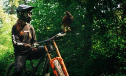
Must Watch: Vaea Verbeeck’s Surreal New Cinematic Passion Project in 'Frequency Realm'
Jun 16, 2026 from pinkbike.com
A breathtaking video shot at Mount Prevost featuring Vaea absolutely ripping.
Video: Revitalizing a Vancouver Island Classic Through Shimano Trail Born
May 27, 2026 from pinkbike.com
Shimano's Trail Born Fund pairs up with the Cowichan Trail Stewardship Society to breathe high-speed, jump-heavy life into Vancouver Island's...
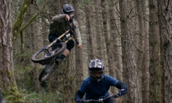
POV: Mind-Melting Speed: Dane Jewett’s Dusty DH Laps on Mt. Prevost
May 12, 2026 from pinkbike.com
Hang on for a high-speed POV as the Giant Factory pro sends it down Vancouver Island’s most iconic shuttle trails.

Video: Reece Wallace Rips Fast DH Laps on Vancouver Island
Apr 23, 2026 from pinkbike.com
Rupert Walker teams up with Reece for a pinned lap down Prevost's iconic 'Memphis' DH track.
Popular Mount Prevost Mountain Biking Trails
• 75 ★ 4.7 • 1,558 ft • 0 ft • 478 •
Adrenaline is Mount Prevosts premiere machine built jump trail. Riders can expect a lot of airtime mixed in with high speed corners. Each feature flows into the next with optional exits before each jump
• 75 ★ 4.4 • 1 mile • 0 ft • 441 •
is a top to bottom high-speed single track trail that acts as an entry point for the majority of trails. The lowest section of is a machine built jump trail, offering a great warm up for Adrenaline Riders can expect steep sections...
• 75 ★ 4.8 • 2,972 ft • 0 ft • 322 •
Mr.T is the go-to trail for racers looking to train. Riders can expect fast single track into tight turns with long steep descents along with some airtime to round things out. Watch for a significant road gap off a well made ramp.
• 70 ★ 4.4 • 1,467 ft • 0 ft • 317 •
Top-most portion is built in a clear cut. A few large, sculptured berms, small gap jumps, and a smooth ramped log drop near the end of this trail addition. Bottom part is fresh with duff. Great addition, particularly when the top bit...
• 70 ★ 5.0 • 1,772 ft • 0 ft • 301 •
Upper extension of Mr. T. Mostly Black Diamond with a couple of Double Black features, particularly one significant step down.
• 70 ★ 4.5 • 4,327 ft • 0 ft • 297 •
Puttin’ on mixes high speeds and jumps into one trail. Riders can expect to start out with big gap jumps that lead into open fast singletrack through a clearcut and back into the forest for some technical steeps. To round things off,...
Mount Prevost Mountain Bike Routes
★ 5.0 • 21 miles • 3,403 ft • 11 •
BCBR Stage 2 2025 Map interpretation. The BLUE line in the Profile depicts the neutralized start, and the...
27 miles • 3,265 ft • 13 •
BCBR 2026 Stage 7: 44 km of riding on the final, final Stage 7 of BCBR's 20-year history. First Timed...
5 miles • 956 ft • 1 • Loop •
Full course for U15 riders. U12 riders will only do stage 2
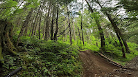
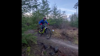
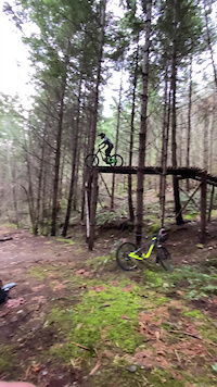
Photos of Mount Prevost Mountain Bike
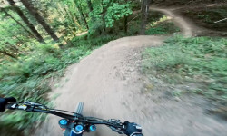
Videos of Mount Prevost Mountain Bike
trail: Memphis
0:15 |
255 |
Jun 17, 2022

trail: Memphis
9:21 |
288 |
Apr 10, 2022

trail: Puttin' on the Ritz
0:18 |
413 |
May 31, 2021
trail: Puttin' on the Ritz
0:56 |
280 |
Jan 11, 2021
trail: Puttin' on the Ritz
0:04 |
861 |
Jan 10, 2021

trail: Prevost Mainline
0:15 |
115 |
Nov 17, 2020
trail: Prevost Mainline
0:15 |
|
Nov 17, 2020

trail: Puttin' on the Ritz
0:24 |
4192 |
Aug 6, 2020
Current Trail Warnings
| status | trail | date | condition | user | info |
|---|---|---|---|---|---|
| Memphis (Lower) | Jun 11, 2026 @ 10:38am (America/Vancouver) Jun 11, 2026 | Ideal | natewynanscreations BCAS | Large tree down right after first jump |
Recent Trail Reports
Activity Feed
| username | action | type | title | date |
|---|---|---|---|---|
| trailforks | add | article_links | activity #97110831 | Jun 16, 2026 @ 8:02am 2 days |
| howyoudoin | ridden | trail | activity #97011998 | Jun 14, 2026 @ 4:23pm Jun 14, 2026 |
| K175QMgQ | wishlist | trail | activity #96786067 | Jun 11, 2026 @ 10:57pm Jun 11, 2026 |
| natewynanscreations | add | report | activity #96747857 | Jun 11, 2026 @ 10:38am Jun 11, 2026 |
| natewynanscreations | vote | trail | activity #96747795 | Jun 11, 2026 @ 10:37am Jun 11, 2026 |
Recent Comments
| username | type | title | comment | date |
|---|---|---|---|---|
| report | Also look out for lots of nettles | Jul 5, 2025 @ 3:26pm Jul 5, 2025 | ||
| trail | Gate is closed on Mt Prevost Road. Can’t shuttle | Jul 2, 2025 @ 10:46am Jul 2, 2025 | ||
| trail | Gate is still closed. | Jul 2, 2025 @ 10:45am Jul 2, 2025 | ||
| trail | Is the gate open? | Apr 20, 2025 @ 9:34am Apr 20, 2025 | ||
| trail | Bubonic Chronic ends at Ponds Road, then the... | Oct 14, 2024 @ 12:40pm Oct 14, 2024 |
Nearby Areas
| name | distance | ||||
|---|---|---|---|---|---|
| Somenos Garry Oak Protected Area | 3 | 4 km | |||
| Mount Richards | 1 | 14 | 2 | 4 km | |
| Maple Mountain | 2 | 13 | 5 | 1 | 5.8 km |
| Cowichan River Provincal Park | 3 | 2 | 6 km | ||
| Mount Tzouhalem | 36 | 21 | 1 | 7.1 km |
Local Badges
-

Completionist2 awarded
Local Mountain Biking Directory
-
Cowichan Trail Stewardship Society
![Cowichan Trail Stewardship Society]()
-
Next Level Riding Ltd
-
Next Level Riding Ltd
![Next Level Riding Ltd]()
-
Cowichan CyclesBike Shop
![Cowichan Cycles]()
-
Experience CyclingBike Shop
-
Iguana CyclesBike Shop
Local Products
Activity Type Stats
| activitytype | trails | distance | descent | descent distance | total vertical | rating | global rank | state rank | photos | reports | routes | ridelogs |
|---|---|---|---|---|---|---|---|---|---|---|---|---|
| Mountain Bike | 34 | 20 miles | 11,293 ft | 12 miles | 2,274 ft | 238 | 302 | 8 | 3,188 | |||
| E-Bike | 37 | 26 miles | 9,879 ft | 11 miles | 2,293 ft | #3,049 | #106 | 239 | 85 | |||
| Hike | 14 | 18 miles | 984 ft | 3 miles | 2,293 ft | #2,908 | #127 | 41 | 212 | 840 | ||
| Trail Running | 14 | 18 miles | 984 ft | 3 miles | 2,293 ft | #6,125 | #225 | 212 | 173 |
Frequently Asked Questions About Mount Prevost
▼
What are the highest rated mountain biking trails in Mount Prevost?
The highest rated mountain biking trails in Mount Prevost are:
- Mr.T (lower) (4.5/5)
- Adrenaline (Jump Trail) (4.5/5)
- Mr.T (Upper) (4.4/5)
- Puttin' on the Ritz (4.3/5)
- Memphis (4.3/5)
▼
What is the best time of the year to ride in Mount Prevost?
Based on ride log data, the most popular months to ride in Mount Prevost are:
- May (58 activities)
- July (37 activities)
- October (36 activities)
▼
Where can I park to ride in Mount Prevost?
There are 3 parking locations listed in Mount Prevost. The most popular parking spots are: View all parking and trailhead locations on the map to plan your visit.
▼
What is the longest trail in Mount Prevost?
The longest trail in Mount Prevost is Memphis at 2.0 km. View all trails sorted by distance.
Activities
Trails
- By canadaka
 Trailforks & contributors
 - Admins: Dubnyk, CRD-Parks, CTSS, CTSS
- #1047 - 46,625 views
- mount prevost activity log | embed map of Mount Prevost mountain bike trails | mount prevost mountain biking points of interest
Downloading of trail gps tracks in kml & gpx formats is enabled for Mount Prevost.
You must login to download files.