close
-
Layers w
- Weather Layers
- Pro
- Pro
- Pro
- Pro
- Pro
- Pro
- More Layers
- Pro
- Pro
- Pro
- Pro
-
Upgrade to

3D
Trail Conditions
- Unknown
- Snow Groomed
- Snow Packed
- Snow Covered
- Snow Cover Partial
- Freeze/thaw Cycle
- Icy
- Prevalent Mud
- Wet
- Variable
- Ideal
- Dry
- Very Dry
Trail Flow (Ridden Direction)
Trailforks scans users ridelogs to determine the most popular direction each trail is ridden. A good flowing trail network will have most trails flowing in a single direction according to their intension.
The colour categories are based on what percentage of riders are riding a trail in its intended direction.
The colour categories are based on what percentage of riders are riding a trail in its intended direction.
- > 96%
- > 90%
- > 80%
- > 70%
- > 50%
- < 50%
- bi-directional trail
- no data
Trail Last Ridden
Trailforks scans ridelogs to determine the last time a trail was ridden.
- < 2 days
- < 1 week
- < 2 weeks
- < 1 month
- < 6 months
- > 6 months
Trail Ridden Direction
The intended direction a trail should be ridden.
- Downhill Only
- Downhill Primary
- Both Directions
- Uphill Primary
- Uphill Only
- One Direction
Contribute Details
Colors indicate trail is missing specified detail.
- Description
- Photos
- Description & Photos
- Videos
Trail Popularity ?
Trailforks scans ridelogs to determine which trails are ridden the most in the last 9 months.
Trails are compared with nearby trails in the same city region with a possible 25 colour shades.
Think of this as a heatmap, more rides = more kinetic energy = warmer colors.
- most popular
- popular
- less popular
- not popular
ATV/ORV/OHV Filter
Max Vehicle Width
inches
US Cell Coverage
Legend

Radar Time
Activity Recordings
Trailforks uses anonymized public activity data.
?
Activity Recordings
Trailforks uses anonymized public activity data.
?
Personal Heatmap
▶
Activity Types
all
/
none
▶
Options
2
Date range
month
–
Winter Trails
Warning
A routing network for winter maps does not exist. Selecting trails using the winter trails layer has been disabled.
Missing Trails
Most Popular
Least Popular
Trails are colored based on popularity. The more popular a trail is, the more red. Less popular trails trend towards green.
Jump Magnitude Heatmap
Heatmap of where riders jump on trails. Zoom in to see individual jumps, click circles to view jump details.
BC Backroad Status
![map legend]()
Service Road Atlas is a free to use, community-driven service for viewing and creating reports on the numerous back-country service roads around B.C. and Alberta.

Slope Aspect
Direction the slope faces
Trails Deemphasized
Trails are shown in grey.
Only show trails with no bike usage.
Suggested Layers
Based on selected activity type
Save the current map location and zoom level as your default home location whenever this page is loaded.
Save
No description for Mount Proctor has been added yet!
Login or register to submit one.
 google parking directions
google parking directions Activities Click to view
- Mountain Bike
19 trails
- E-Bike
17 trails
- Hike
22 trails
- Trail Running
22 trails
- Snowshoe
5 trails
Region Details
- 5
- 4
- 9
- 1
Region Status
Open as of Jun 13, 2026Stats
- Avg Trail Rating
- Trails (view details)
- 21
- Trails Mountain Bike
- 19
- Trails E-Bike
- 17
- Trails Hike
- 22
- Trails Trail Running
- 22
- Trails Snowshoe
- 5
- Total Distance
- 33 miles
- Total Descent
- 9,115 ft
- Total Vertical
- 4,509 ft
- Highest Trailhead
- 7,821 ft
- Reports
- 1,284
- Photos
- 249
- Ridden Counter
- 18,885
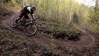
Popular Mount Proctor Mountain Biking Trails
• 95 ★ 4.4 • 1 mile • 18 ft • 2,707 •
This is without doubt one of the most popular in Fernie. Very flowy, with twists, turns, small root drops, banks, berms and all that good stuff. Tackling it at high speed can be high risk, however, and first-time users are encouraged to...
• 100 ★ 3.6 • 2 miles • 979 ft • 2,429 •
The (2019) climb to . It winds through forest with many twists and turns to keep the grade more moderate despite the steep terrain. There are lots of switchbacks and sidehills with some grunts and some relief mixed in. This is a classic...
• 100 ★ 2.0 • 2,165 ft • 26 ft • 2,313 •
The natural continuation of e, after you cross . Mellow terrain with some whoops, and turns and roots. Be aware of hikers, and moderate speed.
• 100 ★ 4.0 • 616 ft • 19 ft • 2,133 •
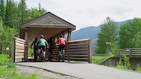
A beautiful new bridge that crosses Fairy Creek, for access to Swine Flu. Now you no longer have to ride the Highway!
• 95 ★ 5.0 • 2,195 ft • 0 ft • 1,595 •
Access trail to get to and the Waterfall Trail.
• 100 ★ 5.0 • 1,010 ft • 3 ft • 1,539 •
A paved trail section from the Fairy Creek Bike Bridge to the Visitor Centre. An awesome new (late 2019) addition that allows those seeking post-biking refreshments at the Fernie Brewing Company a safe route, amongst many other users.
• 50 ★ 2.4 • 1 mile • 377 ft • 614 • • hike
This trail runs from the Visitor Centre to Waterfall. The trail is rated as "easy" but has a few gentle ups and downs. It is well signposted. This is a beautiful hike along the creek all the way to the waterfall through the forest....
Mount Proctor Mountain Bike Routes
30 miles • 4,685 ft • 16 • Loop •
Fernie Trail to Ale route with Today's Special instead of Hyperextension. Start and finish at the brewery....
Photos of Mount Proctor Mountain Bike
Videos of Mount Proctor Mountain Bike
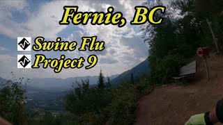
trail: Swine Flu
0:09 |
329 |
Apr 28, 2019
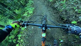
trail: Swine Flu
2:38 |
23665 |
Jun 2, 2012
trail: Swine Flu
2:25 |
120 |
Dec 29, 2011
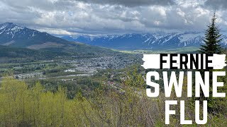
![Fernie - Biking Paradise [EP.12]](https://ev1.pinkbike.org/tf/vt/1/yvt-147504-4.jpg)
trail: Swine Flu
3:34 |
409 |
Oct 15, 2022 , Fernie
trail: Swine Flu
6:21 |
834 |
May 27, 2022 , Fernie
trail: Swine Flu
15:14 |
753 |
Mar 5, 2021 , Fernie

trail: Swine Flu
5:03 |
1211 |
Feb 26, 2020 , Fernie
Recent Trail Reports
Activity Feed
| username | action | type | title | date |
|---|---|---|---|---|
| jsilvaggio | ridden | trail | activity #97224527 | Jun 17, 2026 @ 6:45pm 14 hours |
| Evalchuis | wishlist | trail | activity #97210717 | Jun 17, 2026 @ 2:50pm 18 hours |
| Lucas0976 | wishlist | trail | activity #97123625 | Jun 16, 2026 @ 10:55am 2 days |
| garrettmeunier1 | wishlist | trail | activity #97059301 and 3 more | Jun 15, 2026 @ 12:29pm 3 days |
| Nutrifit | add | report | activity #96984449 | Jun 14, 2026 @ 10:33am Jun 14, 2026 |
Recent Comments
| username | type | title | comment | date |
|---|---|---|---|---|
| trail | Will second the opinion that Swine Flu is NOT... | Sep 17, 2025 @ 6:59am Sep 17, 2025 | ||
| trail | This is NOT a blue trail. It is posted as a... | Sep 3, 2025 @ 7:43pm Sep 3, 2025 | ||
| trail | The trail is fun, the uphill is intense and... | Jul 7, 2025 @ 10:36am Jul 7, 2025 | ||
| trail | Saw a black beer on dairy run in the paddock... | May 31, 2025 @ 3:30pm May 31, 2025 | ||
| trail | Trail is running 100% perfect - get it before... | Apr 15, 2025 @ 7:44pm Apr 15, 2025 |
Nearby Areas
| name | distance | ||||
|---|---|---|---|---|---|
| Mt Fernie | 2 | 6 | 14 | 2.3 km | |
| Ridgemont | 11 | 36 | 12 | 2 | 2.6 km |
| Fernie Ridge | 2.9 km | ||||
| Montane Fernie | 8 | 17 | 1 | 3.6 km | |
| Mount Fernie Provincial Park | 24 | 18 | 10 | 3.7 km |
Local Badges
-

Completionist0 awarded
Local Mountain Biking Directory
-
Mystic Mountain Adventures
![Mystic Mountain Adventures]()
-
Tourism Fernie
![Tourism Fernie]()
-
Fernie Trails AllianceTrail Association
![Fernie Trails Alliance]()
-
Fernie Mountain Bike ClubClub
![Fernie Mountain Bike Club]()
-
GearHub SportsBike Shop
![GearHub Sports]()
-
The Guide's HutBike Shop
![The Guide's Hut]()
Activity Type Stats
| activitytype | trails | distance | descent | descent distance | total vertical | rating | global rank | state rank | photos | reports | routes | ridelogs |
|---|---|---|---|---|---|---|---|---|---|---|---|---|
| Mountain Bike | 19 | 23 miles | 4,557 ft | 9 miles | 1,703 ft | #1,370 | #99 | 209 | 1,268 | 1 | 13,201 | |
| E-Bike | 17 | 18 miles | 3,307 ft | 7 miles | 1,703 ft | #4,716 | #185 | 2 | 1,349 | 1 | 260 | |
| Hike | 22 | 33 miles | 9,114 ft | 14 miles | 4,508 ft | #2,282 | #107 | 38 | 1,434 | 1,350 | ||
| Trail Running | 22 | 33 miles | 9,114 ft | 14 miles | 4,508 ft | #460 | #25 | 1,434 | 1,105 | |||
| Snowshoe | 5 | 3 miles | 417 ft | 1 mile | 738 ft | #1,649 | #128 | 101 | 29 |
Frequently Asked Questions About Mount Proctor
▼
What are the highest rated mountain biking trails in Mount Proctor?
The highest rated mountain biking trails in Mount Proctor are:
- Swine Flu (4.4/5)
- Swine Flu Access (4.2/5)
- FBC Highway Express (4.1/5)
- Y'Eddy (4/5)
- Fairy Creek Bridge Trail (4/5)
▼
What is the best time of the year to ride in Mount Proctor?
Based on ride log data, the most popular months to ride in Mount Proctor are:
- July (206 activities)
- May (190 activities)
- June (141 activities)
▼
Where can I park to ride in Mount Proctor?
There are 1 parking locations listed in Mount Proctor. The most popular parking spots are:
▼
What is the longest trail in Mount Proctor?
The longest trail in Mount Proctor is Swine Flu Climb at 2.8 km. View all trails sorted by distance.
Activities
Trails
- By skibum6969
 FTA VR SAR & contributors
 - Admins: FTA, scottg, skibum6969, STMS, RDEK
- #33772 - 3,969 views
- mount proctor activity log | embed map of Mount Proctor mountain bike trails | mount proctor mountain biking points of interest
Downloading of trail gps tracks in kml & gpx formats is enabled for Mount Proctor.
You must login to download files.