close
-
Layers w
- Weather Layers
- Pro
- Pro
- Pro
- Pro
- Pro
- Pro
- More Layers
- Pro
- Pro
- Pro
- Pro
-
Upgrade to

3D
Trail Conditions
- Unknown
- Snow Groomed
- Snow Packed
- Snow Covered
- Snow Cover Partial
- Freeze/thaw Cycle
- Icy
- Prevalent Mud
- Wet
- Variable
- Ideal
- Dry
- Very Dry
Trail Flow (Ridden Direction)
Trailforks scans users ridelogs to determine the most popular direction each trail is ridden. A good flowing trail network will have most trails flowing in a single direction according to their intension.
The colour categories are based on what percentage of riders are riding a trail in its intended direction.
The colour categories are based on what percentage of riders are riding a trail in its intended direction.
- > 96%
- > 90%
- > 80%
- > 70%
- > 50%
- < 50%
- bi-directional trail
- no data
Trail Last Ridden
Trailforks scans ridelogs to determine the last time a trail was ridden.
- < 2 days
- < 1 week
- < 2 weeks
- < 1 month
- < 6 months
- > 6 months
Trail Ridden Direction
The intended direction a trail should be ridden.
- Downhill Only
- Downhill Primary
- Both Directions
- Uphill Primary
- Uphill Only
- One Direction
Contribute Details
Colors indicate trail is missing specified detail.
- Description
- Photos
- Description & Photos
- Videos
Trail Popularity ?
Trailforks scans ridelogs to determine which trails are ridden the most in the last 9 months.
Trails are compared with nearby trails in the same city region with a possible 25 colour shades.
Think of this as a heatmap, more rides = more kinetic energy = warmer colors.
- most popular
- popular
- less popular
- not popular
ATV/ORV/OHV Filter
Max Vehicle Width
inches
US Cell Coverage
Legend

Radar Time
Activity Recordings
Trailforks uses anonymized public activity data.
?
Activity Recordings
Trailforks uses anonymized public activity data.
?
Personal Heatmap
▶
Activity Types
all
/
none
▶
Options
2
Date range
month
–
Winter Trails
Warning
A routing network for winter maps does not exist. Selecting trails using the winter trails layer has been disabled.
Missing Trails
Most Popular
Least Popular
Trails are colored based on popularity. The more popular a trail is, the more red. Less popular trails trend towards green.
Jump Magnitude Heatmap
Heatmap of where riders jump on trails. Zoom in to see individual jumps, click circles to view jump details.
BC Backroad Status
![map legend]()
Service Road Atlas is a free to use, community-driven service for viewing and creating reports on the numerous back-country service roads around B.C. and Alberta.

Slope Aspect
Direction the slope faces
Trails Deemphasized
Trails are shown in grey.
Only show trails with no bike usage.
Suggested Layers
Based on selected activity type
Save the current map location and zoom level as your default home location whenever this page is loaded.
Save
No description for Mount Shasta has been added yet!
Login or register to submit one.
AKA: Mt. Shasta, Mt Shasta
Activities Click to view
- Mountain Bike
93 trails
- E-Bike
19 trails
- Gravel Bike
3 trails
- Adaptive Bike
0 trails
- Winter Fat Bike
0 trails
- Horse
32 trails
- Hike
137 trails
- Trail Running
123 trails
- Dirtbike/Moto
1 trails
- ATV/ORV/OHV
0 trails
- Snowmobile
0 trails
- Snowshoe
12 trails
- Downhill Ski
35 trails
- Backcountry Ski
0 trails
- Nordic Ski
18 trails
Region Details
- 16
- 2
- 38
- 29
- 7
Region Status
Open as of May 24, 2026Stats
- Avg Trail Rating
- Trails (view details)
- 207
- Trails Mountain Bike
- 93
- Trails E-Bike
- 19
- Trails Gravel Bike
- 3
- Trails Horse
- 32
- Trails Hike
- 137
- Trails Trail Running
- 123
- Trails Dirtbike/Moto
- 1
- Trails Snowshoe
- 12
- Trails Downhill Ski
- 35
- Trails Nordic Ski
- 18
- Total Distance
- 232 miles
- Total Descent
- 51,680 ft
- Total Vertical
- 11,161 ft
- Highest Trailhead
- 14,153 ft
- Reports
- 704
- Photos
- 296
- Ridden Counter
- 19,936
Articles
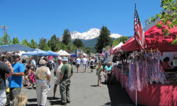
Mt. Shasta Named First PCT "Trail Town"
Mar 5, 2018 from backpacker.com
The Pacific Crest Trail Association's pilot program aims to promote hiking in the area and boost the local economy.
Sub Regions
-
Mount Shasta Area Trails
- 1
- 6
- 2
-
Mt. Shasta Bike Park
- 3
- 5
- 3
-
The Eddys
- 2
- 2
- 2
-
The Gateway Trail System
- 1
- 24
- 16
- 1
Popular Mount Shasta Mountain Biking Trails
• 90 ★ 3.7 • 2,999 ft • 0 ft • 778 •
Popular blue difficulty singletrack. This mountain bike primary trail can be used downhill only. On average it takes 3 minutes to complete this trail.
• 90 ★ 3.7 • 3 miles • 13 ft • 740 •
Northern section of the which provides access from the main trailhead parking area.
• 100 ★ 3.7 • 1 mile • 11 ft • 573 •
Part of the 2021 Phase 2 trail expansion, trail was built as the first addition of that project. Most often ridden in the downhill direction, it offers a fun, easy ride with rolling singletrack, several small rock features, and a short...
• 85 ★ 4.0 • 724 ft • 0 ft • 548 •
Popular blue difficulty singletrack. This mountain bike primary trail can be used downhill only and has a easy overall physical rating. It features berm and jump. Trail visibility is always easy to follow. On average it takes 1 minutes to complete this trail.
• 90 ★ 0.0 • 4,085 ft • 205 ft • 519 •
Popular green difficulty singletrack. This mountain bike primary trail can be used both directions. On average it takes 10 minutes to complete this trail.
• 90 ★ 5.0 • 1 mile • 14 ft • 507 •
An old favorite, was once a non-system trail built by local riders. During the Phase 2 planning process, it was adopted by the Forest Service as a system trail. It has had several recent reroutes to meet Forest Service trail standards,...
• 75 ★ 2.7 • 4,740 ft • 72 ft • 482 •
Popular blue difficulty singletrack. This mountain bike primary trail can be used both directions. On average it takes 7 minutes to complete this trail.
• 100 ★ 5.0 • 2,162 ft • 0 ft • 475 •
Built long ago by motorcycle riders, became a favorite of local mountain bikers, and ultimately it was adopted by the Forest Service as a non-motorized trail in 2021 as part of the Gateway Phase 2 project. A very short trail, the fun on...
Mount Shasta Mountain Bike Routes
★ 3.5 • 11 miles • 1,289 ft • 4 • Loop •
The route has been designed for the Bigfoot Adventure Challenge ( bigfootadventurechallenge.com) but is...
21 miles • 2,728 ft • 10 • Loop •
This Bigfoot Adventure Challenge route at the base of Mount Shasta gives you a lot of what the Gateway...
6 miles • 719 ft • 3 • Loop •
This Bigfoot Adventure Challenge route is touches on some of the best in the Gateway Trail System at the...
11 miles • 1,191 ft • 2 • Loop •
This Bigfoot Adventure Challenge route in the USFS managed Gateway Trail system is on classic trails in a...
13 miles • 1,522 ft • 6 • Loop •
This new to the Bigfoot Adventure Challenge route explores some old school trails with start and end on...
★ 2.0 • 28 miles • 3,440 ft • 17 • Loop •
This is Bigfoot's 2026 interim long course UNTIL Strawberry Valley fuels work is completed by the USFS....
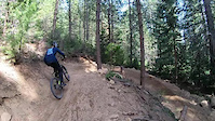
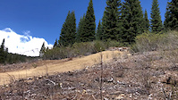
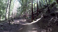
Photos of Mount Shasta Mountain Bike
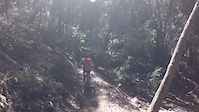
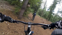
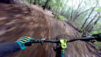
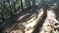
Videos of Mount Shasta Mountain Bike
trail: Bear Springs
0:43 |
119 |
Aug 29, 2022
trail: Downhill Trail
0:14 |
567 |
May 11, 2018
trail: Flow Trail
9:13 |
104 |
Apr 19, 2018
trail: Flow Trail
17:41 |
49 |
Apr 19, 2018
trail: Flow Trail
4:03 |
87 |
Jan 10, 2017
trail: Downhill Trail
5:08 |
267 |
Nov 1, 2016
trail: Flow Trail
9:03 |
81 |
Sep 17, 2016
trail: Marley
0:40 |
244 |
Sep 11, 2016
Recent Trail Reports
Activity Feed
| username | action | type | title | date |
|---|---|---|---|---|
| AnnalisaSlxkFB | wishlist | trail | activity #97155426 | Jun 16, 2026 @ 6:57pm 2 days |
| AnnalisaSlxkFB | wishlist | trail | activity #97155361 and 1 more | Jun 16, 2026 @ 6:56pm 2 days |
| Matiasek | add | karma | activity #97031733 | Jun 15, 2026 @ 4:13am Jun 15, 2026 |
| Brielk | wishlist | route | activity #96771974 | Jun 11, 2026 @ 5:26pm Jun 11, 2026 |
| sixfetty | add | photo | activity #96685216 | Jun 10, 2026 @ 11:12am Jun 10, 2026 |
Recent Comments
| username | type | title | comment | date |
|---|---|---|---|---|
| trail | t | May 31, 2026 @ 5:16pm May 31, 2026 | ||
| trail | Bridges in place on May 21 | May 22, 2026 @ 8:40pm May 22, 2026 | ||
| trail | Great trail for families, beginners and anyone... | May 22, 2026 @ 8:40pm May 22, 2026 | ||
| trail | Super fun flowy jump trail. Safe to it hit it... | Nov 24, 2025 @ 3:12pm Nov 24, 2025 | ||
| trail | Definitely my favorite trail here! Techy rock... | Nov 24, 2025 @ 3:11pm Nov 24, 2025 |
Local Badges
-

Epic Ride Climb 2k88 awarded -

Climbing 10k Badge29 awarded -

Climbing 100k Badge1 awarded -

Epic Ride Descent 2k88 awarded -

Descent 10k Badge44 awarded -

Descent 100k Badge2 awarded
Bike & Skill Parks
| name | type | city | rating |
|---|---|---|---|
| Mount Shasta Ski Park | bike park | Mount Shasta |
Local Trail Supporters
- Mount Shasta Trail Association
![Nat. Rec. Trail]()
Activity Type Stats
| activitytype | trails | distance | descent | descent distance | total vertical | rating | global rank | state rank | photos | reports | routes | ridelogs |
|---|---|---|---|---|---|---|---|---|---|---|---|---|
| Mountain Bike | 93 | 116 miles | 23,921 ft | 62 miles | 5,026 ft | #1,033 | #405 | 228 | 682 | 29 | 11,718 | |
| E-Bike | 19 | 30 miles | 10,180 ft | 21 miles | 4,262 ft | #3,473 | #1,223 | 574 | 3 | 734 | ||
| Gravel Bike | 3 | 5 miles | 210 ft | 1 mile | 1,204 ft | #458 | #1,038 | 35 | 9 | 32 | ||
| Horse | 32 | 43 miles | 4,997 ft | 16 miles | 6,470 ft | #1,027 | #674 | 94 | 6 | 1 | ||
| Hike | 137 | 173 miles | 23,432 ft | 60 miles | 11,161 ft | #624 | #287 | 59 | 653 | 59 | 2,022 | |
| Trail Running | 123 | 169 miles | 23,284 ft | 60 miles | 11,161 ft | #824 | #310 | 653 | 31 | 783 | ||
| Dirtbike/Moto | 1 | 1 mile | 23 ft | 2,008 ft | 13 ft | #1,062 | #418 | 79 | 1 | 8 | ||
| Snowshoe | 12 | 19 miles | 571 ft | 2 miles | 9,731 ft | #495 | #171 | 3 | 2 | 90 | ||
| Downhill Ski | 35 | 18 miles | 16,785 ft | 16 miles | 2,047 ft | #355 | #138 | 5 | 1 | 1,227 | ||
| Nordic Ski | 18 | 15 miles | 814 ft | 4 miles | 469 ft | #619 | #209 | 16 | 220 |
Frequently Asked Questions About Mount Shasta
▼
What are the best places to ride in Mount Shasta?
Mount Shasta has 11 areas to explore for mountain biking. The top rated areas are:
▼
What are the highest rated mountain biking trails in Mount Shasta?
The highest rated mountain biking trails in Mount Shasta are:
- Lemurian Delirium (4.4/5)
- Muir's Ascension (4.2/5)
- Muir's Ascension (4.2/5)
- Muir's Ascension (4.2/5)
- Steam Donkey (4.2/5)
▼
What is the best time of the year to ride in Mount Shasta?
Based on ride log data, the most popular months to ride in Mount Shasta are:
- July (138 activities)
- August (113 activities)
- June (96 activities)
▼
Where can I park to ride in Mount Shasta?
There are 43 parking locations listed in Mount Shasta. The most popular parking spots are: View all parking and trailhead locations on the map to plan your visit.
Activities
Trails
Points of Interest
- [Water Crossing] Other
- Nordic Center Trailhead Information
- Views of Mt. Eddy & Castle Crags Viewpoint
- Mount Bradley Lookout Summit
- Red Fir Flat Campground Camping
- McBride Springs Campground Camping
- Sierra Club Horse Camp Camping
- Grey Butte Summit 2471m - 8106ft
- [Water Crossing] Other
- Panther Meadows Campground Camping
- Misery Hill (13,806 ft)
- Thumb Rock (12,871 ft)
- Shastarama Point (11,161 ft)
- By todd
 Trailforks & contributors
 - Admins: SORA, DSC, MSTA
- #20485 - 19,523 views
- mount shasta activity log | embed map of Mount Shasta mountain bike trails | mount shasta mountain biking points of interest
Downloading of trail gps tracks in kml & gpx formats is enabled for Mount Shasta.
You must login to download files.