close
-
Layers w
- Weather Layers
- Pro
- Pro
- Pro
- Pro
- Pro
- Pro
- More Layers
- Pro
- Pro
- Pro
- Pro
-
Upgrade to

3D
Trail Conditions
- Unknown
- Snow Groomed
- Snow Packed
- Snow Covered
- Snow Cover Partial
- Freeze/thaw Cycle
- Icy
- Prevalent Mud
- Wet
- Variable
- Ideal
- Dry
- Very Dry
Trail Flow (Ridden Direction)
Trailforks scans users ridelogs to determine the most popular direction each trail is ridden. A good flowing trail network will have most trails flowing in a single direction according to their intension.
The colour categories are based on what percentage of riders are riding a trail in its intended direction.
The colour categories are based on what percentage of riders are riding a trail in its intended direction.
- > 96%
- > 90%
- > 80%
- > 70%
- > 50%
- < 50%
- bi-directional trail
- no data
Trail Last Ridden
Trailforks scans ridelogs to determine the last time a trail was ridden.
- < 2 days
- < 1 week
- < 2 weeks
- < 1 month
- < 6 months
- > 6 months
Trail Ridden Direction
The intended direction a trail should be ridden.
- Downhill Only
- Downhill Primary
- Both Directions
- Uphill Primary
- Uphill Only
- One Direction
Contribute Details
Colors indicate trail is missing specified detail.
- Description
- Photos
- Description & Photos
- Videos
Trail Popularity ?
Trailforks scans ridelogs to determine which trails are ridden the most in the last 9 months.
Trails are compared with nearby trails in the same city region with a possible 25 colour shades.
Think of this as a heatmap, more rides = more kinetic energy = warmer colors.
- most popular
- popular
- less popular
- not popular
ATV/ORV/OHV Filter
Max Vehicle Width
inches
US Cell Coverage
Legend

Radar Time
Activity Recordings
Trailforks uses anonymized public activity data.
?
Activity Recordings
Trailforks uses anonymized public activity data.
?
Personal Heatmap
▶
Activity Types
all
/
none
▶
Options
2
Date range
month
–
Winter Trails
Warning
A routing network for winter maps does not exist. Selecting trails using the winter trails layer has been disabled.
Missing Trails
Most Popular
Least Popular
Trails are colored based on popularity. The more popular a trail is, the more red. Less popular trails trend towards green.
Jump Magnitude Heatmap
Heatmap of where riders jump on trails. Zoom in to see individual jumps, click circles to view jump details.
BC Backroad Status
![map legend]()
Service Road Atlas is a free to use, community-driven service for viewing and creating reports on the numerous back-country service roads around B.C. and Alberta.

Slope Aspect
Direction the slope faces
Trails Deemphasized
Trails are shown in grey.
Only show trails with no bike usage.
Suggested Layers
Based on selected activity type
Save the current map location and zoom level as your default home location whenever this page is loaded.
Save
No description for Mount Woodson has been added yet!
Login or register to submit one.
 google parking directions
google parking directions Activities Click to view
- Mountain Bike
19 trails
- E-Bike
17 trails
- Hike
19 trails
- Trail Running
19 trails
Region Details
- 4
- 3
- 9
- 3
Region Status
Caution as of Feb 26, 2026Local Trail Association
Stats
- Avg Trail Rating
- Trails (view details)
- 19
- Trails Mountain Bike
- 19
- Trails E-Bike
- 17
- Trails Horse
- 3
- Trails Hike
- 19
- Trails Trail Running
- 19
- Total Distance
- 20 miles
- Total Descent
- 3,560 ft
- Total Vertical
- 2,259 ft
- Highest Trailhead
- 2,722 ft
- Reports
- 50
- Photos
- 26
- Ridden Counter
- 1,466
Popular Mount Woodson Mountain Biking Trails
• 25 ★ 5.0 • 2 miles • 250 ft • 87 •
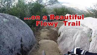
It’s a multidirectional trail that has some technical climbing spots and a fast flow on the way down. The trail has very well maintained dirt. Has a nice bench cut on most of the trail with good erosion control. There are a few rock...
• 45 ★ 5.0 • 3 miles • 1,763 ft • 85 •
Can be ridden up most of the way. Then it’s time to hike the bike. Super fast and flowy on the way down. Just make sure you watch for hikers. Better route up and down if using Fry-Kroegel trail. Makes for a lot less traffic that way.
• 45 ★ 3.0 • 5,203 ft • 43 ft • 77 •
From Poway city: "From Old Coach Staging Area South to the northern Poway city limits and San Dieguito River Park, providing access to the Coast to Crest Trail to the north and “Oak Oasis” to the east. Varies in elevation and...
• 35 ★ 2.0 • 3,679 ft • 43 ft • 74 •
Less popular green difficulty singletrack. This multi-use trail can be used both directions and has a moderate overall physical rating with a 43 ft green climb. On average it takes 3 minutes to complete this trail.
• 30 ★ 3.3 • 2 miles • 579 ft • 56 •
Less popular blue difficulty singletrack. This multi-use trail can be used both directions and has a moderate overall physical rating with a 579 ft blue climb. On average it takes 32 minutes to complete this trail.
• 50 ★ 3.0 • 3,182 ft • 95 ft • 47 •
Quick loop offers good views of Blue Sky Reserve and the lake. A couple of steep but nontechnical sections may require dismount if riding with kids.
• 40 ★ 0.0 • 1,007 ft • 0 ft • 34 •
Moderately popular blue difficulty mixed. This multi-use trail can be used both directions. On average it takes minutes to complete this trail.
• 15 ★ 0.0 • 3,170 ft • 150 ft • 26 •
Less popular blue difficulty singletrack. This multi-use trail can be used both directions with a 150 ft blue climb. On average it takes 8 minutes to complete this trail.
Photos of Mount Woodson Mountain Bike
Videos of Mount Woodson Mountain Bike

trail: Mount Woodson Trail
10:55 |
374 |
Dec 17, 2021 , Poway
20:11 |
854 |
Dec 17, 2021 , Poway
Recent Trail Reports
| status | trail | date | condition | info | user |
|---|---|---|---|---|---|
| Lake Poway (West Access) | Feb 26, 2026 @ 10:17am (America/Tijuana) Feb 26, 2026 | Dry | martinc7 | ||
| Wildgrove - Lake Poway | Feb 26, 2026 @ 10:17am (America/Tijuana) Feb 26, 2026 | Unknown | martinc7 | ||
| Lake Poway (West Loop Spur) | Feb 26, 2026 @ 10:17am (America/Tijuana) Feb 26, 2026 | Dry | martinc7 | ||
| Lake Poway (West Lower) | Feb 26, 2026 @ 10:17am (America/Tijuana) Feb 26, 2026 | Dry | martinc7 | ||
| Lake Poway West Trail | Feb 26, 2026 @ 10:17am (America/Tijuana) Feb 26, 2026 | Dry | martinc7 | ||
| Lake Poway | Feb 26, 2026 @ 12:49pm (America/Los_Angeles) Feb 26, 2026 | Ideal | martinc7 | ||
| Lake Poway (Lower) | Aug 15, 2025 @ 11:04am Aug 15, 2025 | Dry | martinc7 | ||
| Avocado Trail Link | May 10, 2023 @ 11:33am May 10, 2023 | Variable | Ridlam | ||
| Fry Koegle Trail (Potato Chip Rock) | Mar 6, 2023 @ 7:29pm Mar 6, 2023 | Ideal | Wintyfresh | ||
| Old Fry-Koegle Trail | Oct 22, 2022 @ 8:08am Oct 22, 2022 | Very Dry | Bonedocsteve |
Activity Feed
| username | action | type | title | date |
|---|---|---|---|---|
| gromto | ridden | trail | activity #96253666 | Jun 4, 2026 @ 2:53pm Jun 4, 2026 |
| wznsI0 | wishlist | trail | activity #95886163 | May 30, 2026 @ 2:09pm May 30, 2026 |
| my14 | wishlist | trail | activity #93547772 | Apr 27, 2026 @ 4:23pm Apr 27, 2026 |
| martinc7 | add | report | activity #89590653 and 5 more | Feb 26, 2026 @ 12:51pm Feb 26, 2026 |
| martinc7 | ridden | trail | activity #89590555 | Feb 26, 2026 @ 12:49pm Feb 26, 2026 |
Recent Comments
| username | type | title | comment | date |
|---|---|---|---|---|
| trail | Trail is in good condition, some sections are... | Aug 4, 2025 @ 2:49pm Aug 4, 2025 | ||
| trail | Very neglected, nearly impassable sections let... | Dec 2, 2023 @ 1:03pm Dec 2, 2023 | ||
| trail | I'll be honest, this is a pretty long,... | Sep 27, 2023 @ 10:19am Sep 27, 2023 | ||
| report | Trail is in good condition. No downed trees... | Oct 23, 2022 @ 12:02pm Oct 23, 2022 | ||
| trail | Was in good condition. Today. Light rain last... | Oct 23, 2022 @ 11:50am Oct 23, 2022 |
Nearby Areas
| name | distance | ||||
|---|---|---|---|---|---|
| Iron Mountain | 1 | 3 | 1 | 3 km | |
| Ramona Grasslands County Preserve | 2 | 1 | 3.6 km | ||
| San Pasqual Valley | 3 | 1 | 5.5 km | ||
| Ted Williams | 15 | 8 | 5.7 km | ||
| Black Mountain | 32 | 20 | 5 | 6.6 km |
Activity Type Stats
| activitytype | trails | distance | descent | descent distance | total vertical | rating | global rank | state rank | photos | reports | routes | ridelogs |
|---|---|---|---|---|---|---|---|---|---|---|---|---|
| Mountain Bike | 19 | 20 miles | 3,560 ft | 9 miles | 2,260 ft | #8,134 | #3,161 | 26 | 50 | 1,777 | ||
| E-Bike | 17 | 20 miles | 3,465 ft | 9 miles | 2,260 ft | #5,008 | #1,384 | 39 | 178 | |||
| Horse | 3 | 3 miles | 256 ft | 2 miles | 413 ft | 10 | ||||||
| Hike | 19 | 20 miles | 3,560 ft | 9 miles | 2,260 ft | #7,976 | #2,953 | 50 | 769 | |||
| Trail Running | 19 | 20 miles | 3,560 ft | 9 miles | 2,260 ft | #7,486 | #2,517 | 50 | 243 |
Frequently Asked Questions About Mount Woodson
▼
What are the highest rated mountain biking trails in Mount Woodson?
The highest rated mountain biking trails in Mount Woodson are:
- Fry Koegle Trail (Potato Chip Rock) (4.3/5)
- Mount Woodson Trail (4.2/5)
- Old Fry-Koegle Trail (4/5)
- Old Coach Trail (3.8/5)
- Lake Poway West Trail (3.8/5)
▼
What is the best time of the year to ride in Mount Woodson?
Based on ride log data, the most popular months to ride in Mount Woodson are:
- December (10 activities)
- June (9 activities)
- November (8 activities)
▼
Where can I park to ride in Mount Woodson?
There are 1 parking locations listed in Mount Woodson. The most popular parking spots are:
▼
What is the longest trail in Mount Woodson?
The longest trail in Mount Woodson is Mount Woodson Trail at 2.5 miles. View all trails sorted by distance.
Activities
- By The-dirt-farmer
 & contributors
 - Admins: SDMBA
- #7429 - 5,536 views
- mount woodson activity log | embed map of Mount Woodson mountain bike trails | mount woodson mountain biking points of interest
Downloading of trail gps tracks in kml & gpx formats is enabled for Mount Woodson.
You must login to download files.