close
-
Layers w
- Weather Layers
- Pro
- Pro
- Pro
- Pro
- Pro
- Pro
- More Layers
- Pro
- Pro
- Pro
- Pro
-
Upgrade to

3D
Trail Conditions
- Unknown
- Snow Groomed
- Snow Packed
- Snow Covered
- Snow Cover Partial
- Freeze/thaw Cycle
- Icy
- Prevalent Mud
- Wet
- Variable
- Ideal
- Dry
- Very Dry
Trail Flow (Ridden Direction)
Trailforks scans users ridelogs to determine the most popular direction each trail is ridden. A good flowing trail network will have most trails flowing in a single direction according to their intension.
The colour categories are based on what percentage of riders are riding a trail in its intended direction.
The colour categories are based on what percentage of riders are riding a trail in its intended direction.
- > 96%
- > 90%
- > 80%
- > 70%
- > 50%
- < 50%
- bi-directional trail
- no data
Trail Last Ridden
Trailforks scans ridelogs to determine the last time a trail was ridden.
- < 2 days
- < 1 week
- < 2 weeks
- < 1 month
- < 6 months
- > 6 months
Trail Ridden Direction
The intended direction a trail should be ridden.
- Downhill Only
- Downhill Primary
- Both Directions
- Uphill Primary
- Uphill Only
- One Direction
Contribute Details
Colors indicate trail is missing specified detail.
- Description
- Photos
- Description & Photos
- Videos
Trail Popularity ?
Trailforks scans ridelogs to determine which trails are ridden the most in the last 9 months.
Trails are compared with nearby trails in the same city region with a possible 25 colour shades.
Think of this as a heatmap, more rides = more kinetic energy = warmer colors.
- most popular
- popular
- less popular
- not popular
ATV/ORV/OHV Filter
Max Vehicle Width
inches
US Cell Coverage
Legend

Radar Time
Activity Recordings
Trailforks uses anonymized public activity data.
?
Activity Recordings
Trailforks uses anonymized public activity data.
?
Personal Heatmap
▶
Activity Types
all
/
none
▶
Options
2
Date range
month
–
Winter Trails
Warning
A routing network for winter maps does not exist. Selecting trails using the winter trails layer has been disabled.
Missing Trails
Most Popular
Least Popular
Trails are colored based on popularity. The more popular a trail is, the more red. Less popular trails trend towards green.
Jump Magnitude Heatmap
Heatmap of where riders jump on trails. Zoom in to see individual jumps, click circles to view jump details.
BC Backroad Status
![map legend]()
Service Road Atlas is a free to use, community-driven service for viewing and creating reports on the numerous back-country service roads around B.C. and Alberta.

Slope Aspect
Direction the slope faces
Trails Deemphasized
Trails are shown in grey.
Only show trails with no bike usage.
Suggested Layers
Based on selected activity type
Save the current map location and zoom level as your default home location whenever this page is loaded.
Save
No description for Mount Zion has been added yet!
Login or register to submit one.
 google parking directions
Primary Trail Type: Cross-Country
AKA: Mt Zion
google parking directions Activities Click to view
- Mountain Bike
14 trails
- E-Bike
14 trails
- Hike
12 trails
- Trail Running
12 trails
Region Details
- 1
- 5
- 6
- 1
Region Status
Open as of May 18, 2026Stats
- Avg Trail Rating
- Trails (view details)
- 13
- Trails Mountain Bike
- 14
- Trails E-Bike
- 14
- Trails Hike
- 12
- Trails Trail Running
- 12
- Total Distance
- 10 miles
- Total Descent Distance
- 4 miles
- Total Descent
- 659 ft
- Total Vertical
- 63 ft
- Highest Trailhead
- 501 ft
- Reports
- 122
- Photos
- 118
- Ridden Counter
- 1,097
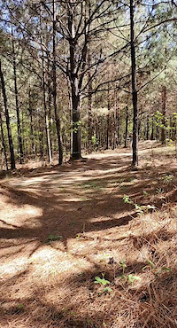
Popular Mount Zion Mountain Biking Trails
• 85 ★ 4.6 • 3 miles • 195 ft • 187 •
The "OG" is the heart of the original 6 mile trail that was carefully and lovingly laid out on a relatively small plot of land. The terrain is mostly hard packed. There are several short and punchy hills designed to get your heart rate up.
• 90 ★ 4.0 • 1,001 ft • 19 ft • 164 •
Wide, smooth road/trail leading into the trail system from the trail head. At the south end heading away from the , go left for a short and fairly beginner friendly ride or go right for everything else!
• 70 ★ 3.7 • 417 ft • 0 ft • 139 •
Fast section of trail with a wooden berm boosting you across the pond dam (think flashing arrows on Mario Kart). Watch out for cross traffic as you exit the pond dam.
• 75 ★ 3.0 • 5,243 ft • 41 ft • 127 •
Mostly wide trail with a few short sections of singletrack and a few bridges that may be outside the comfort zone of beginner riders. You can't miss the namesake " ," featuring steps, a maze through bones, and a banked bridge over a gully.
• 95 ★ 0.0 • 2,644 ft • 20 ft • 76 •
Intermediate trail through the MZ marshes with short and long bridges to keep you out of the muck.
• 60 ★ 0.0 • 1,962 ft • 15 ft • 69 •
Wide and fast trail heading home. During the rainy season some of the turns get soggy and rutted.
• 65 ★ 0.0 • 732 ft • 10 ft • 68 •
Short trail leading to the B loop. Watch out for cross traffic on the "OG" trail both before and after the pond on your left.
• 100 ★ 4.0 • 4 miles • 293 ft • 55 •
The newest additions to the trail system are found here. This intermediate section of trail is a mixture of terrain (hard pack, sand, gravel), obstacles (skinnies, berms, jumps, bridges, etc), and other fun features such as ponds, a...
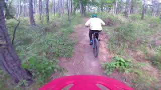
Mount Zion Mountain Bike Routes
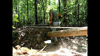
Photos of Mount Zion Mountain Bike
Recent Trail Reports
| status | trail | date | condition | info | user |
|---|---|---|---|---|---|
| 357 | May 20, 2024 @ 3:03pm May 20, 2024 | Variable | spokesmanmtb Durango | ||
| And so it begins. . . | May 20, 2024 @ 3:03pm May 20, 2024 | Variable | spokesmanmtb Durango | ||
| 357 Bypass | May 20, 2024 @ 3:03pm May 20, 2024 | Variable | spokesmanmtb Durango | ||
| T1 Bypass | May 20, 2024 @ 3:03pm May 20, 2024 | Variable | spokesmanmtb Durango | ||
| The OG | May 20, 2024 @ 3:03pm May 20, 2024 | Variable | spokesmanmtb Durango | ||
| 357 Bypass | May 20, 2024 @ 3:03pm May 20, 2024 | Variable | spokesmanmtb Durango | ||
| RC Connect | Jul 31, 2023 @ 3:53pm Jul 31, 2023 | Unknown | Noneya OTB | ||
| Drop Zone Bypass | Jul 31, 2023 @ 3:42pm Jul 31, 2023 | Unknown | Noneya OTB | ||
| Kid's loop cut through | Jul 31, 2023 @ 3:42pm Jul 31, 2023 | Unknown | Noneya OTB | ||
| B Loop Connector | Jul 31, 2023 @ 3:42pm Jul 31, 2023 | Unknown | Noneya OTB |
Activity Feed
| username | action | type | title | date |
|---|---|---|---|---|
| MichaelKitchen | wishlist | trail | activity #80381383 | Sep 14, 2025 @ 6:12pm Sep 14, 2025 |
| kingrich225 | add | route | activity #79485575 | Sep 2, 2025 @ 7:14am Sep 2, 2025 |
| UHsvaFx | wishlist | region | activity #73512641 | Jun 10, 2025 @ 4:45pm Jun 10, 2025 |
| jeff8white | ridden | trail | activity #68573770 | Mar 28, 2025 @ 11:52am Mar 28, 2025 |
| Joe-Bord | add | report | activity #65421115 | Jan 30, 2025 @ 9:38am Jan 30, 2025 |
Recent Comments
| username | type | title | comment | date |
|---|---|---|---|---|
| report | Yeah it is a shame | Feb 15, 2023 @ 10:20am Feb 15, 2023 | ||
| report | Teeter totter has been broken for over a year... | Jan 20, 2023 @ 5:00am Jan 20, 2023 | ||
| report | Yep its really a shame :/ | Jan 19, 2023 @ 10:38pm Jan 19, 2023 | ||
| trail | I believe The black diamond section is no... | Oct 3, 2022 @ 7:13am Oct 3, 2022 | ||
| trail | I still have yet to ride it. Hopefully they... | Mar 6, 2022 @ 6:49pm Mar 6, 2022 |
Nearby Areas
| name | distance | ||||
|---|---|---|---|---|---|
| Clear Springs Recreation Area | 1 | 4 | 33.1 km |
Activity Type Stats
| activitytype | trails | distance | descent | descent distance | total vertical | rating | global rank | state rank | photos | reports | routes | ridelogs |
|---|---|---|---|---|---|---|---|---|---|---|---|---|
| Mountain Bike | 14 | 10 miles | 659 ft | 4 miles | 62 ft | #7,440 | #2,860 | 112 | 122 | 1 | 1,156 | |
| E-Bike | 14 | 10 miles | 659 ft | 4 miles | 62 ft | #7,018 | #2,034 | 5 | 70 | 30 | ||
| Hike | 12 | 9 miles | 643 ft | 4 miles | 62 ft | #13,332 | #5,659 | 119 | 3 | |||
| Trail Running | 12 | 9 miles | 643 ft | 4 miles | 62 ft | #12,299 | #4,909 | 1 | 119 | 5 |
Frequently Asked Questions About Mount Zion
▼
What are the highest rated mountain biking trails in Mount Zion?
The highest rated mountain biking trails in Mount Zion are:
- The OG (4.3/5)
- And so it begins. . . (4/5)
- 357 (4/5)
- RC Connect (3.9/5)
- Boneyard (3.8/5)
▼
What is the best time of the year to ride in Mount Zion?
Based on ride log data, the most popular months to ride in Mount Zion are:
- November (15 activities)
- October (10 activities)
- January (8 activities)
▼
Where can I park to ride in Mount Zion?
There are 1 parking locations listed in Mount Zion. The most popular parking spots are:
▼
What is the longest trail in Mount Zion?
The longest trail in Mount Zion is 357 at 3.7 miles. View all trails sorted by distance.
Activities
Trails
- By markholloway
 Trailforks Map Team & contributors
 - Admins: SMTA
- #12728 - 6,432 views
- mount zion activity log | embed map of Mount Zion mountain bike trails | mount zion mountain biking points of interest
Downloading of trail gps tracks in kml & gpx formats is enabled for Mount Zion.
You must login to download files.