close
-
Layers w
- Weather Layers
- Pro
- Pro
- Pro
- Pro
- Pro
- Pro
- More Layers
- Pro
- Pro
- Pro
- Pro
-
Upgrade to

3D
Trail Conditions
- Unknown
- Snow Groomed
- Snow Packed
- Snow Covered
- Snow Cover Partial
- Freeze/thaw Cycle
- Icy
- Prevalent Mud
- Wet
- Variable
- Ideal
- Dry
- Very Dry
Trail Flow (Ridden Direction)
Trailforks scans users ridelogs to determine the most popular direction each trail is ridden. A good flowing trail network will have most trails flowing in a single direction according to their intension.
The colour categories are based on what percentage of riders are riding a trail in its intended direction.
The colour categories are based on what percentage of riders are riding a trail in its intended direction.
- > 96%
- > 90%
- > 80%
- > 70%
- > 50%
- < 50%
- bi-directional trail
- no data
Trail Last Ridden
Trailforks scans ridelogs to determine the last time a trail was ridden.
- < 2 days
- < 1 week
- < 2 weeks
- < 1 month
- < 6 months
- > 6 months
Trail Ridden Direction
The intended direction a trail should be ridden.
- Downhill Only
- Downhill Primary
- Both Directions
- Uphill Primary
- Uphill Only
- One Direction
Contribute Details
Colors indicate trail is missing specified detail.
- Description
- Photos
- Description & Photos
- Videos
Trail Popularity ?
Trailforks scans ridelogs to determine which trails are ridden the most in the last 9 months.
Trails are compared with nearby trails in the same city region with a possible 25 colour shades.
Think of this as a heatmap, more rides = more kinetic energy = warmer colors.
- most popular
- popular
- less popular
- not popular
ATV/ORV/OHV Filter
Max Vehicle Width
inches
US Cell Coverage
Legend

Radar Time
Activity Recordings
Trailforks uses anonymized public activity data.
?
Activity Recordings
Trailforks uses anonymized public activity data.
?
Personal Heatmap
▶
Activity Types
all
/
none
▶
Options
2
Date range
month
–
Winter Trails
Warning
A routing network for winter maps does not exist. Selecting trails using the winter trails layer has been disabled.
Missing Trails
Most Popular
Least Popular
Trails are colored based on popularity. The more popular a trail is, the more red. Less popular trails trend towards green.
Jump Magnitude Heatmap
Heatmap of where riders jump on trails. Zoom in to see individual jumps, click circles to view jump details.
BC Backroad Status
![map legend]()
Service Road Atlas is a free to use, community-driven service for viewing and creating reports on the numerous back-country service roads around B.C. and Alberta.

Slope Aspect
Direction the slope faces
Trails Deemphasized
Trails are shown in grey.
Only show trails with no bike usage.
Suggested Layers
Based on selected activity type
Save the current map location and zoom level as your default home location whenever this page is loaded.
Save
No description for Mountain Station has been added yet!
Login or register to submit one.
 google parking directions
google parking directions Activities Click to view
- Mountain Bike
47 trails
- E-Bike
48 trails
- Hike
27 trails
- Trail Running
27 trails
Region Details
- 14
- 1
- 7
- 22
- 3
Region Status
Caution as of 19 hoursLocal Trail Association
Stats
- Avg Trail Rating
- Trails (view details)
- 47
- Trails Mountain Bike
- 47
- Trails E-Bike
- 48
- Trails Hike
- 27
- Trails Trail Running
- 27
- Total Distance
- 24 miles
- Total Descent
- 12,351 ft
- Total Vertical
- 3,022 ft
- Highest Trailhead
- 5,298 ft
- Reports
- 2,108
- Photos
- 627
- Ridden Counter
- 15,783
Popular Mountain Station Mountain Biking Trails
• 100 ★ 3.5 • 768 ft • 79 ft • 873 •
Quick singletrack climbing that breaks up the grind on the logging road.
• 90 ★ 4.5 • 5,115 ft • 0 ft • 836 •
A popular choice despite getting roughed-in over the years because of faster, less-technical riding with stunts on the side, and the only true top-to-bottom trail built on this aspect.
• 100 ★ 4.8 • 1,614 ft • 0 ft • 776 •
Good mix up of moderate grade trail and rolling woodwork.
• 100 ★ 3.7 • 906 ft • 0 ft • 663 •
ASG is the continuation of Buddha, but stepped up with a bit more tilt to the pitch and overall ruggedness.
• 95 ★ 4.6 • 1,781 ft • 0 ft • 609 •
Faster and flowier than most Station trails, and a good upper starting trail for or Eli.
• 100 ★ 4.7 • 1,952 ft • 0 ft • 567 •
Classic downhill riding on a flowing, root-encrusted trail, with some steep cruxes and recently renovated airs.
• 95 ★ 4.4 • 1,243 ft • 0 ft • 530 •
Preferred shortcut to from Mountain Station parking area.
• 90 ★ 4.8 • 2,005 ft • 3 ft • 388 •
Nelson’s original steep, rooty singletrack descent. The old stunt sideshow may comeback but the natural flavour will always be worth it.
Mountain Station Mountain Bike Routes
★ 5.0 • 3 miles • 1,183 ft • 20 •
NCC/Backroads Fiver group ride up on Mtn Station. Mixing it up a bit to keep things interesting.
57 miles • 15,424 ft • 27 • Out & Back •
If the triple crown is so fun, why not do it twice?
44 miles • 9,977 ft • 10 • Loop • Race •
BALDFACE CHERRY TOPS CHALLENGE The ride starts in Nelson at the Baldface office, climbs up to the top of...
• 19 miles • 1,547 ft • 1 •
• 3 miles • 566 ft • 0 •
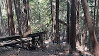
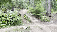
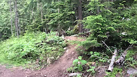
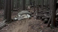
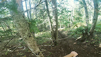
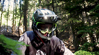
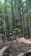
Photos of Mountain Station Mountain Bike
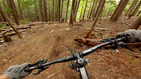
Videos of Mountain Station Mountain Bike
trail: Eli Sim
0:07 |
26 |
May 29, 2025
trail: Lower Dole Dosser
0:43 |
|
Sep 14, 2023
trail: Lower Dole Dosser
0:06 |
267 |
Mar 9, 2022
trail: 719
0:05 |
386 |
Aug 4, 2020
trail: Smiling Buddha
0:15 |
164 |
Nov 9, 2019
trail: 719
0:18 |
546 |
Sep 27, 2019
trail: 719
0:55 |
152 |
Jul 19, 2019
trail: Eli Sim
0:13 |
208 |
Jun 12, 2019
Current Trail Warnings
| status | trail | date | condition | user | info |
|---|---|---|---|---|---|
| Shasta Access | Jun 4, 2026 @ 6:15am (America/Vancouver) Jun 4, 2026 | Unknown | Danksi | ||
| Shasta | Jun 4, 2026 @ 6:14am (America/Vancouver) Jun 4, 2026 | Unknown | Danksi |
Recent Trail Reports
Activity Feed
| username | action | type | title | date |
|---|---|---|---|---|
| ertman | add | photo | activity #97270899 | Jun 18, 2026 @ 12:47pm 2 hours |
| ertman | comment | trail | activity #97270748 | Jun 18, 2026 @ 12:44pm 2 hours |
| Danksi | comment | report | activity #97246662 | Jun 18, 2026 @ 6:06am 9 hours |
| tmowat | add | report | activity #97232063 and 4 more | Jun 17, 2026 @ 9:49pm 17 hours |
| Danksi | add | report | activity #97061323 | Jun 15, 2026 @ 1:04pm Jun 15, 2026 |
Recent Comments
| username | type | title | comment | date |
|---|---|---|---|---|
| trail | This trail between Boneyard and Expresso no... | Jun 18, 2026 @ 12:44pm 2 hours | ||
| report | What is the minor issue? | Jun 18, 2026 @ 6:06am 9 hours | ||
| report | Good to know, was curious myself. Mint Paddington? | Jun 12, 2026 @ 2:04pm Jun 12, 2026 | ||
| trail | Riding down, this is a fun, slightly technical... | Jun 10, 2026 @ 5:21pm Jun 10, 2026 | ||
| report | Thanks for the report. Was getting curious :) | Apr 26, 2026 @ 6:10pm Apr 26, 2026 |
Nearby Areas
| name | distance | ||||
|---|---|---|---|---|---|
| Svoboda Road | 7 | 15 | 3 | 2.5 km | |
| Giveout and Gold Creek | 8 | 5 | 10 | 3 | 3.3 km |
| Morning Mountain | 3 | 11 | 4 | 1 | 4.3 km |
| Shannon Pass | 1 | 1 | 2 | 5.2 km | |
| Whitewater Ski Resort | 1 | 1 | 1 | 6.4 km |
Local Badges
-

Completionist0 awarded
Upcoming Local Events
Local Products
Local Products
Activity Type Stats
| activitytype | trails | distance | descent | descent distance | total vertical | rating | global rank | state rank | photos | reports | routes | ridelogs |
|---|---|---|---|---|---|---|---|---|---|---|---|---|
| Mountain Bike | 47 | 24 miles | 12,352 ft | 13 miles | 3,022 ft | #1,244 | #93 | 627 | 2,106 | 5 | 12,598 | |
| E-Bike | 48 | 10 miles | 8,740 ft | 9 miles | 1,637 ft | #3,715 | #136 | 1,713 | 1 | 653 | ||
| Hike | 27 | 16 miles | 3,596 ft | 6 miles | 3,022 ft | #7,042 | #281 | 1,511 | 464 | |||
| Trail Running | 27 | 16 miles | 3,596 ft | 6 miles | 3,022 ft | #4,477 | #150 | 1,510 | 2,323 |
Frequently Asked Questions About Mountain Station
▼
What are the highest rated mountain biking trails in Mountain Station?
The highest rated mountain biking trails in Mountain Station are:
- Smiling Buddha (4.5/5)
- Legalize It (4.5/5)
- Upper Skirt (4.4/5)
- Fat Chance (4.4/5)
- Skirt (4.4/5)
▼
What is the best time of the year to ride in Mountain Station?
Based on ride log data, the most popular months to ride in Mountain Station are:
- July (193 activities)
- August (134 activities)
- May (127 activities)
▼
Where can I park to ride in Mountain Station?
▼
What is the longest trail in Mountain Station?
The longest trail in Mountain Station is The Vein at 2.6 miles. View all trails sorted by distance.
Activities
Trails
- By canadaka
 Trailforks & contributors
 - Admins: KCTS, NCC, FOPRTS, eastonwest
- #1987 - 31,680 views
- mountain station activity log | embed map of Mountain Station mountain bike trails | mountain station mountain biking points of interest polygons
Downloading of trail gps tracks in kml & gpx formats is disabled for Mountain Station.