close
-
Layers w
- Weather Layers
- Pro
- Pro
- Pro
- Pro
- Pro
- Pro
- More Layers
- Pro
- Pro
- Pro
- Pro
-
Upgrade to

3D
Trail Conditions
- Unknown
- Snow Groomed
- Snow Packed
- Snow Covered
- Snow Cover Partial
- Freeze/thaw Cycle
- Icy
- Prevalent Mud
- Wet
- Variable
- Ideal
- Dry
- Very Dry
Trail Flow (Ridden Direction)
Trailforks scans users ridelogs to determine the most popular direction each trail is ridden. A good flowing trail network will have most trails flowing in a single direction according to their intension.
The colour categories are based on what percentage of riders are riding a trail in its intended direction.
The colour categories are based on what percentage of riders are riding a trail in its intended direction.
- > 96%
- > 90%
- > 80%
- > 70%
- > 50%
- < 50%
- bi-directional trail
- no data
Trail Last Ridden
Trailforks scans ridelogs to determine the last time a trail was ridden.
- < 2 days
- < 1 week
- < 2 weeks
- < 1 month
- < 6 months
- > 6 months
Trail Ridden Direction
The intended direction a trail should be ridden.
- Downhill Only
- Downhill Primary
- Both Directions
- Uphill Primary
- Uphill Only
- One Direction
Contribute Details
Colors indicate trail is missing specified detail.
- Description
- Photos
- Description & Photos
- Videos
Trail Popularity ?
Trailforks scans ridelogs to determine which trails are ridden the most in the last 9 months.
Trails are compared with nearby trails in the same city region with a possible 25 colour shades.
Think of this as a heatmap, more rides = more kinetic energy = warmer colors.
- most popular
- popular
- less popular
- not popular
ATV/ORV/OHV Filter
Max Vehicle Width
inches
US Cell Coverage
Legend

Radar Time
Activity Recordings
Trailforks uses anonymized public activity data.
?
Activity Recordings
Trailforks uses anonymized public activity data.
?
Personal Heatmap
▶
Activity Types
all
/
none
▶
Options
2
Date range
month
–
Winter Trails
Warning
A routing network for winter maps does not exist. Selecting trails using the winter trails layer has been disabled.
Missing Trails
Most Popular
Least Popular
Trails are colored based on popularity. The more popular a trail is, the more red. Less popular trails trend towards green.
Jump Magnitude Heatmap
Heatmap of where riders jump on trails. Zoom in to see individual jumps, click circles to view jump details.
BC Backroad Status
![map legend]()
Service Road Atlas is a free to use, community-driven service for viewing and creating reports on the numerous back-country service roads around B.C. and Alberta.

Slope Aspect
Direction the slope faces
Trails Deemphasized
Trails are shown in grey.
Only show trails with no bike usage.
Suggested Layers
Based on selected activity type
Save the current map location and zoom level as your default home location whenever this page is loaded.
SaveMt Coramba is part of the Woolgoolga Mountain Bike Club Trails. The Trail is maintained by the club and host regular club events.
source: Coffs Downhill
Primary Trail Type: All-Mountain & Downhill
eBikes Allowed:
Yes
Shuttleable: YES
Land Status: State Forest
Land Manager: Forestry NSW
Links
Region Supporters & Maintainers
- Woodseys Wheels
trail builderSponsor
Activities Click to view
- Mountain Bike
4 trails
- E-Bike
2 trails
- Hike
1 trails
- Trail Running
1 trails
Region Details
- 1
- 2
- 1
Region Status
Caution as of Sep 29, 2024Stats
- Avg Trail Rating
- Trails (view details)
- 4
- Trails Mountain Bike
- 4
- Trails E-Bike
- 2
- Trails Hike
- 1
- Trails Trail Running
- 1
- Total Distance
- 4 miles
- Total Descent
- 2,002 ft
- Total Vertical
- 1,316 ft
- Highest Trailhead
- 1,853 ft
- Reports
- 17
- Photos
- 22
- Ridden Counter
- 76
Popular Mt Coramba Mountain Biking Trails
• 30 ★ 3.8 • 1 mile • 33 ft • 42 •
Overview: One of Australia’s most renowned and long standing downhill trails is surrounded by the beauty of the Coffs Harbour forested areas with spectacular views of the mountains and the sea. The trail has a rich history and is...
• 5 ★ 4.0 • 2 miles • 171 ft • 11 •
Flowy moto single trail running alongside Ridge rd. Couple of Steep rocky shutes, plenty of flow and a few little pinches. Easy bitumen ride/shuttle to the top of the trail on Eastern Dorrigo Way.
• 5 ★ 0.0 • 0 ft • 0 ft •
Short fast trail with some gap jumps, a tabletop and a drop at the end all with b-lines
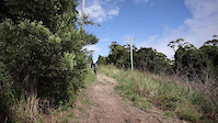
Photos of Mt Coramba Mountain Bike
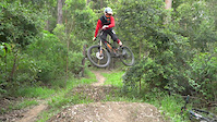
Videos of Mt Coramba Mountain Bike
trail: Downhill Mt Coramba
0:38 |
309 |
Aug 24, 2021
trail: Downhill Mt Coramba
0:44 |
1112 |
Dec 26, 2018

trail: Downhill Mt Coramba
0:36 |
571 |
Dec 6, 2018
Recent Trail Reports
| status | trail | date | condition | info | user |
|---|---|---|---|---|---|
| Downhill Mt Coramba | Sep 29, 2024 @ 8:53pm Sep 29, 2024 | Ideal | Connorg7AoPs |
Activity Feed
| username | action | type | title | date |
|---|---|---|---|---|
| Eggs78 | like | report | activity #89716291 | Feb 28, 2026 @ 12:10pm Feb 28, 2026 |
| Ozoutdoorsman | wishlist | region | activity #76144196 | Jul 18, 2025 @ 3:34am Jul 18, 2025 |
| araujo20 | wishlist | trail | activity #71958575 | May 18, 2025 @ 6:53pm May 18, 2025 |
| LukeubIu4K | wishlist | region | activity #71502229 | May 12, 2025 @ 2:25am May 12, 2025 |
| Adrianjdmtb | wishlist | region | activity #66514843 | Feb 20, 2025 @ 4:16pm Feb 20, 2025 |
Recent Comments
| username | type | title | comment | date |
|---|---|---|---|---|
| trail | Top section of track closed | Jun 16, 2024 @ 4:22am Jun 16, 2024 |
Nearby Areas
| name | distance | ||||
|---|---|---|---|---|---|
| Lower Bucca State Forest | 7 | 6 | 1 | 4 km | |
| Bindarri National Park | 9.6 km | ||||
| Wedding Bells State Forest | 8 | 16 | 6 | 10.9 km | |
| The Sawmill | 4 | 11 | 4 | 11.7 km | |
| Woolgoolga | 6 | 1 | 12.3 km |
Activity Type Stats
| activitytype | trails | distance | descent | descent distance | total vertical | rating | global rank | state rank | photos | reports | routes | ridelogs |
|---|---|---|---|---|---|---|---|---|---|---|---|---|
| Mountain Bike | 4 | 4 miles | 2,001 ft | 3 miles | 1,316 ft | #7,771 | #373 | 22 | 17 | 775 | ||
| E-Bike | 2 | 3 miles | 1,007 ft | 2 miles | 896 ft | #8,074 | #447 | 9 | 97 | |||
| Hike | 1 | 2 miles | 1,007 ft | 2 miles | 866 ft | #15,897 | #609 | 9 | 20 | |||
| Trail Running | 1 | 2 miles | 1,007 ft | 2 miles | 866 ft | #14,678 | #561 | 9 | 5 |
- By Addzz
 TRAILFORKS NEMTB & contributors
 - Admins: CCMTB, WMBC
- #14613 - 6,548 views
- mt coramba activity log | embed map of Mt Coramba mountain bike trails | mt coramba mountain biking points of interest
Downloading of trail gps tracks in kml & gpx formats is enabled for Mt Coramba.
You must login to download files.