close
-
Layers w
- Weather Layers
- Pro
- Pro
- Pro
- Pro
- Pro
- Pro
- More Layers
- Pro
- Pro
- Pro
- Pro
-
Upgrade to

3D
Trail Conditions
- Unknown
- Snow Groomed
- Snow Packed
- Snow Covered
- Snow Cover Partial
- Freeze/thaw Cycle
- Icy
- Prevalent Mud
- Wet
- Variable
- Ideal
- Dry
- Very Dry
Trail Flow (Ridden Direction)
Trailforks scans users ridelogs to determine the most popular direction each trail is ridden. A good flowing trail network will have most trails flowing in a single direction according to their intension.
The colour categories are based on what percentage of riders are riding a trail in its intended direction.
The colour categories are based on what percentage of riders are riding a trail in its intended direction.
- > 96%
- > 90%
- > 80%
- > 70%
- > 50%
- < 50%
- bi-directional trail
- no data
Trail Last Ridden
Trailforks scans ridelogs to determine the last time a trail was ridden.
- < 2 days
- < 1 week
- < 2 weeks
- < 1 month
- < 6 months
- > 6 months
Trail Ridden Direction
The intended direction a trail should be ridden.
- Downhill Only
- Downhill Primary
- Both Directions
- Uphill Primary
- Uphill Only
- One Direction
Contribute Details
Colors indicate trail is missing specified detail.
- Description
- Photos
- Description & Photos
- Videos
Trail Popularity ?
Trailforks scans ridelogs to determine which trails are ridden the most in the last 9 months.
Trails are compared with nearby trails in the same city region with a possible 25 colour shades.
Think of this as a heatmap, more rides = more kinetic energy = warmer colors.
- most popular
- popular
- less popular
- not popular
ATV/ORV/OHV Filter
Max Vehicle Width
inches
US Cell Coverage
Legend

Radar Time
Activity Recordings
Trailforks uses anonymized public activity data.
?
Activity Recordings
Trailforks uses anonymized public activity data.
?
Personal Heatmap
▶
Activity Types
all
/
none
▶
Options
2
Date range
month
–
Winter Trails
Warning
A routing network for winter maps does not exist. Selecting trails using the winter trails layer has been disabled.
Missing Trails
Most Popular
Least Popular
Trails are colored based on popularity. The more popular a trail is, the more red. Less popular trails trend towards green.
Jump Magnitude Heatmap
Heatmap of where riders jump on trails. Zoom in to see individual jumps, click circles to view jump details.
BC Backroad Status
![map legend]()
Service Road Atlas is a free to use, community-driven service for viewing and creating reports on the numerous back-country service roads around B.C. and Alberta.

Slope Aspect
Direction the slope faces
Trails Deemphasized
Trails are shown in grey.
Only show trails with no bike usage.
Suggested Layers
Based on selected activity type
Save the current map location and zoom level as your default home location whenever this page is loaded.
Save
No description for Mt. Gretna has been added yet!
Login or register to submit one.
Activities Click to view
- Mountain Bike
38 trails
- E-Bike
4 trails
- Gravel Bike
1 trails
- Adaptive Bike
1 trails
- Winter Fat Bike
1 trails
- Horse
12 trails
- Hike
55 trails
- Trail Running
55 trails
- Snowshoe
4 trails
Region Details
- 8
- 2
- 11
- 8
- 5
Region Status
Open as of Jun 13, 2026Stats
- Avg Trail Rating
- Trails (view details)
- 46
- Trails Mountain Bike
- 38
- Trails E-Bike
- 4
- Trails Gravel Bike
- 1
- Trails Adaptive Bike
- 1
- Trails Winter Fat Bike
- 1
- Trails Horse
- 12
- Trails Hike
- 55
- Trails Trail Running
- 55
- Trails Snowshoe
- 4
- Trails Nordic Ski
- 1
- Total Distance
- 51 miles
- Total Descent
- 5,178 ft
- Total Vertical
- 767 ft
- Highest Trailhead
- 1,149 ft
- Reports
- 135
- Photos
- 45
- Ridden Counter
- 6,370
Sub Regions
-
Governor Dick
- 10
- 8
- 5
Popular Mt. Gretna Mountain Biking Trails
• 100 ★ 3.5 • 4,104 ft • 0 ft • 330 •
This is an historic old railroad bed. It is the easiest route to the tower at the top of the mountain. Expect to see many hikers on a beautiful day!
• 80 ★ 4.8 • 2,457 ft • 4 ft • 294 •
Also called Lion's Head. Starts near tower and meets at bottom.
• 85 ★ 4.3 • 3,045 ft • 3 ft • 272 •
Trail starts near the top of trail 2 and meets . Be aware this is a multi-use trail. Yield to the hikers and horses.
• 60 ★ 4.0 • 302 ft • 6 ft • 261 •
Moderately popular green difficulty singletrack. This multi-use trail can be used both directions. On average it takes minutes to complete this trail.
• 45 ★ 4.2 • 3 miles • 348 ft • 258 •
A very challenging trail, lots of technical rock gardens and terrain.
• 75 ★ 0.0 • 5 miles • 217 ft • 252 •
• The Lebanon Valley rail-trail will provide a much-needed, close-to-home recreational resource suitable for a wide variety of uses which appeal to a broad cross-section of our community. The trail will be used by all age groups and...
• 75 ★ 4.3 • 1 mile • 162 ft • 242 •
is a multi-use trail. Watch out for hikers and horses. This trail has several small rock gardens; it's a perfect trail to take a new mountain biker with moderate skills.
Mt. Gretna Mountain Bike Routes
★ 5.0 • 6 miles • 617 ft • 1 • Loop •
Simple route starting from Alden way, climbing up the rail trail and onto the easy trails in Gretna.
★ 5.0 • 11 miles • 1,428 ft • 29 • Loop •
Route covers all the best sanctioned trails. If ridden backwards, you will miss two fun downhills.
4 miles • 578 ft • 2 •
This route follows the as is goes through Gov. Dick at Mt. Gretna.
• 30 miles • 1,222 ft • 5 •
• 25 miles • 759 ft • 1 •
Cloudy, 59°F, Feels like 59°F, Humidity 96%, Wind 3mph from E - by Klimat
• 5 miles • 645 ft • 4 •
Photos of Mt. Gretna Mountain Bike
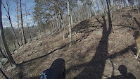
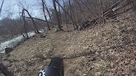
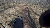
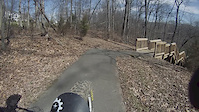
Videos of Mt. Gretna Mountain Bike

0:12 |
147 |
Oct 4, 2021
2:12 |
1 |
Mar 9, 2016
2:08 |
1 |
Mar 9, 2016
0:58 |
3 |
Mar 9, 2016
0:28 |
161 |
Mar 9, 2016
0:56 |
108 |
Feb 29, 2016

5:03 |
410 |
Apr 8, 2015

3:57 |
298 |
Aug 1, 2014
Recent Trail Reports
| status | trail | date | condition | info | user |
|---|---|---|---|---|---|
| Meadow Trail | May 30, 2026 @ 8:15am (America/New_York) May 30, 2026 | Ideal | bummienotes | ||
| Conewago Trail (Blue Rectangle) | May 30, 2026 @ 8:15am (America/New_York) May 30, 2026 | Ideal | bummienotes | ||
| Conewago Trail (Blue Rectangle) & Horseshoe | May 30, 2026 @ 8:15am (America/New_York) May 30, 2026 | Ideal | bummienotes | ||
| Chiques Creek Headwater Trail (white diamond) | May 30, 2026 @ 8:15am (America/New_York) May 30, 2026 | Ideal | bummienotes | ||
| Parking Lot | May 30, 2026 @ 8:15am (America/New_York) May 30, 2026 | Ideal | bummienotes | ||
| Conewago Recreation Trail | Mar 29, 2025 @ 7:05am Mar 29, 2025 | Very Dry | LeviHKUysq | ||
| Clarence & Evetta Shock Trail & Horseshoe (Yellow Rectangle) | Aug 24, 2024 @ 8:57am Aug 24, 2024 | Dry | RDSmtbiker SAMBA-GD | ||
| Campmeeting Trail - North (Green Diamond) | Feb 11, 2024 @ 5:19am Feb 11, 2024 | Variable | cscsguybikr | ||
| Gameland Gravel Extension | Feb 11, 2024 @ 7:19am Feb 11, 2024 | Ideal | willieglititz | ||
| Lebanon Valley Rail Trail - Gretna Segment | Jan 11, 2024 @ 5:09am Jan 11, 2024 | Variable | playah |
Activity Feed
| username | action | type | title | date |
|---|---|---|---|---|
| Glancingaft | vote | trail | activity #96863739 and 2 more | Jun 13, 2026 @ 4:56am Jun 13, 2026 |
| RDSmtbiker | update | trail | activity #96094769 | Jun 2, 2026 @ 10:35am Jun 2, 2026 |
| RDSmtbiker | update | trail | activity #96094633 and 1 more | Jun 2, 2026 @ 10:33am Jun 2, 2026 |
| RDSmtbiker | update | trail | activity #95972038 | May 31, 2026 @ 1:12pm May 31, 2026 |
| bummienotes | add | report | activity #95865914 and 4 more | May 30, 2026 @ 10:18am May 30, 2026 |
Recent Comments
| username | type | title | comment | date |
|---|---|---|---|---|
| trail | Great little trail down, enjoyable on a gravel... | Jul 15, 2025 @ 3:47pm Jul 15, 2025 | ||
| trail | You can get by on a gravel bike but you just... | Jul 15, 2025 @ 3:46pm Jul 15, 2025 | ||
| trail | If you're coming down to the rail trail you're... | Jul 15, 2025 @ 3:41pm Jul 15, 2025 | ||
| trail | Fun descent. The switch back turns really... | Oct 8, 2024 @ 10:04am Oct 8, 2024 | ||
| trail | Leaves are starting to come down. If riding... | Oct 8, 2024 @ 10:00am Oct 8, 2024 |
Local Badges
-

10 Green Trails131 awarded -

Epic Ride Climb 2k3 awarded -

Climbing 10k Badge60 awarded -

Climbing 100k Badge7 awarded -

Epic Ride Descent 2k3 awarded -

Descent 10k Badge62 awarded
Activity Type Stats
| activitytype | trails | distance | descent | descent distance | total vertical | rating | global rank | state rank | photos | reports | routes | ridelogs |
|---|---|---|---|---|---|---|---|---|---|---|---|---|
| Mountain Bike | 38 | 43 miles | 3,770 ft | 22 miles | 768 ft | #2,890 | #1,025 | 52 | 132 | 3 | 14,120 | |
| E-Bike | 4 | 2 miles | 266 ft | 1 mile | 371 ft | #8,606 | #2,623 | 106 | 251 | |||
| Gravel Bike | 1 | #591 | #1,123 | 2 | 104 | |||||||
| Adaptive Bike | 1 | #584 | #1,871 | |||||||||
| Winter Fat Bike | 1 | #340 | #1,122 | |||||||||
| Horse | 12 | 15 miles | 1,729 ft | 8 miles | 682 ft | #2,151 | #1,195 | 18 | 1 | 1 | ||
| Hike | 55 | 51 miles | 5,177 ft | 27 miles | 768 ft | #1,178 | #544 | 134 | 2 | 785 | ||
| Trail Running | 55 | 51 miles | 5,177 ft | 27 miles | 768 ft | #4,006 | #1,213 | 134 | 2 | 672 | ||
| Snowshoe | 4 | 6 miles | 843 ft | 4 miles | 427 ft | #1,261 | #677 | 4 | ||||
| Nordic Ski | 1 | 3 miles | 292 ft | 1 mile | 256 ft | 1 | 13 |
Frequently Asked Questions About Mt. Gretna
▼
What are the best places to ride in Mt. Gretna?
Mt. Gretna has 1 areas to explore for mountain biking. The top rated areas are:
▼
What are the highest rated mountain biking trails in Mt. Gretna?
The highest rated mountain biking trails in Mt. Gretna are:
- Schock Tower House Trail (middle) (red diamond) (4.4/5)
- Conewago Trail (Blue Rectangle) & Horseshoe (4.1/5)
- Chiques Creek Headwater Trail (white diamond) (4.1/5)
- Campmeeting Trail (Green Diamond) & Horseshoe (4.1/5)
- Chautaqua Trail (Horseshoe Trail) (4/5)
▼
What is the best time of the year to ride in Mt. Gretna?
Based on ride log data, the most popular months to ride in Mt. Gretna are:
- July (197 activities)
- August (140 activities)
- June (119 activities)
▼
Where can I park to ride in Mt. Gretna?
There are 12 parking locations listed in Mt. Gretna. The most popular parking spots are: View all parking and trailhead locations on the map to plan your visit.
Activities
Trails
Points of Interest
- By brenthillier
 NSMBA TRAILFORKS & contributors
 - Admins: SAMBA
- #5646 - 13,662 views
- mt. gretna activity log | embed map of Mt. Gretna mountain bike trails | mt. gretna mountain biking points of interest
Downloading of trail gps tracks in kml & gpx formats is enabled for Mt. Gretna.
You must login to download files.