close
-
Layers w
- Weather Layers
- Pro
- Pro
- Pro
- Pro
- Pro
- Pro
- More Layers
- Pro
- Pro
- Pro
- Pro
-
Upgrade to

3D
Trail Conditions
- Unknown
- Snow Groomed
- Snow Packed
- Snow Covered
- Snow Cover Partial
- Freeze/thaw Cycle
- Icy
- Prevalent Mud
- Wet
- Variable
- Ideal
- Dry
- Very Dry
Trail Flow (Ridden Direction)
Trailforks scans users ridelogs to determine the most popular direction each trail is ridden. A good flowing trail network will have most trails flowing in a single direction according to their intension.
The colour categories are based on what percentage of riders are riding a trail in its intended direction.
The colour categories are based on what percentage of riders are riding a trail in its intended direction.
- > 96%
- > 90%
- > 80%
- > 70%
- > 50%
- < 50%
- bi-directional trail
- no data
Trail Last Ridden
Trailforks scans ridelogs to determine the last time a trail was ridden.
- < 2 days
- < 1 week
- < 2 weeks
- < 1 month
- < 6 months
- > 6 months
Trail Ridden Direction
The intended direction a trail should be ridden.
- Downhill Only
- Downhill Primary
- Both Directions
- Uphill Primary
- Uphill Only
- One Direction
Contribute Details
Colors indicate trail is missing specified detail.
- Description
- Photos
- Description & Photos
- Videos
Trail Popularity ?
Trailforks scans ridelogs to determine which trails are ridden the most in the last 9 months.
Trails are compared with nearby trails in the same city region with a possible 25 colour shades.
Think of this as a heatmap, more rides = more kinetic energy = warmer colors.
- most popular
- popular
- less popular
- not popular
ATV/ORV/OHV Filter
Max Vehicle Width
inches
US Cell Coverage
Legend

Radar Time
Activity Recordings
Trailforks uses anonymized public activity data.
?
Activity Recordings
Trailforks uses anonymized public activity data.
?
Personal Heatmap
▶
Activity Types
all
/
none
▶
Options
2
Date range
month
–
Winter Trails
Warning
A routing network for winter maps does not exist. Selecting trails using the winter trails layer has been disabled.
Missing Trails
Most Popular
Least Popular
Trails are colored based on popularity. The more popular a trail is, the more red. Less popular trails trend towards green.
Jump Magnitude Heatmap
Heatmap of where riders jump on trails. Zoom in to see individual jumps, click circles to view jump details.
BC Backroad Status
![map legend]()
Service Road Atlas is a free to use, community-driven service for viewing and creating reports on the numerous back-country service roads around B.C. and Alberta.

Slope Aspect
Direction the slope faces
Trails Deemphasized
Trails are shown in grey.
Only show trails with no bike usage.
Suggested Layers
Based on selected activity type
Save the current map location and zoom level as your default home location whenever this page is loaded.
SaveGravity/Enduro riding area that is growing with more trails lower, middle and up top.
The go-to trail that started it all was "Civil Disobedience" but since then a number of trails and option have been added.
This mountainous area is named after:
Major John K. Mahony VC, from New Westminster. Awarded the Victoria Cross for his actions at Melfa River Italy, 24 April 1944
The go-to trail that started it all was "Civil Disobedience" but since then a number of trails and option have been added.
This mountainous area is named after:
Major John K. Mahony VC, from New Westminster. Awarded the Victoria Cross for his actions at Melfa River Italy, 24 April 1944
Shuttleable: YES
 google parking directions
 Activities Click to view
- Mountain Bike
63 trails
- E-Bike
58 trails
- Horse
12 trails
- Hike
38 trails
- Trail Running
39 trails
Region Details
- 16
- 8
- 11
- 12
Region Status
Caution as of 8 hoursStats
- Avg Trail Rating
- Trails (view details)
- 45
- Trails Mountain Bike
- 67
- Trails E-Bike
- 58
- Trails Horse
- 12
- Trails Hike
- 38
- Trails Trail Running
- 39
- Trails Dirtbike/Moto
- 3
- Trails Observed Trials
- 2
- Trails ATV/ORV/OHV
- 3
- Total Distance
- 34 miles
- Total Descent
- 9,767 ft
- Total Vertical
- 2,675 ft
- Highest Trailhead
- 2,888 ft
- Reports
- 1,055
- Photos
- 522
- Ridden Counter
- 27,040
Popular Mt. Mahony Mountain Biking Trails
• 100 ★ 4.9 • 1 mile • 0 ft • 1,421 •
1.7 kms of progressive downhill single track. A combined blue trail with optional black features built to be a blast on either line. Natural and built up TTF’s winding through beautiful second and old growth forest.
• 100 ★ 4.0 • 1,329 ft • 108 ft • 1,160 •
A challenging climb that will jack your heart rate and test your technical climbing skills. If you can clean this climb to the very top then you deserve an ice cream. This is your gateway to , , Bounty Hunter, and .
• 100 ★ 5.0 • 2,024 ft • 60 ft • 997 •
Machine-built, single track . Begins at the new parking lot area and ascends on an old spur road. Towards the end of the spur, the trail crosses over a ditch and heads through a lush forest at a gentle grade, with minimal need for many...
• 100 ★ 4.9 • 1,542 ft • 0 ft • 947 •
Fun fast techy trail used mostly as the pre-trail for . This trail starts with a ladder bridge right into a nice but steep rock-roll. Trail finishes quickly down onto the double track which riders have an easy climb back up to the top...
• 100 ★ 4.3 • 2,749 ft • 3 ft • 912 •
Fast flowing trail to complete your Mahony Laps, this brings you back to the 4 Km parking spot. This trail is meant as a fast downhill trail only. Berms, table-tops and some speed - enjoy the rush!
• 100 ★ 4.9 • 2,448 ft • 28 ft • 757 •
Machine-built, single track flow trail. Begins with a short to the top of a knoll before descending/traversing through a mature forest. Initial terrain allows for construction of rollers and speed building features that are great...
• 100 ★ 4.8 • 2,812 ft • 6 ft • 750 •
Machine-built, bike park style flow trail with berms, rollers and tabletop jumps. Begins in mature mixed forest. Initial terrain allows for natural and constructed berm and roller features. The trail then exits mature forest to a...
Mt. Mahony Mountain Bike Routes
Burley & Quick-E Loop Featured
★ 3.0 • 7 miles • 1,788 ft • 2 •
Push up. Enjoy the Down. Burley AND makes you go up the climb twice but it is sooo worth it.
8 miles • 1,627 ft • 12 •
Dipper Scholarship Ride 2025 Black alternative route
6 miles • 928 ft • 12 • Loop •
Dipper Scholarship Ride Green/Blue 2025 #DipperWouldDoIt
★ 1.0 • 15 miles • 3,548 ft • 12 • Race •
Island Cup Enduro Race Course
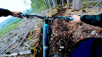
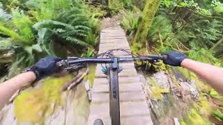
Photos of Mt. Mahony Mountain Bike
Videos of Mt. Mahony Mountain Bike
trail: One Second Per Hour
0:05 |
26 |
May 1, 2026
trail: Mach Loonie
0:09 |
140 |
Apr 7, 2025

trail: Quick-E
3:02 |
30 |
Jan 7, 2025
trail: Fairies Wear Boots
0:18 |
375 |
Aug 4, 2023
trail: Civil Disobedience
0:48 |
862 |
Nov 23, 2021
trail: Civil Disobedience
0:00 |
1097 |
Apr 9, 2020
6:24 |
21 |
May 25, 2026 , Powell River

trail: Fungi
7:56 |
11 |
May 25, 2026 , Powell River
Recent Trail Reports
Activity Feed
| username | action | type | title | date |
|---|---|---|---|---|
| bikebb | add | report | activity #97445341 and 7 more | Jun 20, 2026 @ 5:33pm 1 hours |
| m5WDczwe | add | report | activity #97404088 | Jun 20, 2026 @ 9:23am 9 hours |
| scwright58 | wishlist | trail | activity #97299634 and 4 more | Jun 18, 2026 @ 11:39pm 2 days |
| yurtletheturtle | wishlist | region | activity #97144120 | Jun 16, 2026 @ 4:10pm Jun 16, 2026 |
| rojerebike | vote | trail | activity #97083751 and 1 more | Jun 15, 2026 @ 7:47pm Jun 15, 2026 |
Recent Comments
| username | type | title | comment | date |
|---|---|---|---|---|
| trail | No ride arounds for any of the upper... | Jun 13, 2026 @ 12:14pm Jun 13, 2026 | ||
| trail | Tricky and awesome. Upper portion is techy... | Jun 7, 2026 @ 5:15pm Jun 7, 2026 | ||
| trail | Awesome trail. The double bridge rock roll is... | Jun 7, 2026 @ 5:07pm Jun 7, 2026 | ||
| trail | Great trail. More of a black feel with the... | Jun 7, 2026 @ 5:05pm Jun 7, 2026 | ||
| trail | Super fun trail! The flow is there you just... | May 15, 2026 @ 8:05pm May 15, 2026 |
Nearby Areas
| name | distance | ||||
|---|---|---|---|---|---|
| Gallagher Hill | 1 | 3 | 11 | 2 | 3.2 km |
| Duck Lake Trails | 13 | 53 | 9 | 3.4 km | |
| Millennium Park | 33 | 22 | 2 | 1 | 4.6 km |
| West Lake Trails | 6 | 19 | 8 | 1 | 5.4 km |
| Penticton Street Maze | 16 | 31 | 7 km |
Local Badges
-

Completionist0 awarded
Local Mountain Biking Directory
-
Qathet Regional Cycling Association
![Qathet Regional Cycling Association]()
-
Suncoast CyclesBike Shop
![Suncoast Cycles]()
-
Taws Bike GarageBike Shop
![Taws Bike Garage]()
Local Trail Supporters
- Powell River
![]()
![]()
Activity Type Stats
| activitytype | trails | distance | descent | descent distance | total vertical | rating | global rank | state rank | photos | reports | routes | ridelogs |
|---|---|---|---|---|---|---|---|---|---|---|---|---|
| Mountain Bike | 63 | 34 miles | 9,767 ft | 17 miles | 2,674 ft | #730 | #64 | 518 | 1,055 | 9 | 10,456 | |
| E-Bike | 58 | 33 miles | 9,573 ft | 17 miles | 2,674 ft | #2,368 | #79 | 972 | 1,127 | |||
| Horse | 12 | 13 miles | 633 ft | 4 miles | 1,115 ft | #1,048 | #32 | 90 | 1 | |||
| Hike | 38 | 19 miles | 2,316 ft | 7 miles | 1,385 ft | #6,888 | #274 | 843 | 337 | |||
| Trail Running | 39 | 22 miles | 5,105 ft | 11 miles | 2,546 ft | #5,318 | #192 | 903 | 224 | |||
| Dirtbike/Moto | 3 | 3 miles | 207 ft | 3,999 ft | 640 ft | 4 | 36 | 11 | ||||
| Observed Trials | 2 | 2 miles | 10 ft | 1,755 ft | 627 ft | 4 | ||||||
| ATV/ORV/OHV | 3 | 3 miles | 207 ft | 3,999 ft | 640 ft | 27 | 7 |
Frequently Asked Questions About Mt. Mahony
▼
What are the highest rated mountain biking trails in Mt. Mahony?
The highest rated mountain biking trails in Mt. Mahony are:
- Fairies Wear Boots (4.8/5)
- Fungi (4.7/5)
- kʷukʷum (4.6/5)
- Quaver (4.6/5)
- kʷukʷum (4.6/5)
▼
What is the best time of the year to ride in Mt. Mahony?
Based on ride log data, the most popular months to ride in Mt. Mahony are:
- July (99 activities)
- August (88 activities)
- September (62 activities)
▼
Where can I park to ride in Mt. Mahony?
There are 1 parking locations listed in Mt. Mahony. The most popular parking spots are:
▼
What is the longest trail in Mt. Mahony?
The longest trail in Mt. Mahony is Inland "Loon" Lake Trail at 7.8 miles. View all trails sorted by distance.
Activities
Trails
- By brenthillier
 NSMBA TRAILFORKS & contributors
 - Admins: QRCA, MMSC
- #8936 - 23,028 views
- mt. mahony activity log | embed map of Mt. Mahony mountain bike trails | mt. mahony mountain biking points of interest
Downloading of trail gps tracks in kml & gpx formats is enabled for Mt. Mahony.
You must login to download files.