close
-
Layers w
- Weather Layers
- Pro
- Pro
- Pro
- Pro
- Pro
- Pro
- More Layers
- Pro
- Pro
- Pro
- Pro
-
Upgrade to

3D
Trail Conditions
- Unknown
- Snow Groomed
- Snow Packed
- Snow Covered
- Snow Cover Partial
- Freeze/thaw Cycle
- Icy
- Prevalent Mud
- Wet
- Variable
- Ideal
- Dry
- Very Dry
Trail Flow (Ridden Direction)
Trailforks scans users ridelogs to determine the most popular direction each trail is ridden. A good flowing trail network will have most trails flowing in a single direction according to their intension.
The colour categories are based on what percentage of riders are riding a trail in its intended direction.
The colour categories are based on what percentage of riders are riding a trail in its intended direction.
- > 96%
- > 90%
- > 80%
- > 70%
- > 50%
- < 50%
- bi-directional trail
- no data
Trail Last Ridden
Trailforks scans ridelogs to determine the last time a trail was ridden.
- < 2 days
- < 1 week
- < 2 weeks
- < 1 month
- < 6 months
- > 6 months
Trail Ridden Direction
The intended direction a trail should be ridden.
- Downhill Only
- Downhill Primary
- Both Directions
- Uphill Primary
- Uphill Only
- One Direction
Contribute Details
Colors indicate trail is missing specified detail.
- Description
- Photos
- Description & Photos
- Videos
Trail Popularity ?
Trailforks scans ridelogs to determine which trails are ridden the most in the last 9 months.
Trails are compared with nearby trails in the same city region with a possible 25 colour shades.
Think of this as a heatmap, more rides = more kinetic energy = warmer colors.
- most popular
- popular
- less popular
- not popular
ATV/ORV/OHV Filter
Max Vehicle Width
inches
US Cell Coverage
Legend

Radar Time
Activity Recordings
Trailforks uses anonymized public activity data.
?
Activity Recordings
Trailforks uses anonymized public activity data.
?
Personal Heatmap
▶
Activity Types
all
/
none
▶
Options
2
Date range
month
–
Winter Trails
Warning
A routing network for winter maps does not exist. Selecting trails using the winter trails layer has been disabled.
Missing Trails
Most Popular
Least Popular
Trails are colored based on popularity. The more popular a trail is, the more red. Less popular trails trend towards green.
Jump Magnitude Heatmap
Heatmap of where riders jump on trails. Zoom in to see individual jumps, click circles to view jump details.
BC Backroad Status
![map legend]()
Service Road Atlas is a free to use, community-driven service for viewing and creating reports on the numerous back-country service roads around B.C. and Alberta.

Slope Aspect
Direction the slope faces
Trails Deemphasized
Trails are shown in grey.
Only show trails with no bike usage.
Suggested Layers
Based on selected activity type
Save the current map location and zoom level as your default home location whenever this page is loaded.
SaveMt McIntyre is Whitehorse's main cross country ski area in the winter and has seen the development of a number of quality mountain bike trails, and a bike skills park in recent years.
Primary Trail Type: Cross-Country
AKA: Mt Mac
Land Status: City Managed
 google parking directions
 Access Info:
The main trailhead for the Mt Mac bike trails is at the Bike Park, which you get to by driving up Two Mile Hill, past the Canada Games Centre, then turn right onto Sumanik Drive and park on the spur road to your left after you drive under a bridge.
Activities Click to view
- Mountain Bike
75 trails
- E-Bike
79 trails
- Horse
3 trails
- Hike
78 trails
- Trail Running
79 trails
- Snowshoe
33 trails
- Nordic Ski
44 trails
Region Details
- 1
- 1
- 22
- 45
- 5
- 1
Region Status
Open as of Jun 14, 2026Local Trail Association
Stats
- Avg Trail Rating
- Trails (view details)
- 80
- Trails Mountain Bike
- 75
- Trails E-Bike
- 79
- Trails Winter Fat Bike
- 2
- Trails Horse
- 3
- Trails Hike
- 78
- Trails Trail Running
- 79
- Trails Dirtbike/Moto
- 1
- Trails ATV/ORV/OHV
- 3
- Trails Snowmobile
- 1
- Trails Snowshoe
- 33
- Trails Backcountry Ski
- 2
- Trails Nordic Ski
- 44
- Total Distance
- 84 miles
- Total Descent
- 10,659 ft
- Total Vertical
- 2,845 ft
- Highest Trailhead
- 5,135 ft
- Reports
- 1,687
- Photos
- 306
- Ridden Counter
- 13,718
Popular Mt McIntyre Mountain Biking Trails
• 100 ★ 3.0 • 1,158 ft • 103 ft • 514 •
Popular blue difficulty singletrack. This mountain bike primary trail can be used both directions and has a moderate overall physical rating with a 103 ft blue climb. On average it takes 4 minutes to complete this trail.
• 90 ★ 3.8 • 3 miles • 436 ft • 378 •
A challenging climb up into the alpine leads to a fast, loamy and rooty descent down to the Fraser ski trails. Typically accessed by riding or shuttling the road to first and then after Starbuck's Revenge make your way to and This trail...
• 100 ★ 4.4 • 3,596 ft • 8 ft • 376 •
Popular blue difficulty singletrack. This mountain bike primary trail can be used downhill primary and has a moderate overall physical rating. It features drop and rock face. On average it takes 4 minutes to complete this trail.
• 100 ★ 3.0 • 1,122 ft • 33 ft • 371 •
Quick switchback trail back down to the / Intersection.
• 100 ★ 4.0 • 3,179 ft • 157 ft • 363 •
Popular blue difficulty singletrack. This mountain bike primary trail can be used both directions and has a moderate overall physical rating with a 157 ft blue climb. It features skinny. On average it takes 7 minutes to complete this trail.
• 95 ★ 3.7 • 2 miles • 139 ft • 359 •
Popular blue difficulty singletrack. This mountain bike primary trail can be used both directions and has a moderate overall physical rating with a 139 ft blue climb. On average it takes 21 minutes to complete this trail.
• 90 ★ 4.5 • 1 mile • 50 ft • 345 •
Above treeline XC singletrack with incredible views in all directions.
• 100 ★ 3.5 • 3,402 ft • 46 ft • 338 •
Popular blue difficulty singletrack. This mountain bike primary trail can be used both directions and has a moderate overall physical rating with a 46 ft blue climb. It features bridge. On average it takes 6 minutes to complete this trail.
Mt McIntyre Mountain Bike Routes
2 miles • 313 ft • 4 • Loop •
This Beginner to intermediate loop starts at the bike park parking lot, with a gentle ascend up Lower...
14 miles • 876 ft • 6 • Shuttled •
Ride back to Stadium from Terra Riders Shuttle for Bike Week. Can use bike path to lessen climbing at the...
★ 1.5 • 29 miles • 3,705 ft • 16 • Loop •
This route tries to link almost every mountain bike trail on Mount McIntyre. It starts on the fast and...
14 miles • 953 ft • 14 •
A basic 20-ish Km loop on Mount McIntyre Blue trails. Scenic views on the ridge trails, flowy descents and...
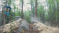
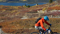
Photos of Mt McIntyre Mountain Bike
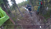
Videos of Mt McIntyre Mountain Bike
trail: Katima Trail
0:32 |
4 |
Jun 11, 2026

trail: Rock Lobster
0:22 |
129 |
Dec 30, 2023
trail: Rock Lobster
0:53 |
404 |
May 31, 2020
trail: Blown Away
3:02 |
850 |
Sep 30, 2017
trail: Kid Vicious!
0:04 |
920 |
Sep 30, 2017
trail: Blown Away
2:00 |
129 |
Nov 8, 2016

trail: Kid Vicious!
2:11 |
733 |
Aug 16, 2021 , Whitehorse
trail: Rock Lobster
0:56 |
738 |
Apr 13, 2021 , Whitehorse
Recent Trail Reports
| status | trail | date | condition | info | user |
|---|---|---|---|---|---|
| Kid Vicious! | Jun 14, 2026 @ 1:57pm (America/Whitehorse) Jun 14, 2026 | Unknown | sylvturc | ||
| Lower Rocky Canyon | Mar 19, 2026 @ 10:00pm (America/Whitehorse) Mar 19, 2026 | Snow Groomed | Camelot | ||
| Bouncing Bunny | Mar 19, 2026 @ 9:55pm (America/Whitehorse) Mar 19, 2026 | Snow Packed | Camelot | ||
| Two Burnt Trees | Mar 2, 2026 @ 3:36pm (America/Whitehorse) Mar 2, 2026 | Snow Packed | bafytca | ||
| Porcupine Ridge | Feb 19, 2026 @ 6:45pm (America/Whitehorse) Feb 19, 2026 | Snow Groomed | Camelot | ||
| Rebirth | Feb 17, 2026 @ 10:58pm (America/Whitehorse) Feb 17, 2026 | Snow Groomed | aakootenay | ||
| Calypso Canyon | Feb 17, 2026 @ 10:52pm (America/Whitehorse) Feb 17, 2026 | Snow Groomed | aakootenay | ||
| Reimer Reason | Feb 17, 2026 @ 9:17pm (America/Whitehorse) Feb 17, 2026 | Snow Groomed | aakootenay | ||
| The Collective | Feb 17, 2026 @ 9:16pm (America/Whitehorse) Feb 17, 2026 | Snow Groomed | aakootenay | ||
| Upper Rocky Canyon | Feb 17, 2026 @ 9:16pm (America/Whitehorse) Feb 17, 2026 | Snow Groomed | aakootenay |
Activity Feed
| username | action | type | title | date |
|---|---|---|---|---|
| alldreidup | wishlist | route | activity #97769688 | Jun 25, 2026 @ 8:15am 17 hours |
| dkotylak | comment | trail | activity #97128648 | Jun 16, 2026 @ 11:55am Jun 16, 2026 |
| Mapa | wishlist | trail | activity #97125416 | Jun 16, 2026 @ 11:16am Jun 16, 2026 |
| Mahonkin | ridden | trail | activity #97013916 | Jun 14, 2026 @ 5:00pm Jun 14, 2026 |
| sylvturc | comment | report | activity #97010981 | Jun 14, 2026 @ 4:04pm Jun 14, 2026 |
Recent Comments
| username | type | title | comment | date |
|---|---|---|---|---|
| trail | Quit your birch’en… These are birch trees... | Jun 16, 2026 @ 11:55am Jun 16, 2026 | ||
| report | Big tree down when you get in the trees before... | Jun 14, 2026 @ 4:04pm Jun 14, 2026 | ||
| report | Np | Jun 14, 2026 @ 3:55pm Jun 14, 2026 | ||
| report | Thanks for posting. :-) The network will get a... | Mar 3, 2026 @ 1:33pm Mar 3, 2026 | ||
| report | Thanks for posting. :-) The network will get a... | Mar 3, 2026 @ 1:32pm Mar 3, 2026 |
Nearby Areas
| name | distance | ||||
|---|---|---|---|---|---|
| Takhini | 5 | 7 | 1.5 km | ||
| Yukon University | 8 | 23 | 1.8 km | ||
| Porter Creek | 10 | 18 | 1.9 km | ||
| Hillcrest | 31 | 37 | 1 | 2.1 km | |
| Range Point | 2 | 1 | 2.3 km |
Local Badges
-

Completionist1 awarded
Bike & Skill Parks
| name | type | city | rating |
|---|---|---|---|
| Dirt n' Soul Mountain Bike Skills Park | skill park | Whitehorse | |
| Skill park | skill park | Whitehorse |
Local Mountain Biking Directory
-
Boréale BikingGuides & Tours
![Boréale Biking]()
-
Contagious Mountain Bike Club
![Contagious Mountain Bike Club]()
-
Cadence CyclesBike Shop
-
Icycle SportBike Shop
Activity Type Stats
| activitytype | trails | distance | descent | descent distance | total vertical | rating | global rank | state rank | photos | reports | routes | ridelogs |
|---|---|---|---|---|---|---|---|---|---|---|---|---|
| Mountain Bike | 75 | 69 miles | 8,117 ft | 29 miles | 2,844 ft | #1,285 | #2 | 280 | 1,633 | 11 | 6,361 | |
| E-Bike | 79 | 4 miles | 1,030 ft | 2 miles | 2,106 ft | #1,872 | #1 | 17 | 690 | 4 | 158 | |
| Winter Fat Bike | 2 | #1,077 | #3 | 39 | 9 | |||||||
| Horse | 3 | 9 miles | 1,007 ft | 2 miles | 2,385 ft | #1,030 | #1 | 258 | ||||
| Hike | 78 | 76 miles | 10,279 ft | 33 miles | 2,844 ft | #2,328 | #2 | 1 | 1,617 | 2 | 202 | |
| Trail Running | 79 | 79 miles | 10,535 ft | 34 miles | 2,844 ft | #1,344 | #2 | 1,617 | 2 | 1,188 | ||
| Dirtbike/Moto | 1 | 7 miles | 102 ft | 3,451 ft | 2,385 ft | 157 | 4 | |||||
| ATV/ORV/OHV | 3 | 8 miles | 167 ft | 1 mile | 2,749 ft | 160 | ||||||
| Snowmobile | 1 | 7 miles | 102 ft | 3,451 ft | 2,385 ft | 58 | 3 | |||||
| Snowshoe | 33 | 26 miles | 1,440 ft | 9 miles | 2,759 ft | #312 | #1 | 159 | 40 | |||
| Backcountry Ski | 2 | 9 miles | 335 ft | 2 miles | 2,385 ft | 58 | 39 | |||||
| Nordic Ski | 44 | 51 miles | 4,341 ft | 19 miles | 2,785 ft | #12 | #1 | 139 | 6,432 |
Frequently Asked Questions About Mt McIntyre
▼
What are the highest rated mountain biking trails in Mt McIntyre?
The highest rated mountain biking trails in Mt McIntyre are:
- Kid Vicious! (4.6/5)
- Rock Lobster (4.5/5)
- Blown Away (4.3/5)
- Upper/Lower Goat (4.3/5)
- El Guapo (4.2/5)
▼
What is the best time of the year to ride in Mt McIntyre?
Based on ride log data, the most popular months to ride in Mt McIntyre are:
- July (166 activities)
- August (137 activities)
- June (134 activities)
▼
Where can I park to ride in Mt McIntyre?
There are 1 parking locations listed in Mt McIntyre. The most popular parking spots are:
▼
What is the longest trail in Mt McIntyre?
The longest trail in Mt McIntyre is Copper at 5.4 miles. View all trails sorted by distance.
Activities
- By karlmcew & contributors
- Admins: brittseels, CMBC, COW, S2Syukon-trails, CMBC
- #3533 - 19,588 views
- mt mcintyre activity log | embed map of Mt McIntyre mountain bike trails | mt mcintyre mountain biking points of interest
Downloading of trail gps tracks in kml & gpx formats is enabled for Mt McIntyre.
You must login to download files.