close
-
Layers w
- Weather Layers
- Pro
- Pro
- Pro
- Pro
- Pro
- Pro
- More Layers
- Pro
- Pro
- Pro
- Pro
-
Upgrade to

3D
Trail Conditions
- Unknown
- Snow Groomed
- Snow Packed
- Snow Covered
- Snow Cover Partial
- Freeze/thaw Cycle
- Icy
- Prevalent Mud
- Wet
- Variable
- Ideal
- Dry
- Very Dry
Trail Flow (Ridden Direction)
Trailforks scans users ridelogs to determine the most popular direction each trail is ridden. A good flowing trail network will have most trails flowing in a single direction according to their intension.
The colour categories are based on what percentage of riders are riding a trail in its intended direction.
The colour categories are based on what percentage of riders are riding a trail in its intended direction.
- > 96%
- > 90%
- > 80%
- > 70%
- > 50%
- < 50%
- bi-directional trail
- no data
Trail Last Ridden
Trailforks scans ridelogs to determine the last time a trail was ridden.
- < 2 days
- < 1 week
- < 2 weeks
- < 1 month
- < 6 months
- > 6 months
Trail Ridden Direction
The intended direction a trail should be ridden.
- Downhill Only
- Downhill Primary
- Both Directions
- Uphill Primary
- Uphill Only
- One Direction
Contribute Details
Colors indicate trail is missing specified detail.
- Description
- Photos
- Description & Photos
- Videos
Trail Popularity ?
Trailforks scans ridelogs to determine which trails are ridden the most in the last 9 months.
Trails are compared with nearby trails in the same city region with a possible 25 colour shades.
Think of this as a heatmap, more rides = more kinetic energy = warmer colors.
- most popular
- popular
- less popular
- not popular
ATV/ORV/OHV Filter
Max Vehicle Width
inches
US Cell Coverage
Legend

Radar Time
Activity Recordings
Trailforks uses anonymized public activity data.
?
Activity Recordings
Trailforks uses anonymized public activity data.
?
Personal Heatmap
▶
Activity Types
all
/
none
▶
Options
2
Date range
month
–
Winter Trails
Warning
A routing network for winter maps does not exist. Selecting trails using the winter trails layer has been disabled.
Missing Trails
Most Popular
Least Popular
Trails are colored based on popularity. The more popular a trail is, the more red. Less popular trails trend towards green.
Jump Magnitude Heatmap
Heatmap of where riders jump on trails. Zoom in to see individual jumps, click circles to view jump details.
BC Backroad Status
![map legend]()
Service Road Atlas is a free to use, community-driven service for viewing and creating reports on the numerous back-country service roads around B.C. and Alberta.

Slope Aspect
Direction the slope faces
Trails Deemphasized
Trails are shown in grey.
Only show trails with no bike usage.
Suggested Layers
Based on selected activity type
Save the current map location and zoom level as your default home location whenever this page is loaded.
SaveMudgee Common
Primary Trail Type: All-Mountain & Downhill
eBikes Allowed:
Yes
Land Status: City Managed
Land Manager: City of Mudgee
 google parking directions
Links
Activities Click to view
- Mountain Bike
38 trails
- E-Bike
38 trails
- Horse
30 trails
- Hike
42 trails
- Trail Running
33 trails
Region Details
- 7
- 8
- 16
- 2
- 3
Region Status
Open as of Jun 12, 2026Stats
- Avg Trail Rating
- Trails (view details)
- 42
- Trails Mountain Bike
- 38
- Trails E-Bike
- 38
- Trails Gravel Bike
- 1
- Trails Horse
- 30
- Trails Hike
- 42
- Trails Trail Running
- 33
- Total Distance
- 20 miles
- Total Descent
- 3,350 ft
- Total Vertical
- 1,188 ft
- Highest Trailhead
- 2,819 ft
- Reports
- 282
- Photos
- 89
- Ridden Counter
- 4,874
Popular Mudgee Common Mountain Biking Trails
• 95 ★ 4.0 • 2,037 ft • 39 ft • 259 •
is a short 643m dirt single track with fun switch back berms and small jumps, with 110m climb and 96m decent it is a great warm up ride linking to some awesome trails.
• 100 ★ 3.0 • 636 ft • 0 ft • 245 •
Popular blue difficulty singletrack. This multi-use trail can be used both directions. It features berm, drop and jump. On average it takes minutes to complete this trail.
• 80 ★ 4.0 • 1 mile • 54 ft • 195 •
Popular green difficulty family friendly singletrack. This mountain bike primary trail can be used one direction and has a moderate overall physical rating with a 54 ft green climb. Trail visibility is always easy to follow. On average it takes 9 minutes to complete this trail.
• 95 ★ 4.0 • 1,125 ft • 0 ft • 193 •
Popular blue difficulty singletrack. This multi-use trail can be used one direction and has a moderate overall physical rating. It features bridge, jump and rock garden. Trail visibility is always easy to follow. On average it takes 2 minutes to complete this trail.
• 40 ★ 1.5 • 1,411 ft • 10 ft • 191 •
Moderately popular green difficulty singletrack. This multi-use trail can be used one direction and has a easy overall physical rating with a 10 ft green climb. Trail visibility is always easy to follow. On average it takes 1 minutes to complete this trail.
• 85 ★ 3.0 • 4,491 ft • 87 ft • 189 •
This is a twisting, rocky track with tree roots everywhere. Super fun for anyone with reasonable strength, but definitely not in the 'young family' category. (My 7 year old struggled.)
• 90 ★ 3.5 • 3,642 ft • 0 ft • 183 •
Popular blue difficulty family friendly singletrack. This multi-use trail can be used downhill only and has a moderate overall physical rating. It features berm, drop, jump, log ride, rock garden and skinny. On average it takes 5 minutes to complete this trail.
• 80 ★ 4.0 • 3,635 ft • 101 ft • 180 •
Popular blue difficulty singletrack. This multi-use trail can be used one direction and has a moderate overall physical rating with a 101 ft blue climb. It features berm, drop and rock garden. Trail visibility is always easy to follow. On average it takes 7 minutes to complete this trail.
Mudgee Common Mountain Bike Routes
6 miles • 757 ft • 11 • Loop •
This years MRMTB hosted XC race is round 1 of the Central west inter-club race series, the trail has been...
6 miles • 560 ft • 12 • Loop • Race •
Mudgee region Mountain Bike Club is pleased to be hosing Round 1 of the 2024 NSW Central West XC Mountain...
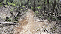
Photos of Mudgee Common Mountain Bike
Videos of Mudgee Common Mountain Bike
trail: Betcha Can't
0:12 |
42 |
Sep 18, 2025

3:03 |
621 |
Nov 11, 2019

6:18 |
1747 |
Nov 11, 2019

trail: Ant Hill
1644 |
Jan 15, 2017 , Mudgee
Recent Trail Reports
Activity Feed
| username | action | type | title | date |
|---|---|---|---|---|
| Eggs78 | add | report | activity #97001582 and 6 more | Jun 14, 2026 @ 1:40pm Jun 14, 2026 |
| organm | wishlist | route | activity #96128852 | Jun 2, 2026 @ 7:05pm Jun 2, 2026 |
| Carthew | wishlist | region | activity #89752747 | Mar 1, 2026 @ 1:36am Mar 1, 2026 |
| Marin25 | wishlist | region | activity #88066272 | Jan 30, 2026 @ 7:59pm Jan 30, 2026 |
| Jennifert121T2 | ridden | trail | activity #87567994 | Jan 21, 2026 @ 3:43am Jan 21, 2026 |
Recent Comments
| username | type | title | comment | date |
|---|---|---|---|---|
| trail | interesting ride and easy climb to other... | Dec 25, 2025 @ 4:11pm Dec 25, 2025 | ||
| trail | This is one of the best trails that I have... | Apr 3, 2025 @ 12:18am Apr 3, 2025 | ||
| trail | This is a very fast trail, with lots of hops... | Apr 3, 2025 @ 12:14am Apr 3, 2025 | ||
| trail | I have been lucky enough to go to lots of bike... | Apr 3, 2025 @ 12:13am Apr 3, 2025 | ||
| trail | This is a single black jump line. With maybe... | Apr 3, 2025 @ 12:11am Apr 3, 2025 |
Nearby Areas
| name | distance | ||||
|---|---|---|---|---|---|
| Clandulla Trails | 1 | 17 | 2 | 30.7 km |
Local Badges
-

Completionist0 awarded
Activity Type Stats
| activitytype | trails | distance | descent | descent distance | total vertical | rating | global rank | state rank | photos | reports | routes | ridelogs |
|---|---|---|---|---|---|---|---|---|---|---|---|---|
| Mountain Bike | 38 | 18 miles | 2,884 ft | 8 miles | 1,188 ft | #3,250 | #151 | 89 | 282 | 3 | 2,890 | |
| E-Bike | 38 | 18 miles | 2,884 ft | 8 miles | 1,188 ft | #2,771 | #133 | 267 | 2 | 513 | ||
| Gravel Bike | 1 | #2,128 | #165 | 6 | 1 | 33 | ||||||
| Horse | 30 | 11 miles | 1,657 ft | 5 miles | 364 ft | #226 | #13 | 34 | 1 | |||
| Hike | 42 | 19 miles | 3,238 ft | 8 miles | 1,188 ft | #5,045 | #133 | 277 | 67 | |||
| Trail Running | 33 | 15 miles | 2,028 ft | 6 miles | 1,188 ft | #4,838 | #146 | 277 | 68 |
Frequently Asked Questions About Mudgee Common
▼
What are the highest rated mountain biking trails in Mudgee Common?
The highest rated mountain biking trails in Mudgee Common are:
- Morewood Gully (4.4/5)
- Barking Mad (4.2/5)
- Quarter Pounder "dual line" (4.2/5)
- Misery Drop (4.1/5)
- The Budgee Smuggler (4.1/5)
▼
What is the best time of the year to ride in Mudgee Common?
Based on ride log data, the most popular months to ride in Mudgee Common are:
- February (37 activities)
- May (29 activities)
- April (27 activities)
▼
Where can I park to ride in Mudgee Common?
There are 1 parking locations listed in Mudgee Common. The most popular parking spots are:
▼
What is the longest trail in Mudgee Common?
The longest trail in Mudgee Common is Waterworks Gully at 5.1 km. View all trails sorted by distance.
Activities
Trails
- By james-wormald
 MRMTB & contributors
 - Admins: MRMTB, MRMTB
- #17457 - 32,705 views
- mudgee common activity log | embed map of Mudgee Common mountain bike trails | mudgee common mountain biking points of interest
Downloading of trail gps tracks in kml & gpx formats is enabled for Mudgee Common.
You must login to download files.