close
-
Layers w
- Weather Layers
- Pro
- Pro
- Pro
- Pro
- Pro
- Pro
- More Layers
- Pro
- Pro
- Pro
- Pro
-
Upgrade to

3D
Trail Conditions
- Unknown
- Snow Groomed
- Snow Packed
- Snow Covered
- Snow Cover Partial
- Freeze/thaw Cycle
- Icy
- Prevalent Mud
- Wet
- Variable
- Ideal
- Dry
- Very Dry
Trail Flow (Ridden Direction)
Trailforks scans users ridelogs to determine the most popular direction each trail is ridden. A good flowing trail network will have most trails flowing in a single direction according to their intension.
The colour categories are based on what percentage of riders are riding a trail in its intended direction.
The colour categories are based on what percentage of riders are riding a trail in its intended direction.
- > 96%
- > 90%
- > 80%
- > 70%
- > 50%
- < 50%
- bi-directional trail
- no data
Trail Last Ridden
Trailforks scans ridelogs to determine the last time a trail was ridden.
- < 2 days
- < 1 week
- < 2 weeks
- < 1 month
- < 6 months
- > 6 months
Trail Ridden Direction
The intended direction a trail should be ridden.
- Downhill Only
- Downhill Primary
- Both Directions
- Uphill Primary
- Uphill Only
- One Direction
Contribute Details
Colors indicate trail is missing specified detail.
- Description
- Photos
- Description & Photos
- Videos
Trail Popularity ?
Trailforks scans ridelogs to determine which trails are ridden the most in the last 9 months.
Trails are compared with nearby trails in the same city region with a possible 25 colour shades.
Think of this as a heatmap, more rides = more kinetic energy = warmer colors.
- most popular
- popular
- less popular
- not popular
ATV/ORV/OHV Filter
Max Vehicle Width
inches
US Cell Coverage
Legend

Radar Time
Activity Recordings
Trailforks uses anonymized public activity data.
?
Activity Recordings
Trailforks uses anonymized public activity data.
?
Personal Heatmap
▶
Activity Types
all
/
none
▶
Options
2
Date range
month
–
Winter Trails
Warning
A routing network for winter maps does not exist. Selecting trails using the winter trails layer has been disabled.
Missing Trails
Most Popular
Least Popular
Trails are colored based on popularity. The more popular a trail is, the more red. Less popular trails trend towards green.
Jump Magnitude Heatmap
Heatmap of where riders jump on trails. Zoom in to see individual jumps, click circles to view jump details.
BC Backroad Status
![map legend]()
Service Road Atlas is a free to use, community-driven service for viewing and creating reports on the numerous back-country service roads around B.C. and Alberta.

Slope Aspect
Direction the slope faces
Trails Deemphasized
Trails are shown in grey.
Only show trails with no bike usage.
Suggested Layers
Based on selected activity type
Save the current map location and zoom level as your default home location whenever this page is loaded.
Save
No description for Muleshoe Bend has been added yet!
Login or register to submit one.
 google parking directions
google parking directions Activities Click to view
- Mountain Bike
9 trails
- Hike
9 trails
- Trail Running
9 trails
Region Details
- 1
- 3
- 3
- 2
Region Status
Open as of May 27, 2026Stats
- Avg Trail Rating
- Trails (view details)
- 9
- Trails Mountain Bike
- 9
- Trails Hike
- 9
- Trails Trail Running
- 9
- Total Distance
- 9 miles
- Total Descent
- 1,025 ft
- Total Vertical
- 128 ft
- Highest Trailhead
- 812 ft
- Reports
- 72
- Photos
- 4
- Ridden Counter
- 2,047
Popular Muleshoe Bend Mountain Biking Trails
• 80 ★ 4.0 • 970 ft • 16 ft • 323 •
Popular green difficulty singletrack. This multi-use trail can be used one direction. On average it takes 1 minutes to complete this trail.
• 70 ★ 4.7 • 6 miles • 463 ft • 309 •
Meant to be a beginner trail. There are a few short sections that will be given a "B Line" to make it truly a beginner trail. Until then, plan to walk 3 or 4 short rocky climbs until the "bypass" is completed..
• 60 ★ 0.0 • 1,430 ft • 40 ft • 292 •
Moderately popular blue difficulty singletrack. This multi-use trail can be used one direction. On average it takes 2 minutes to complete this trail.
• 100 ★ 0.0 • 1,535 ft • 38 ft • 260 •
Popular blue difficulty singletrack. This multi-use trail can be used one direction. On average it takes 4 minutes to complete this trail.
• 90 ★ 4.5 • 2,040 ft • 51 ft • 255 •
Popular blue difficulty singletrack. This multi-use trail can be used one direction. On average it takes 3 minutes to complete this trail.
• 35 ★ 0.0 • 3,850 ft • 81 ft • 205 •
Less popular black diamond difficulty singletrack. This multi-use trail can be used one direction. On average it takes 9 minutes to complete this trail.
• 45 ★ 4.0 • 3,360 ft • 63 ft • 178 •
Black Diamond side loop of of (green trail). More advanced riders and challenge themselves while the less advanced riders wait for your return. This loop comes back to the trail not far from where it left.
• 15 ★ 0.0 • 1,156 ft • 27 ft • 23 •
Less popular green difficulty singletrack. This multi-use trail can be used both directions and has a easy overall physical rating with a 27 ft green climb. On average it takes 23 minutes to complete this trail.
Videos of Muleshoe Bend Mountain Bike
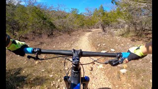
trail: Great Escape
11:21 |
644 |
Jun 12, 2021 , Spicewood
Recent Trail Reports
| status | trail | date | condition | info | user |
|---|---|---|---|---|---|
| Great Escape | Nov 3, 2025 @ 9:58am (America/Chicago) Nov 3, 2025 | Ideal | Kbswish | ||
| Side Winder | Jun 23, 2024 @ 1:42am Jun 23, 2024 | Ideal | DolomiteATX | ||
| Short Track | Apr 28, 2023 @ 12:44pm Apr 28, 2023 | Ideal | htownjj | ||
| Derailleur | Apr 15, 2023 @ 12:18am Apr 15, 2023 | Ideal | Dalep7tDEo | ||
| The Recycler | Apr 15, 2023 @ 7:18am Apr 15, 2023 | Ideal | Dalep7tDEo | ||
| Easy Rider | Oct 2, 2022 @ 6:53am Oct 2, 2022 | Ideal | AxelThomsen | ||
| Sprocket Loop | May 21, 2020 @ 7:04am May 21, 2020 | Ideal | Marc4jenn | ||
| Fishtail Loop | May 17, 2020 @ 12:43pm May 17, 2020 | Ideal | ATX-CJ7 |
Activity Feed
| username | action | type | title | date |
|---|---|---|---|---|
| Caleb3GiN3y | wishlist | region | activity #84791858 | Nov 27, 2025 @ 6:27am Nov 27, 2025 |
| bikersurferboater | vote | trail | activity #84712087 | Nov 25, 2025 @ 11:24am Nov 25, 2025 |
| EricYWxq6K | wishlist | region | activity #83809135 | Nov 8, 2025 @ 1:44pm Nov 8, 2025 |
| Kbswish | add | report | activity #83524846 | Nov 3, 2025 @ 12:33pm Nov 3, 2025 |
| Direwoof | wishlist | region | activity #69288485 | Apr 9, 2025 @ 7:25am Apr 9, 2025 |
Recent Comments
| username | type | title | comment | date |
|---|---|---|---|---|
| trail | Fun trail but lots of river rock. | Aug 28, 2022 @ 11:47am Aug 28, 2022 | ||
| trail | Boulder drops and climbs otherwise... | May 24, 2020 @ 7:32am May 24, 2020 | ||
| trail | Tight trees, tight turns, punchy ledges | May 24, 2020 @ 7:31am May 24, 2020 |
Nearby Areas
| name | distance | ||||
|---|---|---|---|---|---|
| Grelle Recreation Area | 10 | 2.7 km | |||
| Pace Bend | 27 | 14 | 1 | 5.1 km | |
| Tessera | 1 | 5 | 5.5 km | ||
| Schaffer Bend Recreation Area | 1 | 6.3 km | |||
| Milton Reimers Ranch Park | 7 | 5 | 2 | 8.6 km |
Activity Type Stats
| activitytype | trails | distance | descent | descent distance | total vertical | rating | global rank | state rank | photos | reports | routes | ridelogs |
|---|---|---|---|---|---|---|---|---|---|---|---|---|
| Mountain Bike | 9 | 9 miles | 1,024 ft | 4 miles | 128 ft | #9,323 | #3,652 | 4 | 72 | 1,585 | ||
| Hike | 9 | 9 miles | 1,024 ft | 4 miles | 128 ft | #13,660 | #5,855 | 72 | 53 | |||
| Trail Running | 9 | 9 miles | 1,024 ft | 4 miles | 128 ft | #12,634 | #5,104 | 72 | 68 |
Frequently Asked Questions About Muleshoe Bend
▼
What are the highest rated mountain biking trails in Muleshoe Bend?
The highest rated mountain biking trails in Muleshoe Bend are:
- Great Escape (4.5/5)
- Fishtail Loop (4/5)
- Derailleur (4/5)
- Sprocket Loop (4/5)
- Side Winder (0/5)
▼
What is the best time of the year to ride in Muleshoe Bend?
Based on ride log data, the most popular months to ride in Muleshoe Bend are:
- November (21 activities)
- December (21 activities)
- September (20 activities)
▼
Where can I park to ride in Muleshoe Bend?
There are 1 parking locations listed in Muleshoe Bend. The most popular parking spots are:
▼
What is the longest trail in Muleshoe Bend?
The longest trail in Muleshoe Bend is Great Escape at 6.0 miles. View all trails sorted by distance.
- By brenthillier
 NSMBA TRAILFORKS & contributors
 - Admins: ARR, ARR, mtbatx
- #3698 - 9,265 views
- muleshoe bend activity log | embed map of Muleshoe Bend mountain bike trails | muleshoe bend mountain biking points of interest
Downloading of trail gps tracks in kml & gpx formats is enabled for Muleshoe Bend.
You must login to download files.