close
-
Layers w
- Weather Layers
- Pro
- Pro
- Pro
- Pro
- Pro
- Pro
- More Layers
- Pro
- Pro
- Pro
- Pro
-
Upgrade to

3D
Trail Conditions
- Unknown
- Snow Groomed
- Snow Packed
- Snow Covered
- Snow Cover Partial
- Freeze/thaw Cycle
- Icy
- Prevalent Mud
- Wet
- Variable
- Ideal
- Dry
- Very Dry
Trail Flow (Ridden Direction)
Trailforks scans users ridelogs to determine the most popular direction each trail is ridden. A good flowing trail network will have most trails flowing in a single direction according to their intension.
The colour categories are based on what percentage of riders are riding a trail in its intended direction.
The colour categories are based on what percentage of riders are riding a trail in its intended direction.
- > 96%
- > 90%
- > 80%
- > 70%
- > 50%
- < 50%
- bi-directional trail
- no data
Trail Last Ridden
Trailforks scans ridelogs to determine the last time a trail was ridden.
- < 2 days
- < 1 week
- < 2 weeks
- < 1 month
- < 6 months
- > 6 months
Trail Ridden Direction
The intended direction a trail should be ridden.
- Downhill Only
- Downhill Primary
- Both Directions
- Uphill Primary
- Uphill Only
- One Direction
Contribute Details
Colors indicate trail is missing specified detail.
- Description
- Photos
- Description & Photos
- Videos
Trail Popularity ?
Trailforks scans ridelogs to determine which trails are ridden the most in the last 9 months.
Trails are compared with nearby trails in the same city region with a possible 25 colour shades.
Think of this as a heatmap, more rides = more kinetic energy = warmer colors.
- most popular
- popular
- less popular
- not popular
ATV/ORV/OHV Filter
Max Vehicle Width
inches
US Cell Coverage
Legend

Radar Time
Activity Recordings
Trailforks uses anonymized public activity data.
?
Activity Recordings
Trailforks uses anonymized public activity data.
?
Personal Heatmap
▶
Activity Types
all
/
none
▶
Options
2
Date range
month
–
Winter Trails
Warning
A routing network for winter maps does not exist. Selecting trails using the winter trails layer has been disabled.
Missing Trails
Most Popular
Least Popular
Trails are colored based on popularity. The more popular a trail is, the more red. Less popular trails trend towards green.
Jump Magnitude Heatmap
Heatmap of where riders jump on trails. Zoom in to see individual jumps, click circles to view jump details.
BC Backroad Status
![map legend]()
Service Road Atlas is a free to use, community-driven service for viewing and creating reports on the numerous back-country service roads around B.C. and Alberta.

Slope Aspect
Direction the slope faces
Trails Deemphasized
Trails are shown in grey.
Only show trails with no bike usage.
Suggested Layers
Based on selected activity type
Save the current map location and zoom level as your default home location whenever this page is loaded.
Save
No description for Munson Hills has been added yet!
Login or register to submit one.
 google parking directions
google parking directionsLinks
Activities Click to view
- Mountain Bike
20 trails
- E-Bike
0 trails
- Gravel Bike
10 trails
- Hike
22 trails
- Trail Running
22 trails
Region Details
- 10
Region Status
Open as of May 25, 2026Stats
- Avg Trail Rating
- Trails (view details)
- 10
- Trails Mountain Bike
- 20
- Trails Gravel Bike
- 10
- Trails Hike
- 22
- Trails Trail Running
- 22
- Total Distance
- 21 miles
- Total Descent
- 679 ft
- Total Vertical
- 46 ft
- Highest Trailhead
- 64 ft
- Reports
- 141
- Photos
- 29
- Ridden Counter
- 1,668
Popular Munson Hills Mountain Biking Trails
• 100 ★ 4.5 • 2,641 ft • 26 ft • 290 •
Popular green difficulty singletrack. This multi-use trail can be used both directions. On average it takes 2 minutes to complete this trail.
• 100 ★ 4.7 • 4 miles • 86 ft • 248 •
Munson Hills is probably one of the busiest trails in Tallahassee partly due to the fact that it is such a fun flowy trail that can be ridden in the rain. The trail surface is a mixture of hard packed clay, which makes the trail almost...
• 95 ★ 4.2 • 4 miles • 73 ft • 210 •
Highly rated popular green difficulty singletrack. This multi-use trail can be used both directions. On average it takes 22 minutes to complete this trail.
• 90 ★ 4.0 • 3,773 ft • 10 ft • 181 •
Popular green difficulty singletrack. This multi-use trail can be used both directions. On average it takes 4 minutes to complete this trail.
• 100 ★ 4.2 • 2,221 ft • 2 ft • 173 •
A purposely built downhill flow trail elevated above forest floor with red clay.
• 80 ★ 4.6 • 5,203 ft • 13 ft • 162 •
Popular green difficulty singletrack. This multi-use trail can be used both directions. On average it takes 6 minutes to complete this trail.
• 85 ★ 4.5 • 3,255 ft • 3 ft • 155 •
Popular green difficulty singletrack. This multi-use trail can be used both directions. On average it takes 3 minutes to complete this trail.
• 70 ★ 3.8 • 10 miles • 178 ft • 98 •
A true national forest trail. In this area the white sand is abundant. During any type of rainy time it is the go to trail because of how well it drains. When not rainy it can be very loose with the sand. Great for extra mileage in your...
Munson Hills Mountain Bike Routes
15 miles • 240 ft • 12 •
This route combines the two best trails on the Southside, Munson and Twilight. This is referred to as the...
• 25 miles • 148 ft • 3 •
• 16 miles • 72 ft • 0 •
• 21 miles • 504 ft • 7 •
• 10 miles • 183 ft • 2 •
• 7 miles • 169 ft • 2 •
Photos of Munson Hills Mountain Bike
Videos of Munson Hills Mountain Bike
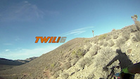
trail: Twilight Trail
2:46 |
329 |
Sep 25, 2015
youtuber
![Munson Hills Mountain Bike Trails -...]()

6:54 |
955 |
Apr 9, 2020
Recent Trail Reports
| status | trail | date | condition | info | user |
|---|---|---|---|---|---|
| Paper Cup | May 25, 2026 @ 8:18am (America/Kentucky/Monticello) May 25, 2026 | Ideal | KarenBear TMBA | ||
| Munson East | May 25, 2026 @ 8:18am (America/Kentucky/Monticello) May 25, 2026 | Ideal | KarenBear TMBA | ||
| West Conn | May 25, 2026 @ 8:18am (America/Kentucky/Monticello) May 25, 2026 | Ideal | KarenBear TMBA | ||
| Twilight Trail | May 25, 2026 @ 8:18am (America/Kentucky/Monticello) May 25, 2026 | Variable | KarenBear TMBA | ||
| Luge | May 25, 2026 @ 8:18am (America/Kentucky/Monticello) May 25, 2026 | Ideal | KarenBear TMBA | ||
| Munson West | May 25, 2026 @ 8:18am (America/Kentucky/Monticello) May 25, 2026 | Variable | KarenBear TMBA | ||
| Tall Pine | Jan 4, 2026 @ 1:38pm (America/New_York) Jan 4, 2026 | Ideal | KarenBear TMBA | ||
| Gun Range Connector | Jan 4, 2026 @ 1:38pm (America/New_York) Jan 4, 2026 | Ideal | KarenBear TMBA | ||
| East Conn | Oct 19, 2025 @ 4:42pm (America/Kentucky/Monticello) Oct 19, 2025 | Dry | KarenBear TMBA | ||
| Woodville Park Acc | May 26, 2025 @ 8:30am May 26, 2025 | Ideal | KarenBear TMBA |
Activity Feed
| username | action | type | title | date |
|---|---|---|---|---|
| schillingsworth | vote | trail | activity #96134502 and 3 more | Jun 2, 2026 @ 9:14pm Jun 2, 2026 |
| KarenBear | add | report | activity #95504715 and 5 more | May 25, 2026 @ 10:56am May 25, 2026 |
| KarenBear | add | report | activity #94835474 and 3 more | May 16, 2026 @ 11:12am May 16, 2026 |
| KarenBear | add | report | activity #93977344 and 1 more | May 3, 2026 @ 1:16pm May 3, 2026 |
| jasonscottcarter | ridden | trail | activity #93431870 and 4 more | Apr 26, 2026 @ 5:18am Apr 26, 2026 |
Recent Comments
| username | type | title | comment | date |
|---|---|---|---|---|
| report | Any wet , muddy or puddle trails today 15 sept... | Sep 15, 2024 @ 1:46pm Sep 15, 2024 | ||
| trail | amazing trail. super flowy | Nov 14, 2022 @ 8:34am Nov 14, 2022 | ||
| trail | Great place to learn off-road cycling and... | Nov 1, 2021 @ 2:46pm Nov 1, 2021 | ||
| report | Took my 8 year old nephew for his first trail... | Apr 6, 2020 @ 2:15pm Apr 6, 2020 | ||
| trail | i expected more, but still a nice trail.. | Jun 7, 2016 @ 8:24am Jun 7, 2016 |
Nearby Areas
| name | distance | ||||
|---|---|---|---|---|---|
| Debbie Lightsey Nature Park | 6.8 km | ||||
| Tom Brown Park | 1 | 4 | 7.5 km | ||
| Apalachicola National Forest | 7.6 km | ||||
| Lafayette Heritage Trail Park | 3 | 5 | 7.7 km | ||
| Edward Ball Wakulla Springs State Park | 1 | 8.4 km |
Activity Type Stats
| activitytype | trails | distance | descent | descent distance | total vertical | rating | global rank | state rank | photos | reports | routes | ridelogs |
|---|---|---|---|---|---|---|---|---|---|---|---|---|
| Mountain Bike | 20 | 21 miles | 679 ft | 5 miles | 46 ft | #3,786 | #1,310 | 25 | 141 | 1 | 5,055 | |
| Gravel Bike | 10 | #110 | #53 | 13 | ||||||||
| Hike | 22 | 21 miles | 669 ft | 5 miles | 46 ft | #8,827 | #3,334 | 4 | 141 | 20 | ||
| Trail Running | 22 | 21 miles | 669 ft | 5 miles | 46 ft | #8,345 | #2,908 | 141 | 38 |
Frequently Asked Questions About Munson Hills
▼
What are the highest rated mountain biking trails in Munson Hills?
The highest rated mountain biking trails in Munson Hills are:
- Munson West (4.3/5)
- Tall Pine (4.3/5)
- Paper Cup (4.2/5)
- Gun Range Connector (4.1/5)
- West Conn (4.1/5)
▼
What is the best time of the year to ride in Munson Hills?
Based on ride log data, the most popular months to ride in Munson Hills are:
- April (28 activities)
- May (28 activities)
- January (27 activities)
▼
Where can I park to ride in Munson Hills?
There are 3 parking locations listed in Munson Hills. The most popular parking spots are: View all parking and trailhead locations on the map to plan your visit.
▼
What is the longest trail in Munson Hills?
The longest trail in Munson Hills is Twilight Trail at 9.6 miles. View all trails sorted by distance.
Activities
- By brenthillier
 NSMBA TRAILFORKS & contributors
 - Admins: TMBA, TMBA
- #3687 - 7,868 views
- munson hills activity log | embed map of Munson Hills mountain bike trails | munson hills mountain biking points of interest
Downloading of trail gps tracks in kml & gpx formats is enabled for Munson Hills.
You must login to download files.