close
-
Layers w
- Weather Layers
- Pro
- Pro
- Pro
- Pro
- Pro
- Pro
- More Layers
- Pro
- Pro
- Pro
- Pro
-
Upgrade to

3D
Trail Conditions
- Unknown
- Snow Groomed
- Snow Packed
- Snow Covered
- Snow Cover Partial
- Freeze/thaw Cycle
- Icy
- Prevalent Mud
- Wet
- Variable
- Ideal
- Dry
- Very Dry
Trail Flow (Ridden Direction)
Trailforks scans users ridelogs to determine the most popular direction each trail is ridden. A good flowing trail network will have most trails flowing in a single direction according to their intension.
The colour categories are based on what percentage of riders are riding a trail in its intended direction.
The colour categories are based on what percentage of riders are riding a trail in its intended direction.
- > 96%
- > 90%
- > 80%
- > 70%
- > 50%
- < 50%
- bi-directional trail
- no data
Trail Last Ridden
Trailforks scans ridelogs to determine the last time a trail was ridden.
- < 2 days
- < 1 week
- < 2 weeks
- < 1 month
- < 6 months
- > 6 months
Trail Ridden Direction
The intended direction a trail should be ridden.
- Downhill Only
- Downhill Primary
- Both Directions
- Uphill Primary
- Uphill Only
- One Direction
Contribute Details
Colors indicate trail is missing specified detail.
- Description
- Photos
- Description & Photos
- Videos
Trail Popularity ?
Trailforks scans ridelogs to determine which trails are ridden the most in the last 9 months.
Trails are compared with nearby trails in the same city region with a possible 25 colour shades.
Think of this as a heatmap, more rides = more kinetic energy = warmer colors.
- most popular
- popular
- less popular
- not popular
ATV/ORV/OHV Filter
Max Vehicle Width
inches
US Cell Coverage
Legend

Radar Time
Activity Recordings
Trailforks uses anonymized public activity data.
?
Activity Recordings
Trailforks uses anonymized public activity data.
?
Personal Heatmap
▶
Activity Types
all
/
none
▶
Options
2
Date range
month
–
Winter Trails
Warning
A routing network for winter maps does not exist. Selecting trails using the winter trails layer has been disabled.
Missing Trails
Most Popular
Least Popular
Trails are colored based on popularity. The more popular a trail is, the more red. Less popular trails trend towards green.
Jump Magnitude Heatmap
Heatmap of where riders jump on trails. Zoom in to see individual jumps, click circles to view jump details.
BC Backroad Status
![map legend]()
Service Road Atlas is a free to use, community-driven service for viewing and creating reports on the numerous back-country service roads around B.C. and Alberta.

Slope Aspect
Direction the slope faces
Trails Deemphasized
Trails are shown in grey.
Only show trails with no bike usage.
Suggested Layers
Based on selected activity type
Save the current map location and zoom level as your default home location whenever this page is loaded.
SaveMurray Valley Trail Area – Dwellingup, Western Australia
The Murray Valley Trail Area is one of Western Australia’s premier mountain bike destinations, delivering a purpose-built gravity riding experience within the forested landscape of Lane Poole Reserve near Dwellingup. Located approximately 10 minutes east of Dwellingup township, the network forms part of the broader Dwellingup Adventure Trails system and is set among steep jarrah and marri forest overlooking the Murray Valley. Combining flowing descents, technical trails, progressive trail grading and scenic forest riding, Murray Valley has established itself as a benchmark ride area for gravity and all-mountain riding in the state.
The network is characterised by sustained elevation, varied terrain and a strong focus on rider progression. Purpose-built descending trails range from beginner-friendly green routes to advanced black trails featuring steeper gradients, technical terrain and larger constructed features. The forested environment, natural contours and ridgeline terrain provide a riding experience that feels immersive and distinctly different from many lower-elevation trail systems elsewhere in Western Australia.
Green-rated trails offer approachable introductions to descending, with wide tread, predictable corners, rollers and supportive berms suited to riders developing confidence. Intermediate blue trails introduce greater speed, tighter turns, steeper sections and more technical trail features, while black-rated trails demand advanced riding skills, incorporating larger jumps, rock features, technical descents and greater consequence. This progressive design allows riders of varying abilities to use the same network while selecting terrain appropriate to their experience.
Several well-known trails have become synonymous with the ride area. Year 1 offers a flowing, accessible descent suitable for riders building gravity skills, while Inzamia and Karrakatoa use the valley’s natural topography to deliver longer, more sustained all-mountain descents through rocky forest terrain. Advanced trails such as Busted Nuts and Bam Bam incorporate larger features and technical riding intended for experienced riders. Climbing access is also integrated into the network, with designated ascent trails including Yarri Up, Fault Line and Captain Hook enabling pedal-powered access to the upper trail system.
A defining feature of Murray Valley is how effectively the trail network integrates with the surrounding landscape. Trails wind through native jarrah forest, cross ridgelines and utilise the valley’s natural elevation to create long, flowing descents rarely found elsewhere in the region. Elevated sections of the network provide expansive views across the Murray Valley, adding a scenic dimension to the riding experience and reinforcing the area’s reputation as both a mountain biking and nature destination.
Primary Trail Type: Cross-Country
Shuttleable: YES
Land Status: State Forest
Land Manager: Western Australian Department of Biodiversity, Conservation and Attractions (DBCA)
 google parking directions
 Access Info:
Trailheads, Parking and Shuttle Services
The Murray Valley network is accessed through Lane Poole Reserve via Bobs Crossing Road, with signage directing visitors to the mountain bike trail area. The primary access points include upper and lower trailheads, with parking available at both locations. Public toilet facilities are located near the lower trailhead. Mobile phone reception is limited in sections of the valley, particularly at lower elevations, though coverage generally improves near the upper trail access point known as The Roost.
The network supports both self-powered and uplift riding. Riders may access descents using designated climbing trails, while a shuttle road enables vehicle-assisted uplift to the upper trailhead. Commercial and volunteer-supported shuttle services are reported to operate regularly, particularly on weekends and during events, although schedules may vary. Current trail conditions, maps and local riding information are available through the Dwellingup Trails and Visitor Centre.
Disclaimer:
Permits, Access Requirements and Riding Rules
Murray Valley is located within Lane Poole Reserve and is managed by the Western Australian Department of Biodiversity, Conservation and Attractions (DBCA). A vehicle entry fee applies for access to Lane Poole Reserve. Riders are required to remain on designated trails and follow posted signage, trail directions and difficulty ratings. Trail classifications follow the Australian mountain bike grading system, and advanced trails include technical features, steep terrain and optional technical lines requiring appropriate skill and judgement.
Helmets are essential, and riders are encouraged to carry sufficient water, tools and spare equipment due to the remote forest environment and variable weather conditions. Trail conditions may change seasonally or following weather events, making it advisable to check for closures or maintenance updates before travelling.
With its combination of gravity-focused descending, technical progression, natural forest setting and scenic elevation, Murray Valley offers one of the most complete mountain biking experiences in Western Australia. The blend of accessible flow trails, challenging technical descents and purpose-built climbing access makes it equally appealing to developing riders, experienced gravity enthusiasts and visitors seeking a destination-level riding experience within the state’s South West region.
Links
Activities Click to view
- Mountain Bike
39 trails
- E-Bike
39 trails
- Horse
0 trails
- Hike
17 trails
- Trail Running
17 trails
Region Details
- 19
- 8
- 9
- 3
Region Status
Open as of Jun 12, 2026Stats
- Avg Trail Rating
- Trails (view details)
- 40
- Trails Mountain Bike
- 39
- Trails E-Bike
- 39
- Trails Gravel Bike
- 14
- Trails Hike
- 17
- Trails Trail Running
- 17
- Total Distance
- 42 miles
- Total Descent Distance
- 19 miles
- Total Descent
- 6,826 ft
- Total Vertical
- 614 ft
- Highest Trailhead
- 1,060 ft
- Reports
- 394
- Photos
- 48
- Ridden Counter
- 12,277
Popular Murray Valley Mountain Biking Trails
• 100 ★ 3.8 • 1 mile • 20 ft • 859 •
is a 2.3km descending green trail suitable for beginners. The trail features open rolling grade reversals, large cambered turns and flowing features on wide smooth surface.
• 100 ★ 4.4 • 4,511 ft • 0 ft • 837 •
is a 1.4km blue downhill flow trail which has large natural surfaced features such as table tops, step downs and step ups, rollers and berms.
• 100 ★ 4.0 • 3,881 ft • 279 ft • 825 •
Popular blue difficulty singletrack. This mountain bike primary trail can be used one direction. On average it takes 8 minutes to complete this trail.
• 100 ★ 4.5 • 1 mile • 19 ft • 789 •
Top section XC style, flowing, slight downhill. Mid section steeper, many tight berms. Lower half fast, flowing, super fun.
• 100 ★ 4.0 • 3,461 ft • 102 ft • 728 •
An access trail to Inzamia, Karackatoa and downhill trails from The Roost shuttle trailhead. An alternative access trail to Fault Line. Some features to add interest such as a log ride, small rock gardens, stump drop jump, and a burnt...
• 100 ★ 5.0 • 1 mile • 238 ft • 673 •
Popular green difficulty singletrack. This mountain bike primary trail can be used one direction. On average it takes 11 minutes to complete this trail.
• 100 ★ 3.8 • 1 mile • 382 ft • 611 •
Easy gradients, flowing in lower half. Gradient increases gradually in upper half. Tight switchbacks and steeper grades in upper third.
• 95 ★ 3.8 • 4,272 ft • 80 ft • 611 •
All mountain trail, some downhill in first half, climbing in last third. Mainly an access trail from climb to Shuttle trail head area.
Murray Valley Mountain Bike Routes
16 miles • 2,030 ft • 19 • Loop •
Meet at the trailhead. All climbs are spaced out. Route ends at a point that allows various options to go...
13 miles • 1,550 ft • 24 • Loop •
20km loop Murray valley mix of easy and moderate trails
Photos of Murray Valley Mountain Bike
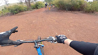
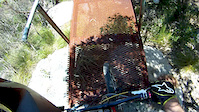
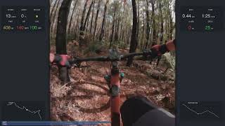
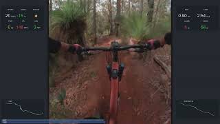
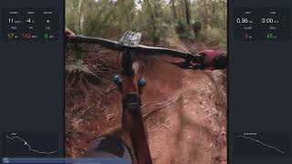
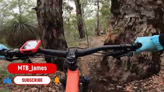
Videos of Murray Valley Mountain Bike
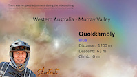
trail: Quokkamoly
4:55 |
56 |
Jan 25, 2025

trail: Busted Nuts
4:08 |
63 |
Jan 25, 2025
trail: Busted Nuts
0:03 |
427 |
Apr 23, 2021
trail: Rock On
0:58 |
969 |
Jan 7, 2013
trail: Snotty Gobble
3:19 |
11 |
May 26, 2026 , Dwellingup
trail: Karrackatoa
6:04 |
19 |
May 26, 2026 , Dwellingup
trail: Inzamia
6:44 |
27 |
May 26, 2026 , Dwellingup
trail: Tombstone
5:32 |
43 |
Sep 7, 2025 , Dwellingup
Recent Trail Reports
| status | trail | date | condition | info | user |
|---|---|---|---|---|---|
| Year 1 | Jun 12, 2026 @ 7:44pm (Australia/Perth) Jun 12, 2026 | Ideal | WillieJacobsz Trailforks | ||
| Yarri Up | Jun 12, 2026 @ 7:44pm (Australia/Perth) Jun 12, 2026 | Ideal | WillieJacobsz Trailforks | ||
| Tombstone | Jun 12, 2026 @ 7:44pm (Australia/Perth) Jun 12, 2026 | Ideal | WillieJacobsz Trailforks | ||
| South Parking Access | Jun 12, 2026 @ 7:44pm (Australia/Perth) Jun 12, 2026 | Ideal | WillieJacobsz Trailforks | ||
| Snotty Gobble | Jun 12, 2026 @ 7:44pm (Australia/Perth) Jun 12, 2026 | Ideal | WillieJacobsz Trailforks | ||
| Shuttle Road | Jun 12, 2026 @ 7:44pm (Australia/Perth) Jun 12, 2026 | Ideal | WillieJacobsz Trailforks | ||
| Rock On | Jun 12, 2026 @ 7:44pm (Australia/Perth) Jun 12, 2026 | Ideal | WillieJacobsz Trailforks | ||
| Quollity Street | Jun 12, 2026 @ 7:44pm (Australia/Perth) Jun 12, 2026 | Ideal | WillieJacobsz Trailforks | ||
| Quokkamoly | Jun 12, 2026 @ 7:44pm (Australia/Perth) Jun 12, 2026 | Ideal | WillieJacobsz Trailforks | ||
| Push-Up | Jun 12, 2026 @ 7:44pm (Australia/Perth) Jun 12, 2026 | Ideal | WillieJacobsz Trailforks |
Activity Feed
| username | action | type | title | date |
|---|---|---|---|---|
| sweatytechie | update | trail | activity #97149845 | Jun 16, 2026 @ 5:27pm 2 days |
| sweatytechie | add | trail | activity #97025999 | Jun 15, 2026 @ 12:07am Jun 15, 2026 |
| sweatytechie | update | region | activity #97025771 | Jun 14, 2026 @ 11:58pm Jun 14, 2026 |
| sweatytechie | add | poi | activity #97025631 and 1 more | Jun 14, 2026 @ 11:53pm Jun 14, 2026 |
| sweatytechie | update | trail | activity #97024236 | Jun 14, 2026 @ 10:55pm Jun 14, 2026 |
Recent Comments
| username | type | title | comment | date |
|---|---|---|---|---|
| trail | nice | Aug 11, 2025 @ 7:20pm Aug 11, 2025 | ||
| trail | This is a great trail! Fast, flowy, all the... | Mar 3, 2025 @ 4:11pm Mar 3, 2025 | ||
| trail | Nice easy flow trail. Some of the berms are... | Mar 3, 2025 @ 4:09pm Mar 3, 2025 | ||
| trail | Awesome flow trail. Looks like it's had a bit... | Mar 3, 2025 @ 4:07pm Mar 3, 2025 | ||
| trail | Nice trail but badly in need of some... | Mar 3, 2025 @ 4:07pm Mar 3, 2025 |
Nearby Areas
| name | distance | ||||
|---|---|---|---|---|---|
| Tom's Crossing MTB | 1.4 km | ||||
| Dwellingup Mountain Bike Trails | 18 | 19 | 6.9 km | ||
| Turner Hill | 2 | 2 | 1 | 11.4 km | |
| Wetlands Park | 1 | 31.2 km | |||
| Langford Park | 2 | 8 | 32.8 km |
Local Badges
-

Completionist1 awarded
Local Trail Supporters
- http://magicdirt.com.au/
- Loztrails
- https://www.facebook.com/loztrails/
Activity Type Stats
| activitytype | trails | distance | descent | descent distance | total vertical | rating | global rank | state rank | photos | reports | routes | ridelogs |
|---|---|---|---|---|---|---|---|---|---|---|---|---|
| Mountain Bike | 39 | 41 miles | 6,467 ft | 18 miles | 614 ft | #1,719 | #92 | 48 | 394 | 4 | 7,019 | |
| E-Bike | 39 | 41 miles | 6,467 ft | 18 miles | 614 ft | #2,380 | #113 | 349 | 1,046 | |||
| Gravel Bike | 14 | 7 miles | 722 ft | 3 miles | 387 ft | #820 | #72 | 3 | 11 | |||
| Hike | 17 | 8 miles | 1,102 ft | 3 miles | 443 ft | #8,769 | 302 | 34 | ||||
| Trail Running | 17 | 8 miles | 1,102 ft | 3 miles | 443 ft | #8,058 | #285 | 305 | 33 |
Frequently Asked Questions About Murray Valley
▼
What are the highest rated mountain biking trails in Murray Valley?
The highest rated mountain biking trails in Murray Valley are:
- Busted Nuts (4.4/5)
- Inzamia (4.2/5)
- Boom Boom (4.2/5)
- Yarri Up (4.1/5)
- Rock On (4.1/5)
▼
What is the best time of the year to ride in Murray Valley?
Based on ride log data, the most popular months to ride in Murray Valley are:
- September (107 activities)
- January (94 activities)
- October (90 activities)
▼
Where can I park to ride in Murray Valley?
There are 3 parking locations listed in Murray Valley. The most popular parking spots are: View all parking and trailhead locations on the map to plan your visit.
▼
What is the longest trail in Murray Valley?
The longest trail in Murray Valley is Munda Biddi - Oakley Dam To Nanga at 10.4 miles. View all trails sorted by distance.
Activities
Trails
- By WillieJacobsz
 Trailforks SBP SWW & contributors
 - Admins: apply
- #27046 - 19,176 views
- murray valley activity log | embed map of Murray Valley mountain bike trails | murray valley mountain biking points of interest
Downloading of trail gps tracks in kml & gpx formats is enabled for Murray Valley.
You must login to download files.