close
-
Layers w
- Weather Layers
- Pro
- Pro
- Pro
- Pro
- Pro
- Pro
- More Layers
- Pro
- Pro
- Pro
- Pro
-
Upgrade to

3D
Trail Conditions
- Unknown
- Snow Groomed
- Snow Packed
- Snow Covered
- Snow Cover Partial
- Freeze/thaw Cycle
- Icy
- Prevalent Mud
- Wet
- Variable
- Ideal
- Dry
- Very Dry
Trail Flow (Ridden Direction)
Trailforks scans users ridelogs to determine the most popular direction each trail is ridden. A good flowing trail network will have most trails flowing in a single direction according to their intension.
The colour categories are based on what percentage of riders are riding a trail in its intended direction.
The colour categories are based on what percentage of riders are riding a trail in its intended direction.
- > 96%
- > 90%
- > 80%
- > 70%
- > 50%
- < 50%
- bi-directional trail
- no data
Trail Last Ridden
Trailforks scans ridelogs to determine the last time a trail was ridden.
- < 2 days
- < 1 week
- < 2 weeks
- < 1 month
- < 6 months
- > 6 months
Trail Ridden Direction
The intended direction a trail should be ridden.
- Downhill Only
- Downhill Primary
- Both Directions
- Uphill Primary
- Uphill Only
- One Direction
Contribute Details
Colors indicate trail is missing specified detail.
- Description
- Photos
- Description & Photos
- Videos
Trail Popularity ?
Trailforks scans ridelogs to determine which trails are ridden the most in the last 9 months.
Trails are compared with nearby trails in the same city region with a possible 25 colour shades.
Think of this as a heatmap, more rides = more kinetic energy = warmer colors.
- most popular
- popular
- less popular
- not popular
ATV/ORV/OHV Filter
Max Vehicle Width
inches
US Cell Coverage
Legend

Radar Time
Activity Recordings
Trailforks uses anonymized public activity data.
?
Activity Recordings
Trailforks uses anonymized public activity data.
?
Personal Heatmap
▶
Activity Types
all
/
none
▶
Options
2
Date range
month
–
Winter Trails
Warning
A routing network for winter maps does not exist. Selecting trails using the winter trails layer has been disabled.
Missing Trails
Most Popular
Least Popular
Trails are colored based on popularity. The more popular a trail is, the more red. Less popular trails trend towards green.
Jump Magnitude Heatmap
Heatmap of where riders jump on trails. Zoom in to see individual jumps, click circles to view jump details.
BC Backroad Status
![map legend]()
Service Road Atlas is a free to use, community-driven service for viewing and creating reports on the numerous back-country service roads around B.C. and Alberta.

Slope Aspect
Direction the slope faces
Trails Deemphasized
Trails are shown in grey.
Only show trails with no bike usage.
Suggested Layers
Based on selected activity type
Save the current map location and zoom level as your default home location whenever this page is loaded.
Save
No description for Muscat has been added yet!
Login or register to submit one.
Activities Click to view
- Mountain Bike
158 trails
- E-Bike
41 trails
- Gravel Bike
0 trails
- Adaptive Bike
0 trails
- Winter Fat Bike
0 trails
- Horse
5 trails
- Hike
149 trails
- Trail Running
149 trails
- Dirtbike/Moto
7 trails
Region Details
- 42
- 1
- 28
- 57
- 28
- 2
Region Status
Open as of May 30, 2026Local Trail Association
Stats
- Avg Trail Rating
- Trails (view details)
- 161
- Trails Mountain Bike
- 158
- Trails E-Bike
- 41
- Trails Horse
- 5
- Trails Hike
- 149
- Trails Trail Running
- 149
- Trails Dirtbike/Moto
- 7
- Total Distance
- 235 miles
- Total Descent
- 23,705 ft
- Total Vertical
- 2,629 ft
- Highest Trailhead
- 2,712 ft
- Reports
- 510
- Photos
- 406
- Ridden Counter
- 5,962
Sub Regions
-
Al Khoud
- 12
- 23
- 7
- 2
-
Bousher
- 1
- 9
- 13
- 2
-
Hamriya
- 3
- 14
- 7
-
Jiffnain Trails
- 5
- 8
Popular Muscat Mountain Biking Trails
• 100 ★ 5.0 • 3 miles • 267 ft • 128 •
A sandy singletrack above Al Khoud village, traversing hillsides, and riding alongside ancient tombs.
• 100 ★ 5.0 • 2,503 ft • 96 ft • 108 •
The extension to , taking you up to the top of the pointy hill, giving you great views over , , and Jurassic World. Also includes a fun descent along the ridges, and the big ender berm
• 90 ★ 5.0 • 1,755 ft • 10 ft • 100 •
See the ancient houses built into the cliffs, and probably some goats too, in this winding and undulating singletrack
• 100 ★ 4.0 • 3,953 ft • 42 ft • 97 •
An add on to Hi High Hill, this takes a couple of berms, crosses a wadi and winds its way up and down a small hill. Following that you will contour round the next hill up a delightful wadi area, before rejoining HHH on your way to JP or...
• 95 ★ 5.0 • 2 miles • 241 ft • 96 •
An undulating track around the hills of Bowsher. Enjoy views over the surrounding Wadi and sand dunes.
• 95 ★ 5.0 • 1 mile • 193 ft • 88 •
A step up from in terms of technicality, has some steep climbs, and fun descents, with a few jumps and drops thrown in. There is a little bit of exposure in places too
• 100 ★ 5.0 • 2,116 ft • 44 ft • 79 •
The recommended entrance to the . Starts in the school carpark, a short sharp climb before it becomes gentle and flowing singletrack, placing you on your way to the start of and the kids trail.
Muscat Mountain Bike Routes
Khoud you believe it? Featured
★ 5.0 • 20 miles • 1,270 ft • 10 • Loop •
A mid-length tour of the singletracks of Al Khoud
★ 5.0 • 10 miles • 969 ft • 12 • Loop •
16km of fun singletrack. Start from the Al Khoud Mosque, and then head straight into linked singletrack -...
3 miles • 564 ft • 2 • Loop •
Built by Al Waal team, this trail rises and falls, offering amazing views over Al Khoud Wadi, and plenty...
★ 5.0 • 2 miles • 351 ft • 9 • Point to Point •
Beyonce's new Album - now with more curves Climb up the power line access road until you see the cairn The...
4 miles • 340 ft • 1 • Loop •
A fun singletrack loop, with some tough but short ascents and descents thrown in.
3,081 ft • 25 ft • 2 •
The route for the middle sized kids - taking in the first two extensions, but missing the final loop with...
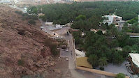
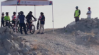
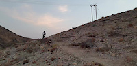
Photos of Muscat Mountain Bike
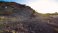
Videos of Muscat Mountain Bike
trail: Panorama Trail
0:56 |
42 |
Jun 3, 2023
0:45 |
6 |
Jun 3, 2023
trail: Rise Above Downhill 2
0:22 |
83 |
Mar 16, 2022
trail: Hidden Views Trail
0:06 |
|
Oct 4, 2020
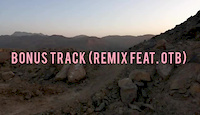
trail: BNA Track 6 - Bonus Track
0:14 |
35 |
Sep 4, 2020
trail: Loud Man
0:00 |
129 |
Aug 8, 2020
trail: Beduminati
0:59 |
105 |
Jun 22, 2020
trail: Hadrosaur Ridge
0:11 |
77 |
Apr 6, 2019
Recent Trail Reports
| status | trail | date | condition | info | user |
|---|---|---|---|---|---|
| Ghalapurna Circuit | Apr 20, 2026 @ 6:32pm (Asia/Muscat) Apr 20, 2026 | Dry | amphalon | ||
| Kenji K's Ascent | Apr 20, 2026 @ 6:32pm (Asia/Muscat) Apr 20, 2026 | Dry | amphalon | ||
| Bousher Farmers' Trail | Apr 20, 2026 @ 6:32pm (Asia/Muscat) Apr 20, 2026 | Dry | amphalon | ||
| Eagle Nest | Mar 19, 2026 @ 6:21am (Asia/Muscat) Mar 18, 2026 | Dry | amphalon | ||
| Jurassic Park | Mar 19, 2026 @ 6:21am (Asia/Muscat) Mar 18, 2026 | Dry | amphalon | ||
| Tomb Raider Entrance | Mar 14, 2026 @ 4:15pm (Asia/Muscat) Mar 14, 2026 | Dry | amphalon | ||
| BNA Track 5 - Outro | Feb 20, 2026 @ 7:15am (Asia/Muscat) Feb 19, 2026 | Dry | amphalon | ||
| Shuknah Pass | Feb 20, 2026 @ 7:15am (Asia/Muscat) Feb 19, 2026 | Very Dry | amphalon | ||
| Level Up | Feb 6, 2026 @ 3:10pm (Asia/Muscat) Feb 6, 2026 | Dry | amphalon | ||
| Up-down-left-right-A-B | Feb 6, 2026 @ 3:10pm (Asia/Muscat) Feb 6, 2026 | Dry | amphalon |
Activity Feed
| username | action | type | title | date |
|---|---|---|---|---|
| amphalon | add | report | activity #93059900 and 2 more | Apr 20, 2026 @ 8:53pm Apr 20, 2026 |
| AbdullahlXn7Js | wishlist | trail | activity #92970707 and 1 more | Apr 19, 2026 @ 12:16pm Apr 19, 2026 |
| AbdullahlXn7Js | wishlist | trail | activity #92970635 and 1 more | Apr 19, 2026 @ 12:16pm Apr 19, 2026 |
| AbdullahlXn7Js | wishlist | trail | activity #92775804 | Apr 17, 2026 @ 2:57am Apr 17, 2026 |
| AbdullahlXn7Js | wishlist | trail | activity #92775555 and 2 more | Apr 17, 2026 @ 2:45am Apr 17, 2026 |
Recent Comments
| username | type | title | comment | date |
|---|---|---|---|---|
| report | It looked like it’d make bridging the gap a... | Mar 19, 2026 @ 2:24am Mar 19, 2026 | ||
| report | Thanks for reporting it. It will be fixed... | Mar 19, 2026 @ 12:05am Mar 19, 2026 | ||
| report | 👍 | Oct 23, 2025 @ 9:39am Oct 23, 2025 | ||
| trail | A comprehensive trail for MTB workout,... | May 9, 2025 @ 11:46pm May 9, 2025 | ||
| report | Sweeping it for my kids! | Apr 29, 2025 @ 10:51pm Apr 29, 2025 |
Local Badges
-

10 Black Trails61 awarded -

Epic Ride 50k1,419 awarded -

Top 10 Trails14 awarded -

Completionist0 awarded -
Completionist0 awarded -
Completionist0 awarded
Bike & Skill Parks
| name | type | city | rating |
|---|---|---|---|
| Trailfoxes Skills Park | skill park | Muscat |
Local Trail Supporters
![]()
- Joe Bunn
![]()
- waleed sayed
Activity Type Stats
| activitytype | trails | distance | descent | descent distance | total vertical | rating | global rank | state rank | photos | reports | routes | ridelogs |
|---|---|---|---|---|---|---|---|---|---|---|---|---|
| Mountain Bike | 158 | 217 miles | 21,624 ft | 88 miles | 2,628 ft | #425 | #1 | 402 | 509 | 48 | 21,365 | |
| E-Bike | 41 | 81 miles | 7,087 ft | 29 miles | 2,628 ft | #797 | #1 | 1 | 378 | 2 | 85 | |
| Horse | 5 | 14 miles | 1,946 ft | 5 miles | 1,634 ft | #405 | #1 | 91 | ||||
| Hike | 149 | 226 miles | 21,598 ft | 88 miles | 2,628 ft | #508 | #1 | 2 | 503 | 9 | 611 | |
| Trail Running | 149 | 226 miles | 21,598 ft | 88 miles | 2,628 ft | #367 | #1 | 503 | 9 | 245 | ||
| Dirtbike/Moto | 7 | 22 miles | 1,955 ft | 6 miles | 1,634 ft | #268 | #1 | 1 | 91 | 9 |
Frequently Asked Questions About Muscat
▼
What are the best places to ride in Muscat?
Muscat has 4 areas to explore for mountain biking. The top rated areas are:
▼
What are the highest rated mountain biking trails in Muscat?
The highest rated mountain biking trails in Muscat are:
- Tomb Raider (4.3/5)
- BNA Track 1 - Introduction (4.3/5)
- Bousher Mount Everest (4.2/5)
- Jurassic Park (4.2/5)
- Hamri-yeah (4.2/5)
▼
What is the best time of the year to ride in Muscat?
Based on ride log data, the most popular months to ride in Muscat are:
- February (232 activities)
- August (188 activities)
- September (161 activities)
▼
Where can I park to ride in Muscat?
There are 8 parking locations listed in Muscat. The most popular parking spots are:
- Tomb Raider/Jurassic Park Parking
- Rise Above Parking
- Al Khoud III Parking
- Tuesday Night Ride Parking 2
- Tuesday Night Ride Parking
Activities
Trails
- By joebunn
 OTB BTBG & contributors
 - Admins: joebunn, whitedp, SaidM, sheezabrat, OTB
- #16126 - 9,770 views
- muscat activity log | embed map of Muscat mountain bike trails | muscat mountain biking points of interest
Downloading of trail gps tracks in kml & gpx formats is enabled for Muscat.
You must login to download files.