close
-
Layers w
- Weather Layers
- Pro
- Pro
- Pro
- Pro
- Pro
- Pro
- More Layers
- Pro
- Pro
- Pro
- Pro
-
Upgrade to

3D
Trail Conditions
- Unknown
- Snow Groomed
- Snow Packed
- Snow Covered
- Snow Cover Partial
- Freeze/thaw Cycle
- Icy
- Prevalent Mud
- Wet
- Variable
- Ideal
- Dry
- Very Dry
Trail Flow (Ridden Direction)
Trailforks scans users ridelogs to determine the most popular direction each trail is ridden. A good flowing trail network will have most trails flowing in a single direction according to their intension.
The colour categories are based on what percentage of riders are riding a trail in its intended direction.
The colour categories are based on what percentage of riders are riding a trail in its intended direction.
- > 96%
- > 90%
- > 80%
- > 70%
- > 50%
- < 50%
- bi-directional trail
- no data
Trail Last Ridden
Trailforks scans ridelogs to determine the last time a trail was ridden.
- < 2 days
- < 1 week
- < 2 weeks
- < 1 month
- < 6 months
- > 6 months
Trail Ridden Direction
The intended direction a trail should be ridden.
- Downhill Only
- Downhill Primary
- Both Directions
- Uphill Primary
- Uphill Only
- One Direction
Contribute Details
Colors indicate trail is missing specified detail.
- Description
- Photos
- Description & Photos
- Videos
Trail Popularity ?
Trailforks scans ridelogs to determine which trails are ridden the most in the last 9 months.
Trails are compared with nearby trails in the same city region with a possible 25 colour shades.
Think of this as a heatmap, more rides = more kinetic energy = warmer colors.
- most popular
- popular
- less popular
- not popular
ATV/ORV/OHV Filter
Max Vehicle Width
inches
US Cell Coverage
Legend

Radar Time
Activity Recordings
Trailforks uses anonymized public activity data.
?
Activity Recordings
Trailforks uses anonymized public activity data.
?
Personal Heatmap
▶
Activity Types
all
/
none
▶
Options
2
Date range
month
–
Winter Trails
Warning
A routing network for winter maps does not exist. Selecting trails using the winter trails layer has been disabled.
Missing Trails
Most Popular
Least Popular
Trails are colored based on popularity. The more popular a trail is, the more red. Less popular trails trend towards green.
Jump Magnitude Heatmap
Heatmap of where riders jump on trails. Zoom in to see individual jumps, click circles to view jump details.
BC Backroad Status
![map legend]()
Service Road Atlas is a free to use, community-driven service for viewing and creating reports on the numerous back-country service roads around B.C. and Alberta.

Slope Aspect
Direction the slope faces
Trails Deemphasized
Trails are shown in grey.
Only show trails with no bike usage.
Suggested Layers
Based on selected activity type
Save the current map location and zoom level as your default home location whenever this page is loaded.
Save
No description for Myślenice has been added yet!
Login or register to submit one.
This region uses the Uk/Euro style trail grading system.
Activities Click to view
- Mountain Bike
63 trails
- E-Bike
47 trails
- Gravel Bike
0 trails
- Adaptive Bike
0 trails
- Winter Fat Bike
0 trails
- Horse
1 trails
- Hike
30 trails
- Trail Running
28 trails
- Observed Trials
0 trails
- Snowshoe
5 trails
- Downhill Ski
0 trails
- Backcountry Ski
5 trails
- Nordic Ski
5 trails
Region Details
- 22
- 3
- 10
- 19
- 7
Region Status
Caution as of May 1, 2026Stats
- Avg Trail Rating
- Trails (view details)
- 61
- Trails Mountain Bike
- 63
- Trails E-Bike
- 47
- Trails Horse
- 1
- Trails Hike
- 30
- Trails Trail Running
- 28
- Trails Snowshoe
- 5
- Trails Backcountry Ski
- 5
- Trails Nordic Ski
- 5
- Total Distance
- 48 miles
- Total Descent
- 20,002 ft
- Total Vertical
- 1,871 ft
- Highest Trailhead
- 2,694 ft
- Reports
- 734
- Photos
- 142
- Ridden Counter
- 8,646
Sub Regions
-
Mikołaj
- 2
- 5
-
Myślenice Singletracks
- 2
- 1
- 2
-
Ukleina
- 2
- 4
- 1
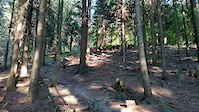
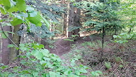
Popular Myślenice Mountain Biking Trails
• 100 ★ 4.6 • 4,206 ft • 13 ft • 284 •
Popular green difficulty singletrack. This mountain bike primary trail can be used downhill only and has a moderate overall physical rating. Trail visibility is always easy to follow. On average it takes 5 minutes to complete this trail.
• 85 ★ 3.8 • 2 miles • 0 ft • 272 • • hike
Zielony szlak turystyczny, dawne trasy zjazdowe DH UWAGA! W weekendy duże ilości ludzi, psów i dzieci na ścieżce.
• 100 ★ 4.0 • 2,238 ft • 0 ft • 247 • • hike
Popular red difficulty family friendly wilderness trail. This hike primary trail can be used both directions and has a moderate overall physical rating with a 0 ft blue climb. It features berm, drop, jump, rock face, rock garden and other. Trail visibility is always easy to follow. On average it takes 15 minutes to complete this trail.
• 100 ★ 4.5 • 1,102 ft • 0 ft • 213 •
Połączenie pomiędzy drogą szutrową. Używana jako skrót do wyjazdu na Uklejne, jednak służy idealnie do szybkiego 30 sek zjazdu. Banan na twarzy gwarantowany :)
• 90 ★ 4.6 • 1,959 ft • 0 ft • 201 •
Singiel łączący szczyt Uklejny z Myszołowem, i . Na singlu znajdziecie kamienie, korzenie - wszystko ubrane w płynną szybką linię.
• 75 ★ 4.3 • 2 miles • 134 ft • 185 •
Popular green difficulty family friendly singletrack. This mountain bike primary trail can be used downhill only and has a moderate overall physical rating. Trail visibility is always easy to follow. On average it takes 7 minutes to complete this trail.
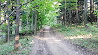
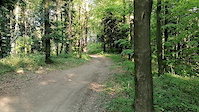
Myślenice Mountain Bike Routes
★ 5.0 • 1 mile • 248 ft • 0 • Loop •
Publiczna trasa rowerowa XC. Zbudowaliśmy na niej wiele hopek, muld, band i stopni.
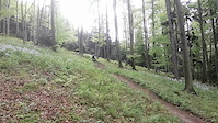
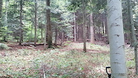
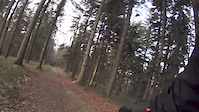
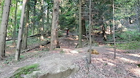
Photos of Myślenice Mountain Bike
Videos of Myślenice Mountain Bike
trail: Boryna
0:07 |
152 |
May 16, 2021
trail: Boryna
0:13 |
153 |
Jul 24, 2020
trail: Nowa Anglia
3:55 |
178 |
Jul 13, 2020
trail: Nowa Anglia
0:13 |
144 |
Jul 13, 2020
trail: Nowa Anglia
0:22 |
79 |
Jul 13, 2020
trail: Nowa Anglia
0:28 |
60 |
Jul 13, 2020
trail: Zielony szlak turystyczny
0:20 |
90 |
Jul 8, 2020
trail: Zielony szlak turystyczny
0:24 |
58 |
Jul 8, 2020
Recent Trail Reports
| status | trail | date | condition | info | user |
|---|---|---|---|---|---|
| LunaLoam | May 1, 2026 @ 3:18pm (Europe/Warsaw) May 1, 2026 | Very Dry | damiantracz | ||
| Django | May 1, 2026 @ 3:16pm (Europe/Warsaw) May 1, 2026 | Very Dry | damiantracz | ||
| OS Stróża | May 1, 2026 @ 3:15pm (Europe/Warsaw) May 1, 2026 | Very Dry | damiantracz | ||
| Kamieniołom | Apr 29, 2026 @ 12:05pm (Europe/Budapest) Apr 29, 2026 | Ideal | marcingabrys | ||
| Ściółkowiec | Feb 22, 2026 @ 10:57am (Europe/Budapest) Feb 22, 2026 | Snow Covered | sciabor | ||
| Boryna | Feb 22, 2026 @ 10:57am (Europe/Budapest) Feb 22, 2026 | Snow Covered | sciabor | ||
| Kamienniki | Dec 30, 2025 @ 9:37pm (Europe/Warsaw) Dec 30, 2025 | Freeze/thaw Cycle | deviz | ||
| KrissKross | Nov 9, 2025 @ 9:05am (Europe/Budapest) Nov 9, 2025 | Variable | marcingabrys | ||
| Giorgio | Nov 9, 2025 @ 9:05am (Europe/Budapest) Nov 9, 2025 | Variable | marcingabrys | ||
| Skrócik | Nov 9, 2025 @ 9:05am (Europe/Budapest) Nov 9, 2025 | Variable | marcingabrys |
Activity Feed
| username | action | type | title | date |
|---|---|---|---|---|
| Barnaba666 | add | trail | activity #97254357 and 2 more | Jun 18, 2026 @ 8:34am Jun 18, 2026 |
| Barnaba666 | add | trail | activity #97254248 | Jun 18, 2026 @ 8:32am Jun 18, 2026 |
| MaLbr | vote | trail | activity #97031372 | Jun 15, 2026 @ 4:03am Jun 15, 2026 |
| MaLbr | vote | trail | activity #97031360 and 3 more | Jun 15, 2026 @ 4:02am Jun 15, 2026 |
| janusz3000 | wishlist | trail | activity #96602069 | Jun 9, 2026 @ 6:40am Jun 9, 2026 |
Recent Comments
| username | type | title | comment | date |
|---|---|---|---|---|
| trail | Trudna. Szczególnie jak mokro to trawers czujny | Jun 7, 2026 @ 2:01pm Jun 7, 2026 | ||
| trail | Swietna trasa | Jun 7, 2026 @ 10:35am Jun 7, 2026 | ||
| trail | Trasa ma jedno bardzo trudne miejsce. Stromy... | Aug 23, 2025 @ 7:50am Aug 23, 2025 | ||
| trail | Cała zasł(r)ana gałęziami z wycinki. | Apr 27, 2025 @ 9:12am Apr 27, 2025 | ||
| trail | Creme de la creme :) | Apr 14, 2025 @ 2:42am Apr 14, 2025 |
Local Badges
-

Epic Mountain Bike Climb 2k65 awarded -

Climbing 10k Badge38 awarded -

Mountain Biking 100k Badge1 awarded -

Completionist0 awarded -

Epic Ride Descent 2k65 awarded -

Descent 10k Badge40 awarded
Bike & Skill Parks
| name | type | city | rating |
|---|---|---|---|
| Biotop Pumptrack | skill park | Myślenice | |
| Skatepark Zarabie | skill park | Myślenice |
Local Trail Supporters
- rafcio, mati i borson
- Mateusz , Wojciech, Rafał...
Activity Type Stats
| activitytype | trails | distance | descent | descent distance | total vertical | rating | global rank | state rank | photos | reports | routes | ridelogs |
|---|---|---|---|---|---|---|---|---|---|---|---|---|
| Mountain Bike | 63 | 48 miles | 20,000 ft | 30 miles | 1,870 ft | #1,277 | #21 | 130 | 733 | 1 | 4,315 | |
| E-Bike | 47 | 31 miles | 14,006 ft | 20 miles | 1,385 ft | #941 | #269 | 9 | 679 | 2,363 | ||
| Horse | 1 | 2,044 ft | 118 ft | #511 | #255 | 11 | ||||||
| Hike | 30 | 29 miles | 7,717 ft | 15 miles | 1,870 ft | #1,862 | #48 | 576 | 677 | |||
| Trail Running | 28 | 28 miles | 6,775 ft | 14 miles | 1,870 ft | #1,578 | #39 | 571 | 156 | |||
| Snowshoe | 5 | 2 miles | 161 ft | 2,116 ft | 200 ft | #193 | #25 | 4 | ||||
| Backcountry Ski | 5 | 2 miles | 161 ft | 2,116 ft | 200 ft | #227 | #29 | 37 | ||||
| Nordic Ski | 5 | 2 miles | 161 ft | 2,116 ft | 200 ft | #257 | #28 | 3 |
Frequently Asked Questions About Myślenice
▼
What are the best places to ride in Myślenice?
Myślenice has 4 areas to explore for mountain biking. The top rated areas are:
▼
What are the highest rated mountain biking trails in Myślenice?
The highest rated mountain biking trails in Myślenice are:
- KrissKross (4.4/5)
- Django (4.4/5)
- PodŚciółka (4.4/5)
- Boryna (4.3/5)
- Kamieniołom (4.3/5)
▼
What is the best time of the year to ride in Myślenice?
Based on ride log data, the most popular months to ride in Myślenice are:
- July (40 activities)
- June (33 activities)
- May (20 activities)
▼
Where can I park to ride in Myślenice?
There are 6 parking locations listed in Myślenice. The most popular parking spots are: View all parking and trailhead locations on the map to plan your visit.
Activities
Trails
- myślenice activity log | embed map of Myślenice mountain bike trails | myślenice mountain biking points of interest
Downloading of trail gps tracks in kml & gpx formats is enabled for Myślenice.
You must login to download files.