close
-
Layers w
- Weather Layers
- Pro
- Pro
- Pro
- Pro
- Pro
- Pro
- More Layers
- Pro
- Pro
- Pro
- Pro
-
Upgrade to

3D
Trail Conditions
- Unknown
- Snow Groomed
- Snow Packed
- Snow Covered
- Snow Cover Partial
- Freeze/thaw Cycle
- Icy
- Prevalent Mud
- Wet
- Variable
- Ideal
- Dry
- Very Dry
Trail Flow (Ridden Direction)
Trailforks scans users ridelogs to determine the most popular direction each trail is ridden. A good flowing trail network will have most trails flowing in a single direction according to their intension.
The colour categories are based on what percentage of riders are riding a trail in its intended direction.
The colour categories are based on what percentage of riders are riding a trail in its intended direction.
- > 96%
- > 90%
- > 80%
- > 70%
- > 50%
- < 50%
- bi-directional trail
- no data
Trail Last Ridden
Trailforks scans ridelogs to determine the last time a trail was ridden.
- < 2 days
- < 1 week
- < 2 weeks
- < 1 month
- < 6 months
- > 6 months
Trail Ridden Direction
The intended direction a trail should be ridden.
- Downhill Only
- Downhill Primary
- Both Directions
- Uphill Primary
- Uphill Only
- One Direction
Contribute Details
Colors indicate trail is missing specified detail.
- Description
- Photos
- Description & Photos
- Videos
Trail Popularity ?
Trailforks scans ridelogs to determine which trails are ridden the most in the last 9 months.
Trails are compared with nearby trails in the same city region with a possible 25 colour shades.
Think of this as a heatmap, more rides = more kinetic energy = warmer colors.
- most popular
- popular
- less popular
- not popular
ATV/ORV/OHV Filter
Max Vehicle Width
inches
US Cell Coverage
Legend

Radar Time
Activity Recordings
Trailforks uses anonymized public activity data.
?
Activity Recordings
Trailforks uses anonymized public activity data.
?
Personal Heatmap
▶
Activity Types
all
/
none
▶
Options
2
Date range
month
–
Winter Trails
Warning
A routing network for winter maps does not exist. Selecting trails using the winter trails layer has been disabled.
Missing Trails
Most Popular
Least Popular
Trails are colored based on popularity. The more popular a trail is, the more red. Less popular trails trend towards green.
Jump Magnitude Heatmap
Heatmap of where riders jump on trails. Zoom in to see individual jumps, click circles to view jump details.
BC Backroad Status
![map legend]()
Service Road Atlas is a free to use, community-driven service for viewing and creating reports on the numerous back-country service roads around B.C. and Alberta.

Slope Aspect
Direction the slope faces
Trails Deemphasized
Trails are shown in grey.
Only show trails with no bike usage.
Suggested Layers
Based on selected activity type
Save the current map location and zoom level as your default home location whenever this page is loaded.
Save
No description for Myrtle Beach has been added yet!
Login or register to submit one.
Links
Region Supporters & Maintainers
Activities Click to view
- Mountain Bike
20 trails
- E-Bike
20 trails
- Hike
17 trails
- Trail Running
17 trails
Region Details
- 7
- 1
- 7
- 4
Region Status
Open as of May 26, 2026Stats
- Avg Trail Rating
- Trails (view details)
- 19
- Trails Mountain Bike
- 20
- Trails E-Bike
- 20
- Trails Hike
- 17
- Trails Trail Running
- 17
- Total Distance
- 15 miles
- Total Descent Distance
- 2 miles
- Total Descent
- 68 ft
- Total Vertical
- 28 ft
- Highest Trailhead
- 38 ft
- Reports
- 277
- Photos
- 78
- Ridden Counter
- 6,940
Sub Regions
-
A-10 @ Barc Park South
- 2
-
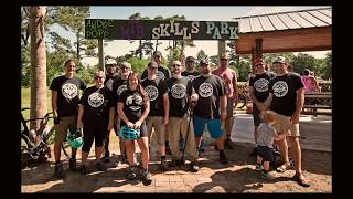
Andre S. Pope MTB Skills Park
- 3
-
Huntington Beach State Park
- 2
-
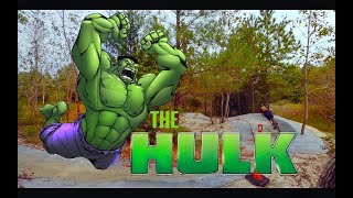
The Hulk - Horry County Bike Run Park
- 2
Popular Myrtle Beach Mountain Biking Trails
• 100 ★ 4.8 • 3 miles • 24 ft • 403 •
Popular blue difficulty family friendly singletrack. This multi-use trail can be used one direction and has a moderate overall physical rating with a 24 ft blue climb. It features berm, bridge, drop, jump, pump track and roller coaster. Trail visibility is always easy to follow. On average it takes 7 minutes to complete this trail.
• 90 ★ 5.0 • 3 miles • 22 ft • 319 •
Popular blue difficulty family friendly singletrack. This multi-use trail can be used one direction. It features berm, bridge, drop, jump, pump track and roller coaster. On average it takes 24 minutes to complete this trail.
• 80 ★ 0.0 • 4 miles • 5 ft • 23 •
Popular green difficulty paved path. This multi-use trail can be used both directions and has a easy overall physical rating with a 5 ft green climb. Trail visibility is always easy to follow. On average it takes 23 minutes to complete this trail.
• 75 ★ 0.0 • 4 miles • 0 ft • 14 • • hike
Popular green difficulty singletrack. This hike primary trail can be used both directions.
• 65 ★ 0.0 • 2 miles • 8 ft • 14 •
Moderately popular green difficulty paved path. This multi-use trail can be used both directions and has a easy overall physical rating with a 8 ft green climb. Trail visibility is always easy to follow. On average it takes 29 minutes to complete this trail.
• 25 ★ 0.0 • 364 ft • 0 ft • 12 •
Less popular green difficulty singletrack. This mountain bike primary trail can be used both directions and has a easy overall physical rating with a 0 ft green climb. Trail visibility is always easy to follow. On average it takes minutes to complete this trail.
• 50 ★ 0.0 • 5,112 ft • 0 ft • 10 • • hike
Moderately popular green difficulty singletrack. This hike primary trail can be used both directions.
• 35 ★ 0.0 • 2,395 ft • 0 ft • 8 •
Less popular green difficulty singletrack. This mountain bike primary trail can be used both directions. On average it takes 3 minutes to complete this trail.
Photos of Myrtle Beach Mountain Bike
Videos of Myrtle Beach Mountain Bike
6:15 |
4184 |
Oct 6, 2020
4:21 |
905 |
Nov 4, 2019

7:55 |
916 |
Jun 20, 2019

13:12 |
882 |
Sep 6, 2018
Recent Trail Reports
| status | trail | date | condition | info | user |
|---|---|---|---|---|---|
| The Hulk Lower | May 26, 2026 @ 11:45am (America/Kentucky/Monticello) May 26, 2026 | Dry | jpivi | ||
| The Hulk Upper | Apr 25, 2026 @ 12:25pm (America/New_York) Apr 25, 2026 | Ideal | Shake-n-bake | ||
| Sandpiper Pond Trail | Mar 19, 2026 @ 12:47pm (America/New_York) Mar 19, 2026 | Ideal | gmclane | ||
| Jetty Loop | Mar 19, 2026 @ 12:47pm (America/New_York) Mar 19, 2026 | Ideal | gmclane | ||
| Gravel Access Road | Feb 26, 2026 @ 1:32pm (America/Kentucky/Monticello) Feb 26, 2026 | Ideal | jpivi | ||
| Skills Loop | Aug 11, 2025 @ 3:21pm Aug 11, 2025 | Variable | bonattomatheus | ||
| A-10 Start | Jul 9, 2024 @ 11:33am Jul 9, 2024 | Unknown | Goomba786 | ||
| A-10 Trail | Jul 9, 2024 @ 7:42am Jul 9, 2024 | Unknown | Goomba786 | ||
| The Hulk Parking | May 9, 2023 @ 4:59am May 9, 2023 | Ideal | splat101 |
Activity Feed
| username | action | type | title | date |
|---|---|---|---|---|
| DJGoIm5d | add | karma | activity #96980359 | Jun 14, 2026 @ 9:53am Jun 14, 2026 |
| JosephgXLSIg | wishlist | region | activity #96293377 | Jun 5, 2026 @ 7:12am Jun 5, 2026 |
| jpivi | add | report | activity #95577220 | May 26, 2026 @ 11:07am May 26, 2026 |
| Shake-n-bake | add | report | activity #93377994 and 1 more | Apr 25, 2026 @ 11:44am Apr 25, 2026 |
| FlatlandDH | add | report | activity #91933508 | Apr 4, 2026 @ 2:38pm Apr 4, 2026 |
Recent Comments
| username | type | title | comment | date |
|---|---|---|---|---|
| trail | Overgrown and too many trees down. Don't attempt. | Jul 20, 2025 @ 4:24pm Jul 20, 2025 | ||
| report | Dry and fast! | Mar 12, 2025 @ 11:35am Mar 12, 2025 | ||
| trail | This trail system is a true mountain biking... | Mar 5, 2023 @ 6:19am Mar 5, 2023 | ||
| trail | Amazing fun little spot. Fast & flowy,... | Jan 2, 2023 @ 11:35am Jan 2, 2023 | ||
| trail | It's fun! The hulk is always improving. It... | Dec 6, 2022 @ 8:06am Dec 6, 2022 |
Local Badges
-

10 Blue Trails214 awarded -

Epic Ride Climb 2k0 awarded -

Climbing 10k Badge4 awarded -

Climbing 100k Badge0 awarded -

Epic Ride Descent 2k0 awarded -

Descent 10k Badge4 awarded
Bike & Skill Parks
| name | type | city | rating |
|---|---|---|---|
| Andre S. Pope MTB Skills Park | skill park | Myrtle Beach |
Activity Type Stats
| activitytype | trails | distance | descent | descent distance | total vertical | rating | global rank | state rank | photos | reports | routes | ridelogs |
|---|---|---|---|---|---|---|---|---|---|---|---|---|
| Mountain Bike | 20 | 15 miles | 69 ft | 2 miles | 30 ft | #4,027 | #1,353 | 76 | 277 | 11,777 | ||
| E-Bike | 20 | 15 miles | 69 ft | 2 miles | 30 ft | #5,284 | #1,639 | 227 | 111 | |||
| Hike | 17 | 7 miles | 16 ft | 1 mile | 16 ft | #9,272 | #3,264 | 259 | 152 | |||
| Trail Running | 17 | 7 miles | 16 ft | 1 mile | 16 ft | #9,445 | #3,208 | 259 | 1 | 89 |
Frequently Asked Questions About Myrtle Beach
▼
What are the best places to ride in Myrtle Beach?
Myrtle Beach has 4 areas to explore for mountain biking. The top rated areas are:
▼
What are the highest rated mountain biking trails in Myrtle Beach?
The highest rated mountain biking trails in Myrtle Beach are:
- The Hulk Lower (4.4/5)
- The Hulk Upper (4.3/5)
- Jetty Loop (0/5)
- Sandpiper Pond Trail (0/5)
- A-10 Trail (0/5)
▼
What is the best time of the year to ride in Myrtle Beach?
Based on ride log data, the most popular months to ride in Myrtle Beach are:
- October (41 activities)
- April (39 activities)
- July (38 activities)
▼
Where can I park to ride in Myrtle Beach?
There are 6 parking locations listed in Myrtle Beach. The most popular parking spots are:
- free parking (as of February 2023)
- Skills Park Parking
- Street side Parking on Center South
- Parking
- Parking
Activities
- By brenthillier
 NSMBA TRAILFORKS & contributors
 - Admins: MBA2 SORBA
- #13557 - 9,452 views
- myrtle beach activity log | embed map of Myrtle Beach mountain bike trails | myrtle beach mountain biking points of interest
Downloading of trail gps tracks in kml & gpx formats is enabled for Myrtle Beach.
You must login to download files.