close
-
Layers w
- Weather Layers
- Pro
- Pro
- Pro
- Pro
- Pro
- Pro
- More Layers
- Pro
- Pro
- Pro
- Pro
-
Upgrade to

3D
Trail Conditions
- Unknown
- Snow Groomed
- Snow Packed
- Snow Covered
- Snow Cover Partial
- Freeze/thaw Cycle
- Icy
- Prevalent Mud
- Wet
- Variable
- Ideal
- Dry
- Very Dry
Trail Flow (Ridden Direction)
Trailforks scans users ridelogs to determine the most popular direction each trail is ridden. A good flowing trail network will have most trails flowing in a single direction according to their intension.
The colour categories are based on what percentage of riders are riding a trail in its intended direction.
The colour categories are based on what percentage of riders are riding a trail in its intended direction.
- > 96%
- > 90%
- > 80%
- > 70%
- > 50%
- < 50%
- bi-directional trail
- no data
Trail Last Ridden
Trailforks scans ridelogs to determine the last time a trail was ridden.
- < 2 days
- < 1 week
- < 2 weeks
- < 1 month
- < 6 months
- > 6 months
Trail Ridden Direction
The intended direction a trail should be ridden.
- Downhill Only
- Downhill Primary
- Both Directions
- Uphill Primary
- Uphill Only
- One Direction
Contribute Details
Colors indicate trail is missing specified detail.
- Description
- Photos
- Description & Photos
- Videos
Trail Popularity ?
Trailforks scans ridelogs to determine which trails are ridden the most in the last 9 months.
Trails are compared with nearby trails in the same city region with a possible 25 colour shades.
Think of this as a heatmap, more rides = more kinetic energy = warmer colors.
- most popular
- popular
- less popular
- not popular
ATV/ORV/OHV Filter
Max Vehicle Width
inches
US Cell Coverage
Legend

Radar Time
Activity Recordings
Trailforks uses anonymized public activity data.
?
Activity Recordings
Trailforks uses anonymized public activity data.
?
Personal Heatmap
▶
Activity Types
all
/
none
▶
Options
2
Date range
month
–
Winter Trails
Warning
A routing network for winter maps does not exist. Selecting trails using the winter trails layer has been disabled.
Missing Trails
Most Popular
Least Popular
Trails are colored based on popularity. The more popular a trail is, the more red. Less popular trails trend towards green.
Jump Magnitude Heatmap
Heatmap of where riders jump on trails. Zoom in to see individual jumps, click circles to view jump details.
BC Backroad Status
![map legend]()
Service Road Atlas is a free to use, community-driven service for viewing and creating reports on the numerous back-country service roads around B.C. and Alberta.

Slope Aspect
Direction the slope faces
Trails Deemphasized
Trails are shown in grey.
Only show trails with no bike usage.
Suggested Layers
Based on selected activity type
Save the current map location and zoom level as your default home location whenever this page is loaded.
SavePopular Trail Networks
view all areas »Region Details
- 378
- 6
- 198
- 255
- 16
- 1
Stats
- Avg Trail Rating
- Trails (view details)
- 918
- Trails Mountain Bike
- 875
- Trails E-Bike
- 822
- Trails Gravel Bike
- 42
- Trails Adaptive Bike
- 49
- Trails Winter Fat Bike
- 160
- Trails Horse
- 37
- Trails Hike
- 911
- Trails Trail Running
- 920
- Trails Dirtbike/Moto
- 37
- Trails Observed Trials
- 33
- Trails ATV/ORV/OHV
- 42
- Total Distance
- 1,439 miles
- Total Descent Distance
- 606 miles
- Total Descent
- 82,853 ft
- Total Vertical
- 6,475 ft
- Highest Trailhead
- 6,479 ft
- Reports
- 1,260
- Photos
- 182
- Ridden Counter
- 7,867
Sub Regions
- Erongo Region (446)
- Grootspitzkop (81)
- Karibib (1)
- Omaruru (152)
- Swakopmund (186)
- Walvis Bay (27)
- Grootspitzkop (81)
- Hardap Region (53)
- Karas Region (122)
- Aus (Karas Region) (93)
- Helmeringhausen (28)
- Seeheim (1)
- Aus (Karas Region) (93)
- Kavango Region (0)
- Khomas Region (286)
- Kunene Region (0)
- Ohangwena Region (0)
- Omaheke Region (2)
- Gobabis (2)
- Gobabis (2)
- Omusati Region (0)
- Oshana Region (0)
- Oshikoto Region (5)
- Tsumeb (5)
- Tsumeb (5)
- Otjozondjupa Region (7)
- Grootfontein (2)
- Kombat (2)
- Otavi (3)
- Grootfontein (2)
- Africa Safari Lodge (1)
- Avis Dam Recreational Area (39)
- Donkerhoek Desert Trails (53)
- Erongo Rocks Mountain Trails (25)
- Farm Landsberg (9)
- Fish River Lodge (1)
- Hoffnung Area (29)
- IJG Trails @ Farm Windhoek (105)
- Klein Aus Vista (79)
- Loskop Farm MTB Trail Network (127)
- Namib Desert Lodge (7)
- Namibgrens Guest Farm (21)
- Nauams Namibia (15)
- Rooirand MTB Trails @ Aubures Camp (18)
- Sossusvlei (13)
- Spitzkoppe (81)
- Swakopmund Town Trail Network (84)
- The Koppie (4)
- Towerbos Trails (19)
- Yellowstone Trails (Windhoek) (19)
Popular Namibia Mountain Biking Trails
• 100 ★ 4.4 • 1,230 ft • 0 ft • 79 •
Popular blue difficulty singletrack. This multi-use trail can be used both directions and has a moderate overall physical rating with a 0 ft blue climb. Trail visibility is always easy to follow. On average it takes 1 minutes to complete this trail.
• 100 ★ 4.7 • 2 miles • 157 ft • 57 •
is a fun and playful trail which is equal punchy climb and flowy downhill, whichever end you start. The elevation change is about 50 meters, with the highest point about midway through the trail.The trail surface is generally solid with...
• 95 ★ 0.0 • 2,690 ft • 75 ft • 47 •
Popular blue difficulty singletrack. This multi-use trail can be used both directions and has a moderate overall physical rating with a 75 ft blue climb. Trail visibility is always easy to follow. On average it takes 2 minutes to complete this trail.
• 100 ★ 0.0 • 5,049 ft • 27 ft • 45 •
Mannie's is a 1.5 km blue singletrack trail located near Windhoek. This multi-use trail can be used both directions and has a moderate overall physical rating. On average it takes 6 minutes to complete this trail from top to bottom....
• 95 ★ 5.0 • 1 mile • 221 ft • 45 •
Popular blue difficulty singletrack. This multi-use trail can be used both directions and has a moderate overall physical rating with a 221 ft blue climb. It features berm. Trail visibility is always easy to follow. On average it takes 9 minutes to complete this trail.
• 100 ★ 0.0 • 2,493 ft • 25 ft • 44 •
is a popular green singletrack trail located near Windhoek. This multi-use trail can be used both directions and has a easy overall physical rating.
• 100 ★ 0.0 • 1,726 ft • 6 ft • 44 •
Short Section of Mixed Trail that links all routes together safely, currently over the pipelines and under the highway to old C28, Golf course and Dash Route
• 95 ★ 3.7 • 2 miles • 60 ft • 43 •
Popular blue difficulty singletrack. This multi-use trail can be used both directions and has a moderate overall physical rating with a 60 ft blue climb. It features jump. Trail visibility is always easy to follow. On average it takes 9 minutes to complete this trail.
Namibia Mountain Bike Routes
4km Easy Wake Up Featured
2 miles • 192 ft • 13 • Loop •
Easy 4km singletrack ROute, starting at Kleine Kuppe Gate.
4 miles • 364 ft • 1 • Loop •
Towerbos: XCO 31 May 25 Featured
3 miles • 261 ft • 1 • Loop •
Nauams Camp Loop Featured
11 miles • 1,115 ft • 6 • Loop •
: Distance: ~17 km Elevation Gain: ~250 m Difficulty: Intermediate Trail Type: Loop / Multi-use
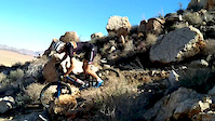
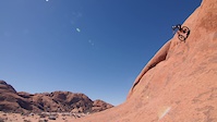
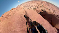
Videos of Namibia Mountain Bike
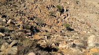
trail: Costas Climb - The Wall
0:16 |
16 |
May 17, 2020
trail: Costas Climb - The Wall
0:04 |
15 |
May 17, 2020

trail: Find The Flow
0:55 |
18 |
May 13, 2020

trail: Serengeti
0:58 |
70 |
Mar 1, 2020
trail: Savannah
7:18 |
7319 |
Jun 17, 2018
trail: Savannah
0:06 |
64 |
Jun 14, 2018
trail: Savannah
0:16 |
104 |
Jun 14, 2018

trail: Pumba
15:54 |
353 |
Aug 5, 2021 , Windhoek
Recent Comments
| username | type | title | comment | date |
|---|---|---|---|---|
| report | February 13,2026 | Feb 13, 2026 @ 1:54am Feb 13, 2026 | ||
| trail | This trail should be marked as "closed". It is... | Oct 10, 2024 @ 3:58am Oct 10, 2024 | ||
| trail | Awesome technical downhill trail! | May 13, 2020 @ 4:28pm May 13, 2020 |
Activity Type Stats
| activitytype | trails | distance | descent | descent distance | total vertical | rating | global rank | state rank | photos | reports | routes | ridelogs |
|---|---|---|---|---|---|---|---|---|---|---|---|---|
| Mountain Bike | 875 | 1,392 miles | 77,405 ft | 589 miles | 6,476 ft | #36 | 156 | 1,251 | 92 | 18,550 | ||
| E-Bike | 822 | 1,299 miles | 72,507 ft | 551 miles | 6,476 ft | #32 | 3 | 1,187 | 68 | 911 | ||
| Gravel Bike | 42 | 23 miles | 2,326 ft | 9 miles | 6,096 ft | #38 | 300 | 11 | 128 | |||
| Adaptive Bike | 49 | 77 miles | 2,769 ft | 31 miles | 6,093 ft | #30 | 102 | |||||
| Winter Fat Bike | 160 | 309 miles | 15,331 ft | 113 miles | 6,394 ft | #22 | 177 | |||||
| Horse | 37 | 120 miles | 2,694 ft | 45 miles | 6,289 ft | #42 | 302 | |||||
| Hike | 911 | 1,374 miles | 79,997 ft | 578 miles | 6,476 ft | #33 | 3 | 1,247 | 42 | 2,288 | ||
| Trail Running | 920 | 1,379 miles | 80,584 ft | 581 miles | 6,476 ft | #30 | 18 | 1,248 | 51 | 1,112 | ||
| Dirtbike/Moto | 37 | 106 miles | 2,605 ft | 40 miles | 5,984 ft | #38 | 301 | 9 | ||||
| Observed Trials | 33 | 87 miles | 1,483 ft | 32 miles | 3,271 ft | #32 | 1 | 105 | ||||
| ATV/ORV/OHV | 42 | 147 miles | 3,425 ft | 77 miles | 5,240 ft | #32 | 301 | 1 |
Activities
- Namibia Mountain Biking Trails
- Namibia E-Biking Trails
- Namibia Gravel Biking Trails
- Namibia Adaptive Biking Trails
- Namibia Winter Fat Biking Trails
- Namibia Horseback Trails
- Namibia Hiking Trails
- Namibia Trail Running Trails
- Namibia Dirtbiking Trails
- Namibia Observed Trials Trails
- Namibia ATVing/Offroading Trails
Trails
- By canadaka
 Trailforks & contributors
 - Admins: WillieJacobsz
- #18112 - 6,471 views
- namibia activity log | embed map of Namibia mountain bike trails | namibia mountain biking points of interest polygons
Downloading of trail gps tracks in kml & gpx formats is enabled for Namibia.
You must login to download files.