close
-
Layers w
- Weather Layers
- Pro
- Pro
- Pro
- Pro
- Pro
- Pro
- More Layers
- Pro
- Pro
- Pro
- Pro
-
Upgrade to

3D
Trail Conditions
- Unknown
- Snow Groomed
- Snow Packed
- Snow Covered
- Snow Cover Partial
- Freeze/thaw Cycle
- Icy
- Prevalent Mud
- Wet
- Variable
- Ideal
- Dry
- Very Dry
Trail Flow (Ridden Direction)
Trailforks scans users ridelogs to determine the most popular direction each trail is ridden. A good flowing trail network will have most trails flowing in a single direction according to their intension.
The colour categories are based on what percentage of riders are riding a trail in its intended direction.
The colour categories are based on what percentage of riders are riding a trail in its intended direction.
- > 96%
- > 90%
- > 80%
- > 70%
- > 50%
- < 50%
- bi-directional trail
- no data
Trail Last Ridden
Trailforks scans ridelogs to determine the last time a trail was ridden.
- < 2 days
- < 1 week
- < 2 weeks
- < 1 month
- < 6 months
- > 6 months
Trail Ridden Direction
The intended direction a trail should be ridden.
- Downhill Only
- Downhill Primary
- Both Directions
- Uphill Primary
- Uphill Only
- One Direction
Contribute Details
Colors indicate trail is missing specified detail.
- Description
- Photos
- Description & Photos
- Videos
Trail Popularity ?
Trailforks scans ridelogs to determine which trails are ridden the most in the last 9 months.
Trails are compared with nearby trails in the same city region with a possible 25 colour shades.
Think of this as a heatmap, more rides = more kinetic energy = warmer colors.
- most popular
- popular
- less popular
- not popular
ATV/ORV/OHV Filter
Max Vehicle Width
inches
US Cell Coverage
Legend

Radar Time
Activity Recordings
Trailforks uses anonymized public activity data.
?
Activity Recordings
Trailforks uses anonymized public activity data.
?
Personal Heatmap
▶
Activity Types
all
/
none
▶
Options
2
Date range
month
–
Winter Trails
Warning
A routing network for winter maps does not exist. Selecting trails using the winter trails layer has been disabled.
Missing Trails
Most Popular
Least Popular
Trails are colored based on popularity. The more popular a trail is, the more red. Less popular trails trend towards green.
Jump Magnitude Heatmap
Heatmap of where riders jump on trails. Zoom in to see individual jumps, click circles to view jump details.
BC Backroad Status
![map legend]()
Service Road Atlas is a free to use, community-driven service for viewing and creating reports on the numerous back-country service roads around B.C. and Alberta.

Slope Aspect
Direction the slope faces
Trails Deemphasized
Trails are shown in grey.
Only show trails with no bike usage.
Suggested Layers
Based on selected activity type
Save the current map location and zoom level as your default home location whenever this page is loaded.
SaveArrondissement administratif de Namur:
Andenne, Assesse, Éghezée, Fernelmont, Floreffe, Fosses-la-Ville,
Gembloux, Gesves, Jemeppe-sur-Sambre, La Bruyère, Mettet, Namur,
Ohey, Profondeville, Sambreville, Sombreffe
Andenne, Assesse, Éghezée, Fernelmont, Floreffe, Fosses-la-Ville,
Gembloux, Gesves, Jemeppe-sur-Sambre, La Bruyère, Mettet, Namur,
Ohey, Profondeville, Sambreville, Sombreffe
This region uses the Uk/Euro style trail grading system.
Activities Click to view
- Mountain Bike
41 trails
- E-Bike
41 trails
- Adaptive Bike
0 trails
- Winter Fat Bike
0 trails
- Horse
10 trails
- Hike
41 trails
- Trail Running
41 trails
Region Details
- 1
- 19
- 13
- 4
- 3
Region Status
Open as of Jul 14, 2025Stats
- Avg Trail Rating
- Trails (view details)
- 40
- Trails Mountain Bike
- 41
- Trails E-Bike
- 41
- Trails Horse
- 10
- Trails Hike
- 41
- Trails Trail Running
- 41
- Trails Dirtbike/Moto
- 2
- Trails Observed Trials
- 2
- Trails ATV/ORV/OHV
- 2
- Total Distance
- 15 miles
- Total Descent
- 7,160 ft
- Total Vertical
- 577 ft
- Highest Trailhead
- 890 ft
- Reports
- 111
- Photos
- 52
- Ridden Counter
- 827
Sub Regions
-
Les 7 Meuses
- 4
- 4
- 1
Popular Namur Mountain Biking Trails
• 95 ★ 3.0 • 2,047 ft • 64 ft • 60 •
Descente rapide mais attention aux pièges (dévers et champs de pierres)
• 15 ★ 4.0 • 1,962 ft • 2 ft • 36 •
Less popular green difficulty singletrack. This mountain bike primary trail can be used downhill primary. On average it takes 1 minutes to complete this trail.
• 15 ★ 4.0 • 4,292 ft • 38 ft • 35 •
La plus technique. Attention : la trace coupe une rue à faible circulation après la chapelle.
• 100 ★ 0.0 • 1,198 ft • 0 ft • 33 •
Tech trail starting with a family friendly section then going steep trough somewhat of a rock garden then a bunch of long stair steps in a narrow path. It gets a bit muddy in wet weather but I'd worry more about the slippery rocks. If...
• 75 ★ 5.0 • 1,591 ft • 81 ft • 32 •
Une série d'épingles abgrémentées de racines, pierres et marches
• 100 ★ 4.0 • 4,755 ft • 144 ft • 31 •
Popular green difficulty singletrack. This mountain bike primary trail can be used downhill primary. On average it takes 5 minutes to complete this trail.
• 80 ★ 2.7 • 1,297 ft • 1 ft • 30 •
Popular blue difficulty singletrack. This mountain bike primary trail can be used downhill primary and has a moderate overall physical rating. On average it takes 3 minutes to complete this trail.
• 50 ★ 3.0 • 3,035 ft • 48 ft • 30 •
La plus rapide. Attention l'arrivée se fait dans une cours d'école. Faites gaffe pendant les heures de cours.
Namur Mountain Bike Routes
48 miles • 3,245 ft • 0 • Loop •
A singletrack trail located near Namur. This mountain bike primary trail can be used both directions.
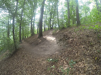
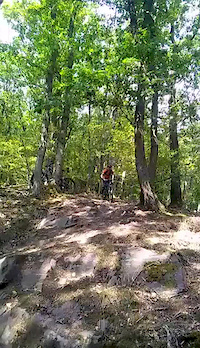
Photos of Namur Mountain Bike
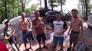
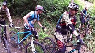
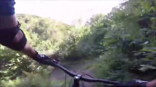
Videos of Namur Mountain Bike
trail: Les épingles de la Sibérie
0:25 |
167 |
Jan 6, 2021
trail: The Devil's ride + épingles
0:08 |
116 |
Aug 16, 2020

13:51 |
519 |
Mar 16, 2021

trail: The Devil's ride + épingles
6:07 |
811 |
Sep 28, 2018 , Namur

trail: DH Pierre
6:07 |
858 |
Sep 28, 2018 , Namur
trail: The Devil's ride + épingles
6:07 |
514 |
Aug 15, 2018 , Namur
10:28 |
416 |
Aug 14, 2018
trail: DH Pierre
4:36 |
795 |
Aug 14, 2018 , Namur
Recent Trail Reports
| status | trail | date | condition | info | user |
|---|---|---|---|---|---|
| DH Profondeville | Jul 14, 2025 @ 8:28am Jul 14, 2025 | Dry | TomDB | ||
| DH bois de Mont | Aug 4, 2024 @ 2:34am Aug 4, 2024 | Prevalent Mud | givada | ||
| Bois de Sart-Eustache | Aug 28, 2023 @ 10:24am Aug 28, 2023 | Ideal | Buzboz | ||
| Vers la ferme noël | Aug 28, 2023 @ 10:23am Aug 28, 2023 | Ideal | Buzboz | ||
| Descente au Vivier | Aug 28, 2023 @ 10:22am Aug 28, 2023 | Ideal | Buzboz | ||
| Descente vers les étangs d'Hanzinne | Jun 13, 2023 @ 1:20pm Jun 13, 2023 | Ideal | Buzboz | ||
| Orée du bois | Jun 13, 2023 @ 1:20pm Jun 13, 2023 | Ideal | Buzboz | ||
| Descente technique Les bans | May 21, 2023 @ 8:15am May 21, 2023 | Dry | Buzboz | ||
| Dh Burnot par la carrière alias "la pschitt" | Jun 17, 2022 @ 1:06am Jun 17, 2022 | Dry | Vincentw54 MBFB | ||
| DH straight through the woods | Feb 24, 2022 @ 4:48am Feb 24, 2022 | Unknown | Buzboz |
Activity Feed
| username | action | type | title | date |
|---|---|---|---|---|
| Fred2822 | ridden | trail | activity #97169272 and 1 more | Jun 17, 2026 @ 1:59am 2 days |
| steevo2184 | ridden | trail | activity #96961181 and 1 more | Jun 14, 2026 @ 6:17am Jun 14, 2026 |
| Fred2822 | comment | trail | activity #92650980 | Apr 15, 2026 @ 4:13am Apr 15, 2026 |
| Fred2822 | ridden | trail | activity #92650897 and 1 more | Apr 15, 2026 @ 4:11am Apr 15, 2026 |
| Fred2822 | ridden | trail | activity #91596901 | Mar 30, 2026 @ 11:07am Mar 30, 2026 |
Recent Comments
| username | type | title | comment | date |
|---|---|---|---|---|
| trail | Épingles assez compliquées , rendues très... | Apr 15, 2026 @ 4:13am Apr 15, 2026 | ||
| trail | Due to loose rocks on the steeper parts, this... | Aug 28, 2023 @ 2:21am Aug 28, 2023 | ||
| trail | Cool trail, but indeed a dangerous rock garden... | Aug 16, 2020 @ 12:26pm Aug 16, 2020 | ||
| trail | Nice, technical trail but some parts are... | Aug 16, 2020 @ 11:53am Aug 16, 2020 | ||
| report | Signalé au DNF | Jun 5, 2019 @ 12:53am Jun 5, 2019 |
Local Badges
-

Epic Mountain Bike Climb 2k109 awarded -

Climbing 10k Badge23 awarded -

Mountain Biking 100k Badge3 awarded -

Epic Ride Descent 2k109 awarded -

Descent 10k Badge23 awarded -

Descent 100k Badge3 awarded
Activity Type Stats
| activitytype | trails | distance | descent | descent distance | total vertical | rating | global rank | state rank | photos | reports | routes | ridelogs |
|---|---|---|---|---|---|---|---|---|---|---|---|---|
| Mountain Bike | 41 | 15 miles | 7,159 ft | 11 miles | 577 ft | #2,358 | #23 | 52 | 111 | 2 | 4,222 | |
| E-Bike | 41 | 15 miles | 7,159 ft | 11 miles | 577 ft | #1,398 | #16 | 110 | 1 | 266 | ||
| Horse | 10 | 3 miles | 925 ft | 3 miles | 249 ft | #599 | #8 | 35 | ||||
| Hike | 41 | 15 miles | 7,159 ft | 11 miles | 577 ft | #2,262 | #26 | 111 | 201 | |||
| Trail Running | 41 | 15 miles | 7,159 ft | 11 miles | 577 ft | #1,768 | #27 | 111 | 85 | |||
| Dirtbike/Moto | 2 | 32 | ||||||||||
| Observed Trials | 2 | |||||||||||
| ATV/ORV/OHV | 2 | 32 |
Frequently Asked Questions About Namur
▼
What are the best places to ride in Namur?
Namur has 1 areas to explore for mountain biking. The top rated areas are:
▼
What are the highest rated mountain biking trails in Namur?
The highest rated mountain biking trails in Namur are:
- The Devil's ride + épingles (4.2/5)
- Les épingles de la Sibérie (4.2/5)
- DH Pierre (4/5)
- Le Forchifond (4/5)
- Dh Burnot par la carrière alias "la pschitt" (4/5)
▼
What is the best time of the year to ride in Namur?
Based on ride log data, the most popular months to ride in Namur are:
- September (48 activities)
- July (39 activities)
- November (36 activities)
▼
Where can I park to ride in Namur?
There are 2 parking locations listed in Namur. The most popular parking spots are:
Activities
Trails
Points of Interest
- By Tantist & contributors
- Admins: apply
- #24576 - 4,705 views
- namur activity log | embed map of Namur mountain bike trails | namur mountain biking points of interest polygons
Downloading of trail gps tracks in kml & gpx formats is enabled for Namur.
You must login to download files.