close
-
Layers w
- Weather Layers
- Pro
- Pro
- Pro
- Pro
- Pro
- Pro
- More Layers
- Pro
- Pro
- Pro
- Pro
-
Upgrade to

3D
Trail Conditions
- Unknown
- Snow Groomed
- Snow Packed
- Snow Covered
- Snow Cover Partial
- Freeze/thaw Cycle
- Icy
- Prevalent Mud
- Wet
- Variable
- Ideal
- Dry
- Very Dry
Trail Flow (Ridden Direction)
Trailforks scans users ridelogs to determine the most popular direction each trail is ridden. A good flowing trail network will have most trails flowing in a single direction according to their intension.
The colour categories are based on what percentage of riders are riding a trail in its intended direction.
The colour categories are based on what percentage of riders are riding a trail in its intended direction.
- > 96%
- > 90%
- > 80%
- > 70%
- > 50%
- < 50%
- bi-directional trail
- no data
Trail Last Ridden
Trailforks scans ridelogs to determine the last time a trail was ridden.
- < 2 days
- < 1 week
- < 2 weeks
- < 1 month
- < 6 months
- > 6 months
Trail Ridden Direction
The intended direction a trail should be ridden.
- Downhill Only
- Downhill Primary
- Both Directions
- Uphill Primary
- Uphill Only
- One Direction
Contribute Details
Colors indicate trail is missing specified detail.
- Description
- Photos
- Description & Photos
- Videos
Trail Popularity ?
Trailforks scans ridelogs to determine which trails are ridden the most in the last 9 months.
Trails are compared with nearby trails in the same city region with a possible 25 colour shades.
Think of this as a heatmap, more rides = more kinetic energy = warmer colors.
- most popular
- popular
- less popular
- not popular
ATV/ORV/OHV Filter
Max Vehicle Width
inches
US Cell Coverage
Legend

Radar Time
Activity Recordings
Trailforks uses anonymized public activity data.
?
Activity Recordings
Trailforks uses anonymized public activity data.
?
Personal Heatmap
▶
Activity Types
all
/
none
▶
Options
2
Date range
month
–
Winter Trails
Warning
A routing network for winter maps does not exist. Selecting trails using the winter trails layer has been disabled.
Missing Trails
Most Popular
Least Popular
Trails are colored based on popularity. The more popular a trail is, the more red. Less popular trails trend towards green.
Jump Magnitude Heatmap
Heatmap of where riders jump on trails. Zoom in to see individual jumps, click circles to view jump details.
BC Backroad Status
![map legend]()
Service Road Atlas is a free to use, community-driven service for viewing and creating reports on the numerous back-country service roads around B.C. and Alberta.

Slope Aspect
Direction the slope faces
Trails Deemphasized
Trails are shown in grey.
Only show trails with no bike usage.
Suggested Layers
Based on selected activity type
Save the current map location and zoom level as your default home location whenever this page is loaded.
Save
No description for Napa has been added yet!
Login or register to submit one.
Activities Click to view
- Mountain Bike
39 trails
- E-Bike
35 trails
- Gravel Bike
0 trails
- Adaptive Bike
0 trails
- Winter Fat Bike
0 trails
- Horse
17 trails
- Hike
45 trails
- Trail Running
45 trails
Region Details
- 5
- 2
- 7
- 13
- 6
- 1
Region Status
Caution as of May 25, 2026Stats
- Avg Trail Rating
- Trails (view details)
- 39
- Trails Mountain Bike
- 39
- Trails E-Bike
- 35
- Trails Horse
- 17
- Trails Hike
- 45
- Trails Trail Running
- 45
- Total Distance
- 41 miles
- Total Descent
- 7,263 ft
- Total Vertical
- 2,241 ft
- Highest Trailhead
- 2,249 ft
- Reports
- 502
- Photos
- 169
- Ridden Counter
- 14,449
Sub Regions
-
Lake Berryessa
- 1
- 1
- 2
-
Skyline Wilderness Park
- 1
- 3
- 7
- 6
- 1
-
Suscol Headwaters Park
- 1
- 4
Popular Napa Mountain Biking Trails
• 70 ★ 4.3 • 2 miles • 457 ft • 1,194 •
Highly rated popular black diamond difficulty singletrack. This multi-use trail can be used downhill primary. On average it takes 18 minutes to complete this trail.
• 85 ★ 4.2 • 2 miles • 800 ft • 891 •
Highly rated popular blue difficulty singletrack. This multi-use trail can be used both directions and has a hard overall physical rating with a 800 ft blue climb. On average it takes 18 minutes to complete this trail.
• 100 ★ 4.0 • 2 miles • 280 ft • 885 •
A great trail to up your technical riding abilities! If you like going fast, it's possible to hit 25mph+ on the trail. You can go slow too. I highly recommend this trail. There are two ways to get into the trail. One way is to go...
• 100 ★ 3.7 • 2 miles • 236 ft • 822 •
Popular green difficulty singletrack. This multi-use trail can be used both directions and has a easy overall physical rating with a 236 ft green climb. Trail visibility is always easy to follow. On average it takes 12 minutes to complete this trail.
• 70 ★ 4.1 • 1 mile • 133 ft • 778 •
Highly rated popular black diamond difficulty singletrack. This multi-use trail can be used downhill primary. It features drop and rock garden. On average it takes 11 minutes to complete this trail.
• 95 ★ 3.8 • 2 miles • 259 ft • 662 •
Popular green difficulty singletrack. This multi-use trail can be used both directions and has a moderate overall physical rating with a 259 ft blue climb. Trail visibility is always easy to follow. On average it takes 11 minutes to complete this trail.
• 50 ★ 0.0 • 433 ft • 26 ft • 495 •
Moderately popular green difficulty doubletrack. This multi-use trail can be used both directions and has a easy overall physical rating with a 26 ft green climb. On average it takes minutes to complete this trail.
• 55 ★ 4.2 • 2,612 ft • 100 ft • 491 •
Highly rated moderately popular blue difficulty singletrack. This multi-use trail can be used both directions. On average it takes 6 minutes to complete this trail.
Napa Mountain Bike Routes
★ 2.0 • 8 miles • 1,468 ft • 3 •
Full loop from the main parking lot to Suscol Ridge and back.
26 miles • 5,020 ft • 17 • Loop •
Thought I'd update a full route at to include the fantastic new downhill trail, .
28 miles • 5,136 ft • 14 • Out & Back •
Hit everything at that's worth hitting, because is awful and you definitely DON'T want to ride that. This...
26 miles • 5,276 ft • 18 • Loop •
Hit everything at ! Be ready to work for it, or bring an e-bike! Note that is quite awful, this route is...
11 miles • 2,349 ft • 15 • Loop •
This is a solid loop that feels like you're climbing and climbing and climbing. Good workout! Start your...
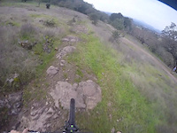
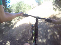
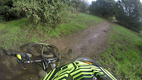
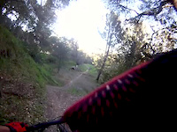
Photos of Napa Mountain Bike
Videos of Napa Mountain Bike
trail: Lake Marie Road
0:33 |
214 |
Nov 11, 2016
trail: Alston Park
0:49 |
163 |
Oct 6, 2016
trail: Alston Park
0:30 |
170 |
Jun 30, 2016

trail: Skyline Trail
3:23 |
168 |
Jul 27, 2015
trail: Skyline Trail
0:47 |
473 |
Mar 3, 2013

trail: Buckeye Trail
7:40 |
80 |
Dec 19, 2025 , Napa

trail: Manzanita Trail
3:27 |
125 |
Oct 12, 2025 , Napa

trail: Suscol Ridge Trail
8:29 |
53 |
Oct 1, 2025 , Napa
Current Trail Warnings
| status | trail | date | condition | user | info |
|---|---|---|---|---|---|
| Zane | May 25, 2026 @ 8:41pm (America/Los_Angeles) May 25, 2026 | Ideal | Aclwitt | Major tree down right below the steep... |
Recent Trail Reports
| status | trail | date | condition | info | user |
|---|---|---|---|---|---|
| Lower Skyline Trail | May 24, 2026 @ 11:31am (America/Los_Angeles) May 24, 2026 | Ideal | thatcubingguy | ||
| Buckeye Trail | May 11, 2026 @ 4:20pm (America/Los_Angeles) May 11, 2026 | Ideal | stance-1-29 | ||
| Lookout Trail | May 11, 2026 @ 4:20pm (America/Los_Angeles) May 11, 2026 | Dry | stance-1-29 | ||
| Suscol Ridge Trail | May 11, 2026 @ 4:20pm (America/Los_Angeles) May 11, 2026 | Ideal | stance-1-29 | ||
| Perdida Trail | May 11, 2026 @ 4:20pm (America/Los_Angeles) May 11, 2026 | Ideal | stance-1-29 | ||
| Big Bend | May 11, 2026 @ 4:20pm (America/Los_Angeles) May 11, 2026 | Ideal | stance-1-29 | ||
| Buckaroo | May 11, 2026 @ 4:20pm (America/Los_Angeles) May 11, 2026 | Ideal | stance-1-29 | ||
| Napa Solano Ridge Trail Loop | May 11, 2026 @ 4:20pm (America/Los_Angeles) May 11, 2026 | Ideal | stance-1-29 | ||
| River to Ridge Trail | Apr 26, 2026 @ 5:13pm (America/Los_Angeles) Apr 26, 2026 | Ideal | Xvrmorales | ||
| Manzanita Trail | Apr 25, 2026 @ 12:02pm (America/Los_Angeles) Apr 25, 2026 | Variable | aarondailey |
Activity Feed
| username | action | type | title | date |
|---|---|---|---|---|
| mustangchris66 | wishlist | region | activity #97051648 | Jun 15, 2026 @ 10:36am 3 days |
| justridingalong1 | comment | trail | activity #96187335 | Jun 3, 2026 @ 4:14pm Jun 3, 2026 |
| justridingalong1 | vote | trail | activity #96187276 | Jun 3, 2026 @ 4:13pm Jun 3, 2026 |
| javisant | wishlist | route | activity #95856350 | May 30, 2026 @ 8:42am May 30, 2026 |
| ffmill | wishlist | region | activity #95567010 | May 26, 2026 @ 8:38am May 26, 2026 |
Recent Comments
| username | type | title | comment | date |
|---|---|---|---|---|
| trail | Great trail, agree with solid single black... | Jun 3, 2026 @ 4:14pm Jun 3, 2026 | ||
| trail | Super fun trail, really chunky but gets flowy... | Apr 18, 2026 @ 6:40pm Apr 18, 2026 | ||
| trail | Pretty awesome! | Mar 21, 2026 @ 9:51pm Mar 21, 2026 | ||
| trail | Must be ridden as an out and back, starting... | Feb 1, 2026 @ 8:49pm Feb 1, 2026 | ||
| trail | It’s been about a week since we got a lot of... | Dec 30, 2025 @ 5:02pm Dec 30, 2025 |
Local Badges
-

Epic Ride Climb 2k87 awarded -

Climbing 10k Badge108 awarded -

Climbing 100k Badge9 awarded -

Epic Ride Descent 2k88 awarded -

Descent 10k Badge107 awarded -

Descent 100k Badge9 awarded
Bike & Skill Parks
| name | type | city | rating |
|---|---|---|---|
| Skyline Park Pump Track | skill park | Napa |
Activity Type Stats
| activitytype | trails | distance | descent | descent distance | total vertical | rating | global rank | state rank | photos | reports | routes | ridelogs |
|---|---|---|---|---|---|---|---|---|---|---|---|---|
| Mountain Bike | 39 | 34 miles | 5,102 ft | 13 miles | 1,627 ft | #2,123 | #759 | 162 | 502 | 10 | 18,937 | |
| E-Bike | 35 | 25 miles | 4,823 ft | 9 miles | 1,627 ft | #3,130 | #1,134 | 4 | 444 | 3 | 2,066 | |
| Horse | 17 | 5 miles | 1,283 ft | 2 miles | 1,322 ft | #2,495 | #1,372 | 109 | 1 | |||
| Hike | 45 | 41 miles | 7,264 ft | 16 miles | 2,241 ft | #4,747 | #1,670 | 4 | 501 | 937 | ||
| Trail Running | 45 | 41 miles | 7,264 ft | 16 miles | 2,241 ft | #896 | #338 | 501 | 569 |
Frequently Asked Questions About Napa
▼
What are the best places to ride in Napa?
Napa has 5 areas to explore for mountain biking. The top rated areas are:
▼
What are the highest rated mountain biking trails in Napa?
The highest rated mountain biking trails in Napa are:
- Zane (4.3/5)
- Manzanita Trail (4.2/5)
- Skyline Trail (4.2/5)
- Manzanita Trail (4.2/5)
- Lower Skyline Trail (4.1/5)
▼
What is the best time of the year to ride in Napa?
Based on ride log data, the most popular months to ride in Napa are:
- July (99 activities)
- February (89 activities)
- May (86 activities)
▼
Where can I park to ride in Napa?
There are 10 parking locations listed in Napa. The most popular parking spots are: View all parking and trailhead locations on the map to plan your visit.
Activities
Trails
Points of Interest
- By TheBikeNerd
 NWTA & contributors
 - Admins: REMBA
- #5771 - 13,989 views
- napa activity log | embed map of Napa mountain bike trails | napa mountain biking points of interest
Downloading of trail gps tracks in kml & gpx formats is enabled for Napa.
You must login to download files.