close
-
Layers w
- Weather Layers
- Pro
- Pro
- Pro
- Pro
- Pro
- Pro
- More Layers
- Pro
- Pro
- Pro
- Pro
-
Upgrade to

3D
Trail Conditions
- Unknown
- Snow Groomed
- Snow Packed
- Snow Covered
- Snow Cover Partial
- Freeze/thaw Cycle
- Icy
- Prevalent Mud
- Wet
- Variable
- Ideal
- Dry
- Very Dry
Trail Flow (Ridden Direction)
Trailforks scans users ridelogs to determine the most popular direction each trail is ridden. A good flowing trail network will have most trails flowing in a single direction according to their intension.
The colour categories are based on what percentage of riders are riding a trail in its intended direction.
The colour categories are based on what percentage of riders are riding a trail in its intended direction.
- > 96%
- > 90%
- > 80%
- > 70%
- > 50%
- < 50%
- bi-directional trail
- no data
Trail Last Ridden
Trailforks scans ridelogs to determine the last time a trail was ridden.
- < 2 days
- < 1 week
- < 2 weeks
- < 1 month
- < 6 months
- > 6 months
Trail Ridden Direction
The intended direction a trail should be ridden.
- Downhill Only
- Downhill Primary
- Both Directions
- Uphill Primary
- Uphill Only
- One Direction
Contribute Details
Colors indicate trail is missing specified detail.
- Description
- Photos
- Description & Photos
- Videos
Trail Popularity ?
Trailforks scans ridelogs to determine which trails are ridden the most in the last 9 months.
Trails are compared with nearby trails in the same city region with a possible 25 colour shades.
Think of this as a heatmap, more rides = more kinetic energy = warmer colors.
- most popular
- popular
- less popular
- not popular
ATV/ORV/OHV Filter
Max Vehicle Width
inches
US Cell Coverage
Legend

Radar Time
Activity Recordings
Trailforks uses anonymized public activity data.
?
Activity Recordings
Trailforks uses anonymized public activity data.
?
Personal Heatmap
▶
Activity Types
all
/
none
▶
Options
2
Date range
month
–
Winter Trails
Warning
A routing network for winter maps does not exist. Selecting trails using the winter trails layer has been disabled.
Missing Trails
Most Popular
Least Popular
Trails are colored based on popularity. The more popular a trail is, the more red. Less popular trails trend towards green.
Jump Magnitude Heatmap
Heatmap of where riders jump on trails. Zoom in to see individual jumps, click circles to view jump details.
BC Backroad Status
![map legend]()
Service Road Atlas is a free to use, community-driven service for viewing and creating reports on the numerous back-country service roads around B.C. and Alberta.

Slope Aspect
Direction the slope faces
Trails Deemphasized
Trails are shown in grey.
Only show trails with no bike usage.
Suggested Layers
Based on selected activity type
Save the current map location and zoom level as your default home location whenever this page is loaded.
Save
No description for Napa County has been added yet!
Login or register to submit one.
Activities Click to view
- Mountain Bike
247 trails
- E-Bike
160 trails
- Horse
62 trails
- Hike
256 trails
- Trail Running
261 trails
Stats
- Avg Trail Rating
- Trails (view details)
- 251
- Trails Mountain Bike
- 249
- Trails E-Bike
- 160
- Trails Horse
- 62
- Trails Hike
- 258
- Trails Trail Running
- 261
- Total Distance
- 207 miles
- Total Descent
- 38,510 ft
- Total Vertical
- 4,311 ft
- Highest Trailhead
- 4,314 ft
- Reports
- 3,266
- Photos
- 493
- Ridden Counter
- 40,381
Sub Regions
- American Canyon (6)
- Angwin (137)
- Calistoga (17)
- Napa (39)
- Saint Helena (48)
Popular Napa County Mountain Biking Trails
• 70 ★ 4.3 • 2 miles • 457 ft • 1,194 •
Highly rated popular black diamond difficulty singletrack. This multi-use trail can be used downhill primary. On average it takes 18 minutes to complete this trail.
• 85 ★ 4.2 • 2 miles • 800 ft • 891 •
Highly rated popular blue difficulty singletrack. This multi-use trail can be used both directions and has a hard overall physical rating with a 800 ft blue climb. On average it takes 18 minutes to complete this trail.
• 100 ★ 4.0 • 2 miles • 280 ft • 885 •
A great trail to up your technical riding abilities! If you like going fast, it's possible to hit 25mph+ on the trail. You can go slow too. I highly recommend this trail. There are two ways to get into the trail. One way is to go...
• 100 ★ 3.7 • 2 miles • 236 ft • 822 •
Popular green difficulty singletrack. This multi-use trail can be used both directions and has a easy overall physical rating with a 236 ft green climb. Trail visibility is always easy to follow. On average it takes 12 minutes to complete this trail.
• 70 ★ 4.1 • 1 mile • 133 ft • 778 •
Highly rated popular black diamond difficulty singletrack. This multi-use trail can be used downhill primary. It features drop and rock garden. On average it takes 11 minutes to complete this trail.
• 95 ★ 3.8 • 2 miles • 259 ft • 662 •
Popular green difficulty singletrack. This multi-use trail can be used both directions and has a moderate overall physical rating with a 259 ft blue climb. Trail visibility is always easy to follow. On average it takes 11 minutes to complete this trail.
• 100 ★ 4.5 • 2,726 ft • 58 ft • 645 •
Nice flowy little singletrack. Note: shared with horses. Bikers should slow and offer to dismount around horses.
• 100 ★ 4.5 • 1 mile • 11 ft • 640 •
Fast and flowy descent. Avoid climbing during busy weekend hours as there are blind corners. Easiest way up is to ride the Alta fire road, or come down from Conn Peak.
Napa County Mountain Bike Routes
Singletrack Sampler Featured
8 miles • 785 ft • 16 • Loop •
A selection of winding single track trails on the "Front Side" of the forest (keeping you off the more...
★ 4.3 • 8 miles • 1,206 ft • 4 •
Fire road climb to to Sam the Eagle. Climb Conn Peak and back down to the parking lot.
★ 4.0 • 9 miles • 1,358 ft • 5 •
Moore Creek Lower Loop counter clockw
★ 4.0 • 12 miles • 1,635 ft • 17 • Loop •
One of My PUC Rides, a bit truncated due to Forest Work on Busy Body and Meadow Trail.
★ 4.5 • 26 miles • 5,268 ft • 6 • Out & Back •
A great place to practice some basic, all the way to advanced MTB skills, before races, or just to stay in...
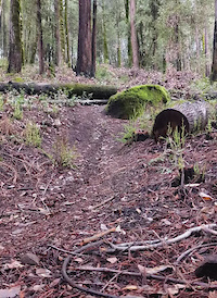
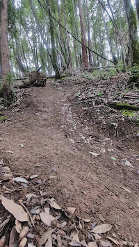
Photos of Napa County Mountain Bike
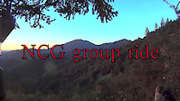
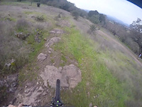
Videos of Napa County Mountain Bike
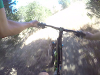
trail: Blue Post
0:04 |
|
Feb 7, 2024
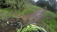
trail: The Dragon
0:09 |
|
Feb 7, 2024
trail: Oat Hill Mine
7:01 |
95 |
Sep 9, 2017
trail: Lake Marie Road
0:33 |
214 |
Nov 11, 2016
trail: Alston Park
0:49 |
163 |
Oct 6, 2016
trail: Alston Park
0:30 |
170 |
Jun 30, 2016
trail: Oat Hill Mine
0:47 |
67 |
Apr 23, 2016
trail: Oat Hill Mine
0:49 |
90 |
Apr 22, 2016
Current Trail Warnings
| status | trail | date | condition | user | info |
|---|---|---|---|---|---|
| Zane Suscol Headwaters Park | May 25, 2026 @ 8:41pm (America/Los_Angeles) May 25, 2026 | Ideal | Aclwitt | Major tree down right below the steep... | |
| Blue Post Pacific Union College Forest | May 25, 2026 @ 7:10am (America/Los_Angeles) May 25, 2026 | Unknown | nickb27 | Several down trees up to 12” in diameter |
Recent Trail Reports
Activity Feed
| username | action | type | title | date |
|---|---|---|---|---|
| mustangchris66 | wishlist | region | activity #97051648 | Jun 15, 2026 @ 10:36am Jun 15, 2026 |
| DavidkI0RcF | wishlist | region | activity #96296118 | Jun 5, 2026 @ 7:56am Jun 5, 2026 |
| justridingalong1 | comment | trail | activity #96187335 | Jun 3, 2026 @ 4:14pm Jun 3, 2026 |
| justridingalong1 | vote | trail | activity #96187276 | Jun 3, 2026 @ 4:13pm Jun 3, 2026 |
| west_jelm | wishlist | trail | activity #96050764 | Jun 1, 2026 @ 5:10pm Jun 1, 2026 |
Recent Comments
| username | type | title | comment | date |
|---|---|---|---|---|
| trail | Great trail, agree with solid single black... | Jun 3, 2026 @ 4:14pm Jun 3, 2026 | ||
| trail | AKA: “Trainer” | May 5, 2026 @ 3:23pm May 5, 2026 | ||
| trail | Super fun trail, really chunky but gets flowy... | Apr 18, 2026 @ 6:40pm Apr 18, 2026 | ||
| trail | Pretty awesome! | Mar 21, 2026 @ 9:51pm Mar 21, 2026 | ||
| trail | It's a short list of us who long for the uber... | Mar 17, 2026 @ 11:32am Mar 17, 2026 |
Local Badges
-

Diamond Collector4 awarded -

Big Ride 30k874 awarded -

Descent 10k Badge45 awarded -

Epic Ride 50k305 awarded -

Epic Mountain Bike Climb 2k24 awarded -

Climbing 10k Badge14 awarded
Bike & Skill Parks
| name | type | city | rating |
|---|---|---|---|
| Skyline Park Pump Track | skill park | Napa |
Activity Type Stats
| activitytype | trails | distance | descent | descent distance | total vertical | rating | global rank | state rank | photos | reports | routes | ridelogs |
|---|---|---|---|---|---|---|---|---|---|---|---|---|
| Mountain Bike | 247 | 169 miles | 29,337 ft | 76 miles | 4,311 ft | 487 | 3,274 | 20 | 38,211 | |||
| E-Bike | 160 | 75 miles | 13,793 ft | 34 miles | 1,972 ft | 15 | 2,939 | 5 | 4,179 | |||
| Horse | 62 | 35 miles | 4,101 ft | 15 miles | 1,801 ft | 529 | 1 | 2 | ||||
| Hike | 256 | 205 miles | 37,175 ft | 89 miles | 4,311 ft | 10 | 3,244 | 3 | 2,486 | |||
| Trail Running | 261 | 203 miles | 36,086 ft | 88 miles | 4,311 ft | 3,247 | 3 | 1,955 |
Frequently Asked Questions About Napa County
▼
What are the best places to ride in Napa County?
Napa County has 12 areas to explore for mountain biking. The top rated areas are:
▼
What are the highest rated mountain biking trails in Napa County?
The highest rated mountain biking trails in Napa County are:
- Teepee (4.4/5)
- Valentine Vista (4.4/5)
- Fall-Line (4.3/5)
- Zane (4.3/5)
- Serpent (4.3/5)
▼
What is the best time of the year to ride in Napa County?
Based on ride log data, the most popular months to ride in Napa County are:
- July (256 activities)
- February (234 activities)
- May (226 activities)
▼
What is the longest trail in Napa County?
The longest trail in Napa County is Vine Trail (St. Helena to Calistoga) at 6.6 miles. View all trails sorted by distance.
Activities
Trails
- By brenthillier
 NSMBA TRAILFORKS & contributors
 - Admins: jpmcghee, sanfret, brianpetry, REMBA
- #7897 - 8,332 views
- napa county activity log | embed map of Napa County mountain bike trails | napa county mountain biking points of interest polygons
Downloading of trail gps tracks in kml & gpx formats is enabled for Napa County.
You must login to download files.