close
-
Layers w
- Weather Layers
- Pro
- Pro
- Pro
- Pro
- Pro
- Pro
- More Layers
- Pro
- Pro
- Pro
- Pro
-
Upgrade to

3D
Trail Conditions
- Unknown
- Snow Groomed
- Snow Packed
- Snow Covered
- Snow Cover Partial
- Freeze/thaw Cycle
- Icy
- Prevalent Mud
- Wet
- Variable
- Ideal
- Dry
- Very Dry
Trail Flow (Ridden Direction)
Trailforks scans users ridelogs to determine the most popular direction each trail is ridden. A good flowing trail network will have most trails flowing in a single direction according to their intension.
The colour categories are based on what percentage of riders are riding a trail in its intended direction.
The colour categories are based on what percentage of riders are riding a trail in its intended direction.
- > 96%
- > 90%
- > 80%
- > 70%
- > 50%
- < 50%
- bi-directional trail
- no data
Trail Last Ridden
Trailforks scans ridelogs to determine the last time a trail was ridden.
- < 2 days
- < 1 week
- < 2 weeks
- < 1 month
- < 6 months
- > 6 months
Trail Ridden Direction
The intended direction a trail should be ridden.
- Downhill Only
- Downhill Primary
- Both Directions
- Uphill Primary
- Uphill Only
- One Direction
Contribute Details
Colors indicate trail is missing specified detail.
- Description
- Photos
- Description & Photos
- Videos
Trail Popularity ?
Trailforks scans ridelogs to determine which trails are ridden the most in the last 9 months.
Trails are compared with nearby trails in the same city region with a possible 25 colour shades.
Think of this as a heatmap, more rides = more kinetic energy = warmer colors.
- most popular
- popular
- less popular
- not popular
ATV/ORV/OHV Filter
Max Vehicle Width
inches
US Cell Coverage
Legend

Radar Time
Activity Recordings
Trailforks uses anonymized public activity data.
?
Activity Recordings
Trailforks uses anonymized public activity data.
?
Personal Heatmap
▶
Activity Types
all
/
none
▶
Options
2
Date range
month
–
Winter Trails
Warning
A routing network for winter maps does not exist. Selecting trails using the winter trails layer has been disabled.
Missing Trails
Most Popular
Least Popular
Trails are colored based on popularity. The more popular a trail is, the more red. Less popular trails trend towards green.
Jump Magnitude Heatmap
Heatmap of where riders jump on trails. Zoom in to see individual jumps, click circles to view jump details.
BC Backroad Status
![map legend]()
Service Road Atlas is a free to use, community-driven service for viewing and creating reports on the numerous back-country service roads around B.C. and Alberta.

Slope Aspect
Direction the slope faces
Trails Deemphasized
Trails are shown in grey.
Only show trails with no bike usage.
Suggested Layers
Based on selected activity type
Save the current map location and zoom level as your default home location whenever this page is loaded.
Save
No description for Nashua has been added yet!
Login or register to submit one.
Activities Click to view
- Mountain Bike
54 trails
- Adaptive Bike
0 trails
- Winter Fat Bike
0 trails
- Hike
54 trails
- Trail Running
54 trails
- Snowshoe
22 trails
- Nordic Ski
21 trails
Region Details
- 4
- 34
- 14
- 2
Region Status
Caution as of Apr 12, 2026Stats
- Avg Trail Rating
- Trails (view details)
- 54
- Trails Mountain Bike
- 54
- Trails Hike
- 54
- Trails Trail Running
- 54
- Trails Snowshoe
- 22
- Trails Nordic Ski
- 21
- Total Distance
- 28 miles
- Total Descent
- 2,113 ft
- Total Vertical
- 180 ft
- Highest Trailhead
- 300 ft
- Reports
- 1,207
- Photos
- 115
- Ridden Counter
- 40,653
Sub Regions
-
Mine Falls
- 9
-
Yudicky Farm
- 25
- 13
- 2
Popular Nashua Mountain Biking Trails
• 90 ★ 4.7 • 4,612 ft • 160 ft • 1,961 •
fun trail with a moderate climb bench cut into the hill, some small jumps and gaps, and some killer flowy berms winding back and forth. Must hit this trail if you head out to Yudicky.
• 85 ★ 4.3 • 2 miles • 79 ft • 1,901 •
old school singletrack, narrow squeeze areas, a couple of moderate rock rollers, small drop
• 100 ★ 4.3 • 1,621 ft • 8 ft • 1,892 •
Highly rated popular green difficulty singletrack. This mountain bike primary trail. It features berm. Trail visibility is always easy to follow. On average it takes 1 minutes to complete this trail.
• 90 ★ 4.3 • 1,557 ft • 11 ft • 1,857 •
Highly rated popular blue difficulty singletrack. This mountain bike primary trail. On average it takes 2 minutes to complete this trail.
• 85 ★ 4.3 • 1,886 ft • 8 ft • 1,857 •
Big techy at the start but quickly fades into tight flowy loops in a young pine forest. When you enter the "wormhole" you will know.
• 85 ★ 3.8 • 4,927 ft • 82 ft • 1,822 •
Popular blue difficulty mixed. This multi-use trail. On average it takes 10 minutes to complete this trail.
• 100 ★ 5.0 • 452 ft • 28 ft • 1,725 •
Popular green difficulty mixed. This multi-use trail can be used both directions. On average it takes 1 minutes to complete this trail.
Nashua Mountain Bike Routes
★ 5.0 • 7 miles • 359 ft • 11 • Loop •
Warm up on to cruise through all of Barbwire. Enjoy some flow at the end with and Creepy Teepee
★ 5.0 • 11 miles • 764 ft • 20 •
Created this 11 miles route to ride late afternoon in a fall day. It hits all good stuffs and may be done...
★ 3.5 • 10 miles • 620 ft • 18 •
Fun ride with some Black Diamonds thrown in for good measure!!
• 13 miles • 871 ft • 27 •
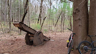
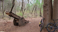
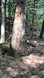
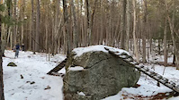
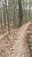
Photos of Nashua Mountain Bike
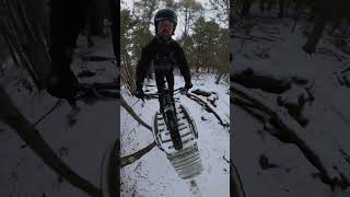
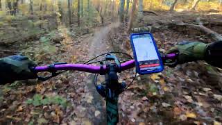
Videos of Nashua Mountain Bike
trail: Development Trail
0:09 |
140 |
Apr 22, 2023
trail: Development Trail
0:11 |
90 |
Apr 22, 2023
trail: Creepy Teepee
0:08 |
335 |
Apr 16, 2021
trail: Spaghetti Bowl
0:07 |
779 |
Mar 17, 2021
trail: Creepy Teepee
0:14 |
140 |
Jan 24, 2021
0:31 |
84 |
Aug 25, 2025

trail: Barbwire
6:13 |
177 |
Nov 29, 2024 , Nashua
trail: Creepy Teepee
9:44 |
187 |
Oct 22, 2024 , Nashua
Recent Trail Reports
| status | trail | date | condition | info | user |
|---|---|---|---|---|---|
| Barbwire | Apr 12, 2026 @ 6:19am (America/New_York) Apr 12, 2026 | Ideal | KamiFJKzxA | ||
| Yudicky Farm Trail | Apr 12, 2026 @ 6:19am (America/New_York) Apr 12, 2026 | Ideal | KamiFJKzxA | ||
| Wormhole | Apr 12, 2026 @ 6:19am (America/New_York) Apr 12, 2026 | Ideal | KamiFJKzxA | ||
| Inchworm | Apr 12, 2026 @ 6:19am (America/New_York) Apr 12, 2026 | Ideal | KamiFJKzxA | ||
| Salamander | Feb 14, 2026 @ 2:37pm (America/New_York) Feb 14, 2026 | Snow Packed | rabbittat | ||
| Development Trail | Feb 14, 2026 @ 2:37pm (America/New_York) Feb 14, 2026 | Snow Packed | rabbittat | ||
| Ermine Loop | Feb 14, 2026 @ 2:37pm (America/New_York) Feb 14, 2026 | Snow Packed | rabbittat | ||
| Red Dot Trail | Feb 14, 2026 @ 2:37pm (America/New_York) Feb 14, 2026 | Snow Packed | rabbittat | ||
| Swamp Loop | Feb 13, 2026 @ 2:28pm (America/New_York) Feb 13, 2026 | Snow Packed | nhmtnbkr1 | ||
| Windigo | Feb 13, 2026 @ 2:28pm (America/New_York) Feb 13, 2026 | Snow Packed | nhmtnbkr1 |
Activity Feed
| username | action | type | title | date |
|---|---|---|---|---|
| SeanQXkKEk | wishlist | route | activity #97452262 and 1 more | Jun 20, 2026 @ 8:09pm 7 hours |
| kwgaines | wishlist | route | activity #97447662 | Jun 20, 2026 @ 6:15pm 9 hours |
| MattKatZt8 | wishlist | route | activity #97240199 | Jun 18, 2026 @ 3:04am Jun 18, 2026 |
| JustinNbZWeP | wishlist | route | activity #97153726 | Jun 16, 2026 @ 6:27pm Jun 16, 2026 |
| forkthetrails | wishlist | region | activity #96923680 | Jun 13, 2026 @ 4:07pm Jun 13, 2026 |
Recent Comments
| username | type | title | comment | date |
|---|---|---|---|---|
| trail | I have a hardtail my bike is a Trek Marlin 6... | Dec 6, 2025 @ 11:21pm Dec 6, 2025 | ||
| trail | As the description says, this is half trail,... | Jul 10, 2025 @ 7:24pm Jul 10, 2025 | ||
| trail | If you like tech twisty natural terrain that... | May 17, 2025 @ 11:03am May 17, 2025 | ||
| trail | Not fun or enjoyable outside of the several... | Nov 13, 2024 @ 7:49pm Nov 13, 2024 | ||
| trail | Rooty, not flowy…probably used to be better,... | May 22, 2024 @ 7:53pm May 22, 2024 |
Local Badges
-

10 Green Trails827 awarded -

10 Blue Trails1,174 awarded -

Epic Ride Climb 2k6 awarded -

Climbing 10k Badge44 awarded -

Climbing 100k Badge0 awarded -

Epic Ride Descent 2k4 awarded
Activity Type Stats
| activitytype | trails | distance | descent | descent distance | total vertical | rating | global rank | state rank | photos | reports | routes | ridelogs |
|---|---|---|---|---|---|---|---|---|---|---|---|---|
| Mountain Bike | 54 | 28 miles | 2,113 ft | 10 miles | 180 ft | #484 | #177 | 119 | 1,203 | 5 | 28,206 | |
| Hike | 54 | 28 miles | 2,113 ft | 10 miles | 180 ft | #6,048 | #2,118 | 1,202 | 311 | |||
| Trail Running | 54 | 28 miles | 2,113 ft | 10 miles | 180 ft | #5,493 | #1,735 | 1,202 | 513 | |||
| Snowshoe | 22 | 8 miles | 482 ft | 3 miles | 125 ft | #881 | #415 | 13 | 89 | |||
| Nordic Ski | 21 | 8 miles | 482 ft | 3 miles | 125 ft | #1,285 | #578 | 13 | 39 |
Frequently Asked Questions About Nashua
▼
What are the best places to ride in Nashua?
Nashua has 2 areas to explore for mountain biking. The top rated areas are:
▼
What are the highest rated mountain biking trails in Nashua?
The highest rated mountain biking trails in Nashua are:
- Creepy Teepee (4.5/5)
- Windigo (4.5/5)
- Ermine Loop (4.3/5)
- Stargazer (4.3/5)
- Teepee Topper (4.3/5)
▼
What is the best time of the year to ride in Nashua?
Based on ride log data, the most popular months to ride in Nashua are:
- July (570 activities)
- May (544 activities)
- August (539 activities)
▼
Where can I park to ride in Nashua?
There are 5 parking locations listed in Nashua. The most popular parking spots are: View all parking and trailhead locations on the map to plan your visit.
Activities
Trails
- By benmob1898 & contributors
- Admins: SNH NEMBA, SNH NEMBA
- #3985 - 8,385 views
- nashua activity log | embed map of Nashua mountain bike trails | nashua mountain biking points of interest
Downloading of trail gps tracks in kml & gpx formats is enabled for Nashua.
You must login to download files.