close
-
Layers w
- Weather Layers
- Pro
- Pro
- Pro
- Pro
- Pro
- Pro
- More Layers
- Pro
- Pro
- Pro
- Pro
-
Upgrade to

3D
Trail Conditions
- Unknown
- Snow Groomed
- Snow Packed
- Snow Covered
- Snow Cover Partial
- Freeze/thaw Cycle
- Icy
- Prevalent Mud
- Wet
- Variable
- Ideal
- Dry
- Very Dry
Trail Flow (Ridden Direction)
Trailforks scans users ridelogs to determine the most popular direction each trail is ridden. A good flowing trail network will have most trails flowing in a single direction according to their intension.
The colour categories are based on what percentage of riders are riding a trail in its intended direction.
The colour categories are based on what percentage of riders are riding a trail in its intended direction.
- > 96%
- > 90%
- > 80%
- > 70%
- > 50%
- < 50%
- bi-directional trail
- no data
Trail Last Ridden
Trailforks scans ridelogs to determine the last time a trail was ridden.
- < 2 days
- < 1 week
- < 2 weeks
- < 1 month
- < 6 months
- > 6 months
Trail Ridden Direction
The intended direction a trail should be ridden.
- Downhill Only
- Downhill Primary
- Both Directions
- Uphill Primary
- Uphill Only
- One Direction
Contribute Details
Colors indicate trail is missing specified detail.
- Description
- Photos
- Description & Photos
- Videos
Trail Popularity ?
Trailforks scans ridelogs to determine which trails are ridden the most in the last 9 months.
Trails are compared with nearby trails in the same city region with a possible 25 colour shades.
Think of this as a heatmap, more rides = more kinetic energy = warmer colors.
- most popular
- popular
- less popular
- not popular
ATV/ORV/OHV Filter
Max Vehicle Width
inches
US Cell Coverage
Legend

Radar Time
Activity Recordings
Trailforks uses anonymized public activity data.
?
Activity Recordings
Trailforks uses anonymized public activity data.
?
Personal Heatmap
▶
Activity Types
all
/
none
▶
Options
2
Date range
month
–
Winter Trails
Warning
A routing network for winter maps does not exist. Selecting trails using the winter trails layer has been disabled.
Missing Trails
Most Popular
Least Popular
Trails are colored based on popularity. The more popular a trail is, the more red. Less popular trails trend towards green.
Jump Magnitude Heatmap
Heatmap of where riders jump on trails. Zoom in to see individual jumps, click circles to view jump details.
BC Backroad Status
![map legend]()
Service Road Atlas is a free to use, community-driven service for viewing and creating reports on the numerous back-country service roads around B.C. and Alberta.

Slope Aspect
Direction the slope faces
Trails Deemphasized
Trails are shown in grey.
Only show trails with no bike usage.
Suggested Layers
Based on selected activity type
Save the current map location and zoom level as your default home location whenever this page is loaded.
SavePopular Trail Networks
view all areas »
No description for Nebraska has been added yet!
Login or register to submit one.
Stats
- Avg Trail Rating
- Trails (view details)
- 517
- Trails Mountain Bike
- 412
- Trails E-Bike
- 264
- Trails Gravel Bike
- 36
- Trails Adaptive Bike
- 52
- Trails Winter Fat Bike
- 54
- Trails Horse
- 61
- Trails Hike
- 519
- Trails Trail Running
- 521
- Trails Snowshoe
- 40
- Trails Backcountry Ski
- 25
- Trails Nordic Ski
- 65
- Total Distance
- 869 miles
- Total Descent
- 46,404 ft
- Total Vertical
- 3,806 ft
- Highest Trailhead
- 4,684 ft
- Reports
- 3,253
- Photos
- 2,119
- Ridden Counter
- 15,585
Sub Regions
- Central Nebraska (61)
- Buffalo County (4)
- Lincoln County (50)
- Merrick County (1)
- North Nebraska (0)
- Northeast Nebraska (42)
- Antelope County (2)
- Dixon County (29)
- Knox County (2)
- Madison County (2)
- Stanton County (7)
- Northwest Nebraska - Panhandle (69)
- Cheyenne County (1)
- Dawes County (49)
- Scotts Bluff County (15)
- Sioux County (4)
- Southeast Nebraska - Greater Omaha Metro (245)
- Butler County (1)
- Cass County (48)
- Dodge County (4)
- Douglas County (51)
- Gage County (6)
- Jefferson County (1)
- Lancaster County (73)
- Nemaha County (4)
- Otoe County (2)
- Pawnee County (1)
- Richardson County (1)
- Saline County (4)
- Sarpy County (23)
- Saunders County (24)
- Seward County (1)
- Washington County (14)
Popular Nebraska Mountain Biking Trails
• 85 ★ 4.0 • 2,372 ft • 96 ft • 247 •
Nice flowy ride to the top of the east loops from the "new" trailhead.
• 90 ★ 4.6 • 6 miles • 518 ft • 252 •
The South Loop is Currently Closed for the City of Omaha Sanitary System and Construction. The North XC Loop is open.
• 75 ★ 3.9 • 2,966 ft • 74 ft • 218 •
Fun, flowy, speedy down with lots of dirt features and then back up. Prepare for a hard right uphill at the bottom after the gravel. Finish on the boardwalk you came in on.
• 60 ★ 3.4 • 1,516 ft • 81 ft • 193 •
Uphill back to the summit of the east side. Switchbacks, 3 skinny bridges, and a unique, historic Oak Tree used by native's to signal a trail and water source. DO NOT CLIMB ON THE TREE - there are only 3 left in the state of Nebraska.
• 35 ★ 3.2 • 1,385 ft • 46 ft • 182 •
Head north from the "Great intersection" on the east side. T's into Run where you must take a right.
• 95 ★ 4.9 • 4,734 ft • 93 ft • 231 •
Relatively easy loop, a blue/green trail with optional features. Ideal for beginners who think is too easy. This trail starts and ends near the TeePee Parking Lot.
• 95 ★ 3.7 • 4,990 ft • 114 ft • 177 •
Takes you west, high on the bluffs above "Eastbound and Down".
Nebraska Mountain Bike Routes
Calvin Crest Main Loop Featured
★ 5.0 • 5 miles • 615 ft • 3 • Loop •
Cross Country Mountain bike route. Mix of flowy single track with a few steep climbs and roots mixed in....
Swanson Main Loop Featured
5 miles • 387 ft • 1 • Loop •
Great loop to hike or ride cross country mtbs.
★ 5.0 • 27 miles • 4,148 ft • 14 • Loop •
Experience the full MTB route at Ponca, sporting over 3500' of elevation and 20 miles!
14 miles • 1,762 ft • 17 • Loop •
This route starts and stops at the main parking lot for the mountain bike trails and takes you throughout...
★ 5.0 • 22 miles • 3,075 ft • 20 •
Take a lap through all Platte River State Park has to offer!
6 miles • 449 ft • 1 • Loop •
Tranquility Park is a mellow yet fun trail that you can do multiple laps in. This map only shows the south...
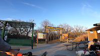
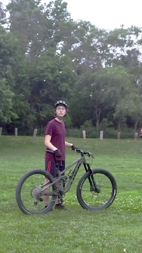
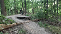
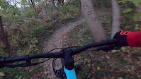
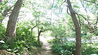
Photos of Nebraska Mountain Bike
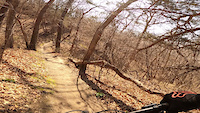
Videos of Nebraska Mountain Bike
trail: Cedar Maze
3:29 |
43 |
Dec 19, 2025
trail: Sandy Flow Part 1
0:24 |
56 |
Jul 5, 2025

0:18 |
89 |
Jul 6, 2024
trail: Sandy Flow Part 3
0:10 |
279 |
Jul 24, 2022
0:16 |
244 |
May 8, 2022
trail: Walnut Creek Trail
0:09 |
175 |
May 7, 2022
trail: Sandy Flow Part 3
0:17 |
151 |
Nov 9, 2021
trail: Sandy Flow Part 3
0:14 |
138 |
Jun 23, 2021
Activity Feed
| username | action | type | title | date |
|---|---|---|---|---|
| handstand | add | report | activity #97257008 and 17 more | Jun 18, 2026 @ 9:18am 6 hours |
| handstand | add | poi | activity #97254320 | Jun 18, 2026 @ 8:33am 7 hours |
| handstand | add | trail | activity #97253306 and 1 more | Jun 18, 2026 @ 8:15am 7 hours |
| spargenc23 | comment | report | activity #97225085 | Jun 17, 2026 @ 6:57pm 20 hours |
| jessepetersen | add | report | activity #97205747 | Jun 17, 2026 @ 1:13pm 1 day |
Recent Comments
| username | type | title | comment | date |
|---|---|---|---|---|
| report | Addressed the hole on the top side of the drop... | Jun 17, 2026 @ 6:57pm 20 hours | ||
| report | on the downhill stretch heading north after... | Jun 16, 2026 @ 6:43pm 2 days | ||
| trail | This area is completely closed as of June 2026... | Jun 15, 2026 @ 3:03pm Jun 15, 2026 | ||
| trail | Sandy Walsh has been completely redone and... | Jun 15, 2026 @ 2:59pm Jun 15, 2026 | ||
| trail | Part of this has been mowed, but the further... | Jun 15, 2026 @ 2:58pm Jun 15, 2026 |
Local Badges
-

Big Ride 30k9 awarded -

Epic Ride 50k176 awarded -
Big Ride 30k4 awarded -
Epic Ride 50k0 awarded -
Big Ride 30k379 awarded -
Big Ride 30k2 awarded
Bike & Skill Parks
| name | type | city | rating |
|---|---|---|---|
| Razors Edge MX | skill park | ||
| Abbott Motocross Track | skill park | ||
| Off Road Ranch ATV & Motocross | skill park | Norfolk | |
| White Sands Raceway | skill park | Ashland | |
| Platte Valley Dirt Riders | skill park |
Activity Type Stats
| activitytype | trails | distance | descent | descent distance | total vertical | rating | global rank | state rank | photos | reports | routes | ridelogs |
|---|---|---|---|---|---|---|---|---|---|---|---|---|
| Mountain Bike | 412 | 802 miles | 38,159 ft | 362 miles | 3,802 ft | #57 | 2,128 | 3,214 | 12 | 33,009 | ||
| E-Bike | 264 | 581 miles | 15,971 ft | 264 miles | 3,707 ft | #47 | 2 | 2,489 | 3 | 3,048 | ||
| Gravel Bike | 36 | 283 miles | 4,085 ft | 162 miles | 2,585 ft | #46 | 269 | 1 | 642 | |||
| Adaptive Bike | 52 | 310 miles | 5,509 ft | 172 miles | 2,625 ft | #43 | 342 | 1 | ||||
| Winter Fat Bike | 54 | 39 miles | 3,337 ft | 13 miles | 2,113 ft | #51 | 200 | 6 | ||||
| Horse | 61 | 288 miles | 6,138 ft | 160 miles | 2,720 ft | #50 | 316 | 2 | ||||
| Hike | 519 | 864 miles | 45,696 ft | 385 miles | 3,806 ft | #57 | 3 | 3,145 | 5 | 1,943 | ||
| Trail Running | 521 | 867 miles | 46,083 ft | 387 miles | 3,806 ft | #56 | 16 | 3,159 | 5 | 773 | ||
| Snowshoe | 40 | 29 miles | 397 ft | 5 miles | 59 ft | #53 | 2 | 11 | ||||
| Backcountry Ski | 25 | 59 miles | 5,745 ft | 25 miles | 3,501 ft | #45 | 11 | 20 | ||||
| Nordic Ski | 65 | 87 miles | 6,115 ft | 30 miles | 3,547 ft | #50 | 12 | 15 |
Activities
- Nebraska Mountain Biking Trails
- Nebraska E-Biking Trails
- Nebraska Gravel Biking Trails
- Nebraska Adaptive Biking Trails
- Nebraska Winter Fat Biking Trails
- Nebraska Horseback Trails
- Nebraska Hiking Trails
- Nebraska Trail Running Trails
- Nebraska Snowshoeing Trails
- Nebraska Backcountry Skiing Trails
- Nebraska Nordic Skiing Trails
Trails
Points of Interest
- Bicycle Playground / Skills Area TTF
- Narrow trail between trees TTF
- Rock garden TTF
- Double Dips Twin Bridges
- Wooden A-frame Bridge TTF
- wooden roller TTF
- Entry Level Wood Feature TTF
- Cedar Risge Trail Viewpoint
- Stone Shelter Cabin
- Cedar Risge Trail Viewpoint
- Mount Edna (5,030 ft)
- Squaw Mound (4,659 ft)
- The Hat (4,649 ft)
- By canadaka
 Trailforks & contributors
 - Admins: Map Team, IMBA, chuktA, msmcfate, WillieJacobsz, PlumbBobM, ReckitRolley, colinreuter, NGPC, handstand
- #3198 - 18,373 views
- nebraska activity log | embed map of Nebraska mountain bike trails | nebraska mountain biking points of interest
Downloading of trail gps tracks in kml & gpx formats is enabled for Nebraska.
You must login to download files.