close
-
Layers w
- Weather Layers
- Pro
- Pro
- Pro
- Pro
- Pro
- Pro
- More Layers
- Pro
- Pro
- Pro
- Pro
-
Upgrade to

3D
Trail Conditions
- Unknown
- Snow Groomed
- Snow Packed
- Snow Covered
- Snow Cover Partial
- Freeze/thaw Cycle
- Icy
- Prevalent Mud
- Wet
- Variable
- Ideal
- Dry
- Very Dry
Trail Flow (Ridden Direction)
Trailforks scans users ridelogs to determine the most popular direction each trail is ridden. A good flowing trail network will have most trails flowing in a single direction according to their intension.
The colour categories are based on what percentage of riders are riding a trail in its intended direction.
The colour categories are based on what percentage of riders are riding a trail in its intended direction.
- > 96%
- > 90%
- > 80%
- > 70%
- > 50%
- < 50%
- bi-directional trail
- no data
Trail Last Ridden
Trailforks scans ridelogs to determine the last time a trail was ridden.
- < 2 days
- < 1 week
- < 2 weeks
- < 1 month
- < 6 months
- > 6 months
Trail Ridden Direction
The intended direction a trail should be ridden.
- Downhill Only
- Downhill Primary
- Both Directions
- Uphill Primary
- Uphill Only
- One Direction
Contribute Details
Colors indicate trail is missing specified detail.
- Description
- Photos
- Description & Photos
- Videos
Trail Popularity ?
Trailforks scans ridelogs to determine which trails are ridden the most in the last 9 months.
Trails are compared with nearby trails in the same city region with a possible 25 colour shades.
Think of this as a heatmap, more rides = more kinetic energy = warmer colors.
- most popular
- popular
- less popular
- not popular
ATV/ORV/OHV Filter
Max Vehicle Width
inches
US Cell Coverage
Legend

Radar Time
Activity Recordings
Trailforks uses anonymized public activity data.
?
Activity Recordings
Trailforks uses anonymized public activity data.
?
Personal Heatmap
▶
Activity Types
all
/
none
▶
Options
2
Date range
month
–
Winter Trails
Warning
A routing network for winter maps does not exist. Selecting trails using the winter trails layer has been disabled.
Missing Trails
Most Popular
Least Popular
Trails are colored based on popularity. The more popular a trail is, the more red. Less popular trails trend towards green.
Jump Magnitude Heatmap
Heatmap of where riders jump on trails. Zoom in to see individual jumps, click circles to view jump details.
BC Backroad Status
![map legend]()
Service Road Atlas is a free to use, community-driven service for viewing and creating reports on the numerous back-country service roads around B.C. and Alberta.

Slope Aspect
Direction the slope faces
Trails Deemphasized
Trails are shown in grey.
Only show trails with no bike usage.
Suggested Layers
Based on selected activity type
Save the current map location and zoom level as your default home location whenever this page is loaded.
SaveWelcome to Nederland
Nestled in the heart of the Peak-to-Peak region, Nederland is an up-and-coming hub for outdoor recreation, offering a fantastic mix of established and hidden gems for mountain biking and hiking enthusiasts. The well-marked trails of the West Mag area provide excellent cross-country riding for all skill levels, with plenty of greens and blues to explore. Beyond these, adventurous riders can discover numerous social trails, built over the years by the local community. These unofficial trails offer a chance to uncover the untamed beauty of our region.
Whether you're here for the biking or the hiking, Nederland's unique blend of mapped and unmapped trails ensures there's something for everyone. The town itself is growing as an outdoor adventure destination, yet it retains its charming, laid-back vibe. It's the perfect base for exploring the greater Nederland area and the scenic Peak-to-Peak region.
So grab your bike, lace up your hiking boots, and come explore the trails and the hidden treasures of Nederland. Your adventure awaits!
Activities Click to view
- Mountain Bike
163 trails
- E-Bike
42 trails
- Gravel Bike
0 trails
- Adaptive Bike
0 trails
- Winter Fat Bike
0 trails
- Horse
83 trails
- Hike
220 trails
- Trail Running
219 trails
- Dirtbike/Moto
26 trails
- ATV/ORV/OHV
21 trails
- Snowshoe
9 trails
- Downhill Ski
68 trails
- Backcountry Ski
4 trails
- Nordic Ski
20 trails
Region Details
- 37
- 27
- 65
- 32
- 2
Region Status
Open as of Jun 6, 2026Stats
- Avg Trail Rating
- Trails (view details)
- 299
- Trails Mountain Bike
- 163
- Trails E-Bike
- 42
- Trails Horse
- 83
- Trails Hike
- 220
- Trails Trail Running
- 219
- Trails Dirtbike/Moto
- 26
- Trails Observed Trials
- 2
- Trails ATV/ORV/OHV
- 21
- Trails Snowshoe
- 9
- Trails Downhill Ski
- 68
- Trails Backcountry Ski
- 4
- Trails Nordic Ski
- 27
- Total Distance
- 356 miles
- Total Descent
- 77,616 ft
- Total Vertical
- 5,661 ft
- Highest Trailhead
- 13,460 ft
- Reports
- 1,476
- Photos
- 237
- Ridden Counter
- 34,891
Sub Regions
-
Caribou
- 3
- 5
- 4
-
Magnolia
- 6
- 40
- 15
-
Mud Lake
- 9
- 3
- 1
-
Sugarloaf Mountain
- 1
-
Tolland
- 2
- 5
Popular Nederland Mountain Biking Trails
• 100 ★ 3.2 • 4,406 ft • 35 ft • 1,118 •
A loose and fast trail with a couple of quick turns through the woods. The sections between the lot and access road are wide, mostly loose-over-hard with a small amount of baseball sized rocks strewn about and some roots here and there....
• 100 ★ 3.8 • 2 miles • 164 ft • 1,067 •
This trail was one of the first re-routes conducted by the Boulder Mountainbike Alliance to pull the trail away from private land and was recently extended to connect with Trail near P2P parking area. To access from the trailhead at the...
• 100 ★ 3.6 • 3 miles • 36 ft • 1,062 •
This is currently the flagship trail in the Magnolia Trail system. Please access the top of this trail from Roots and Rocks or one of the several road crossings. Speeds are high descending and sight lines can be very short. I would...
• 100 ★ 3.8 • 1 mile • 158 ft • 903 •
runs from the Peak to Peak parking area all the way to the end of West Magnolia Road ( ). The trail has a little bit of everything from narrow hand raked singletrack to bumps, berms, doubles and drops. When starting from the P2P parking...
• 95 ★ 3.9 • 4,177 ft • 94 ft • 867 •
Good trail in both directions. Connections to and the main West Mag parking area. Rolling easy to moderate singletrack trail recently rerouted by Boulder Mountainbike Alliance per the Magnolia Trails Plan recently approved by the USFS....
• 95 ★ 3.4 • 4 miles • 468 ft • 762 •
The trail is the backbone of the lower West Mag system. Formally known as 1, 2, and segments, this classic trail winds through meadows and pine forests. Starting from the center parking head south through the meadow and aspen grove....
• 95 ★ 3.7 • 4,869 ft • 316 ft • 736 •
.5 begins at the intersection of and and connects to . You'll climb a bit, then have a short descent, then a steep punchy climb to the meadow. At the end of the meadow is the intersection with .
Nederland Mountain Bike Routes
West Magnolia Tour Featured
★ 2.0 • 8 miles • 739 ft • 2 • Loop •
Unlike many classic Front Range rides, this one doesn't start with a big climb and end with a downhill....
West Mag to Eldora and Back Featured
★ 2.5 • 17 miles • 2,260 ft • 10 • Out & Back •
Ride from West Mag to Eldora and back! Getting to Kinglet is a ride in and of itself with the closest...
West Mag to Kinglet (High Point) Featured
12 miles • 1,649 ft • 9 • Out & Back •
Ride from West Mag to Eldora and back! Getting to Kinglet is a ride in and of itself with the closest...
5 miles • 385 ft • 3 • Loop •
This fun little loop at West Mag is a great introduction to the area. It's beginner friendly, but there is...
East Mag Tour Featured
★ 3.0 • 11 miles • 1,411 ft • 7 • Out & Back •
This route is rated black/advanced for technical features, climbing/descending steepness and way-finding....
West Mag Backcounty Route Featured
★ 2.7 • 12 miles • 1,603 ft • 6 • Loop •
Here's an updated version of the West Mag Backcountry Ride from the main center parking lot and newer...
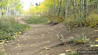
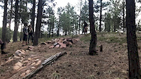
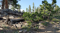
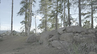
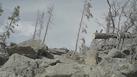
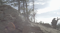
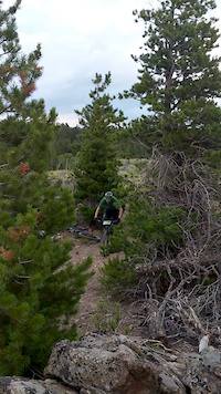
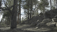
Photos of Nederland Mountain Bike
Videos of Nederland Mountain Bike
trail: Aspen Alley
0:48 |
136 |
Sep 27, 2020
trail: Dog
0:20 |
168 |
May 18, 2020
trail: Re-Root
0:16 |
313 |
Sep 3, 2019
trail: Re-Root
0:05 |
213 |
Sep 3, 2019
trail: Re-Root
0:09 |
157 |
Sep 3, 2019
trail: Re-Root
0:08 |
146 |
Sep 3, 2019
trail: Re-Root
0:12 |
117 |
Aug 2, 2019
trail: Re-Root
0:03 |
171 |
Aug 1, 2019
Recent Trail Reports
| status | trail | date | condition | info | user |
|---|---|---|---|---|---|
| Kinnickinnick Loop | Jun 6, 2026 @ 4:16pm (America/Denver) Jun 6, 2026 | Ideal | AshleyZYq0p0 | ||
| Tungsten Loop | Jun 6, 2026 @ 4:16pm (America/Denver) Jun 6, 2026 | Ideal | AshleyZYq0p0 | ||
| Nederland High Access Road | Jun 3, 2026 @ 4:06pm (America/Denver) Jun 3, 2026 | Ideal | Skyryk | ||
| Cutacross | Jun 3, 2026 @ 4:06pm (America/Denver) Jun 3, 2026 | Ideal | Skyryk | ||
| Observatory Spur Road | Jun 3, 2026 @ 4:06pm (America/Denver) Jun 3, 2026 | Ideal | Skyryk | ||
| Rollinsville Road Connector | Jun 3, 2026 @ 4:06pm (America/Denver) Jun 3, 2026 | Ideal | Skyryk | ||
| South Tennessee Mountain Spur Road | Jun 3, 2026 @ 4:06pm (America/Denver) Jun 3, 2026 | Ideal | Skyryk | ||
| Kinglet Connector | Jun 3, 2026 @ 4:06pm (America/Denver) Jun 3, 2026 | Ideal | Skyryk | ||
| Kinglet | Jun 3, 2026 @ 4:06pm (America/Denver) Jun 3, 2026 | Ideal | Skyryk | ||
| 503 | Jun 3, 2026 @ 4:06pm (America/Denver) Jun 3, 2026 | Ideal | Skyryk |
National Scenic Trails & Official Routes
-
Continental Divide Trail
- Mountain Bike
- Hike
- Trail Running

Activity Feed
| username | action | type | title | date |
|---|---|---|---|---|
| ashleybrooke | wishlist | region | activity #97231002 | Jun 17, 2026 @ 9:12pm 1 day |
| cokrafter | wishlist | route | activity #97229235 | Jun 17, 2026 @ 8:22pm 1 day |
| cokrafter | wishlist | route | activity #97176895 | Jun 17, 2026 @ 5:48am 2 days |
| MichaelGNdtx | vote | route | activity #97157554 | Jun 16, 2026 @ 7:39pm 2 days |
| MichaelGNdtx | ridden | route | activity #97157531 | Jun 16, 2026 @ 7:39pm 2 days |
Recent Comments
| username | type | title | comment | date |
|---|---|---|---|---|
| report | Yay | May 15, 2026 @ 9:00am May 15, 2026 | ||
| trail | I personally love this trail. Not sure why... | Oct 15, 2025 @ 7:55am Oct 15, 2025 | ||
| trail | Washed out hike a bike at the start but... | Sep 14, 2025 @ 7:44pm Sep 14, 2025 | ||
| trail | I think it’s a great trail rather do this up... | Sep 2, 2025 @ 1:18pm Sep 2, 2025 | ||
| trail | Clockwise is the way to go. Easier climbing... | Aug 21, 2025 @ 11:33am Aug 21, 2025 |
Local Badges
-

10 Blue Trails356 awarded -

10 Black Trails97 awarded -

Epic Ride Climb 2k178 awarded -

Climbing 10k Badge57 awarded -

Climbing 100k Badge1 awarded -

Epic Ride Descent 2k220 awarded
Bike & Skill Parks
| name | type | city | rating |
|---|---|---|---|
| Eldora Mountain Resort | bike park | Nederland |
Activity Type Stats
| activitytype | trails | distance | descent | descent distance | total vertical | rating | global rank | state rank | photos | reports | routes | ridelogs |
|---|---|---|---|---|---|---|---|---|---|---|---|---|
| Mountain Bike | 163 | 169 miles | 20,223 ft | 65 miles | 3,976 ft | #772 | #299 | 148 | 1,454 | 17 | 11,476 | |
| E-Bike | 42 | 90 miles | 7,516 ft | 31 miles | 3,586 ft | #2,094 | #936 | 4 | 1,141 | 422 | ||
| Horse | 83 | 149 miles | 32,766 ft | 67 miles | 5,151 ft | #215 | #422 | 715 | 18 | 1 | ||
| Hike | 220 | 329 miles | 61,519 ft | 141 miles | 5,663 ft | #193 | #105 | 80 | 1,460 | 23 | 3,404 | |
| Trail Running | 219 | 324 miles | 60,801 ft | 140 miles | 5,663 ft | #348 | #135 | 1,459 | 24 | 822 | ||
| Dirtbike/Moto | 26 | 66 miles | 5,262 ft | 22 miles | 3,399 ft | #573 | #189 | 3 | 614 | 20 | ||
| Observed Trials | 2 | 2 miles | 36 ft | 3,307 ft | 161 ft | 2 | 5 | 4 | ||||
| ATV/ORV/OHV | 21 | 52 miles | 4,364 ft | 20 miles | 3,399 ft | #445 | #146 | 613 | 2 | |||
| Snowshoe | 9 | 10 miles | 217 ft | 3,018 ft | 4,482 ft | #826 | #381 | 11 | 80 | |||
| Downhill Ski | 68 | 15 miles | 14,501 ft | 15 miles | 1,342 ft | #254 | #103 | 3,866 | ||||
| Backcountry Ski | 4 | 7 miles | 95 ft | 1,401 ft | 4,114 ft | #352 | #71 | 1,856 | ||||
| Nordic Ski | 20 | 11 miles | 1,161 ft | 5 miles | 3,717 ft | #551 | #176 | 1 | 878 |
Frequently Asked Questions About Nederland
▼
What are the best places to ride in Nederland?
Nederland has 9 areas to explore for mountain biking. The top rated areas are:
▼
What are the highest rated mountain biking trails in Nederland?
The highest rated mountain biking trails in Nederland are:
- Bear Down (4.2/5)
- Pirate's Revenge (4.1/5)
- Kinnickinnick Loop (4.1/5)
- Sugar Magnolia (4/5)
- Sherwood Forest Trail (4/5)
▼
What is the best time of the year to ride in Nederland?
Based on ride log data, the most popular months to ride in Nederland are:
- July (201 activities)
- June (169 activities)
- August (168 activities)
▼
Where can I park to ride in Nederland?
There are 23 parking locations listed in Nederland. The most popular parking spots are: View all parking and trailhead locations on the map to plan your visit.
Activities
Trails
Points of Interest
- By canadaka
 Trailforks & contributors
 - Admins: BMA, NATO, GNAR, BMA, amrosen, getvert, mpopetz, Pumpntrail, andrewbikeboulder, Skyryk
- #4944 - 17,258 views
- nederland activity log | embed map of Nederland mountain bike trails | nederland mountain biking points of interest
Downloading of trail gps tracks in kml & gpx formats is enabled for Nederland.
You must login to download files.