close
-
Layers w
- Weather Layers
- Pro
- Pro
- Pro
- Pro
- Pro
- Pro
- More Layers
- Pro
- Pro
- Pro
- Pro
-
Upgrade to

3D
Trail Conditions
- Unknown
- Snow Groomed
- Snow Packed
- Snow Covered
- Snow Cover Partial
- Freeze/thaw Cycle
- Icy
- Prevalent Mud
- Wet
- Variable
- Ideal
- Dry
- Very Dry
Trail Flow (Ridden Direction)
Trailforks scans users ridelogs to determine the most popular direction each trail is ridden. A good flowing trail network will have most trails flowing in a single direction according to their intension.
The colour categories are based on what percentage of riders are riding a trail in its intended direction.
The colour categories are based on what percentage of riders are riding a trail in its intended direction.
- > 96%
- > 90%
- > 80%
- > 70%
- > 50%
- < 50%
- bi-directional trail
- no data
Trail Last Ridden
Trailforks scans ridelogs to determine the last time a trail was ridden.
- < 2 days
- < 1 week
- < 2 weeks
- < 1 month
- < 6 months
- > 6 months
Trail Ridden Direction
The intended direction a trail should be ridden.
- Downhill Only
- Downhill Primary
- Both Directions
- Uphill Primary
- Uphill Only
- One Direction
Contribute Details
Colors indicate trail is missing specified detail.
- Description
- Photos
- Description & Photos
- Videos
Trail Popularity ?
Trailforks scans ridelogs to determine which trails are ridden the most in the last 9 months.
Trails are compared with nearby trails in the same city region with a possible 25 colour shades.
Think of this as a heatmap, more rides = more kinetic energy = warmer colors.
- most popular
- popular
- less popular
- not popular
ATV/ORV/OHV Filter
Max Vehicle Width
inches
US Cell Coverage
Legend

Radar Time
Activity Recordings
Trailforks uses anonymized public activity data.
?
Activity Recordings
Trailforks uses anonymized public activity data.
?
Personal Heatmap
▶
Activity Types
all
/
none
▶
Options
2
Date range
month
–
Winter Trails
Warning
A routing network for winter maps does not exist. Selecting trails using the winter trails layer has been disabled.
Missing Trails
Most Popular
Least Popular
Trails are colored based on popularity. The more popular a trail is, the more red. Less popular trails trend towards green.
Jump Magnitude Heatmap
Heatmap of where riders jump on trails. Zoom in to see individual jumps, click circles to view jump details.
BC Backroad Status
![map legend]()
Service Road Atlas is a free to use, community-driven service for viewing and creating reports on the numerous back-country service roads around B.C. and Alberta.

Slope Aspect
Direction the slope faces
Trails Deemphasized
Trails are shown in grey.
Only show trails with no bike usage.
Suggested Layers
Based on selected activity type
Save the current map location and zoom level as your default home location whenever this page is loaded.
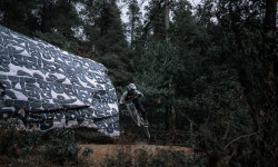
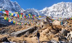
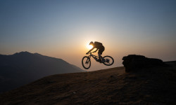
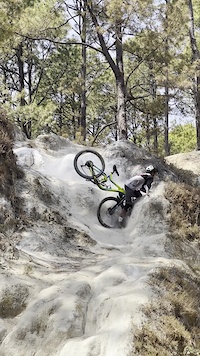
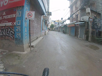
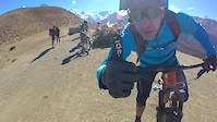
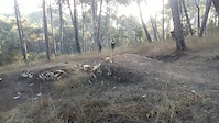
SaveNepal is a world-class mountain biking destination, home to the towering Himalayas and an incredible diversity of terrain. From high-altitude alpine trails with breathtaking views of Everest and Annapurna to lush jungle singletracks in the lowlands, the country offers something for every rider. Expect a mix of ancient footpaths, technical descents, and long, rewarding climbs through remote villages and rich cultural landscapes. Trails are often shared with locals, adding a unique human element to every ride. Nepal combines adventure, challenge, and unforgettable scenery in one truly epic riding experience.
Region Details
- 58
- 1
- 5
- 39
- 40
- 5
Stats
- Avg Trail Rating
- Trails (view details)
- 154
- Trails Mountain Bike
- 157
- Trails E-Bike
- 76
- Trails Gravel Bike
- 2
- Trails Hike
- 182
- Trails Trail Running
- 138
- Total Distance
- 206 miles
- Total Descent
- 65,396 ft
- Total Vertical
- 27,272 ft
- Highest Trailhead
- 28,881 ft
- Reports
- 103
- Photos
- 715
- Ridden Counter
- 1,400
Articles
Video: How an Enduro Race is Transforming a Mountain Town in Nepal
Aug 21, 2025 from pinkbike.com
The incredible impact an MTB club’s activities are having on the town of Phaplu, in the shadow of the world’s tallest peaks.
Skip Everest Base Camp for These 9 Epic (and Less-Crowded) Treks in Nepal
Jul 2, 2025 from outsideonline.com
From sacred lakes to former kingdoms, these expert-picked trails deliver all the Himalayan drama without the Everest circus.
Video & Race Report: 2024 Ratnange Enduro in Solu Khumbu, Nepal
Sep 16, 2024 from pinkbike.com
An enduro with the backdrop of the world's tallest peak.

Video & Race Report: 2024 Ratnange Enduro in Solu Khumbu, Nepal
Sep 16, 2024 from pinkbike.com
An enduro with the backdrop of the world's tallest peak.
Sub Regions
Popular Nepal Mountain Biking Trails
• 100 ★ 5.0 • 2 miles • 428 ft • 107 •
has been a feature of the Asain Enduro Series for 2016/17/18/19 and for good reason because this trail is fun! A solid trail with good traction that offers flowy single track with short, steep descents and hair pin turns. A guaranteed...
• 100 ★ 5.0 • 2 miles • 190 ft • 88 •
What a trail, some short uphill, very fast sectio, some ridge, the end is more flat ! Do not miss this trail !
• 95 ★ 4.8 • 2 miles • 20 ft • 86 •
Nice single track that follows the ridge back towards KTM. It has some nice technical sections evenly spaced throughout that includes steep rollers and rutted areas that require agile handling. There is a slight fall danger as you cut...
• 100 ★ 3.6 • 2 miles • 3 ft • 73 •
Very nice trail, start with stairs, and then more flow, some small climbs, watchout for hikers, and some stairs at the end but you can avoid by doing right and left turns.
• 75 ★ 5.0 • 1 mile • 618 ft • 65 •
Some parts are good to pedal, some you have to push !
• 90 ★ 5.0 • 2 miles • 92 ft • 48 •
Nice singletrack, some exposed and steep parts, some switchbacks and rocky section !
• 90 ★ 5.0 • 1,630 ft • 188 ft • 39 •
This trail leads you to the entrance of the Kopan Monastery. This has some stairs to descend and a very quick climb. Good views.
Nepal Mountain Bike Routes
★ 5.0 • 13 miles • 1,503 ft • 0 •
32 miles • 2,497 ft • 0 • Loop •
The KORA Route goes around in a loop around the city, clockwise, through small lanes, and by lanes of the...
52 miles • 7,781 ft • 0 •
18 miles • 1,369 ft • 0 •
18 miles • 3,010 ft • 0 •
26 miles • 3,611 ft • 0 •
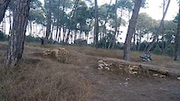
Photos of Nepal Mountain Bike
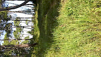
Videos of Nepal Mountain Bike
trail: Lupra Pass Magic Trail
0:14 |
7 |
Apr 23, 2026
trail: Helipad Descent
0:11 |
369 |
Mar 14, 2022
trail: Lakuri Bhanjyang - kot dada
16:47 |
172 |
Sep 7, 2020
trail: Lupra Pass DH
2:09 |
166 |
Apr 24, 2020
trail: Hattiban Downhill
0:05 |
119 |
Dec 29, 2019
trail: Hattiban Downhill
0:08 |
62 |
Dec 29, 2019
trail: Hattiban Downhill
0:08 |
22 |
Dec 5, 2019

trail: Hattiban Downhill
2:02 |
91 |
Dec 5, 2019
Recent Comments
| username | type | title | comment | date |
|---|---|---|---|---|
| trail | E-bike ascend by the jeep track until the... | Nov 6, 2024 @ 5:04am Nov 6, 2024 | ||
| trail | OXIGEEEEEEEEN!!!! | Mar 22, 2024 @ 7:20am Mar 22, 2024 | ||
| trail | almost all these "trails" around Kathmandu are... | Sep 19, 2023 @ 8:00am Sep 19, 2023 | ||
| trail | First time down it today. Had fun but was a... | Aug 20, 2022 @ 7:31am Aug 20, 2022 | ||
| trail | This is a dirt road not a singletrack | Jan 1, 2022 @ 11:52pm Jan 1, 2022 |
Activity Type Stats
| activitytype | trails | distance | descent | descent distance | total vertical | rating | global rank | state rank | photos | reports | routes | ridelogs |
|---|---|---|---|---|---|---|---|---|---|---|---|---|
| Mountain Bike | 157 | 191 miles | 60,653 ft | 103 miles | 11,516 ft | #72 | 713 | 103 | 7 | 11,756 | ||
| E-Bike | 76 | #96 | 87 | 116 | ||||||||
| Gravel Bike | 2 | #45 | 10 | |||||||||
| Hike | 160 | 206 miles | 65,397 ft | 108 miles | 27,270 ft | #60 | 2 | 99 | 2 | 7,609 | ||
| Trail Running | 138 | 198 miles | 65,387 ft | 107 miles | 11,516 ft | #69 | 99 | 1 | 90 |
Activities
Trails
- By canadaka
 Trailforks & contributors
 - Admins: freerider48, trailforksnepal
- #3243 - 16,231 views
- nepal activity log | embed map of Nepal mountain bike trails | nepal mountain biking points of interest
Downloading of trail gps tracks in kml & gpx formats is enabled for Nepal.
You must login to download files.