close
-
Layers w
- Weather Layers
- Pro
- Pro
- Pro
- Pro
- Pro
- Pro
- More Layers
- Pro
- Pro
- Pro
- Pro
-
Upgrade to

3D
Trail Conditions
- Unknown
- Snow Groomed
- Snow Packed
- Snow Covered
- Snow Cover Partial
- Freeze/thaw Cycle
- Icy
- Prevalent Mud
- Wet
- Variable
- Ideal
- Dry
- Very Dry
Trail Flow (Ridden Direction)
Trailforks scans users ridelogs to determine the most popular direction each trail is ridden. A good flowing trail network will have most trails flowing in a single direction according to their intension.
The colour categories are based on what percentage of riders are riding a trail in its intended direction.
The colour categories are based on what percentage of riders are riding a trail in its intended direction.
- > 96%
- > 90%
- > 80%
- > 70%
- > 50%
- < 50%
- bi-directional trail
- no data
Trail Last Ridden
Trailforks scans ridelogs to determine the last time a trail was ridden.
- < 2 days
- < 1 week
- < 2 weeks
- < 1 month
- < 6 months
- > 6 months
Trail Ridden Direction
The intended direction a trail should be ridden.
- Downhill Only
- Downhill Primary
- Both Directions
- Uphill Primary
- Uphill Only
- One Direction
Contribute Details
Colors indicate trail is missing specified detail.
- Description
- Photos
- Description & Photos
- Videos
Trail Popularity ?
Trailforks scans ridelogs to determine which trails are ridden the most in the last 9 months.
Trails are compared with nearby trails in the same city region with a possible 25 colour shades.
Think of this as a heatmap, more rides = more kinetic energy = warmer colors.
- most popular
- popular
- less popular
- not popular
ATV/ORV/OHV Filter
Max Vehicle Width
inches
US Cell Coverage
Legend

Radar Time
Activity Recordings
Trailforks uses anonymized public activity data.
?
Activity Recordings
Trailforks uses anonymized public activity data.
?
Personal Heatmap
▶
Activity Types
all
/
none
▶
Options
2
Date range
month
–
Winter Trails
Warning
A routing network for winter maps does not exist. Selecting trails using the winter trails layer has been disabled.
Missing Trails
Most Popular
Least Popular
Trails are colored based on popularity. The more popular a trail is, the more red. Less popular trails trend towards green.
Jump Magnitude Heatmap
Heatmap of where riders jump on trails. Zoom in to see individual jumps, click circles to view jump details.
BC Backroad Status
![map legend]()
Service Road Atlas is a free to use, community-driven service for viewing and creating reports on the numerous back-country service roads around B.C. and Alberta.

Slope Aspect
Direction the slope faces
Trails Deemphasized
Trails are shown in grey.
Only show trails with no bike usage.
Suggested Layers
Based on selected activity type
Save the current map location and zoom level as your default home location whenever this page is loaded.
Save
No description for Neustift has been added yet!
Login or register to submit one.
This region uses the Uk/Euro style trail grading system.
Activities Click to view
- Mountain Bike
10 trails
- E-Bike
10 trails
- Adaptive Bike
0 trails
- Winter Fat Bike
0 trails
- Hike
28 trails
- Trail Running
30 trails
Region Details
- 8
- 1
- 1
Region Status
Open as of Jun 6, 2026Stats
- Avg Trail Rating
- Trails (view details)
- 24
- Trails Mountain Bike
- 10
- Trails E-Bike
- 10
- Trails Hike
- 28
- Trails Trail Running
- 30
- Trails Backcountry Ski
- 3
- Total Distance
- 42 miles
- Total Descent Distance
- 16 miles
- Total Descent
- 18,943 ft
- Total Vertical
- 6,677 ft
- Highest Trailhead
- 9,659 ft
- Reports
- 26
- Photos
- 26
- Ridden Counter
- 499
Popular Neustift Mountain Biking Trails
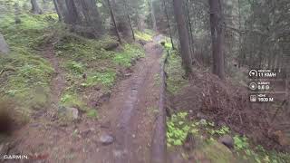
• 80 ★ 4.8 • 2 miles • 123 ft • 114 •
The is the first bike-only trail in the Stubaital. Going up with the Elferlifte gondola and descending about 800 vertical meters down. The first two-thirds are very natural, rooty, rocky with some handmade berms. The last third is more...
• 100 ★ 5.0 • 2 miles • 9 ft • 91 •
It's as natural as it's brother "Eins Einser Trail", but slightly less challenging. Playful trail with rocks, some roots and a mix of flowy and tight corners.
Photos of Neustift Mountain Bike
Videos of Neustift Mountain Bike
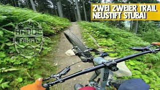
trail: Zwei Zweier Trail
9:10 |
882 |
Jun 16, 2019 , Neustift
youtuber
![Zwei Zweier Trail (22er) | Neustift im...]()
7:32 |
597 |
Aug 21, 2018
youtuber
![Eins Einser Trail Stubai]()

trail: EinsEinser Trail
0:45 |
890 |
Jun 13, 2018 , Neustift

trail: EinsEinser Trail
740 |
May 6, 2017 , Neustift

trail: EinsEinser Trail
570 |
Oct 6, 2016 , Neustift
Recent Trail Reports
| status | trail | date | condition | info | user |
|---|---|---|---|---|---|
| Zwei Zweier Trail | Jun 6, 2026 @ 2:25pm (Europe/Vienna) Jun 6, 2026 | Ideal | AperolSpritz | ||
| EinsEinser Trail | Aug 5, 2024 @ 12:14pm Aug 5, 2024 | Variable | Nasopanic | ||
| Schlick 2000 Uphill Trail - Upper | Jun 22, 2024 @ 2:10am Jun 22, 2024 | Ideal | Neekens | ||
| Uphill Schlick 2000 | Jun 22, 2024 @ 2:10am Jun 22, 2024 | Ideal | Neekens | ||
| Panoramabahn Elfer | Sep 16, 2023 @ 2:50am Sep 16, 2023 | Ideal | katko | ||
| Uphill Neustift to Elfer | Aug 21, 2019 @ 3:39am Aug 21, 2019 | Variable | ktm-boy-69 TRAILFORKS |
Activity Feed
| username | action | type | title | date |
|---|---|---|---|---|
| AperolSpritz | add | report | activity #96359342 | Jun 6, 2026 @ 5:25am Jun 6, 2026 |
| PaulPhilippiznm6n | ridden | trail | activity #95578726 and 1 more | May 26, 2026 @ 11:26am May 26, 2026 |
| AlexYtYZlV | wishlist | trail | activity #95515041 | May 25, 2026 @ 12:44pm May 25, 2026 |
| ATWebsn | wishlist | trail | activity #94409482 | May 10, 2026 @ 3:20am May 10, 2026 |
| kyleluvsdh | wishlist | trail | activity #82961271 and 1 more | Oct 24, 2025 @ 10:03pm Oct 24, 2025 |
Recent Comments
| username | type | title | comment | date |
|---|---|---|---|---|
| trail | du kannst auch einfach eine beschreibung hier... | Aug 15, 2025 @ 12:20pm Aug 15, 2025 | ||
| trail | A description from a popular blog... | Aug 14, 2025 @ 5:23am Aug 14, 2025 | ||
| trail | Steiler Uphill auf Schotter, im Sommer aber... | Aug 21, 2019 @ 3:39am Aug 21, 2019 | ||
| trail | Excellent trail, lots of Nature experience.... | Aug 18, 2018 @ 10:49am Aug 18, 2018 | ||
| report | Waiting for the new season ! | Jan 23, 2017 @ 3:18am Jan 23, 2017 |
Local Badges
-

Epic Ride Descent 2k22 awarded -

Descent 10k Badge2 awarded -

Descent 100k Badge0 awarded
Activity Type Stats
| activitytype | trails | distance | descent | descent distance | total vertical | rating | global rank | state rank | photos | reports | routes | ridelogs |
|---|---|---|---|---|---|---|---|---|---|---|---|---|
| Mountain Bike | 10 | 19 miles | 4,590 ft | 4 miles | 4,026 ft | #3,327 | #31 | 26 | 26 | 1,113 | ||
| E-Bike | 10 | 19 miles | 4,590 ft | 4 miles | 4,026 ft | #2,636 | #34 | 23 | 96 | |||
| Hike | 28 | 32 miles | 14,547 ft | 12 miles | 6,617 ft | #3,248 | #39 | 19 | 808 | |||
| Trail Running | 30 | 32 miles | 14,547 ft | 12 miles | 6,617 ft | #3,026 | #33 | 19 | 16 | |||
| Backcountry Ski | 3 | 9 miles | 52 ft | 866 ft | 4,314 ft | 576 |
Frequently Asked Questions About Neustift
▼
What are the highest rated mountain biking trails in Neustift?
The highest rated mountain biking trails in Neustift are:
- EinsEinser Trail (4.5/5)
- Zwei Zweier Trail (4.4/5)
▼
What is the best time of the year to ride in Neustift?
Based on ride log data, the most popular months to ride in Neustift are:
- July (8 activities)
- August (5 activities)
- September (3 activities)
▼
Where can I park to ride in Neustift?
There are 1 parking locations listed in Neustift. The most popular parking spots are:
▼
What is the longest trail in Neustift?
The longest trail in Neustift is EinsEinser Trail at 2.0 miles. View all trails sorted by distance.
Activities
Trails
- By lines
 TRAILFORKS & contributors
 - Admins: PatrickMeraner
- #16269 - 3,921 views
- neustift activity log | embed map of Neustift mountain bike trails | neustift mountain biking points of interest
Downloading of trail gps tracks in kml & gpx formats is enabled for Neustift.
You must login to download files.