close
-
Layers w
- Weather Layers
- Pro
- Pro
- Pro
- Pro
- Pro
- Pro
- More Layers
- Pro
- Pro
- Pro
- Pro
-
Upgrade to

3D
Trail Conditions
- Unknown
- Snow Groomed
- Snow Packed
- Snow Covered
- Snow Cover Partial
- Freeze/thaw Cycle
- Icy
- Prevalent Mud
- Wet
- Variable
- Ideal
- Dry
- Very Dry
Trail Flow (Ridden Direction)
Trailforks scans users ridelogs to determine the most popular direction each trail is ridden. A good flowing trail network will have most trails flowing in a single direction according to their intension.
The colour categories are based on what percentage of riders are riding a trail in its intended direction.
The colour categories are based on what percentage of riders are riding a trail in its intended direction.
- > 96%
- > 90%
- > 80%
- > 70%
- > 50%
- < 50%
- bi-directional trail
- no data
Trail Last Ridden
Trailforks scans ridelogs to determine the last time a trail was ridden.
- < 2 days
- < 1 week
- < 2 weeks
- < 1 month
- < 6 months
- > 6 months
Trail Ridden Direction
The intended direction a trail should be ridden.
- Downhill Only
- Downhill Primary
- Both Directions
- Uphill Primary
- Uphill Only
- One Direction
Contribute Details
Colors indicate trail is missing specified detail.
- Description
- Photos
- Description & Photos
- Videos
Trail Popularity ?
Trailforks scans ridelogs to determine which trails are ridden the most in the last 9 months.
Trails are compared with nearby trails in the same city region with a possible 25 colour shades.
Think of this as a heatmap, more rides = more kinetic energy = warmer colors.
- most popular
- popular
- less popular
- not popular
ATV/ORV/OHV Filter
Max Vehicle Width
inches
US Cell Coverage
Legend

Radar Time
Activity Recordings
Trailforks uses anonymized public activity data.
?
Activity Recordings
Trailforks uses anonymized public activity data.
?
Personal Heatmap
▶
Activity Types
all
/
none
▶
Options
2
Date range
month
–
Winter Trails
Warning
A routing network for winter maps does not exist. Selecting trails using the winter trails layer has been disabled.
Missing Trails
Most Popular
Least Popular
Trails are colored based on popularity. The more popular a trail is, the more red. Less popular trails trend towards green.
Jump Magnitude Heatmap
Heatmap of where riders jump on trails. Zoom in to see individual jumps, click circles to view jump details.
BC Backroad Status
![map legend]()
Service Road Atlas is a free to use, community-driven service for viewing and creating reports on the numerous back-country service roads around B.C. and Alberta.

Slope Aspect
Direction the slope faces
Trails Deemphasized
Trails are shown in grey.
Only show trails with no bike usage.
Suggested Layers
Based on selected activity type
Save the current map location and zoom level as your default home location whenever this page is loaded.
SavePopular Trail Networks
view all areas »Region Details
- 428
- 83
- 400
- 691
- 197
- 43
- 3
Stats
- Avg Trail Rating
- Trails (view details)
- 2,655
- Trails Mountain Bike
- 1,869
- Trails E-Bike
- 926
- Trails Gravel Bike
- 166
- Trails Adaptive Bike
- 391
- Trails Winter Fat Bike
- 240
- Trails Horse
- 488
- Trails Hike
- 2,385
- Trails Trail Running
- 2,345
- Trails Dirtbike/Moto
- 137
- Trails Observed Trials
- 16
- Trails ATV/ORV/OHV
- 109
- Trails Snowmobile
- 3
- Trails Snowshoe
- 18
- Trails Downhill Ski
- 157
- Trails Backcountry Ski
- 16
- Trails Nordic Ski
- 40
- Total Distance
- 3,967 miles
- Total Descent
- 639,879 ft
- Total Vertical
- 15,621 ft
- Highest Trailhead
- 16,145 ft
- Reports
- 19,080
- Photos
- 6,682
- Ridden Counter
- 409,215
Articles
Mountain Bike News, Photos, Videos & Events | Pinkbike
Apr 13, 2026 from betamtb.com
Pinkbike is the homepage of mountain biking. Stay updated with the latest news, reviews, videos, buyer's guides and racing results. Join the...
Ole Burro MTB Race Brings Enduro, XC, and Community Spirit to Nevada
Nov 24, 2025 from pinkbike.com
Fast-flowing trails, timed stages, and shuttle-supported logistics make it easy to ride, race, and enjoy the desert’s hidden gems.
Details Announced for the Ole Burro Enduro Series at Bootleg Canyon
Aug 1, 2025 from pinkbike.com
2025 Ole Burro Enduro at Bootleg Canyon Joins the Ole Burro Enduro at Blue Diamond.
Race Report: 2025 Southwest Regional Gravity Champs Round #2 at Bootleg Canyon
Feb 19, 2025 from pinkbike.com
The racecourse got watered with 1/2 an inch of rain on Thursday, providing perfect tacky conditions for racing.
Sub Regions
- Eastern Nevada (102)
- White Pine County (103)
- Northern Nevada (151)
- Churcill County (11)
- Elko County (83)
- Humboldt County (4)
- Lander County (17)
- Southern Nevada (956)
- Clark County (819)
- Humboldt Toiyabe National Forest (19)
- Lincoln County (54)
- Monitor Range (2)
- Nye County (44)
- Western Nevada (660)
- Carson City County (173)
- Douglas County (74)
- Washoe County (437)
Popular Nevada Mountain Biking Trails
• 55 ★ 4.5 • 4 miles • 298 ft • 3,262 •
The trail itself is very easy to ride (barring one mandatory walk-a-bike section), but it is cut out of a very steep hillside and the exposure may be too much for new riders.
• 100 ★ 4.1 • 3 miles • 654 ft • 2,096 •
Highly rated popular green difficulty singletrack. This mountain bike primary trail. On average it takes 29 minutes to complete this trail.
• 100 ★ 4.4 • 1 mile • 15 ft • 2,043 •
Highly rated popular green difficulty singletrack. This mountain bike primary trail can be used both directions and has a easy overall physical rating with a 15 ft green climb. Trail visibility is always easy to follow. On average it takes 9 minutes to complete this trail.
• 100 ★ 3.6 • 1,463 ft • 0 ft • 1,945 •
Easy desert singletrack to connect the 2 trail systems. Some washed gravel sections, but pretty easy.
• 100 ★ 4.8 • 4,961 ft • 152 ft • 1,913 •
This is one of the most well known trails in the Cottonwood Valley riding area. Be on the lookout for the family of wild ducks that have taken up residence in one of the native Joshua Trees!
• 100 ★ 3.3 • 1,873 ft • 0 ft • 1,860 •
Popular blue difficulty singletrack. This mountain bike primary trail can be used uphill primary and has a hard overall physical rating with a 0 ft black diamond climb. On average it takes 3 minutes to complete this trail.
• 100 ★ 4.5 • 4 miles • 363 ft • 1,669 •
Highly rated popular green difficulty singletrack. This mountain bike primary trail can be used both directions and has a easy overall physical rating with a 363 ft green climb. On average it takes 8 minutes to complete this trail.
• 100 ★ 4.4 • 4,134 ft • 49 ft • 1,603 •
Highly rated popular blue difficulty singletrack. This mountain bike primary trail can be used both directions. On average it takes 5 minutes to complete this trail.
Nevada Mountain Bike Routes
15 miles • 1,178 ft • 1 • Loop •
This is the intermediate gravel grinder route for the Beatty Days Festival. Expect some short sections of...
2019 Beatty Days - Gravel Advanced Featured
37 miles • 3,197 ft • 4 • Loop •
Beatty Days Advanced Gravel Grinder Route. This route includes more altitude than the intermediate route,...
★ 3.9 • 10 miles • 639 ft • 6 • Loop •
The Blue Diamond Loop is my go-to loop at Cottonwood. It can be ridden in well under an hour, is nearly 10...
★ 4.5 • 6 miles • 1,100 ft • 4 • Loop •
A regular loop in the Reno area with a fun descent on the North side. Keep speed low and manageable to...
★ 5.0 • 12 miles • 1,971 ft • 6 • Loop •
Great tour of some peavine hits. , and fisticuffs
★ 4.5 • 7 miles • 683 ft • 13 •
Visitor created, going to try it out tomorrow if the rain doesn't get crazy. 4/10/16- didn't actually get...
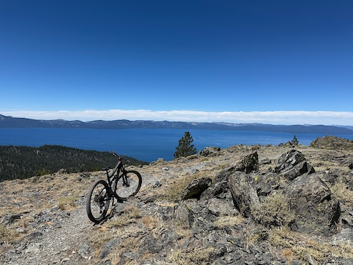
Photos of Nevada Mountain Bike
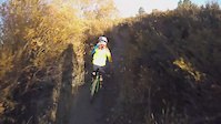
Videos of Nevada Mountain Bike
trail: GnarWhale
0:51 |
12 |
May 11, 2026
trail: Kingsbury Stinger Trail
0:02 |
4 |
Apr 24, 2026
trail: Lower Kingsbury Stinger
0:43 |
5 |
Feb 27, 2026
trail: Ivy the Flyer
0:57 |
18 |
Sep 26, 2025
trail: Frenchman's Freeride
0:29 |
36 |
Sep 3, 2025
trail: Galena Creek
0:29 |
30 |
Jul 29, 2025
0:21 |
|
May 9, 2025
trail: Sneaky Pete
0:32 |
|
Mar 23, 2025
National Scenic Trails & Official Routes
-
Tahoe Rim Trail
- Mountain Bike
- E-Bike
- Horse
- Hike
- Trail Running
Activity Feed
| username | action | type | title | date |
|---|---|---|---|---|
| vcrivello | wishlist | route | activity #97436496 | Jun 20, 2026 @ 3:10pm 12 mins |
| vcrivello | wishlist | route | activity #97436362 | Jun 20, 2026 @ 3:09pm 14 mins |
| chr2442 | wishlist | trail | activity #97435169 | Jun 20, 2026 @ 2:50pm 32 mins |
| chr2442 | wishlist | trail | activity #97435124 | Jun 20, 2026 @ 2:50pm 33 mins |
| chr2442 | wishlist | trail | activity #97435017 and 1 more | Jun 20, 2026 @ 2:48pm 35 mins |
Recent Comments
| username | type | title | comment | date |
|---|---|---|---|---|
| trail | We shouldn’t skew the Blue Diamond area... | Jun 18, 2026 @ 3:40pm 2 days | ||
| trail | This is black - take it to get to Flowered... | Jun 17, 2026 @ 7:59am Jun 17, 2026 | ||
| trail | This trail is phenomenal. Absolutely worth the... | Jun 14, 2026 @ 11:28pm Jun 14, 2026 | ||
| trail | This might just be the best trail in bears... | Jun 14, 2026 @ 11:26pm Jun 14, 2026 | ||
| trail | This is a pretty fun trail and the wash... | Jun 14, 2026 @ 11:24pm Jun 14, 2026 |
Local Badges
-

Henderson Top 10 Trails1 awarded -

Completionist0 awarded -

Top 10 Trails3 awarded -
Completionist0 awarded -
Completionist0 awarded -
Completionist0 awarded
Bike & Skill Parks
| name | type | city | rating |
|---|---|---|---|
| Sky Tavern Bike Park | bike park | Reno | |
| Lee Canyon Resort | bike park | Las Vegas | |
| Mt. Rose Ski Tahoe | bike park | Incline Village | |
| Diamond Peak Ski Resort | bike park | Incline Village | |
| Arroyo Grande Bike Park | skill park | Henderson |
Activity Type Stats
| activitytype | trails | distance | descent | descent distance | total vertical | rating | global rank | state rank | photos | reports | routes | ridelogs |
|---|---|---|---|---|---|---|---|---|---|---|---|---|
| Mountain Bike | 1,869 | 2,827 miles | 400,413 ft | 1,251 miles | 15,620 ft | #32 | 6,202 | 19,021 | 331 | 441,971 | ||
| E-Bike | 926 | 1,487 miles | 201,325 ft | 647 miles | 9,951 ft | #26 | 67 | 16,890 | 49 | 39,475 | ||
| Gravel Bike | 166 | 322 miles | 27,963 ft | 116 miles | 8,015 ft | #34 | 23 | 880 | 18 | 1,927 | ||
| Adaptive Bike | 391 | 646 miles | 53,816 ft | 259 miles | 9,035 ft | #24 | 1,742 | 1 | 25 | |||
| Winter Fat Bike | 240 | 247 miles | 28,402 ft | 101 miles | 8,274 ft | #34 | 1,505 | 1 | 29 | |||
| Horse | 488 | 1,386 miles | 203,642 ft | 524 miles | 11,522 ft | #21 | 2,945 | 5 | 30 | |||
| Hike | 2,384 | 3,812 miles | 569,016 ft | 1,585 miles | 15,620 ft | #33 | 423 | 18,890 | 105 | 42,734 | ||
| Trail Running | 2,345 | 3,749 miles | 561,444 ft | 1,564 miles | 15,620 ft | #32 | 59 | 18,878 | 98 | 28,520 | ||
| Dirtbike/Moto | 137 | 460 miles | 73,251 ft | 218 miles | 8,901 ft | #21 | 6 | 2,744 | 9 | 657 | ||
| Observed Trials | 16 | 19 miles | 2,224 ft | 6 miles | 6,791 ft | #34 | 10 | 36 | 2 | 74 | ||
| ATV/ORV/OHV | 109 | 404 miles | 56,729 ft | 188 miles | 8,901 ft | #22 | 6 | 2,729 | 8 | 250 | ||
| Snowmobile | 3 | 6 miles | 1,289 ft | 4 miles | 1,076 ft | #37 | 39 | 2 | 28 | |||
| Snowshoe | 18 | 30 miles | 5,016 ft | 12 miles | 4,888 ft | #41 | 67 | 4 | 724 | |||
| Downhill Ski | 157 | 42 miles | 44,108 ft | 40 miles | 3,179 ft | #26 | 49 | 7,795 | ||||
| Backcountry Ski | 16 | 9 miles | 5,896 ft | 3 miles | 3,842 ft | #27 | 1 | 40 | 5,627 | |||
| Nordic Ski | 40 | 44 miles | 6,814 ft | 21 miles | 4,134 ft | #43 | 168 | 2,408 |
Activities
- Nevada Mountain Biking Trails
- Nevada E-Biking Trails
- Nevada Gravel Biking Trails
- Nevada Adaptive Biking Trails
- Nevada Winter Fat Biking Trails
- Nevada Horseback Trails
- Nevada Hiking Trails
- Nevada Trail Running Trails
- Nevada Dirtbiking Trails
- Nevada Observed Trials Trails
- Nevada ATVing/Offroading Trails
- Nevada Snowshoeing Trails
- Nevada Skiing Trails
- Nevada Backcountry Skiing Trails
- Nevada Nordic Skiing Trails
Trails
Points of Interest
- Atlatl Rock Pertoglyphs Sight
- [water crossing] Often muddy field Other
- [water crossing] Often muddy field Other
- Robber's Roost Cave Sight
- Mount Wilson Summit
- The Knoll Summit
- Whiskey Peak Summit
- Windy Peak Summit
- Hollow Rock Peak Summit
- Turtlehead Peak Summit
- Wheeler Peak (13,061 ft)
- Doso Doyabi (12,766 ft)
- Baker Peak (12,116 ft)
- By canadaka
 Trailforks & contributors
 - Admins: Map Team, IMBA, chuktA, msmcfate, WillieJacobsz, PlumbBobM, ReckitRolley, colinreuter, jpmcghee, cemoorelife
- #3169 - 52,581 views
- nevada activity log | embed map of Nevada mountain bike trails | nevada mountain biking points of interest polygons
Downloading of trail gps tracks in kml & gpx formats is enabled for Nevada.
You must login to download files.