close
-
Layers w
- Weather Layers
- Pro
- Pro
- Pro
- Pro
- Pro
- Pro
- More Layers
- Pro
- Pro
- Pro
- Pro
-
Upgrade to

3D
Trail Conditions
- Unknown
- Snow Groomed
- Snow Packed
- Snow Covered
- Snow Cover Partial
- Freeze/thaw Cycle
- Icy
- Prevalent Mud
- Wet
- Variable
- Ideal
- Dry
- Very Dry
Trail Flow (Ridden Direction)
Trailforks scans users ridelogs to determine the most popular direction each trail is ridden. A good flowing trail network will have most trails flowing in a single direction according to their intension.
The colour categories are based on what percentage of riders are riding a trail in its intended direction.
The colour categories are based on what percentage of riders are riding a trail in its intended direction.
- > 96%
- > 90%
- > 80%
- > 70%
- > 50%
- < 50%
- bi-directional trail
- no data
Trail Last Ridden
Trailforks scans ridelogs to determine the last time a trail was ridden.
- < 2 days
- < 1 week
- < 2 weeks
- < 1 month
- < 6 months
- > 6 months
Trail Ridden Direction
The intended direction a trail should be ridden.
- Downhill Only
- Downhill Primary
- Both Directions
- Uphill Primary
- Uphill Only
- One Direction
Contribute Details
Colors indicate trail is missing specified detail.
- Description
- Photos
- Description & Photos
- Videos
Trail Popularity ?
Trailforks scans ridelogs to determine which trails are ridden the most in the last 9 months.
Trails are compared with nearby trails in the same city region with a possible 25 colour shades.
Think of this as a heatmap, more rides = more kinetic energy = warmer colors.
- most popular
- popular
- less popular
- not popular
ATV/ORV/OHV Filter
Max Vehicle Width
inches
US Cell Coverage
Legend

Radar Time
Activity Recordings
Trailforks uses anonymized public activity data.
?
Activity Recordings
Trailforks uses anonymized public activity data.
?
Personal Heatmap
▶
Activity Types
all
/
none
▶
Options
2
Date range
month
–
Winter Trails
Warning
A routing network for winter maps does not exist. Selecting trails using the winter trails layer has been disabled.
Missing Trails
Most Popular
Least Popular
Trails are colored based on popularity. The more popular a trail is, the more red. Less popular trails trend towards green.
Jump Magnitude Heatmap
Heatmap of where riders jump on trails. Zoom in to see individual jumps, click circles to view jump details.
BC Backroad Status
![map legend]()
Service Road Atlas is a free to use, community-driven service for viewing and creating reports on the numerous back-country service roads around B.C. and Alberta.

Slope Aspect
Direction the slope faces
Trails Deemphasized
Trails are shown in grey.
Only show trails with no bike usage.
Suggested Layers
Based on selected activity type
Save the current map location and zoom level as your default home location whenever this page is loaded.
SavePopular Trail Networks
view all areas »
No description for Nevada County has been added yet!
Login or register to submit one.
Activities Click to view
- Mountain Bike
1,000 trails
- E-Bike
492 trails
- Gravel Bike
119 trails
- Horse
558 trails
- Hike
973 trails
- Trail Running
964 trails
- Dirtbike/Moto
124 trails
- Observed Trials
22 trails
- ATV/ORV/OHV
84 trails
- Snowmobile
19 trails
- Snowshoe
22 trails
- Downhill Ski
309 trails
- Backcountry Ski
24 trails
- Nordic Ski
186 trails
Stats
- Avg Trail Rating
- Trails (view details)
- 1,558
- Trails Mountain Bike
- 1,001
- Trails E-Bike
- 492
- Trails Gravel Bike
- 119
- Trails Adaptive Bike
- 5
- Trails Winter Fat Bike
- 5
- Trails Horse
- 558
- Trails Hike
- 973
- Trails Trail Running
- 964
- Trails Dirtbike/Moto
- 124
- Trails Observed Trials
- 22
- Trails ATV/ORV/OHV
- 84
- Trails Snowmobile
- 19
- Trails Snowshoe
- 22
- Trails Downhill Ski
- 309
- Trails Backcountry Ski
- 24
- Trails Nordic Ski
- 186
- Total Distance
- 1,473 miles
- Total Descent
- 299,684 ft
- Total Vertical
- 8,933 ft
- Highest Trailhead
- 9,195 ft
- Reports
- 7,589
- Photos
- 2,822
- Ridden Counter
- 386,193
Articles
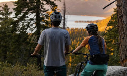
North Lake Tahoe Is a Cycling Paradise
Sep 27, 2023 from pinkbike.com
From cruising through town to shredding in the mountains. [I]Presented by North Lake Tahoe.[/I]
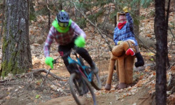
Video: How the Grinch (Almost) Ruined MTB Christmas
Dec 24, 2019 from pinkbike.com
Don't be like the Grinch, tune-up your trail etiquette in a cinch.
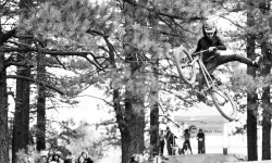
Video & Report: Racing and Slopestyle for All at the Little Big Bike Festival
Oct 23, 2019 from pinkbike.com
Blue slope courses and loads of kids' events make the Little Big Bike Festival suitable for everyone.

Video: Melamed, Gauvin, Lanthier Nadeau & Ostroski Take on America in Episode 5 of 'The Jank Files'
Sep 6, 2019 from pinkbike.com
The combination of moon dust and boulders at Northstar meant staying upright was a gamble on every stage.
Sub Regions
- Grass Valley (30)
- Grass Valley (11)
- Loma Rica Ranch (1)
- Lake Of The Pines (1)
- Nevada City (190)
- North San Juan (1)
- Penn Valley (13)
- Rough and Ready (1)
- Truckee (719)
- 16 Acre Forest (7)
- Armstrong Urban Trails (8)
- Big Chief (12)
- Boreal Mountain Resort (6)
- Canyon Springs (0)
- Castle Peak (25)
- Coldstream Canyon (20)
- Donkey Town (7)
- Donner Memorial State Park (35)
- Donner Summit (20)
- Elizabethtown Meadows (2)
- Five Creeks (16)
- Glenshire Neighborhood Trails (38)
- Independence Lake Preserve (2)
- Johnson Canyon (8)
- Lower Carpenter Valley (9)
- Northstar at Tahoe Resort (68)
- Prosser Hill (58)
- Royal Gorge (47)
- Sawtooth (51)
- Sugar Bowl (17)
- Summit Lakes (2)
- Tahoe Donner (114)
- Truckee Bike Park (7)
- Truckee River Canyon (15)
- Truckee Urban Trails (14)
- Waddle Ranch Preserve (20)
- Washington (3)
- Fordyce (8)
- Yuba Gap (4)
Popular Nevada County Mountain Biking Trails
• 100 ★ 4.6 • 2 miles • 81 ft • 2,660 •
Multi-User 2 WAY TRAIL with bike friendly design. Yield to uphill travel! While most bikes ride down it and loop to the top by going left or right at the bottom, it is not a one-way trail and you will encounter bikes, hikers and horses...
• 100 ★ 4.9 • 1,837 ft • 42 ft • 2,446 •
Loop to the top of Point with berms and jumps. Makeshift rest area at top. The loop strongly runs clockwise.
• 100 ★ 4.8 • 2 miles • 16 ft • 2,190 •
New was made during the 2013 season. It is now mostly wooden features with the occasional jump and some rocks. A very technical riding trail.
• 100 ★ 4.4 • 3 miles • 118 ft • 2,177 •
Pretty fun trail. Primarily ridden downhill, but open to uphill traffic (who have the right of way). Best way up is on the road, though. And best karma.
• 100 ★ 4.7 • 2 miles • 7 ft • 2,163 •
Northstar's signature jump trail. ADAPTIVE MTB INFO Rating: aMTB1 - No Obstacles Exist - Expert Only This is a fast DH trail with features, including off-camber berms
• 100 ★ 4.3 • 2,661 ft • 0 ft • 2,157 •
The main way down from mid mountain to the village. It has a bunch of fun jumps and wooden burms to ride. At the top (a green) splits off to the left. Half way down Lift line (blue) heads off on the left and (blue) to the right....
• 100 ★ 3.4 • 1,919 ft • 125 ft • 2,046 •
Popular blue difficulty singletrack. This mountain bike primary trail can be used uphill primary and has a moderate overall physical rating with a 125 ft blue climb. On average it takes 5 minutes to complete this trail.
Nevada County Mountain Bike Routes
★ 4.5 • 13 miles • 1,190 ft • 11 • Loop •
This is a great loop that gets you all the goods Sawtooth ridge has to offer. Starting off at the Thelin...
★ 4.5 • 4 miles • 701 ft • 3 • Loop •
The standard jackass loop route for the 2020 season.
★ 4.0 • 15 miles • 1,946 ft • 2 • Loop •
Climb road drop trail. Mostly drop but definitely pedally and a little climbing on the "descent". Although...
★ 5.0 • 10 miles • 657 ft • 7 • Loop •
This route should take 1-2 hours on an e-bike or 90 minutes to 3 hours with no pedal assist. Great route...
★ 3.7 • 8 miles • 999 ft • 22 • Loop •
I discovered that this sequence (Motherlode > Fool's Gold > Sidewinder) gives an incredible series...
Photos of Nevada County Mountain Bike
Videos of Nevada County Mountain Bike
featured
![The Little Big 2013]()
5:27 |
2619 |
Jul 21, 2014
0:07 |
4 |
May 27, 2026
trail: Talon Show
6:48 |
10 |
Jul 30, 2025
trail: Shimmer
3:21 |
12 |
Jul 30, 2025
trail: Scotts Flat Trail
0:07 |
|
Sep 13, 2024

trail: Scotts Flat Trail
0:07 |
49 |
Sep 9, 2024
trail: Karpiel (Upper)
0:10 |
|
Jul 19, 2024
trail: Martis
3:18 |
21 |
Apr 11, 2024
Current Trail Warnings
| status | trail | date | condition | user | info |
|---|---|---|---|---|---|
| Taxi Cab Harmony/Washington Ridge | Jun 20, 2026 @ 11:22am (America/Boise) 3 days | Very Dry | jacobrian | E-Bike Thistles. So many thistles. Overgrown... | |
| Upper Aster Royal Gorge | May 25, 2026 @ 2:37pm (America/Los_Angeles) May 25, 2026 | Dry | Jmagik172 | 4 large trees down. | |
| Razorback/Claim Jumper Connector Royal Gorge | May 25, 2026 @ 2:36pm (America/Los_Angeles) May 25, 2026 | Variable | Jmagik172 | 3 large trees down. |
Recent Trail Reports
Activity Feed
| username | action | type | title | date |
|---|---|---|---|---|
| LindsO | wishlist | route | activity #97599026 | Jun 22, 2026 @ 7:08pm 12 hours |
| essimike | wishlist | trail | activity #97596545 | Jun 22, 2026 @ 6:11pm 13 hours |
| mellokristen | wishlist | route | activity #97594324 | Jun 22, 2026 @ 5:28pm 14 hours |
| MattRGQW5 | wishlist | route | activity #97593074 | Jun 22, 2026 @ 5:04pm 14 hours |
| MattRGQW5 | ridden | route | activity #97592453 | Jun 22, 2026 @ 4:51pm 14 hours |
Recent Comments
| username | type | title | comment | date |
|---|---|---|---|---|
| trail | Ripping new section of trail. Go ride ‘em... | Jun 11, 2026 @ 10:02pm Jun 11, 2026 | ||
| trail | Do not ride this trail. I ride it on 6/8/26 bc... | Jun 8, 2026 @ 8:01pm Jun 8, 2026 | ||
| trail | Please be aware that the Truckee Trails and... | Jun 7, 2026 @ 5:21pm Jun 7, 2026 | ||
| report | There is lots of signage at the top and not... | Jun 1, 2026 @ 4:26pm Jun 1, 2026 | ||
| trail | Mostly impassable from the south. Downed trees... | May 31, 2026 @ 2:17pm May 31, 2026 |
Local Badges
-

Climbing 10k Badge1 awarded -

Epic Mountain Bike Climb 2k1 awarded -
Epic Mountain Bike Climb 2k0 awarded -
Climbing 10k Badge4 awarded -

Completionist0 awarded -

Mountain Biking 100k Badge0 awarded
Bike & Skill Parks
| name | type | city | rating |
|---|---|---|---|
| Northstar at Tahoe Resort | bike park | Truckee | |
| Boreal Mountain Resort | bike park | Truckee | |
| Sugar Bowl | bike park | Truckee | |
| Donner Ski Ranch | bike park | Truckee | |
| Tahoe Donner Ski Area | bike park | Truckee |
Upcoming Local Events
Local Products
Local Products
Activity Type Stats
| activitytype | trails | distance | descent | descent distance | total vertical | rating | global rank | state rank | photos | reports | routes | ridelogs |
|---|---|---|---|---|---|---|---|---|---|---|---|---|
| Mountain Bike | 1,000 | 1,143 miles | 170,436 ft | 511 miles | 8,934 ft | 2,563 | 7,547 | 126 | 172,073 | |||
| E-Bike | 492 | 655 miles | 95,745 ft | 299 miles | 8,875 ft | 42 | 6,002 | 17 | 17,261 | |||
| Gravel Bike | 119 | 153 miles | 13,963 ft | 54 miles | 6,293 ft | 821 | 10 | 641 | ||||
| Adaptive Bike | 5 | 11 | 8 | |||||||||
| Winter Fat Bike | 5 | 35 | 13 | |||||||||
| Horse | 558 | 689 miles | 90,840 ft | 288 miles | 8,684 ft | 2,564 | 9 | 95 | ||||
| Hike | 973 | 1,180 miles | 165,850 ft | 514 miles | 8,934 ft | 187 | 7,293 | 24 | 14,194 | |||
| Trail Running | 964 | 1,168 miles | 162,703 ft | 508 miles | 8,934 ft | 2 | 7,260 | 20 | 17,025 | |||
| Dirtbike/Moto | 124 | 294 miles | 35,207 ft | 124 miles | 7,408 ft | 25 | 1,336 | 2 | 576 | |||
| Observed Trials | 22 | 64 miles | 7,776 ft | 30 miles | 3,048 ft | 211 | 107 | |||||
| ATV/ORV/OHV | 84 | 195 miles | 18,901 ft | 73 miles | 5,154 ft | 1,225 | 1 | 58 | ||||
| Snowmobile | 19 | 54 miles | 5,702 ft | 21 miles | 2,881 ft | 190 | 1 | 22 | ||||
| Snowshoe | 22 | 44 miles | 4,580 ft | 17 miles | 5,715 ft | 142 | 2 | 1,091 | ||||
| Downhill Ski | 309 | 110 miles | 92,497 ft | 104 miles | 2,215 ft | 2 | 67 | 11,143 | ||||
| Backcountry Ski | 24 | 30 miles | 8,635 ft | 10 miles | 4,665 ft | 102 | 5,815 | |||||
| Nordic Ski | 186 | 116 miles | 13,241 ft | 52 miles | 1,385 ft | 2 | 126 | 1 | 10,734 |
Frequently Asked Questions About Nevada County
▼
What are the best places to ride in Nevada County?
Nevada County has 51 areas to explore for mountain biking. The top rated areas are:
▼
What are the highest rated mountain biking trails in Nevada County?
The highest rated mountain biking trails in Nevada County are:
- Donkey Town Trail (aka "Jackass") (4.6/5)
- Gypsy (4.6/5)
- Shimmer (4.6/5)
- Woodsplitter Jump Trail (4.6/5)
- Jackass Point (4.6/5)
▼
What is the best time of the year to ride in Nevada County?
Based on ride log data, the most popular months to ride in Nevada County are:
- July (3,189 activities)
- June (2,196 activities)
- August (1,887 activities)
▼
What is the longest trail in Nevada County?
The longest trail in Nevada County is Pines to Mines at 21.3 miles. View all trails sorted by distance.
Activities
- Nevada County Mountain Biking Trails
- Nevada County E-Biking Trails
- Nevada County Gravel Biking Trails
- Nevada County Horseback Trails
- Nevada County Hiking Trails
- Nevada County Trail Running Trails
- Nevada County Dirtbiking Trails
- Nevada County Observed Trials Trails
- Nevada County ATVing/Offroading Trails
- Nevada County Snowmobiling Trails
- Nevada County Snowshoeing Trails
- Nevada County Skiing Trails
- Nevada County Backcountry Skiing Trails
- Nevada County Nordic Skiing Trails
Trails
Points of Interest
- Bill & Flora's Point Viewpoint
- Environmental Camp Camping
- Skiliman Campground Camping
- Inn Town Campground Camping
- Cross Country, Telemark & Snowshoe Center Lodge
- Caboose Hut Cabin
- View of Tahoe Lake Viewpoint
- Norhstar California Resort Lodge
- Auburn Ski Club Lodge
- Wildy Hut Cabin
- Mount Lola (9,137 ft)
- Castle Peak (9,098 ft)
- Basin Peak (9,019 ft)
- By brenthillier
 NSMBA TRAILFORKS & contributors
 - Admins: jpmcghee, sanfret, brianpetry, TheAngryTomato, BONC, TTF, LC, elikat715, Redhawk, dgoldsmith
- #7908 - 19,611 views
- nevada county activity log | embed map of Nevada County mountain bike trails | nevada county mountain biking points of interest polygons
Downloading of trail gps tracks in kml & gpx formats is enabled for Nevada County.
You must login to download files.