close
-
Layers w
- Weather Layers
- Pro
- Pro
- Pro
- Pro
- Pro
- Pro
- More Layers
- Pro
- Pro
- Pro
- Pro
-
Upgrade to

3D
Trail Conditions
- Unknown
- Snow Groomed
- Snow Packed
- Snow Covered
- Snow Cover Partial
- Freeze/thaw Cycle
- Icy
- Prevalent Mud
- Wet
- Variable
- Ideal
- Dry
- Very Dry
Trail Flow (Ridden Direction)
Trailforks scans users ridelogs to determine the most popular direction each trail is ridden. A good flowing trail network will have most trails flowing in a single direction according to their intension.
The colour categories are based on what percentage of riders are riding a trail in its intended direction.
The colour categories are based on what percentage of riders are riding a trail in its intended direction.
- > 96%
- > 90%
- > 80%
- > 70%
- > 50%
- < 50%
- bi-directional trail
- no data
Trail Last Ridden
Trailforks scans ridelogs to determine the last time a trail was ridden.
- < 2 days
- < 1 week
- < 2 weeks
- < 1 month
- < 6 months
- > 6 months
Trail Ridden Direction
The intended direction a trail should be ridden.
- Downhill Only
- Downhill Primary
- Both Directions
- Uphill Primary
- Uphill Only
- One Direction
Contribute Details
Colors indicate trail is missing specified detail.
- Description
- Photos
- Description & Photos
- Videos
Trail Popularity ?
Trailforks scans ridelogs to determine which trails are ridden the most in the last 9 months.
Trails are compared with nearby trails in the same city region with a possible 25 colour shades.
Think of this as a heatmap, more rides = more kinetic energy = warmer colors.
- most popular
- popular
- less popular
- not popular
ATV/ORV/OHV Filter
Max Vehicle Width
inches
US Cell Coverage
Legend

Radar Time
Activity Recordings
Trailforks uses anonymized public activity data.
?
Activity Recordings
Trailforks uses anonymized public activity data.
?
Personal Heatmap
▶
Activity Types
all
/
none
▶
Options
2
Date range
month
–
Winter Trails
Warning
A routing network for winter maps does not exist. Selecting trails using the winter trails layer has been disabled.
Missing Trails
Most Popular
Least Popular
Trails are colored based on popularity. The more popular a trail is, the more red. Less popular trails trend towards green.
Jump Magnitude Heatmap
Heatmap of where riders jump on trails. Zoom in to see individual jumps, click circles to view jump details.
BC Backroad Status
![map legend]()
Service Road Atlas is a free to use, community-driven service for viewing and creating reports on the numerous back-country service roads around B.C. and Alberta.

Slope Aspect
Direction the slope faces
Trails Deemphasized
Trails are shown in grey.
Only show trails with no bike usage.
Suggested Layers
Based on selected activity type
Save the current map location and zoom level as your default home location whenever this page is loaded.
Save
No description for New Hill has been added yet!
Login or register to submit one.
Activities Click to view
- Mountain Bike
17 trails
- E-Bike
16 trails
- Adaptive Bike
0 trails
- Hike
6 trails
- Trail Running
6 trails
Region Details
- 2
- 1
- 2
- 7
- 4
- 1
Region Status
Open as of 1 dayStats
- Avg Trail Rating
- Trails (view details)
- 21
- Trails Mountain Bike
- 17
- Trails E-Bike
- 16
- Trails Horse
- 1
- Trails Hike
- 6
- Trails Trail Running
- 6
- Total Distance
- 37 miles
- Total Descent Distance
- 15 miles
- Total Descent
- 1,112 ft
- Total Vertical
- 161 ft
- Highest Trailhead
- 380 ft
- Reports
- 10,418
- Photos
- 21
- Ridden Counter
- 8,100
Sub Regions
-
Harris Lake County Park
- 2
- 5
- 4
- 1
Popular New Hill Mountain Biking Trails
• 100 ★ 4.5 • 968 ft • 0 ft • 648 •
A short trail filled with , lots of tabletops, rollers, and berms. The longer you go the bigger the tabletops are until the end which is filled with rollers.
• 90 ★ 4.5 • 2 miles • 116 ft • 612 •
Hog Run (advanced section) ~ 5 miles The advanced sections are identified by red circles. They offer the longest ride as they are made up of a series of sections that offer different routes and more challenges to the more skilled riders.
• 75 ★ 3.7 • 3,373 ft • 17 ft • 581 •
Hog Run (beginner loop) ~ .7 miles The beginner loop starts at the main trail head and is identified by blue circles. This loop is designed to give those riders just starting out a taste of mountain biking. The terrain is relatively...
• 70 ★ 3.6 • 735 ft • 6 ft • 476 •
This is the outer loop of the skills park. The return line is closest to the parking lot.
• 90 ★ 4.7 • 3,064 ft • 15 ft • 465 •
Popular black diamond difficulty singletrack. This mountain bike primary trail can be used both directions. On average it takes 4 minutes to complete this trail.
• 95 ★ 5.0 • 1 mile • 59 ft • 464 •
Popular black diamond difficulty singletrack. This mountain bike primary trail can be used both directions. On average it takes 5 minutes to complete this trail.
• 80 ★ 5.0 • 3,432 ft • 36 ft • 367 •
Popular blue difficulty singletrack. This mountain bike primary trail can be used both directions and has a hard overall physical rating with a 36 ft black diamond climb. On average it takes 4 minutes to complete this trail.
• 85 ★ 3.0 • 1 mile • 53 ft • 364 •
Popular black diamond difficulty singletrack. This mountain bike primary trail can be used both directions. On average it takes 8 minutes to complete this trail.
New Hill Mountain Bike Routes
★ 4.0 • 7 miles • 347 ft • 11 • Loop •
Hog Run Trail outer loop at Harris Lake taken CCW.
Photos of New Hill Mountain Bike
Videos of New Hill Mountain Bike
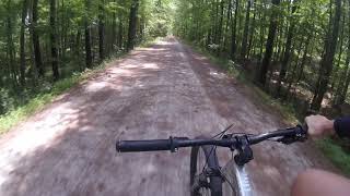
trail: American Tobacco
2:18 |
437 |
Jul 19, 2019 , New Hill
Recent Trail Reports
| status | trail | date | condition | info | user |
|---|---|---|---|---|---|
| West Section (Advanced) | Jun 24, 2026 @ 1:01pm (America/New_York) 1 day | Unknown | HarrisLake Harris Lake | ||
| Step box line | Jun 24, 2026 @ 1:01pm (America/New_York) 1 day | Unknown | HarrisLake Harris Lake | ||
| South Section (Advanced) | Jun 24, 2026 @ 1:01pm (America/New_York) 1 day | Unknown | HarrisLake Harris Lake | ||
| Skills Area Access (N) | Jun 24, 2026 @ 1:01pm (America/New_York) 1 day | Unknown | HarrisLake Harris Lake | ||
| Skill Park Connector | Jun 24, 2026 @ 1:01pm (America/New_York) 1 day | Unknown | HarrisLake Harris Lake | ||
| North Section (Advanced) | Jun 24, 2026 @ 1:01pm (America/New_York) 1 day | Unknown | HarrisLake Harris Lake | ||
| Inner Loop B | Jun 24, 2026 @ 1:01pm (America/New_York) 1 day | Unknown | HarrisLake Harris Lake | ||
| Inner Loop A | Jun 24, 2026 @ 1:01pm (America/New_York) 1 day | Unknown | HarrisLake Harris Lake | ||
| Hog Run Paved Parking Access | Jun 24, 2026 @ 1:01pm (America/New_York) 1 day | Unknown | HarrisLake Harris Lake | ||
| Hog Run Parking Access | Jun 24, 2026 @ 1:01pm (America/New_York) 1 day | Unknown | HarrisLake Harris Lake |
Activity Feed
| username | action | type | title | date |
|---|---|---|---|---|
| HarrisLake | add | report | activity #97705981 and 17 more | Jun 24, 2026 @ 10:01am 1 day |
| HarrisLake | add | report | activity #97637869 and 17 more | Jun 23, 2026 @ 10:43am 2 days |
| HarrisLake | add | report | activity #97381776 and 17 more | Jun 20, 2026 @ 4:42am Jun 20, 2026 |
| HarrisLake | add | report | activity #97310149 and 17 more | Jun 19, 2026 @ 5:37am Jun 19, 2026 |
| aumaitrem | wishlist | region | activity #96860415 | Jun 13, 2026 @ 3:55am Jun 13, 2026 |
Recent Comments
| username | type | title | comment | date |
|---|---|---|---|---|
| report | Hiking in smoky mountains Bryson city nc | Oct 31, 2025 @ 10:37am Oct 31, 2025 | ||
| trail | This is the hardest section of Harris Lake but... | Oct 9, 2023 @ 10:09am Oct 9, 2023 | ||
| trail | This is a beginner/intermediate trail. It is... | Oct 9, 2023 @ 10:08am Oct 9, 2023 | ||
| trail | This is a beginner trail. There is absolutely... | Oct 9, 2023 @ 9:57am Oct 9, 2023 | ||
| trail | Very mellow, winds through the trees,... | May 21, 2022 @ 7:51am May 21, 2022 |
Local Badges
-

Epic Ride Climb 2k3 awarded -

Climbing 10k Badge35 awarded -

Climbing 100k Badge0 awarded -

Epic Ride Descent 2k2 awarded -

Descent 10k Badge35 awarded -

Descent 100k Badge0 awarded
Bike & Skill Parks
| name | type | city | rating |
|---|---|---|---|
| HLCP Skill Park | skill park | New Hill |
Activity Type Stats
| activitytype | trails | distance | descent | descent distance | total vertical | rating | global rank | state rank | photos | reports | routes | ridelogs |
|---|---|---|---|---|---|---|---|---|---|---|---|---|
| Mountain Bike | 17 | 32 miles | 994 ft | 14 miles | 157 ft | #2,039 | #739 | 21 | 10,418 | 1 | 12,720 | |
| E-Bike | 16 | 32 miles | 935 ft | 14 miles | 157 ft | #3,993 | #1,329 | 8,777 | 1 | 342 | ||
| Horse | 1 | 22 miles | 440 ft | 10 miles | 144 ft | 61 | ||||||
| Hike | 6 | 27 miles | 614 ft | 11 miles | 161 ft | #7,075 | #2,505 | 10,380 | 310 | |||
| Trail Running | 6 | 27 miles | 614 ft | 11 miles | 161 ft | #6,980 | #2,296 | 10,380 | 100 |
Frequently Asked Questions About New Hill
▼
What are the best places to ride in New Hill?
New Hill has 1 areas to explore for mountain biking. The top rated areas are:
▼
What are the highest rated mountain biking trails in New Hill?
The highest rated mountain biking trails in New Hill are:
- North Section (Advanced) (4.3/5)
- South Section (Advanced) (4.2/5)
- American Tobacco (4.2/5)
- Flow Trail (4.2/5)
- East Section (Advanced) (4.2/5)
▼
What is the best time of the year to ride in New Hill?
Based on ride log data, the most popular months to ride in New Hill are:
- July (69 activities)
- October (68 activities)
- September (61 activities)
▼
Where can I park to ride in New Hill?
There are 8 parking locations listed in New Hill. The most popular parking spots are: View all parking and trailhead locations on the map to plan your visit.
Activities
- By markholloway
 Trailforks Map Team & contributors
 - Admins: FritzNeal, TORC
- #10921 - 3,678 views
- new hill activity log | embed map of New Hill mountain bike trails | new hill mountain biking points of interest
Downloading of trail gps tracks in kml & gpx formats is enabled for New Hill.
You must login to download files.