close
-
Layers w
- Weather Layers
- Pro
- Pro
- Pro
- Pro
- Pro
- Pro
- More Layers
- Pro
- Pro
- Pro
- Pro
-
Upgrade to

3D
Trail Conditions
- Unknown
- Snow Groomed
- Snow Packed
- Snow Covered
- Snow Cover Partial
- Freeze/thaw Cycle
- Icy
- Prevalent Mud
- Wet
- Variable
- Ideal
- Dry
- Very Dry
Trail Flow (Ridden Direction)
Trailforks scans users ridelogs to determine the most popular direction each trail is ridden. A good flowing trail network will have most trails flowing in a single direction according to their intension.
The colour categories are based on what percentage of riders are riding a trail in its intended direction.
The colour categories are based on what percentage of riders are riding a trail in its intended direction.
- > 96%
- > 90%
- > 80%
- > 70%
- > 50%
- < 50%
- bi-directional trail
- no data
Trail Last Ridden
Trailforks scans ridelogs to determine the last time a trail was ridden.
- < 2 days
- < 1 week
- < 2 weeks
- < 1 month
- < 6 months
- > 6 months
Trail Ridden Direction
The intended direction a trail should be ridden.
- Downhill Only
- Downhill Primary
- Both Directions
- Uphill Primary
- Uphill Only
- One Direction
Contribute Details
Colors indicate trail is missing specified detail.
- Description
- Photos
- Description & Photos
- Videos
Trail Popularity ?
Trailforks scans ridelogs to determine which trails are ridden the most in the last 9 months.
Trails are compared with nearby trails in the same city region with a possible 25 colour shades.
Think of this as a heatmap, more rides = more kinetic energy = warmer colors.
- most popular
- popular
- less popular
- not popular
ATV/ORV/OHV Filter
Max Vehicle Width
inches
US Cell Coverage
Legend

Radar Time
Activity Recordings
Trailforks uses anonymized public activity data.
?
Activity Recordings
Trailforks uses anonymized public activity data.
?
Personal Heatmap
▶
Activity Types
all
/
none
▶
Options
2
Date range
month
–
Winter Trails
Warning
A routing network for winter maps does not exist. Selecting trails using the winter trails layer has been disabled.
Missing Trails
Most Popular
Least Popular
Trails are colored based on popularity. The more popular a trail is, the more red. Less popular trails trend towards green.
Jump Magnitude Heatmap
Heatmap of where riders jump on trails. Zoom in to see individual jumps, click circles to view jump details.
BC Backroad Status
![map legend]()
Service Road Atlas is a free to use, community-driven service for viewing and creating reports on the numerous back-country service roads around B.C. and Alberta.

Slope Aspect
Direction the slope faces
Trails Deemphasized
Trails are shown in grey.
Only show trails with no bike usage.
Suggested Layers
Based on selected activity type
Save the current map location and zoom level as your default home location whenever this page is loaded.
Save
No description for Newark has been added yet!
Login or register to submit one.
Activities Click to view
- Mountain Bike
33 trails
- E-Bike
26 trails
- Adaptive Bike
0 trails
- Horse
11 trails
- Hike
64 trails
- Trail Running
67 trails
Region Details
- 11
- 1
- 5
- 6
- 6
- 3
Region Status
Open as of Jun 13, 2026Stats
- Avg Trail Rating
- Trails (view details)
- 36
- Trails Mountain Bike
- 43
- Trails E-Bike
- 26
- Trails Horse
- 11
- Trails Hike
- 67
- Trails Trail Running
- 67
- Total Distance
- 24 miles
- Total Descent
- 5,758 ft
- Total Vertical
- 335 ft
- Highest Trailhead
- 1,084 ft
- Reports
- 209
- Photos
- 30
- Ridden Counter
- 6,429
Sub Regions
-
Blackhand Gorge State Nature Preserve
- 1
-
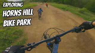
Horns Hill Park
- 6
- 6
- 6
- 3
Popular Newark Mountain Biking Trails
• 95 ★ 5.0 • 2,165 ft • 0 ft • 321 •
Rebuilt early 2023 -- Beginner to intermediate flow trail that you can ride as slow or as fast as you want. Large berms; table top jumps; on-off pad; watch the high-side of the trail for optional lines. This is a great progression trail
• 90 ★ 4.6 • 1,804 ft • 0 ft • 297 •
An advanced trail with optional wood drop at the start; medium-sized jumps that can be rolled; a few loose, rutted sections; an optional gap jump; ending with a steep root section to a fast exit.
• 65 ★ 4.5 • 1,811 ft • 0 ft • 290 •
An advanced trail with large doubles; some tight singletrack; machine built flow; and a steep, loose, rocky and rooty tech section at the end.
• 70 ★ 4.5 • 2,352 ft • 3 ft • 266 •
Popular green difficulty machine groomed. This mountain bike primary trail can be used downhill only and has a moderate overall physical rating with a 3 ft green climb. It features berm and jump. Trail visibility is always easy to follow. On average it takes 2 minutes to complete this trail.
• 55 ★ 5.0 • 2,110 ft • 6 ft • 257 •
A very fun flowing machine trail with huge berms and rollable jumps the whole way down. Blue because everything can be ridden around but depending on the rider's skills you can make it black by hitting the many gap jumps throughout.
• 80 ★ 4.5 • 1,394 ft • 100 ft • 255 •
Climb trail to access Slim Shady jump trail and Jurassic flow trail
• 85 ★ 4.9 • 2,766 ft • 0 ft • 248 •
A super fun trail at Horns Hill with a good mix of technical single track, machine built berms, table top jumps, drops, and steep tech at the end.
• 50 ★ 5.0 • 1,906 ft • 0 ft • 238 •
Moderately popular green difficulty machine groomed. This mountain bike primary trail can be used downhill only and has a moderate overall physical rating with a 0 ft green climb. It features berm and jump. Trail visibility is always easy to follow. On average it takes 2 minutes to complete this trail.
Newark Mountain Bike Routes
1 mile • 245 ft • 2 • Loop •
★ 5.0 • 8 miles • 1,734 ft • 18 • Loop • Race •
Race course for the Horns Hill FUNduro in 2022. Stage 1: (Novice Only) Stage 2: > Lower Deez Ruts >...
• 14 miles • 2,623 ft • 38 •
• 14 miles • 5,254 ft • 70 •
• 22 miles • 4,943 ft • 62 •
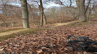
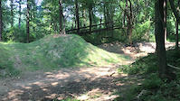
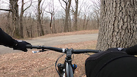
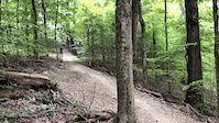
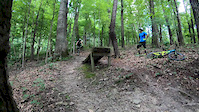
Photos of Newark Mountain Bike


Recent Trail Reports
| status | trail | date | condition | info | user |
|---|---|---|---|---|---|
| Dog Bone | Jun 13, 2026 @ 5:20pm (America/New_York) Jun 13, 2026 | Ideal | Tamling | ||
| Backroad/Climbing Connector | Jun 13, 2026 @ 5:20pm (America/New_York) Jun 13, 2026 | Ideal | Tamling | ||
| Eight Mile | Jun 13, 2026 @ 5:20pm (America/New_York) Jun 13, 2026 | Ideal | Tamling | ||
| Playground Loop | Jun 13, 2026 @ 5:20pm (America/New_York) Jun 13, 2026 | Ideal | Tamling | ||
| Blackhand Trail | Apr 7, 2026 @ 12:04am (America/New_York) Apr 6, 2026 | Unknown | dcesnak | ||
| Joyride | Aug 22, 2025 @ 7:55am Aug 22, 2025 | Ideal | breckbike | ||
| Shuttle Return Path | Aug 22, 2025 @ 7:55am Aug 22, 2025 | Ideal | breckbike | ||
| Pro DH | Aug 22, 2025 @ 7:55am Aug 22, 2025 | Ideal | breckbike | ||
| Drop In | Aug 22, 2025 @ 7:55am Aug 22, 2025 | Ideal | breckbike | ||
| Gaunltet | Aug 22, 2025 @ 7:55am Aug 22, 2025 | Ideal | breckbike |
Activity Feed
| username | action | type | title | date |
|---|---|---|---|---|
| Tamling | add | report | activity #96956392 and 3 more | Jun 14, 2026 @ 5:03am Jun 14, 2026 |
| DougYGXw9B | wishlist | region | activity #96548535 | Jun 8, 2026 @ 10:19am Jun 8, 2026 |
| Mimedina | ridden | trail | activity #93535365 | Apr 27, 2026 @ 12:50pm Apr 27, 2026 |
| Mimedina | wishlist | trail | activity #93535363 | Apr 27, 2026 @ 12:50pm Apr 27, 2026 |
| dcesnak | add | report | activity #92097582 | Apr 6, 2026 @ 9:04pm Apr 6, 2026 |
Recent Comments
| username | type | title | comment | date |
|---|---|---|---|---|
| trail | Ouch!!! Bring full gloves. The thorny bushes... | Aug 15, 2025 @ 7:41am Aug 15, 2025 | ||
| trail | awesome trail, | Aug 2, 2023 @ 7:58am Aug 2, 2023 | ||
| trail | Awesome easy ride and can get good speed | Aug 2, 2023 @ 7:57am Aug 2, 2023 | ||
| trail | workin on it | Dec 14, 2020 @ 6:11pm Dec 14, 2020 | ||
| trail | The map of these trails is completely wrong.... | May 24, 2020 @ 4:55pm May 24, 2020 |
Local Badges
-

Epic Ride Climb 2k16 awarded -

Climbing 10k Badge35 awarded -

Climbing 100k Badge1 awarded -

Epic Ride Descent 2k16 awarded -

Descent 10k Badge35 awarded -

Descent 100k Badge1 awarded
Bike & Skill Parks
| name | type | city | rating |
|---|---|---|---|
| Briarcliff MX | skill park | Newark |
Activity Type Stats
| activitytype | trails | distance | descent | descent distance | total vertical | rating | global rank | state rank | photos | reports | routes | ridelogs |
|---|---|---|---|---|---|---|---|---|---|---|---|---|
| Mountain Bike | 33 | 18 miles | 4,383 ft | 10 miles | 331 ft | #2,254 | #806 | 37 | 342 | 3 | 4,271 | |
| E-Bike | 26 | 13 miles | 2,920 ft | 7 miles | 331 ft | #3,846 | #1,294 | 321 | 2 | 587 | ||
| Horse | 11 | #2,752 | #1,526 | 3 | 1 | |||||||
| Hike | 64 | 16 miles | 3,018 ft | 7 miles | 335 ft | #5,214 | #1,839 | 325 | 81 | |||
| Trail Running | 67 | 16 miles | 3,018 ft | 7 miles | 335 ft | #6,100 | #1,961 | 325 | 21 |
Frequently Asked Questions About Newark
▼
What are the best places to ride in Newark?
Newark has 7 areas to explore for mountain biking. The top rated areas are:
▼
What are the highest rated mountain biking trails in Newark?
The highest rated mountain biking trails in Newark are:
- Radioactive (4.4/5)
- Enduro Flow (4.4/5)
- Dog Bone (4.4/5)
- Joyride (4.3/5)
- Gaunltet (4.3/5)
▼
What is the best time of the year to ride in Newark?
Based on ride log data, the most popular months to ride in Newark are:
- May (67 activities)
- July (58 activities)
- October (55 activities)
▼
Where can I park to ride in Newark?
Activities
Trails
Points of Interest
- By swampboy62 & contributors
- Admins: COMBO
- #6082 - 4,805 views
- newark activity log | embed map of Newark mountain bike trails | newark mountain biking points of interest
Downloading of trail gps tracks in kml & gpx formats is enabled for Newark.
You must login to download files.