close
-
Layers w
- Weather Layers
- Pro
- Pro
- Pro
- Pro
- Pro
- Pro
- More Layers
- Pro
- Pro
- Pro
- Pro
-
Upgrade to

3D
Trail Conditions
- Unknown
- Snow Groomed
- Snow Packed
- Snow Covered
- Snow Cover Partial
- Freeze/thaw Cycle
- Icy
- Prevalent Mud
- Wet
- Variable
- Ideal
- Dry
- Very Dry
Trail Flow (Ridden Direction)
Trailforks scans users ridelogs to determine the most popular direction each trail is ridden. A good flowing trail network will have most trails flowing in a single direction according to their intension.
The colour categories are based on what percentage of riders are riding a trail in its intended direction.
The colour categories are based on what percentage of riders are riding a trail in its intended direction.
- > 96%
- > 90%
- > 80%
- > 70%
- > 50%
- < 50%
- bi-directional trail
- no data
Trail Last Ridden
Trailforks scans ridelogs to determine the last time a trail was ridden.
- < 2 days
- < 1 week
- < 2 weeks
- < 1 month
- < 6 months
- > 6 months
Trail Ridden Direction
The intended direction a trail should be ridden.
- Downhill Only
- Downhill Primary
- Both Directions
- Uphill Primary
- Uphill Only
- One Direction
Contribute Details
Colors indicate trail is missing specified detail.
- Description
- Photos
- Description & Photos
- Videos
Trail Popularity ?
Trailforks scans ridelogs to determine which trails are ridden the most in the last 9 months.
Trails are compared with nearby trails in the same city region with a possible 25 colour shades.
Think of this as a heatmap, more rides = more kinetic energy = warmer colors.
- most popular
- popular
- less popular
- not popular
ATV/ORV/OHV Filter
Max Vehicle Width
inches
US Cell Coverage
Legend

Radar Time
Activity Recordings
Trailforks uses anonymized public activity data.
?
Activity Recordings
Trailforks uses anonymized public activity data.
?
Personal Heatmap
▶
Activity Types
all
/
none
▶
Options
2
Date range
month
–
Winter Trails
Warning
A routing network for winter maps does not exist. Selecting trails using the winter trails layer has been disabled.
Missing Trails
Most Popular
Least Popular
Trails are colored based on popularity. The more popular a trail is, the more red. Less popular trails trend towards green.
Jump Magnitude Heatmap
Heatmap of where riders jump on trails. Zoom in to see individual jumps, click circles to view jump details.
BC Backroad Status
![map legend]()
Service Road Atlas is a free to use, community-driven service for viewing and creating reports on the numerous back-country service roads around B.C. and Alberta.

Slope Aspect
Direction the slope faces
Trails Deemphasized
Trails are shown in grey.
Only show trails with no bike usage.
Suggested Layers
Based on selected activity type
Save the current map location and zoom level as your default home location whenever this page is loaded.
Save
No description for Newburgh has been added yet!
Login or register to submit one.
Activities Click to view
- Mountain Bike
112 trails
- E-Bike
21 trails
- Gravel Bike
0 trails
- Adaptive Bike
0 trails
- Winter Fat Bike
0 trails
- Horse
17 trails
- Hike
115 trails
- Trail Running
105 trails
- Dirtbike/Moto
0 trails
- Snowmobile
16 trails
- Snowshoe
1 trails
- Nordic Ski
0 trails
Region Details
- 17
- 3
- 23
- 51
- 3
Region Status
Caution as of Jun 15, 2026Stats
- Avg Trail Rating
- Trails (view details)
- 101
- Trails Mountain Bike
- 112
- Trails E-Bike
- 21
- Trails Horse
- 17
- Trails Hike
- 115
- Trails Trail Running
- 105
- Trails Snowmobile
- 16
- Trails Snowshoe
- 1
- Total Distance
- 76 miles
- Total Descent
- 8,430 ft
- Total Vertical
- 764 ft
- Highest Trailhead
- 1,083 ft
- Reports
- 2,513
- Photos
- 193
- Ridden Counter
- 24,874
Sub Regions
-
Cronomer Hill Park - Upper Region
- 10
- 17
- 1
-
Stewart State Forest
- 3
- 12
- 37
- 1
Popular Newburgh Mountain Biking Trails
• 100 ★ 4.0 • 3,914 ft • 15 ft • 793 •
Popular green difficulty singletrack. This multi-use trail can be used downhill primary and has a moderate overall physical rating with a 15 ft blue climb. On average it takes 4 minutes to complete this trail.
• 100 ★ 4.2 • 5,226 ft • 57 ft • 747 •
Highly rated popular blue difficulty singletrack. This multi-use trail can be used both directions. On average it takes 6 minutes to complete this trail.
• 100 ★ 3.2 • 3,123 ft • 38 ft • 658 •
Popular blue difficulty singletrack. This multi-use trail can be used both directions. On average it takes 5 minutes to complete this trail.
• 100 ★ 3.5 • 2,484 ft • 21 ft • 618 •
Popular blue difficulty singletrack. This multi-use trail can be used both directions and has a moderate overall physical rating with a 21 ft green climb. Trail visibility is always easy to follow. On average it takes 3 minutes to complete this trail.
• 100 ★ 4.0 • 3,366 ft • 81 ft • 582 •
Highly rated popular blue difficulty singletrack. This multi-use trail can be used both directions with a 81 ft blue climb. On average it takes 6 minutes to complete this trail.
• 95 ★ 4.6 • 3,054 ft • 65 ft • 566 •
Highly rated popular blue difficulty singletrack. This multi-use trail can be used both directions and has a moderate overall physical rating with a 65 ft green climb. On average it takes 5 minutes to complete this trail.
• 95 ★ 3.6 • 1 mile • 121 ft • 555 •
Popular blue difficulty singletrack. This multi-use trail can be used both directions and has a hard overall physical rating with a 121 ft blue climb. It features rock garden. On average it takes 11 minutes to complete this trail.
Newburgh Mountain Bike Routes
15 miles • 463 ft • 11 • Point to Point •
I wanted to create a nice easy simple coarse.
7 miles • 269 ft • 3 • Loop •
Beginner Loop for a new rider who wants to ease into the sport
17 miles • 1,275 ft • 18 •
The funway. This route should be fast and fun. Drake's in. climb. to wilkens pond loop. downhill
20 miles • 941 ft • 11 •
Mainly clockwise route of just some of the great trials at Stewart. Fun and flowy!
★ 5.0 • 9 miles • 559 ft • 0 • Loop •
Mixed flow that darts in and out of main road. Includes some short technical climbs and some descents.
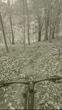
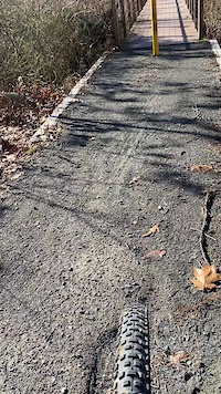
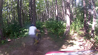
Photos of Newburgh Mountain Bike
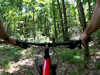
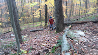
Videos of Newburgh Mountain Bike
trail: Pond Ridge Pucker Up
0:42 |
127 |
Jun 2, 2025
trail: Swamp Thing
0:59 |
130 |
Dec 1, 2020
trail: 3 Sisters
0:10 |
337 |
Jul 21, 2020
trail: Rock Wall
0:10 |
551 |
Nov 12, 2017

trail: Rock Wall
0:53 |
275 |
Mar 14, 2017

trail: Orlando
3:44 |
411 |
Oct 20, 2014
trail: Orchard
0:01 |
457 |
Sep 18, 2014
trail: Drop Out
5:23 |
1271 |
Dec 4, 2013
Current Trail Warnings
| status | trail | date | condition | user | info |
|---|---|---|---|---|---|
| Power Line | Jun 15, 2026 @ 12:57pm (America/New_York) Jun 15, 2026 | Ideal | Levifuel | Several down trees, some turd ripped out... | |
| Rock Wall | Jun 3, 2026 @ 11:03am (America/Vancouver) Jun 3, 2026 | Unknown | trailforks Trailforks | ||
| Beaver Pond | May 30, 2026 @ 8:41pm (America/New_York) May 30, 2026 | Wet | jfinn | Still underwater, rode right into it.... |
Recent Trail Reports
| status | trail | date | condition | info | user |
|---|---|---|---|---|---|
| Meadow View | Jun 15, 2026 @ 12:57pm (America/New_York) Jun 15, 2026 | Ideal | Levifuel | ||
| Giant Steps | Jun 15, 2026 @ 12:57pm (America/New_York) Jun 15, 2026 | Ideal | Levifuel | ||
| Senior | Jun 15, 2026 @ 12:57pm (America/New_York) Jun 15, 2026 | Ideal | Levifuel | ||
| 3 Sisters | Jun 15, 2026 @ 12:57pm (America/New_York) Jun 15, 2026 | Ideal | Levifuel | ||
| Bryan's Way | Jun 15, 2026 @ 12:57pm (America/New_York) Jun 15, 2026 | Ideal | Levifuel | ||
| Drakes | Jun 3, 2026 @ 11:03am (America/Los_Angeles) Jun 3, 2026 | Unknown | trailforks Trailforks | ||
| Fiesta | May 22, 2026 @ 6:25pm (America/New_York) May 22, 2026 | Prevalent Mud | cmguarino FCBC | ||
| Middle Earth | May 22, 2026 @ 1:36pm (America/New_York) May 22, 2026 | Ideal | cmguarino FCBC | ||
| Ant Hill | May 22, 2026 @ 2:23pm (America/New_York) May 22, 2026 | Variable | BBClanston | ||
| Prime | May 16, 2026 @ 8:52am (America/New_York) May 16, 2026 | Ideal | cmguarino FCBC |
Activity Feed
| username | action | type | title | date |
|---|---|---|---|---|
| AaronkgOFnh | wishlist | region | activity #97275321 | Jun 18, 2026 @ 2:09pm Jun 18, 2026 |
| Levifuel | add | report | activity #97070866 and 6 more | Jun 15, 2026 @ 3:58pm Jun 15, 2026 |
| crambike | ridden | trail | activity #97018914 | Jun 14, 2026 @ 7:12pm Jun 14, 2026 |
| crambike | vote | trail | activity #97018911 | Jun 14, 2026 @ 7:12pm Jun 14, 2026 |
| XevdariiXzCaPH | ridden | trail | activity #96296146 and 3 more | Jun 5, 2026 @ 7:57am Jun 5, 2026 |
Recent Comments
| username | type | title | comment | date |
|---|---|---|---|---|
| trail | The beavers have won- trail is underwater | May 16, 2026 @ 9:28am May 16, 2026 | ||
| report | Yes, passable, not muddy puddles | May 4, 2026 @ 11:01am May 4, 2026 | ||
| report | New bridge | Apr 12, 2026 @ 4:49pm Apr 12, 2026 | ||
| report | Correction. This tree is bigger than it looks.... | Oct 12, 2025 @ 9:11am Oct 12, 2025 | ||
| trail | Beginning is unrideable. It is too overgrown | May 26, 2025 @ 7:25pm May 26, 2025 |
Local Badges
-

10 Green Trails247 awarded -

10 Blue Trails466 awarded -

Epic Ride Climb 2k5 awarded -

Climbing 10k Badge59 awarded -

Climbing 100k Badge0 awarded -

Epic Ride Descent 2k5 awarded
Activity Type Stats
| activitytype | trails | distance | descent | descent distance | total vertical | rating | global rank | state rank | photos | reports | routes | ridelogs |
|---|---|---|---|---|---|---|---|---|---|---|---|---|
| Mountain Bike | 112 | 73 miles | 7,651 ft | 31 miles | 397 ft | #1,171 | #451 | 193 | 2,513 | 16 | 17,549 | |
| E-Bike | 21 | 13 miles | 2,280 ft | 7 miles | 397 ft | #6,092 | #1,866 | 2,259 | 1 | 294 | ||
| Horse | 17 | 21 miles | 607 ft | 8 miles | 285 ft | #2,017 | #1,129 | 207 | ||||
| Hike | 115 | 76 miles | 8,428 ft | 32 miles | 764 ft | #3,300 | #1,161 | 2,512 | 1 | 520 | ||
| Trail Running | 105 | 74 miles | 8,061 ft | 31 miles | 764 ft | #2,976 | #864 | 1 | 2,511 | 1 | 95 | |
| Snowmobile | 16 | 18 miles | 535 ft | 6 miles | 285 ft | #293 | #154 | 28 | ||||
| Snowshoe | 1 | 2,641 ft | 190 ft | 2,615 ft | 194 ft | #986 | #484 | 14 |
Frequently Asked Questions About Newburgh
▼
What are the best places to ride in Newburgh?
Newburgh has 2 areas to explore for mountain biking. The top rated areas are:
▼
What are the highest rated mountain biking trails in Newburgh?
The highest rated mountain biking trails in Newburgh are:
- Causeway (4.3/5)
- Grand Entrance (4.2/5)
- Escarpment (4.2/5)
- Drakes (4.2/5)
- Grande (4.1/5)
▼
What is the best time of the year to ride in Newburgh?
Based on ride log data, the most popular months to ride in Newburgh are:
- June (550 activities)
- July (530 activities)
- May (497 activities)
▼
Where can I park to ride in Newburgh?
There are 9 parking locations listed in Newburgh. The most popular parking spots are:
- Ridge Road Parking Lot
- Stewart State Forest - Parking
- Barron Road Parking
- Parking
- Wildcat Mountain Trail Parking
Activities
Trails
- By brenthillier
 NSMBA TRAILFORKS & contributors
 - Admins: PMTB, OCOPJ
- #15973 - 6,169 views
- newburgh activity log | embed map of Newburgh mountain bike trails | newburgh mountain biking points of interest polygons
Downloading of trail gps tracks in kml & gpx formats is enabled for Newburgh.
You must login to download files.