close
-
Layers w
- Weather Layers
- Pro
- Pro
- Pro
- Pro
- Pro
- Pro
- More Layers
- Pro
- Pro
- Pro
- Pro
-
Upgrade to

3D
Trail Conditions
- Unknown
- Snow Groomed
- Snow Packed
- Snow Covered
- Snow Cover Partial
- Freeze/thaw Cycle
- Icy
- Prevalent Mud
- Wet
- Variable
- Ideal
- Dry
- Very Dry
Trail Flow (Ridden Direction)
Trailforks scans users ridelogs to determine the most popular direction each trail is ridden. A good flowing trail network will have most trails flowing in a single direction according to their intension.
The colour categories are based on what percentage of riders are riding a trail in its intended direction.
The colour categories are based on what percentage of riders are riding a trail in its intended direction.
- > 96%
- > 90%
- > 80%
- > 70%
- > 50%
- < 50%
- bi-directional trail
- no data
Trail Last Ridden
Trailforks scans ridelogs to determine the last time a trail was ridden.
- < 2 days
- < 1 week
- < 2 weeks
- < 1 month
- < 6 months
- > 6 months
Trail Ridden Direction
The intended direction a trail should be ridden.
- Downhill Only
- Downhill Primary
- Both Directions
- Uphill Primary
- Uphill Only
- One Direction
Contribute Details
Colors indicate trail is missing specified detail.
- Description
- Photos
- Description & Photos
- Videos
Trail Popularity ?
Trailforks scans ridelogs to determine which trails are ridden the most in the last 9 months.
Trails are compared with nearby trails in the same city region with a possible 25 colour shades.
Think of this as a heatmap, more rides = more kinetic energy = warmer colors.
- most popular
- popular
- less popular
- not popular
ATV/ORV/OHV Filter
Max Vehicle Width
inches
US Cell Coverage
Legend

Radar Time
Activity Recordings
Trailforks uses anonymized public activity data.
?
Activity Recordings
Trailforks uses anonymized public activity data.
?
Personal Heatmap
▶
Activity Types
all
/
none
▶
Options
2
Date range
month
–
Winter Trails
Warning
A routing network for winter maps does not exist. Selecting trails using the winter trails layer has been disabled.
Missing Trails
Most Popular
Least Popular
Trails are colored based on popularity. The more popular a trail is, the more red. Less popular trails trend towards green.
Jump Magnitude Heatmap
Heatmap of where riders jump on trails. Zoom in to see individual jumps, click circles to view jump details.
BC Backroad Status
![map legend]()
Service Road Atlas is a free to use, community-driven service for viewing and creating reports on the numerous back-country service roads around B.C. and Alberta.

Slope Aspect
Direction the slope faces
Trails Deemphasized
Trails are shown in grey.
Only show trails with no bike usage.
Suggested Layers
Based on selected activity type
Save the current map location and zoom level as your default home location whenever this page is loaded.
Save
No description for Newcastle has been added yet!
Login or register to submit one.
Activities Click to view
- Mountain Bike
276 trails
- E-Bike
131 trails
- Gravel Bike
0 trails
- Adaptive Bike
0 trails
- Winter Fat Bike
0 trails
- Horse
5 trails
- Hike
224 trails
- Trail Running
254 trails
- Dirtbike/Moto
10 trails
Region Details
- 25
- 8
- 89
- 132
- 18
- 1
Region Status
Caution as of 23 hoursStats
- Avg Trail Rating
- Trails (view details)
- 274
- Trails Mountain Bike
- 277
- Trails E-Bike
- 131
- Trails Horse
- 5
- Trails Hike
- 224
- Trails Trail Running
- 254
- Trails Dirtbike/Moto
- 10
- Total Distance
- 143 miles
- Total Descent
- 22,559 ft
- Total Vertical
- 1,121 ft
- Highest Trailhead
- 1,122 ft
- Reports
- 2,679
- Photos
- 808
- Ridden Counter
- 75,231
Sub Regions
-
Belmont Wetlands State Park
- 4
-
Fossil Winding Creek Nature Reserve
- 1
-
Glenrock
- 10
- 27
- 4
-
Hillsborough
- 1
- 6
-
Holmesville
- 21
-
Jesmond
- 2
- 1
- 1
-
Killingworth
- 13
- 12
- 2
-
Munibung Hill
- 1
-
Teralba
-
Teralba Bushlands
- 1
-
Tingira Heights Nature Reserve
- 4
- 13
- 17
- 2
-
Wallarah Peninsular
- 12
- 31
- 4
- 1
-
Warners Bay
- 4
- 11
-
Whitebridge
- 1
- 1
- 18
Popular Newcastle Mountain Biking Trails
• 100 ★ 3.7 • 1 mile • 98 ft • 1,383 •
Popular green difficulty singletrack. This mountain bike primary trail can be used one direction and has a easy overall physical rating with a 98 ft green climb. Trail visibility is always easy to follow. On average it takes 8 minutes to complete this trail.
• 100 ★ 4.0 • 1,014 ft • 20 ft • 1,362 •
Popular blue difficulty singletrack. This mountain bike primary trail can be used one direction and has a moderate overall physical rating with a 20 ft blue climb. On average it takes minutes to complete this trail.
• 100 ★ 3.8 • 2,762 ft • 64 ft • 1,295 •
Popular blue difficulty singletrack. This mountain bike primary trail can be used uphill primary and has a easy overall physical rating with a 64 ft green climb. On average it takes 4 minutes to complete this trail.
• 100 ★ 3.3 • 1,644 ft • 48 ft • 1,234 •
Popular green difficulty dirt/gravel road. This mountain bike primary trail can be used both directions and has a easy overall physical rating with a 48 ft green climb. On average it takes 2 minutes to complete this trail.
• 100 ★ 4.2 • 1,385 ft • 20 ft • 1,177 •
Highly rated popular blue difficulty singletrack. This mountain bike primary trail can be used downhill primary and has a easy overall physical rating. It features jump and pump track. On average it takes 4 minutes to complete this trail.
• 100 ★ 4.5 • 2,890 ft • 152 ft • 1,173 •
Highly rated popular blue difficulty singletrack. This mountain bike primary trail can be used uphill only and has a moderate overall physical rating with a 152 ft blue climb. On average it takes 7 minutes to complete this trail.
• 100 ★ 3.9 • 4,596 ft • 68 ft • 1,156 •
Popular blue difficulty singletrack. This mountain bike primary trail can be used one direction. On average it takes 8 minutes to complete this trail.
• 100 ★ 4.0 • 1,342 ft • 32 ft • 1,116 •
Highly rated popular green difficulty singletrack. This mountain bike primary trail can be used downhill only and has a easy overall physical rating. It features jump. On average it takes 1 minutes to complete this trail.
Newcastle Mountain Bike Routes
★ 4.5 • 5 miles • 596 ft • 16 • Loop •
A basic loop around glenrock to give beginners an idea of the place
★ 3.5 • 4 miles • 564 ft • 8 •
Intro into glenrock, with the scenic look out
★ 3.0 • 6 miles • 308 ft • 7 • Loop •
This is the full length of trail available at the track off Coachwood Drive. There are several options for...
7 miles • 498 ft • 13 • Loop •
The red loop takes in most of the trails at Holmesville. It is reasonably well marked, suitable for all...
★ 3.0 • 10 miles • 1,345 ft • 43 • Loop •
AN intermediate loop of Glenrock covering most trails of the Northern Zone. The loop incorporates a rest...
5 miles • 699 ft • 5 • Loop •
Easy Intro to Glenrock but starting from the Fernleigh Track
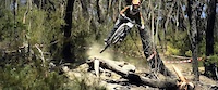
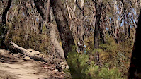
Photos of Newcastle Mountain Bike
Videos of Newcastle Mountain Bike

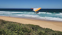
trail: Merewether-Bar Beach
0:17 |
3 |
Dec 26, 2024
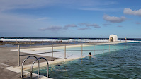
trail: Merewether-Bar Beach
0:36 |
|
Dec 26, 2024
trail: Merewether-Bar Beach
0:17 |
12 |
Apr 17, 2023
trail: Merewether-Bar Beach
0:41 |
5 |
Apr 16, 2023
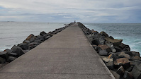
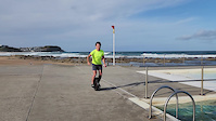
trail: Macquarie Pier Lighthouse
0:11 |
1 |
Apr 14, 2023
trail: Pony Express
0:50 |
2405 |
Oct 25, 2016

trail: Get Some
4:16 |
2862 |
Nov 24, 2015
trail: Pony Express
0:34 |
603 |
Oct 3, 2015
Recent Trail Reports
Activity Feed
| username | action | type | title | date |
|---|---|---|---|---|
| Jam2697 | add | report | activity #97298796 and 3 more | Jun 18, 2026 @ 11:08pm 21 hours |
| SergioNicolas4pUhsu | wishlist | region | activity #96778261 | Jun 11, 2026 @ 7:15pm Jun 11, 2026 |
| DOCWHO | add | photo | activity #96765748 and 1 more | Jun 11, 2026 @ 3:52pm Jun 11, 2026 |
| DOCWHO | add | poi | activity #96744649 and 12 more | Jun 11, 2026 @ 9:51am Jun 11, 2026 |
| DOCWHO | vote | poi | activity #96706314 and 1 more | Jun 10, 2026 @ 5:28pm Jun 10, 2026 |
Recent Comments
| username | type | title | comment | date |
|---|---|---|---|---|
| trail | No black on this trail, unless you count... | Oct 1, 2025 @ 7:07pm Oct 1, 2025 | ||
| trail | Fun track, pretty tech but not that bad. Did... | Sep 6, 2025 @ 10:36pm Sep 6, 2025 | ||
| trail | Very steep and pebbly, deep 4x4 ruts coming up... | Apr 1, 2024 @ 3:39pm Apr 1, 2024 | ||
| trail | very rooty | Mar 30, 2024 @ 2:26am Mar 30, 2024 | ||
| trail | Do four laps and then drop the hammer! A great... | Mar 23, 2024 @ 8:22pm Mar 23, 2024 |
Local Badges
-

Completionist0 awarded -

Epic Ride 50k4,411 awarded -

Top 10 Trails52 awarded -
Completionist17 awarded -
Completionist3 awarded -
Completionist0 awarded
Activity Type Stats
| activitytype | trails | distance | descent | descent distance | total vertical | rating | global rank | state rank | photos | reports | routes | ridelogs |
|---|---|---|---|---|---|---|---|---|---|---|---|---|
| Mountain Bike | 276 | 140 miles | 22,234 ft | 66 miles | 1,122 ft | #166 | #12 | 623 | 2,675 | 14 | 90,251 | |
| E-Bike | 131 | 75 miles | 10,902 ft | 35 miles | 413 ft | #458 | #43 | 172 | 2,341 | 3 | 9,554 | |
| Horse | 5 | 5 miles | 666 ft | 2 miles | 335 ft | #564 | #31 | 4 | 539 | 3 | ||
| Hike | 224 | 128 miles | 18,921 ft | 59 miles | 1,122 ft | #652 | #21 | 15 | 2,572 | 3 | 3,176 | |
| Trail Running | 254 | 136 miles | 21,112 ft | 63 miles | 1,122 ft | #521 | #16 | 2,646 | 10 | 3,830 | ||
| Dirtbike/Moto | 10 | 5 miles | 758 ft | 3 miles | 279 ft | #397 | #18 | 545 | 90 |
Frequently Asked Questions About Newcastle
▼
What are the best places to ride in Newcastle?
Newcastle has 14 areas to explore for mountain biking. The top rated areas are:
▼
What are the highest rated mountain biking trails in Newcastle?
The highest rated mountain biking trails in Newcastle are:
- Fernleigh Track (4.2/5)
- Shoes (4.2/5)
- Tonka (4.2/5)
- Ewoks (4.2/5)
- Pump Action (4.2/5)
▼
What is the best time of the year to ride in Newcastle?
Based on ride log data, the most popular months to ride in Newcastle are:
- August (590 activities)
- July (543 activities)
- September (509 activities)
▼
Where can I park to ride in Newcastle?
There are 12 parking locations listed in Newcastle. The most popular parking spots are: View all parking and trailhead locations on the map to plan your visit.
Activities
Trails
Points of Interest
- No. 208 Radar Station RAAF North Arrangement Sight
- Leichhardts Lookout Viewpoint
- Mawson Lookout 114 Viewpoint
- Spoon Rocks Lookout Viewpoint
- Mereweather Lookout Viewpoint
- Ruins Sight
- Little Flaggy Creek Culvert Tunnel Sight
- Historic Bailey's Farm Sheds Sight
- Ruins, Old No.1 Burwood Colliery Sight
- Leichhardts Lookout Viewpoint
- By brenthillier
 NSMBA TRAILFORKS & contributors
 - Admins: stuartrichardson, HMBA
- #3802 - 40,531 views
- newcastle activity log | embed map of Newcastle mountain bike trails | newcastle mountain biking points of interest
Downloading of trail gps tracks in kml & gpx formats is enabled for Newcastle.
You must login to download files.