close
-
Layers w
- Weather Layers
- Pro
- Pro
- Pro
- Pro
- Pro
- Pro
- More Layers
- Pro
- Pro
- Pro
- Pro
-
Upgrade to

3D
Trail Conditions
- Unknown
- Snow Groomed
- Snow Packed
- Snow Covered
- Snow Cover Partial
- Freeze/thaw Cycle
- Icy
- Prevalent Mud
- Wet
- Variable
- Ideal
- Dry
- Very Dry
Trail Flow (Ridden Direction)
Trailforks scans users ridelogs to determine the most popular direction each trail is ridden. A good flowing trail network will have most trails flowing in a single direction according to their intension.
The colour categories are based on what percentage of riders are riding a trail in its intended direction.
The colour categories are based on what percentage of riders are riding a trail in its intended direction.
- > 96%
- > 90%
- > 80%
- > 70%
- > 50%
- < 50%
- bi-directional trail
- no data
Trail Last Ridden
Trailforks scans ridelogs to determine the last time a trail was ridden.
- < 2 days
- < 1 week
- < 2 weeks
- < 1 month
- < 6 months
- > 6 months
Trail Ridden Direction
The intended direction a trail should be ridden.
- Downhill Only
- Downhill Primary
- Both Directions
- Uphill Primary
- Uphill Only
- One Direction
Contribute Details
Colors indicate trail is missing specified detail.
- Description
- Photos
- Description & Photos
- Videos
Trail Popularity ?
Trailforks scans ridelogs to determine which trails are ridden the most in the last 9 months.
Trails are compared with nearby trails in the same city region with a possible 25 colour shades.
Think of this as a heatmap, more rides = more kinetic energy = warmer colors.
- most popular
- popular
- less popular
- not popular
ATV/ORV/OHV Filter
Max Vehicle Width
inches
US Cell Coverage
Legend

Radar Time
Activity Recordings
Trailforks uses anonymized public activity data.
?
Activity Recordings
Trailforks uses anonymized public activity data.
?
Personal Heatmap
▶
Activity Types
all
/
none
▶
Options
2
Date range
month
–
Winter Trails
Warning
A routing network for winter maps does not exist. Selecting trails using the winter trails layer has been disabled.
Missing Trails
Most Popular
Least Popular
Trails are colored based on popularity. The more popular a trail is, the more red. Less popular trails trend towards green.
Jump Magnitude Heatmap
Heatmap of where riders jump on trails. Zoom in to see individual jumps, click circles to view jump details.
BC Backroad Status
![map legend]()
Service Road Atlas is a free to use, community-driven service for viewing and creating reports on the numerous back-country service roads around B.C. and Alberta.

Slope Aspect
Direction the slope faces
Trails Deemphasized
Trails are shown in grey.
Only show trails with no bike usage.
Suggested Layers
Based on selected activity type
Save the current map location and zoom level as your default home location whenever this page is loaded.
Save
No description for Newport County has been added yet!
Login or register to submit one.
This region uses the Uk/Euro style trail grading system.
Activities Click to view
- Mountain Bike
153 trails
- E-Bike
85 trails
- Horse
6 trails
- Hike
77 trails
- Trail Running
76 trails
Region Details
- 31
- 8
- 14
- 50
- 26
Stats
- Avg Trail Rating
- Trails (view details)
- 137
- Trails Mountain Bike
- 153
- Trails E-Bike
- 85
- Trails Horse
- 6
- Trails Hike
- 77
- Trails Trail Running
- 76
- Total Distance
- 91 miles
- Total Descent
- 30,990 ft
- Total Vertical
- 1,164 ft
- Highest Trailhead
- 1,365 ft
- Reports
- 1,228
- Photos
- 887
- Ridden Counter
- 19,112
Sub Regions
- Newport (150)
- Cwmcarn Forest Drive (81)
- Wyllie Bike Park (47)
Popular Newport County Mountain Biking Trails
• 100 ★ 3.0 • 4,613 ft • 310 ft • 1,319 •
Popular red difficulty singletrack. This mountain bike primary trail can be used one direction. It features berm, drop and rock garden. Trail visibility is always easy to follow. On average it takes 9 minutes to complete this trail.
• 95 ★ 4.0 • 1 mile • 200 ft • 1,101 •
Popular red difficulty singletrack. This mountain bike primary trail can be used one direction. On average it takes 15 minutes to complete this trail.
• 100 ★ 4.4 • 2,713 ft • 0 ft • 1,091 •
Highly rated popular red difficulty singletrack. This mountain bike primary trail can be used one direction. On average it takes 2 minutes to complete this trail.
• 95 ★ 4.3 • 1,391 ft • 156 ft • 1,070 •
Popular red difficulty singletrack. This mountain bike primary trail can be used one direction. On average it takes 3 minutes to complete this trail.
• 90 ★ 5.0 • 1 mile • 309 ft • 975 •
Popular red difficulty singletrack. This mountain bike primary trail can be used one direction. Trail visibility is always easy to follow. On average it takes 14 minutes to complete this trail.
• 80 ★ 4.0 • 2,612 ft • 184 ft • 947 •
Popular red difficulty singletrack. This mountain bike primary trail can be used one direction. On average it takes 6 minutes to complete this trail.
• 95 ★ 4.8 • 2,612 ft • 11 ft • 914 •
Popular red difficulty singletrack. This mountain bike primary trail can be used one direction. On average it takes 5 minutes to complete this trail.
• 95 ★ 4.0 • 2,726 ft • 205 ft • 913 •
Popular red difficulty singletrack. This mountain bike primary trail can be used one direction. On average it takes 6 minutes to complete this trail.
Newport County Mountain Bike Routes
★ 3.5 • 6 miles • 1,186 ft • 1 •
STEEP TECHNICAL DESCENTS AMAZING FUN, MUDDY AND SLIPPY IN THE WET.
★ 5.0 • 9 miles • 1,745 ft • 0 •
Climbing to altitudes of over 400 metres, this trail gives you a real sense of adventure. Tough climbs and...
17 miles • 4,665 ft • 5 • Loop •
A loop of most of Cafall. Then climb out of the valley up to the mast and down towards Pontypool. Then...
★ 5.0 • 12 miles • 2,298 ft • 5 • Loop •
Gentle climbs with some good technical decents
★ 4.0 • 10 miles • 1,308 ft • 0 • Loop •
A loop round Wentwoon starting and finishing at the central car park.
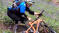
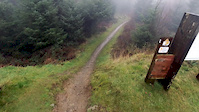
Photos of Newport County Mountain Bike
Videos of Newport County Mountain Bike
trail: Y Mynydd Downhill
2:52 |
91 |
Jun 21, 2022

trail: Cwmcarn Forest Drive
0:54 |
42 |
Jun 9, 2021
trail: Cwmcarn Forest Drive
0:25 |
78 |
Dec 1, 2020
trail: Cwmcarn Forest Drive
0:43 |
27 |
Dec 1, 2020
trail: Cwmcarn Forest Drive
0:56 |
102 |
Nov 16, 2020

trail: Wyllie DH
2:14 |
2263 |
Nov 11, 2020
trail: Wentwood DH
0:10 |
286 |
Apr 26, 2020
trail: Cwmcarn Forest Drive
3:31 |
173 |
Jan 28, 2020
Recent Trail Reports
Activity Feed
| username | action | type | title | date |
|---|---|---|---|---|
| XTOWpg | wishlist | trail | activity #96976472 | Jun 14, 2026 @ 9:13am Jun 14, 2026 |
| Jon-Davis | ridden | trail | activity #96924617 | Jun 13, 2026 @ 4:22pm Jun 13, 2026 |
| RadBikeBro | add | report | activity #96912338 and 1 more | Jun 13, 2026 @ 1:38pm Jun 13, 2026 |
| VanillaBrys | add | report | activity #96474738 | Jun 7, 2026 @ 10:13am Jun 7, 2026 |
| MOUNTAINBIKER926 | ridden | trail | activity #95311170 | May 23, 2026 @ 6:23am May 23, 2026 |
Recent Comments
| username | type | title | comment | date |
|---|---|---|---|---|
| trail | Very overgrown, not rideable at all | Oct 8, 2025 @ 2:03pm Oct 8, 2025 | ||
| trail | One of the best at cwmcarn drops and berms... | Jul 24, 2025 @ 4:58pm Jul 24, 2025 | ||
| trail | this small forest is full with some real tech... | May 30, 2025 @ 6:16am May 30, 2025 | ||
| trail | it's not really a forest road. lower half is... | May 30, 2025 @ 6:13am May 30, 2025 | ||
| trail | Is this trail still there does anyone know ?... | Apr 21, 2025 @ 1:18pm Apr 21, 2025 |
Local Badges
-

Descent 100k Badge0 awarded -

Big Ride 30k1,126 awarded -
Big Ride 30k502 awarded -
Big Ride 30k147 awarded -
Descent 100k Badge4 awarded -

Descent 10k Badge9 awarded
Bike & Skill Parks
| name | type | city | rating |
|---|---|---|---|
| St Mellons Pumptrack | skill park | Newport | |
| Splott Pumptrack | skill park | Newport | |
| Machen skills area | skill park | Newport |
Local Trail Supporters
- Risca Riders
- Cognation Mountain Biking
![]()
![]()
Activity Type Stats
| activitytype | trails | distance | descent | descent distance | total vertical | rating | global rank | state rank | photos | reports | routes | ridelogs |
|---|---|---|---|---|---|---|---|---|---|---|---|---|
| Mountain Bike | 153 | 90 miles | 30,663 ft | 48 miles | 1,152 ft | 886 | 1,227 | 8 | 26,330 | |||
| E-Bike | 85 | 60 miles | 15,030 ft | 29 miles | 1,138 ft | 1 | 1,164 | 2 | 9,348 | |||
| Horse | 6 | 7 miles | 774 ft | 3 miles | 968 ft | 40 | ||||||
| Hike | 77 | 63 miles | 17,316 ft | 30 miles | 1,165 ft | 1,130 | 776 | |||||
| Trail Running | 76 | 62 miles | 16,900 ft | 30 miles | 1,165 ft | 1,124 | 323 |
Frequently Asked Questions About Newport County
▼
What are the best places to ride in Newport County?
Newport County has 2 areas to explore for mountain biking. The top rated areas are:
▼
What are the highest rated mountain biking trails in Newport County?
The highest rated mountain biking trails in Newport County are:
- Y Mynydd Downhill (4.4/5)
- Pedalhounds (4.4/5)
- Secrets (4.4/5)
- Twrch Trail (4.4/5)
- Y Mynydd Black (4.3/5)
▼
What is the best time of the year to ride in Newport County?
Based on ride log data, the most popular months to ride in Newport County are:
- September (113 activities)
- July (110 activities)
- October (109 activities)
▼
What is the longest trail in Newport County?
The longest trail in Newport County is Route 47 - Wyllie Link at 4.3 miles. View all trails sorted by distance.
Activities
Trails
Points of Interest
- By brenthillier
 NSMBA TRAILFORKS & contributors
 - Admins: UKTP, 20twenty-p
- #6991 - 4,247 views
- newport county activity log | embed map of Newport County mountain bike trails | newport county mountain biking points of interest polygons
Downloading of trail gps tracks in kml & gpx formats is enabled for Newport County.
You must login to download files.