close
-
Layers w
- Weather Layers
- Pro
- Pro
- Pro
- Pro
- Pro
- Pro
- More Layers
- Pro
- Pro
- Pro
- Pro
-
Upgrade to

3D
Trail Conditions
- Unknown
- Snow Groomed
- Snow Packed
- Snow Covered
- Snow Cover Partial
- Freeze/thaw Cycle
- Icy
- Prevalent Mud
- Wet
- Variable
- Ideal
- Dry
- Very Dry
Trail Flow (Ridden Direction)
Trailforks scans users ridelogs to determine the most popular direction each trail is ridden. A good flowing trail network will have most trails flowing in a single direction according to their intension.
The colour categories are based on what percentage of riders are riding a trail in its intended direction.
The colour categories are based on what percentage of riders are riding a trail in its intended direction.
- > 96%
- > 90%
- > 80%
- > 70%
- > 50%
- < 50%
- bi-directional trail
- no data
Trail Last Ridden
Trailforks scans ridelogs to determine the last time a trail was ridden.
- < 2 days
- < 1 week
- < 2 weeks
- < 1 month
- < 6 months
- > 6 months
Trail Ridden Direction
The intended direction a trail should be ridden.
- Downhill Only
- Downhill Primary
- Both Directions
- Uphill Primary
- Uphill Only
- One Direction
Contribute Details
Colors indicate trail is missing specified detail.
- Description
- Photos
- Description & Photos
- Videos
Trail Popularity ?
Trailforks scans ridelogs to determine which trails are ridden the most in the last 9 months.
Trails are compared with nearby trails in the same city region with a possible 25 colour shades.
Think of this as a heatmap, more rides = more kinetic energy = warmer colors.
- most popular
- popular
- less popular
- not popular
ATV/ORV/OHV Filter
Max Vehicle Width
inches
US Cell Coverage
Legend

Radar Time
Activity Recordings
Trailforks uses anonymized public activity data.
?
Activity Recordings
Trailforks uses anonymized public activity data.
?
Personal Heatmap
▶
Activity Types
all
/
none
▶
Options
2
Date range
month
–
Winter Trails
Warning
A routing network for winter maps does not exist. Selecting trails using the winter trails layer has been disabled.
Missing Trails
Most Popular
Least Popular
Trails are colored based on popularity. The more popular a trail is, the more red. Less popular trails trend towards green.
Jump Magnitude Heatmap
Heatmap of where riders jump on trails. Zoom in to see individual jumps, click circles to view jump details.
BC Backroad Status
![map legend]()
Service Road Atlas is a free to use, community-driven service for viewing and creating reports on the numerous back-country service roads around B.C. and Alberta.

Slope Aspect
Direction the slope faces
Trails Deemphasized
Trails are shown in grey.
Only show trails with no bike usage.
Suggested Layers
Based on selected activity type
Save the current map location and zoom level as your default home location whenever this page is loaded.
SaveNewtown is host to two riding areas on state land: Upper and Lower Paugussett State Forests. You can also access Collis P Huntington State Park, as well. There are numerous open space parcels with rideable trails, too, such as Newtown Forestry Association's Brunot Property and Town open space at Pole Bridge and Fairfield Hills. There is also a 10 mile trail, some sections are not rideable called Al's Trail that connects Upper Paugussett State Forest, with some Nature Conservancy Land, Rocky Glenn State Park, and Fairfield Hills.
Activities Click to view
- Mountain Bike
23 trails
- Gravel Bike
0 trails
- Adaptive Bike
0 trails
- Horse
1 trails
- Hike
29 trails
- Trail Running
32 trails
- Snowshoe
1 trails
Region Details
- 6
- 1
- 5
- 7
- 2
Region Status
Caution as of Oct 26, 2024Stats
- Avg Trail Rating
- Trails (view details)
- 27
- Trails Mountain Bike
- 23
- Trails Horse
- 1
- Trails Hike
- 33
- Trails Trail Running
- 32
- Trails Snowshoe
- 1
- Total Distance
- 25 miles
- Total Descent
- 4,132 ft
- Total Vertical
- 552 ft
- Highest Trailhead
- 663 ft
- Reports
- 135
- Photos
- 36
- Ridden Counter
- 1,957
Sub Regions
-
Paugussett State Forest - Shepaug Dam Area
- 4
- 1
-
Paugussett State Forest - Zoar Lake Area
- 6
Popular Newtown Mountain Biking Trails
• 95 ★ 5.0 • 2 miles • 173 ft • 175 •
Popular blue difficulty singletrack. This multi-use trail can be used both directions and has a easy overall physical rating with a 173 ft green climb. It features drop, log ride, rock face, rock garden and skinny. On average it takes 19 minutes to complete this trail.
• 80 ★ 0.0 • 581 ft • 42 ft • 135 •
Connector trail starting from the pullout on Hanover Road that crosses over a small stream and then climbs with a bermed turn. Use this trail to get to the Blue Blazed Trail, the Trail, or the Forest Road
• 100 ★ 5.0 • 1 mile • 40 ft • 108 •
The approved version of the Mulikin Trail that combines the Rerouted Mulikin with Easy Up. Blazed Yellow by the State DEEP
• 40 ★ 0.0 • 1,348 ft • 0 ft • 12 • • hike
Moderately popular blue difficulty singletrack. This hike primary trail can be used both directions and has a moderate overall physical rating. On average it takes minutes to complete this trail.
• 50 ★ 0.0 • 2,149 ft • 114 ft • 10 •
Continuation after a jog at the junction of the Zoar Trail.
• 30 ★ 0.0 • 2,205 ft • 0 ft • 4 • • hike
Less popular blue difficulty singletrack. This hike primary trail can be used both directions and has a moderate overall physical rating. On average it takes 3 minutes to complete this trail.
• 35 ★ 0.0 • 2,484 ft • 108 ft • 2 •
Less popular blue difficulty singletrack. This multi-use trail can be used both directions and has a moderate overall physical rating with a 108 ft blue climb. Trail visibility is always easy to follow.
• 5 ★ 0.0 • 574 ft • 0 ft • 1 • • hike
Short spur along Falls. Falls are seasonal.
Photos of Newtown Mountain Bike
Videos of Newtown Mountain Bike

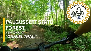
trail: Brody Road
3:17 |
49 |
Sep 8, 2025 , Newtown

14:33 |
55 |
Sep 8, 2025 , Newtown

trail: Upper Gussy - Orange Blazed
14:33 |
46 |
Sep 8, 2025 , Newtown
3:17 |
118 |
Jan 13, 2024

14:33 |
190 |
Jan 13, 2024
trail: Upper Gussy - Orange Blazed
19:03 |
278 |
Oct 11, 2023 , Newtown

trail: Lillinonah Trail
29:47 |
243 |
Oct 11, 2023 , Newtown
Recent Trail Reports
| status | trail | date | condition | info | user |
|---|---|---|---|---|---|
| Brody Road | Apr 1, 2024 @ 2:28pm Apr 1, 2024 | Dry | aqua8897 | ||
| New Mulikin Trail - Yellow Blazed | Mar 29, 2024 @ 5:48pm Mar 29, 2024 | Wet | aqua8897 | ||
| Upper Gussy - Jeep Trail | Mar 12, 2024 @ 6:29am Mar 12, 2024 | Wet | SpencerBoi | ||
| Lillinonah Trail - Upper Gussy | Mar 12, 2024 @ 6:29am Mar 12, 2024 | Wet | SpencerBoi | ||
| Upper Gussy - Orange Blazed | Mar 12, 2024 @ 6:29am Mar 12, 2024 | Wet | SpencerBoi | ||
| Lillinonah Trail - Pond Brook Connector | Nov 8, 2021 @ 6:20am Nov 8, 2021 | Ideal | Achapman1 | ||
| Brody Road/ Lillinonah Trail | Nov 8, 2021 @ 6:20am Nov 8, 2021 | Ideal | Achapman1 |
Activity Feed
| username | action | type | title | date |
|---|---|---|---|---|
| GregMVVZc2 | wishlist | region | activity #91319053 | Mar 26, 2026 @ 7:15am Mar 26, 2026 |
| Anthonyguitar | wishlist | region | activity #81722711 | Oct 4, 2025 @ 7:14pm Oct 4, 2025 |
| Josuee1Torres | add | video | activity #79905652 | Sep 8, 2025 @ 3:20am Sep 8, 2025 |
| Josuee1Torres | add | video | activity #79905622 and 1 more | Sep 8, 2025 @ 3:19am Sep 8, 2025 |
| nevermore13 | checkin | trail | activity #77168888 | Aug 1, 2025 @ 11:18am Aug 1, 2025 |
Recent Comments
| username | type | title | comment | date |
|---|---|---|---|---|
| trail | The new Mulikin trail was very good. Big shout... | Jun 13, 2023 @ 3:39am Jun 13, 2023 | ||
| trail | Rode this over the weekend. It's my cup of... | Jun 13, 2023 @ 3:35am Jun 13, 2023 |
Local Badges
-

Epic Ride Climb 2k0 awarded -

Climbing 10k Badge16 awarded -

Climbing 100k Badge1 awarded -

Epic Ride Descent 2k0 awarded -

Descent 10k Badge16 awarded -

Descent 100k Badge1 awarded
Activity Type Stats
| activitytype | trails | distance | descent | descent distance | total vertical | rating | global rank | state rank | photos | reports | routes | ridelogs |
|---|---|---|---|---|---|---|---|---|---|---|---|---|
| Mountain Bike | 23 | 9 miles | 1,683 ft | 5 miles | 394 ft | #5,172 | #1,745 | 41 | 127 | 3,831 | ||
| Horse | 1 | 1 mile | 305 ft | 1 mile | 266 ft | #3,386 | #1,950 | 71 | ||||
| Hike | 29 | 25 miles | 4,078 ft | 12 miles | 551 ft | #3,458 | #1,218 | 14 | 133 | 663 | ||
| Trail Running | 32 | 25 miles | 4,078 ft | 12 miles | 551 ft | #6,870 | #2,253 | 133 | 47 | |||
| Snowshoe | 1 | 1 mile | 305 ft | 1 mile | 266 ft | #1,537 | #869 | 1 | 83 |
Frequently Asked Questions About Newtown
▼
What are the best places to ride in Newtown?
Newtown has 4 areas to explore for mountain biking. The top rated areas are:
▼
What are the highest rated mountain biking trails in Newtown?
The highest rated mountain biking trails in Newtown are:
- Upper Gussy - Orange Blazed (4.2/5)
- New Mulikin Trail - Yellow Blazed (4.2/5)
- Lillinonah Trail - Pond Brook Connector (0/5)
- Prydden Brook Trail (0/5)
- Paugussett Road Connector (0/5)
▼
What is the best time of the year to ride in Newtown?
Based on ride log data, the most popular months to ride in Newtown are:
- June (40 activities)
- May (33 activities)
- August (31 activities)
▼
Where can I park to ride in Newtown?
There are 10 parking locations listed in Newtown. The most popular parking spots are: View all parking and trailhead locations on the map to plan your visit.
Trails
Points of Interest
- By brenthillier
 NSMBA TRAILFORKS & contributors
 - Admins: HCH, NEMBAEXEC, HV NEMBA, FC NEMBA
- #3308 - 4,699 views
- newtown activity log | embed map of Newtown mountain bike trails | newtown mountain biking points of interest
Downloading of trail gps tracks in kml & gpx formats is enabled for Newtown.
You must login to download files.