close
-
Layers w
- Weather Layers
- Pro
- Pro
- Pro
- Pro
- Pro
- Pro
- More Layers
- Pro
- Pro
- Pro
- Pro
-
Upgrade to

3D
Trail Conditions
- Unknown
- Snow Groomed
- Snow Packed
- Snow Covered
- Snow Cover Partial
- Freeze/thaw Cycle
- Icy
- Prevalent Mud
- Wet
- Variable
- Ideal
- Dry
- Very Dry
Trail Flow (Ridden Direction)
Trailforks scans users ridelogs to determine the most popular direction each trail is ridden. A good flowing trail network will have most trails flowing in a single direction according to their intension.
The colour categories are based on what percentage of riders are riding a trail in its intended direction.
The colour categories are based on what percentage of riders are riding a trail in its intended direction.
- > 96%
- > 90%
- > 80%
- > 70%
- > 50%
- < 50%
- bi-directional trail
- no data
Trail Last Ridden
Trailforks scans ridelogs to determine the last time a trail was ridden.
- < 2 days
- < 1 week
- < 2 weeks
- < 1 month
- < 6 months
- > 6 months
Trail Ridden Direction
The intended direction a trail should be ridden.
- Downhill Only
- Downhill Primary
- Both Directions
- Uphill Primary
- Uphill Only
- One Direction
Contribute Details
Colors indicate trail is missing specified detail.
- Description
- Photos
- Description & Photos
- Videos
Trail Popularity ?
Trailforks scans ridelogs to determine which trails are ridden the most in the last 9 months.
Trails are compared with nearby trails in the same city region with a possible 25 colour shades.
Think of this as a heatmap, more rides = more kinetic energy = warmer colors.
- most popular
- popular
- less popular
- not popular
ATV/ORV/OHV Filter
Max Vehicle Width
inches
US Cell Coverage
Legend

Radar Time
Activity Recordings
Trailforks uses anonymized public activity data.
?
Activity Recordings
Trailforks uses anonymized public activity data.
?
Personal Heatmap
▶
Activity Types
all
/
none
▶
Options
2
Date range
month
–
Winter Trails
Warning
A routing network for winter maps does not exist. Selecting trails using the winter trails layer has been disabled.
Missing Trails
Most Popular
Least Popular
Trails are colored based on popularity. The more popular a trail is, the more red. Less popular trails trend towards green.
Jump Magnitude Heatmap
Heatmap of where riders jump on trails. Zoom in to see individual jumps, click circles to view jump details.
BC Backroad Status
![map legend]()
Service Road Atlas is a free to use, community-driven service for viewing and creating reports on the numerous back-country service roads around B.C. and Alberta.

Slope Aspect
Direction the slope faces
Trails Deemphasized
Trails are shown in grey.
Only show trails with no bike usage.
Suggested Layers
Based on selected activity type
Save the current map location and zoom level as your default home location whenever this page is loaded.
SavePopular Trail Networks
view all areas »
No description for Niagara Region has been added yet!
Login or register to submit one.
Links
Activities Click to view
- Mountain Bike
313 trails
- E-Bike
17 trails
- Horse
8 trails
- Hike
349 trails
- Trail Running
342 trails
- Snowshoe
15 trails
Region Details
- 61
- 21
- 69
- 118
- 31
- 9
Stats
- Avg Trail Rating
- Trails (view details)
- 355
- Trails Mountain Bike
- 313
- Trails E-Bike
- 17
- Trails Horse
- 8
- Trails Hike
- 349
- Trails Trail Running
- 342
- Trails Snowshoe
- 15
- Trails Nordic Ski
- 1
- Total Distance
- 184 miles
- Total Descent
- 13,236 ft
- Total Vertical
- 427 ft
- Highest Trailhead
- 673 ft
- Reports
- 1,090
- Photos
- 448
- Ridden Counter
- 25,997
Sub Regions
- Fort Erie (1)
- Grimsby (13)
- Lincoln (54)
- Niagara Falls (49)
- Firemen's Park (31)
- Queenston Heights Park (4)
- Walker Park (2)
- Niagara-on-the-Lake (6)
- Port Colborne (52)
- Limestone Hill (27)
- The Hood (20)
- St. Catharines (101)
- Vineland (32)
- Welland (3)
Popular Niagara Region Mountain Biking Trails
• 100 ★ 4.0 • 2 miles • 8 ft • 495 •
Popular blue difficulty singletrack. This multi-use trail can be used both directions and has a moderate overall physical rating with a 8 ft blue climb. It features bridge. On average it takes 9 minutes to complete this trail.
• 70 ★ 0.0 • 2,034 ft • 24 ft • 445 •
Popular blue difficulty mixed. This multi-use trail can be used both directions. On average it takes 3 minutes to complete this trail.
• 100 ★ 0.0 • 3,904 ft • 10 ft • 332 •
Popular green difficulty singletrack. This mountain bike primary trail can be used both directions and has a easy overall physical rating with a 10 ft green climb. On average it takes 4 minutes to complete this trail.
• 90 ★ 4.0 • 1,640 ft • 12 ft • 331 •
Popular blue difficulty singletrack. This multi-use trail can be used both directions. On average it takes 2 minutes to complete this trail.
• 100 ★ 0.0 • 2,191 ft • 0 ft • 322 •
Popular blue difficulty dirt/gravel road. This multi-use trail can be used both directions and has a moderate overall physical rating with a 0 ft blue climb. Trail visibility is always easy to follow. On average it takes 3 minutes to complete this trail.
• 95 ★ 5.0 • 2,497 ft • 7 ft • 316 •
Popular blue difficulty singletrack. This multi-use trail can be used both directions and has a moderate overall physical rating with a 7 ft blue climb. On average it takes 2 minutes to complete this trail.
• 95 ★ 0.0 • 417 ft • 15 ft • 314 •
Popular blue difficulty singletrack. This multi-use trail can be used both directions and has a moderate overall physical rating with a 15 ft blue climb. On average it takes minutes to complete this trail.
• 90 ★ 3.5 • 1,337 ft • 22 ft • 310 •
Popular blue difficulty singletrack. This mountain bike primary trail can be used both directions. On average it takes 2 minutes to complete this trail.
Niagara Region Mountain Bike Routes
43 miles • 6,243 ft • 19 • Loop •
essentially a gravel ride with some gnarly down hill at the end if you know where to look.
★ 3.0 • 6 miles • 229 ft • 0 • Loop •
Not many hills - not too crazy - but overall a good time. If you are looking for a mix of wide mud, sand,...
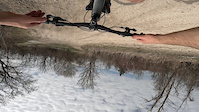
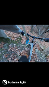
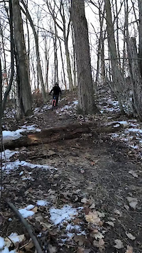
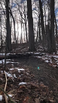
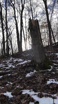
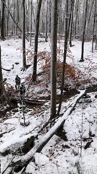
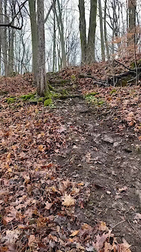
Photos of Niagara Region Mountain Bike
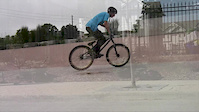
Videos of Niagara Region Mountain Bike
trail: Ridgeline
0:01 |
|
Apr 15, 2023
trail: White Knuckle
0:30 |
405 |
Dec 2, 2021
trail: Ex-Lax
0:05 |
233 |
Jan 10, 2021
trail: Ex-Lax
0:37 |
80 |
Jan 10, 2021
trail: O-Face
0:07 |
253 |
Jan 10, 2021
trail: Pipeline
0:06 |
108 |
Jan 3, 2021
trail: O-Face
0:13 |
157 |
Dec 30, 2020
trail: GET OUT
2:30 |
595 |
Jan 1, 2015
Recent Trail Reports
Activity Feed
| username | action | type | title | date |
|---|---|---|---|---|
| Kenneth6qbr5M | wishlist | trail | activity #97445348 | Jun 20, 2026 @ 5:33pm 7 hours |
| Sauljea | vote | trail | activity #97056195 and 1 more | Jun 15, 2026 @ 11:42am Jun 15, 2026 |
| Sauljea | add | report | activity #96927859 and 2 more | Jun 13, 2026 @ 5:14pm Jun 13, 2026 |
| QuinnTheCanadian | ridden | trail | activity #95869501 | May 30, 2026 @ 10:56am May 30, 2026 |
| Jamesparlee13 | ridden | trail | activity #95730714 | May 28, 2026 @ 1:40pm May 28, 2026 |
Recent Comments
| username | type | title | comment | date |
|---|---|---|---|---|
| trail | Are these trails being maintained? 2025-10-19 | Oct 19, 2025 @ 8:17pm Oct 19, 2025 | ||
| trail | Super steep and gnarly beginning, especially... | Jul 1, 2025 @ 6:58pm Jul 1, 2025 | ||
| trail | Some fun tech obstacles for beginners. Quite... | Jul 1, 2025 @ 6:52pm Jul 1, 2025 | ||
| trail | Descent chewed by dirt bikes, heavy ruts... | Oct 24, 2024 @ 3:24pm Oct 24, 2024 | ||
| report | Descents heavily rutted by dirt bikes, pedals... | Oct 24, 2024 @ 3:23pm Oct 24, 2024 |
Local Badges
-

Completionist0 awarded -

Epic Ride 50k61 awarded -

Top 10 Trails5 awarded -
Top 10 Trails0 awarded -
Top 10 Trails1 awarded -

Big Ride 30k178 awarded
Bike & Skill Parks
| name | type | city | rating |
|---|---|---|---|
| Lincoln Skatepark & Pump Track | skill park | Beamsville | |
| ALGOPORT - SKATE & BMX PARK | skill park | Port Colborne |
Local Mountain Biking Directory
-
Energy Cycling Club
![Energy Cycling Club]()
-
Sunflowers Cycling Club
![Sunflowers Cycling Club]()
-
Gentlemen Bicycle Repair
-
Rapid City CycleBike Shop
-
DroppindownBike Shop
![Droppindown]()
-
Pedal... Bicycle ShopBike Shop
![Pedal... Bicycle Shop]()
Local Trail Supporters
- @theofficialboverr
Activity Type Stats
| activitytype | trails | distance | descent | descent distance | total vertical | rating | global rank | state rank | photos | reports | routes | ridelogs |
|---|---|---|---|---|---|---|---|---|---|---|---|---|
| Mountain Bike | 313 | 155 miles | 9,439 ft | 59 miles | 427 ft | 414 | 1,085 | 6 | 28,747 | |||
| E-Bike | 17 | 22 miles | 1,037 ft | 9 miles | 384 ft | 861 | 3 | 484 | ||||
| Horse | 8 | 15 miles | 456 ft | 6 miles | 302 ft | 212 | 1 | |||||
| Hike | 349 | 183 miles | 13,150 ft | 72 miles | 427 ft | 29 | 1,080 | 2 | 1,873 | |||
| Trail Running | 342 | 182 miles | 13,005 ft | 71 miles | 427 ft | 2 | 1,079 | 1 | 1,822 | |||
| Snowshoe | 15 | 15 miles | 364 ft | 6 miles | 203 ft | 24 | 2 | 30 | ||||
| Nordic Ski | 1 | 3,343 ft | 16 ft | 928 ft | 13 ft | 4 | 33 |
Frequently Asked Questions About Niagara Region
▼
What are the best places to ride in Niagara Region?
Niagara Region has 19 areas to explore for mountain biking. The top rated areas are:
▼
What are the highest rated mountain biking trails in Niagara Region?
The highest rated mountain biking trails in Niagara Region are:
- Snakes and Ladders (4.4/5)
- White Knuckle (4.4/5)
- Suzanne's (4.3/5)
- Baby Snakes (4.2/5)
- O-Face (4.2/5)
▼
What is the best time of the year to ride in Niagara Region?
Based on ride log data, the most popular months to ride in Niagara Region are:
- August (312 activities)
- July (296 activities)
- September (268 activities)
▼
What is the longest trail in Niagara Region?
The longest trail in Niagara Region is Friendship Recreation Trail at 16.0 miles. View all trails sorted by distance.
Activities
Trails
- By markholloway
 Trailforks Map Team & contributors
 - Admins: Canadmos, NTMA
- #10042 - 26,837 views
- niagara region activity log | embed map of Niagara Region mountain bike trails | niagara region mountain biking points of interest
Downloading of trail gps tracks in kml & gpx formats is enabled for Niagara Region.
You must login to download files.