close
-
Layers w
- Weather Layers
- Pro
- Pro
- Pro
- Pro
- Pro
- Pro
- More Layers
- Pro
- Pro
- Pro
- Pro
-
Upgrade to

3D
Trail Conditions
- Unknown
- Snow Groomed
- Snow Packed
- Snow Covered
- Snow Cover Partial
- Freeze/thaw Cycle
- Icy
- Prevalent Mud
- Wet
- Variable
- Ideal
- Dry
- Very Dry
Trail Flow (Ridden Direction)
Trailforks scans users ridelogs to determine the most popular direction each trail is ridden. A good flowing trail network will have most trails flowing in a single direction according to their intension.
The colour categories are based on what percentage of riders are riding a trail in its intended direction.
The colour categories are based on what percentage of riders are riding a trail in its intended direction.
- > 96%
- > 90%
- > 80%
- > 70%
- > 50%
- < 50%
- bi-directional trail
- no data
Trail Last Ridden
Trailforks scans ridelogs to determine the last time a trail was ridden.
- < 2 days
- < 1 week
- < 2 weeks
- < 1 month
- < 6 months
- > 6 months
Trail Ridden Direction
The intended direction a trail should be ridden.
- Downhill Only
- Downhill Primary
- Both Directions
- Uphill Primary
- Uphill Only
- One Direction
Contribute Details
Colors indicate trail is missing specified detail.
- Description
- Photos
- Description & Photos
- Videos
Trail Popularity ?
Trailforks scans ridelogs to determine which trails are ridden the most in the last 9 months.
Trails are compared with nearby trails in the same city region with a possible 25 colour shades.
Think of this as a heatmap, more rides = more kinetic energy = warmer colors.
- most popular
- popular
- less popular
- not popular
ATV/ORV/OHV Filter
Max Vehicle Width
inches
US Cell Coverage
Legend

Radar Time
Activity Recordings
Trailforks uses anonymized public activity data.
?
Activity Recordings
Trailforks uses anonymized public activity data.
?
Personal Heatmap
▶
Activity Types
all
/
none
▶
Options
2
Date range
month
–
Winter Trails
Warning
A routing network for winter maps does not exist. Selecting trails using the winter trails layer has been disabled.
Missing Trails
Most Popular
Least Popular
Trails are colored based on popularity. The more popular a trail is, the more red. Less popular trails trend towards green.
Jump Magnitude Heatmap
Heatmap of where riders jump on trails. Zoom in to see individual jumps, click circles to view jump details.
BC Backroad Status
![map legend]()
Service Road Atlas is a free to use, community-driven service for viewing and creating reports on the numerous back-country service roads around B.C. and Alberta.

Slope Aspect
Direction the slope faces
Trails Deemphasized
Trails are shown in grey.
Only show trails with no bike usage.
Suggested Layers
Based on selected activity type
Save the current map location and zoom level as your default home location whenever this page is loaded.
Save
No description for Nijmegen has been added yet!
Login or register to submit one.
Activities Click to view
- Mountain Bike
9 trails
- Gravel Bike
0 trails
- Adaptive Bike
0 trails
- Winter Fat Bike
0 trails
- Hike
2 trails
- Trail Running
2 trails
Region Details
- 1
- 4
- 3
Region Status
Open as of Apr 30, 2026Stats
- Avg Trail Rating
- Trails (view details)
- 8
- Trails Mountain Bike
- 9
- Trails E-Bike
- 2
- Trails Hike
- 2
- Trails Trail Running
- 2
- Total Distance
- 1 mile
- Total Descent
- 252 ft
- Total Vertical
- 131 ft
- Highest Trailhead
- 308 ft
- Reports
- 175
- Photos
- 29
- Ridden Counter
- 3,704
Sub Regions
-
Rijk van Nijmegen
- 4
Popular Nijmegen Mountain Biking Trails
• 95 ★ 4.8 • 3,799 ft • 7 ft • 820 •
This might just be the most challenging trail in the area that´s actually part of the official route. It has several features that for the strong hearted mountain biker. The trail serves both flow and roots. It also packs some nice...
• 70 ★ 4.0 • 3,510 ft • 21 ft • 321 •
Popular green difficulty family friendly singletrack. This mountain bike primary trail can be used one direction and has a easy overall physical rating with a 21 ft green climb. Trail visibility is always easy to follow.
• 65 ★ 4.0 • 2 miles • 192 ft • 321 •
Moderately popular green difficulty family friendly singletrack. This mountain bike primary trail can be used one direction and has a easy overall physical rating with a 192 ft green climb. Trail visibility is always easy to follow.
• 80 ★ 5.0 • 2 miles • 126 ft • 316 •
Popular green difficulty singletrack. This mountain bike primary trail can be used one direction and has a easy overall physical rating with a 126 ft green climb. Trail visibility is always easy to follow.
• 55 ★ 3.0 • 2 miles • 122 ft • 211 •
Moderately popular green difficulty singletrack. This mountain bike primary trail can be used one direction and has a easy overall physical rating with a 122 ft green climb. Trail visibility is always easy to follow.
• 40 ★ 4.0 • 426 ft • 0 ft • 76 •
This trail is not for the faint hearted. It's rather rough to ride down here
Nijmegen Mountain Bike Routes
★ 5.0 • 9 miles • 763 ft • 1 • Loop •
Great route with the “traumatrail“ in it!
★ 5.0 • 11 miles • 452 ft • 1 • Loop •
Dit is de makkelijkste MTB route van het Rijk van Nijmegen. Er zijn concrete plannen om deze route in...
★ 5.0 • 125 miles • 7,506 ft • 9 • Loop •
The Ultimate MTB adventure crossing the border. In this route you'll meet everything the Ketelwald has to...
11 miles • 920 ft • 1 • Loop •
The SHIMANO mtb route/loop Groesbeek takes you through the woods of Groesbeek On this route is the...
★ 3.7 • 19 miles • 1,423 ft • 0 • Loop •
De twee nieuwe Rijk van Nijmegen routes in één: Rood en Paars. In de toekomst volgen er nog meer. Dit is...
Photos of Nijmegen Mountain Bike
Videos of Nijmegen Mountain Bike
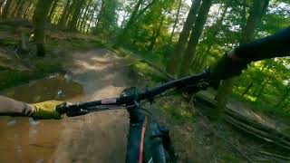
trail: Klein Zwitserland
18:09 |
164 |
Nov 27, 2023 , Nijmegen

trail: Traumatrail
18:09 |
151 |
Nov 27, 2023 , Nijmegen

trail: Traumatrail
19:54 |
265 |
Jun 15, 2023 , Nijmegen
19:54 |
162 |
Jun 15, 2023
trail: Muntberg Madness
5:28 |
266 |
Jan 7, 2022 , Nijmegen
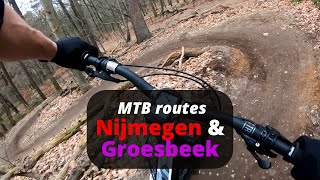
youtuber
![Groesbeek - MTB Rijk van Nijmegen - Fast fun...]()

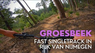
trail: Traumatrail
5:28 |
307 |
Jan 7, 2022 , Nijmegen

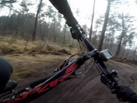
trail: Traumatrail
2:52 |
1705 |
Mar 31, 2020 , Nijmegen
trail: Traumatrail
2:53 |
1103 |
Jan 23, 2020 , Nijmegen
Recent Trail Reports
| status | trail | date | condition | info | user |
|---|---|---|---|---|---|
| MTB route mook | Apr 30, 2026 @ 10:56am (Europe/Amsterdam) Apr 30, 2026 | Variable | olafjeffsy | ||
| MTB route mook | Apr 30, 2026 @ 10:56am (Europe/Amsterdam) Apr 30, 2026 | Variable | olafjeffsy | ||
| MTB route mook | Apr 30, 2026 @ 10:56am (Europe/Amsterdam) Apr 30, 2026 | Variable | olafjeffsy | ||
| Traumatrail | Apr 30, 2026 @ 10:56am (Europe/Amsterdam) Apr 30, 2026 | Variable | olafjeffsy | ||
| verbinding Groesbeek - Nijmegen (Wolfsberg-But) | Apr 30, 2026 @ 10:56am (Europe/Amsterdam) Apr 30, 2026 | Variable | olafjeffsy | ||
| Traumatrail Klim | Apr 30, 2026 @ 10:56am (Europe/Amsterdam) Apr 30, 2026 | Variable | olafjeffsy | ||
| MTB route mook | Apr 30, 2026 @ 10:56am (Europe/Amsterdam) Apr 30, 2026 | Variable | olafjeffsy | ||
| Muntberg Madness | Mar 8, 2026 @ 6:07pm (Europe/Amsterdam) Mar 8, 2026 | Unknown | Jonashommen | ||
| aanrijroute Nijmegen vanaf Tivoli-Heksendans | May 5, 2022 @ 10:46pm May 5, 2022 | Ideal | Knagie | ||
| Klein Zwitserland | Oct 13, 2021 @ 3:50am Oct 13, 2021 | Dry | maartenrijdtver |
Activity Feed
| username | action | type | title | date |
|---|---|---|---|---|
| mtb-challenge | add | photo | activity #97119944 and 6 more | Jun 16, 2026 @ 10:10am 2 days |
| joostkempen | ridden | trail | activity #94738329 | May 15, 2026 @ 2:32am May 15, 2026 |
| olafjeffsy | add | report | activity #93760082 and 1 more | May 1, 2026 @ 12:35am May 1, 2026 |
| olafjeffsy | add | report | activity #93760080 and 4 more | May 1, 2026 @ 12:35am May 1, 2026 |
| Jonashommen | wishlist | trail | activity #90209800 | Mar 8, 2026 @ 10:11am Mar 8, 2026 |
Bike & Skill Parks
| name | type | city | rating |
|---|---|---|---|
| Groesbeek MX | skill park | Nijmegen | |
| Pumptrack Nijmegen Lindenholt | skill park | Nijmegen | |
| Pumptrack Nyma | skill park | Nijmegen |
Activity Type Stats
| activitytype | trails | distance | descent | descent distance | total vertical | rating | global rank | state rank | photos | reports | routes | ridelogs |
|---|---|---|---|---|---|---|---|---|---|---|---|---|
| Mountain Bike | 9 | 1 mile | 253 ft | 4,088 ft | 131 ft | #2,116 | #12 | 29 | 175 | 12 | 13,344 | |
| E-Bike | 2 | 151 | 4 | 622 | ||||||||
| Hike | 2 | 3,389 ft | 121 ft | 1,526 ft | 95 ft | #2,895 | #29 | 161 | 177 | |||
| Trail Running | 2 | 3,389 ft | 121 ft | 1,526 ft | 95 ft | #2,374 | #27 | 161 | 176 |
Frequently Asked Questions About Nijmegen
▼
What are the best places to ride in Nijmegen?
Nijmegen has 1 areas to explore for mountain biking. The top rated areas are:
▼
What are the highest rated mountain biking trails in Nijmegen?
The highest rated mountain biking trails in Nijmegen are:
- Traumatrail (4.4/5)
- MTB route mook (4.1/5)
- MTB route mook (4/5)
- MTB route mook (4/5)
- Klein Zwitserland (4/5)
▼
What is the best time of the year to ride in Nijmegen?
Based on ride log data, the most popular months to ride in Nijmegen are:
- July (39 activities)
- September (28 activities)
- April (27 activities)
▼
Where can I park to ride in Nijmegen?
There are 1 parking locations listed in Nijmegen. The most popular parking spots are:
- By arjan16 & contributors
- Admins: apply
- #16046 - 4,827 views
- nijmegen activity log | embed map of Nijmegen mountain bike trails | nijmegen mountain biking points of interest
Downloading of trail gps tracks in kml & gpx formats is enabled for Nijmegen.
You must login to download files.