close
-
Layers w
- Weather Layers
- Pro
- Pro
- Pro
- Pro
- Pro
- Pro
- More Layers
- Pro
- Pro
- Pro
- Pro
-
Upgrade to

3D
Trail Conditions
- Unknown
- Snow Groomed
- Snow Packed
- Snow Covered
- Snow Cover Partial
- Freeze/thaw Cycle
- Icy
- Prevalent Mud
- Wet
- Variable
- Ideal
- Dry
- Very Dry
Trail Flow (Ridden Direction)
Trailforks scans users ridelogs to determine the most popular direction each trail is ridden. A good flowing trail network will have most trails flowing in a single direction according to their intension.
The colour categories are based on what percentage of riders are riding a trail in its intended direction.
The colour categories are based on what percentage of riders are riding a trail in its intended direction.
- > 96%
- > 90%
- > 80%
- > 70%
- > 50%
- < 50%
- bi-directional trail
- no data
Trail Last Ridden
Trailforks scans ridelogs to determine the last time a trail was ridden.
- < 2 days
- < 1 week
- < 2 weeks
- < 1 month
- < 6 months
- > 6 months
Trail Ridden Direction
The intended direction a trail should be ridden.
- Downhill Only
- Downhill Primary
- Both Directions
- Uphill Primary
- Uphill Only
- One Direction
Contribute Details
Colors indicate trail is missing specified detail.
- Description
- Photos
- Description & Photos
- Videos
Trail Popularity ?
Trailforks scans ridelogs to determine which trails are ridden the most in the last 9 months.
Trails are compared with nearby trails in the same city region with a possible 25 colour shades.
Think of this as a heatmap, more rides = more kinetic energy = warmer colors.
- most popular
- popular
- less popular
- not popular
ATV/ORV/OHV Filter
Max Vehicle Width
inches
US Cell Coverage
Legend

Radar Time
Activity Recordings
Trailforks uses anonymized public activity data.
?
Activity Recordings
Trailforks uses anonymized public activity data.
?
Personal Heatmap
▶
Activity Types
all
/
none
▶
Options
2
Date range
month
–
Winter Trails
Warning
A routing network for winter maps does not exist. Selecting trails using the winter trails layer has been disabled.
Missing Trails
Most Popular
Least Popular
Trails are colored based on popularity. The more popular a trail is, the more red. Less popular trails trend towards green.
Jump Magnitude Heatmap
Heatmap of where riders jump on trails. Zoom in to see individual jumps, click circles to view jump details.
BC Backroad Status
![map legend]()
Service Road Atlas is a free to use, community-driven service for viewing and creating reports on the numerous back-country service roads around B.C. and Alberta.

Slope Aspect
Direction the slope faces
Trails Deemphasized
Trails are shown in grey.
Only show trails with no bike usage.
Suggested Layers
Based on selected activity type
Save the current map location and zoom level as your default home location whenever this page is loaded.
Save
No description for Norco has been added yet!
Login or register to submit one.
Activities Click to view
- Mountain Bike
12 trails
- E-Bike
8 trails
- Adaptive Bike
0 trails
- Winter Fat Bike
0 trails
- Hike
9 trails
- Trail Running
8 trails
Region Details
- 1
- 2
- 1
- 4
- 3
Region Status
Caution as of May 29, 2026Stats
- Avg Trail Rating
- Trails (view details)
- 11
- Trails Mountain Bike
- 12
- Trails E-Bike
- 8
- Trails Horse
- 2
- Trails Hike
- 9
- Trails Trail Running
- 8
- Total Distance
- 9 miles
- Total Descent
- 2,519 ft
- Total Vertical
- 888 ft
- Highest Trailhead
- 1,443 ft
- Reports
- 54
- Photos
- 27
- Ridden Counter
- 593
Sub Regions
-
Norco Ridge Ranch
- 2
Popular Norco Mountain Biking Trails
• 90 ★ 4.2 • 3,645 ft • 22 ft • 124 •
single track hand built DH trail with big jumps and drops
• 100 ★ 4.3 • 3,665 ft • 0 ft • 90 •
Popular black diamond difficulty singletrack. This mountain bike primary trail can be used downhill primary and has a hard overall physical rating. It features rock face. Trail visibility is sometimes hard to follow. On average it takes 5 minutes to complete this trail.
• 80 ★ 0.0 • 2,647 ft • 34 ft • 46 •
Short section typically used as an out-n-back to the substation.
• 35 ★ 2.8 • 3,907 ft • 0 ft • 38 •
Less popular black diamond difficulty singletrack. This mountain bike primary trail can be used downhill primary and has a moderate overall physical rating. It features berm, rock garden and skinny. On average it takes 14 minutes to complete this trail.
• 60 ★ 0.0 • 4,189 ft • 57 ft • 25 •
Paved loop in the southwest corner of the park
• 70 ★ 4.0 • 3 miles • 44 ft • 22 •
Eastvale Trail is a 2.6 mile segment of the Santa Ana River Trail (SART) located in the City of Eastvale. Most of the way there is both gravel and paved paths next to each other. Route is clearly marked with distance markers every 0.5...
• 45 ★ 4.0 • 4,980 ft • 374 ft • 20 •
This trail is a steep climb specially when combined with other nearby trails. Typical drop after the climb is Sinister followed my Pumpkin Rock ending at Banzai trail.
• ★ 4.5 • 3,894 ft • 0 ft • 19 •
Black diamond difficulty singletrack. This mountain bike primary trail can be used downhill only. It features berm, drop, jump, gap jump, rock face, rock garden and wallride. Trail visibility is always easy to follow.
Norco Mountain Bike Routes
7 miles • 229 ft • 0 •
Starting in Norco/Riverside Santa Ana River to Martha McLean Park.
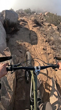
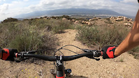
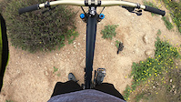
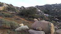
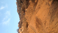
Photos of Norco Mountain Bike
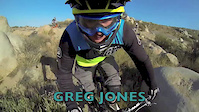
Videos of Norco Mountain Bike
trail: Wyle Rocket Experiment
0:10 |
46 |
Dec 2, 2025
trail: Wyle Rocket Experiment
3:41 |
284 |
Jul 27, 2021
trail: Candy DH
3:21 |
178 |
Mar 29, 2021

trail: Candy DH
2:50 |
1046 |
Jan 1, 2015
trail: Candy DH
0:20 |
441 |
Dec 21, 2014
trail: Candy DH
0:11 |
437 |
Mar 7, 2014
trail: Candy DH
2:39 |
447 |
May 24, 2013
trail: Candy DH
2:38 |
541 |
Dec 21, 2012
Recent Trail Reports
| status | trail | date | condition | info | user |
|---|---|---|---|---|---|
| Acme | May 29, 2026 @ 10:27am (America/Los_Angeles) May 29, 2026 | Unknown | marcello42 | ||
| Rodeo | Jan 9, 2025 @ 7:31pm Jan 9, 2025 | Very Dry | quanix | ||
| Sinister | Aug 25, 2024 @ 5:00pm Aug 25, 2024 | Dry | Scrapmatt | ||
| Candy DH | Aug 16, 2024 @ 9:54pm Aug 16, 2024 | Very Dry | UbiquitousodDJCT | ||
| Wyle Rocket Experiment | Dec 14, 2023 @ 4:08pm Dec 14, 2023 | Very Dry | Builtbygriffin BBTA | ||
| Candyland climb | May 8, 2022 @ 3:33pm May 8, 2022 | Ideal | chris-sendersen | ||
| SART - Power Station | May 9, 2020 @ 12:55pm May 9, 2020 | Unknown | jdmtb2000 | ||
| Santa Ana River Regional Park Loop | Jun 4, 2019 @ 12:22pm Jun 4, 2019 | Very Dry | JSTootell |
Activity Feed
| username | action | type | title | date |
|---|---|---|---|---|
| marcello42 | vote | trail | activity #95787467 | May 29, 2026 @ 10:28am May 29, 2026 |
| marcello42 | add | report | activity #95787439 | May 29, 2026 @ 10:27am May 29, 2026 |
| claussm | wishlist | region | activity #94784811 | May 15, 2026 @ 7:02pm May 15, 2026 |
| MtBwithDad | ridden | trail | activity #94572104 and 2 more | May 12, 2026 @ 11:11am May 12, 2026 |
| jskipp1 | wishlist | trail | activity #92738204 | Apr 16, 2026 @ 11:27am Apr 16, 2026 |
Recent Comments
| username | type | title | comment | date |
|---|---|---|---|---|
| trail | Sweet tech trail, everything rolls pretty... | Feb 15, 2026 @ 3:47pm Feb 15, 2026 | ||
| trail | very true | Feb 1, 2025 @ 10:25pm Feb 1, 2025 | ||
| trail | 100% not a blue trail. I’ve ridden many blue... | Jan 6, 2025 @ 4:56pm Jan 6, 2025 | ||
| trail | THIS IS NOT A BLUE TRAIL. I took a friend who... | Jan 5, 2025 @ 1:56pm Jan 5, 2025 | ||
| report | Feel free to maintain the bottom of Sinister.... | Aug 27, 2024 @ 8:25am Aug 27, 2024 |
Activity Type Stats
| activitytype | trails | distance | descent | descent distance | total vertical | rating | global rank | state rank | photos | reports | routes | ridelogs |
|---|---|---|---|---|---|---|---|---|---|---|---|---|
| Mountain Bike | 12 | 9 miles | 2,520 ft | 4 miles | 889 ft | #6,018 | #2,043 | 33 | 54 | 1 | 2,831 | |
| E-Bike | 8 | 6 miles | 1,778 ft | 3 miles | 889 ft | #7,316 | #2,207 | 31 | 1 | 662 | ||
| Horse | 2 | 4 miles | 157 ft | 4,199 ft | 889 ft | 13 | ||||||
| Hike | 9 | 8 miles | 1,877 ft | 4 miles | 889 ft | #11,138 | #3,975 | 43 | 154 | |||
| Trail Running | 8 | 7 miles | 1,417 ft | 3 miles | 889 ft | #11,045 | #3,812 | 42 | 26 |
Frequently Asked Questions About Norco
▼
What are the best places to ride in Norco?
Norco has 1 areas to explore for mountain biking. The top rated areas are:
▼
What are the highest rated mountain biking trails in Norco?
The highest rated mountain biking trails in Norco are:
- Candy DH (4/5)
- Wyle Rocket Experiment (4/5)
- Eastvale Trail - Santa Ana River Trail (4/5)
- Two-Bit Climb (4/5)
- Sinister (4/5)
▼
What is the best time of the year to ride in Norco?
Based on ride log data, the most popular months to ride in Norco are:
- June (8 activities)
- February (6 activities)
- May (5 activities)
▼
Where can I park to ride in Norco?
There are 1 parking locations listed in Norco. The most popular parking spots are:
- By EGxMOTO & contributors
- Admins: IVMTB
- #23403 - 7,764 views
- norco activity log | embed map of Norco mountain bike trails | norco mountain biking points of interest
Downloading of trail gps tracks in kml & gpx formats is enabled for Norco.
You must login to download files.