close
-
Layers w
- Weather Layers
- Pro
- Pro
- Pro
- Pro
- Pro
- Pro
- More Layers
- Pro
- Pro
- Pro
- Pro
-
Upgrade to

3D
Trail Conditions
- Unknown
- Snow Groomed
- Snow Packed
- Snow Covered
- Snow Cover Partial
- Freeze/thaw Cycle
- Icy
- Prevalent Mud
- Wet
- Variable
- Ideal
- Dry
- Very Dry
Trail Flow (Ridden Direction)
Trailforks scans users ridelogs to determine the most popular direction each trail is ridden. A good flowing trail network will have most trails flowing in a single direction according to their intension.
The colour categories are based on what percentage of riders are riding a trail in its intended direction.
The colour categories are based on what percentage of riders are riding a trail in its intended direction.
- > 96%
- > 90%
- > 80%
- > 70%
- > 50%
- < 50%
- bi-directional trail
- no data
Trail Last Ridden
Trailforks scans ridelogs to determine the last time a trail was ridden.
- < 2 days
- < 1 week
- < 2 weeks
- < 1 month
- < 6 months
- > 6 months
Trail Ridden Direction
The intended direction a trail should be ridden.
- Downhill Only
- Downhill Primary
- Both Directions
- Uphill Primary
- Uphill Only
- One Direction
Contribute Details
Colors indicate trail is missing specified detail.
- Description
- Photos
- Description & Photos
- Videos
Trail Popularity ?
Trailforks scans ridelogs to determine which trails are ridden the most in the last 9 months.
Trails are compared with nearby trails in the same city region with a possible 25 colour shades.
Think of this as a heatmap, more rides = more kinetic energy = warmer colors.
- most popular
- popular
- less popular
- not popular
ATV/ORV/OHV Filter
Max Vehicle Width
inches
US Cell Coverage
Legend

Radar Time
Activity Recordings
Trailforks uses anonymized public activity data.
?
Activity Recordings
Trailforks uses anonymized public activity data.
?
Personal Heatmap
▶
Activity Types
all
/
none
▶
Options
2
Date range
month
–
Winter Trails
Warning
A routing network for winter maps does not exist. Selecting trails using the winter trails layer has been disabled.
Missing Trails
Most Popular
Least Popular
Trails are colored based on popularity. The more popular a trail is, the more red. Less popular trails trend towards green.
Jump Magnitude Heatmap
Heatmap of where riders jump on trails. Zoom in to see individual jumps, click circles to view jump details.
BC Backroad Status
![map legend]()
Service Road Atlas is a free to use, community-driven service for viewing and creating reports on the numerous back-country service roads around B.C. and Alberta.

Slope Aspect
Direction the slope faces
Trails Deemphasized
Trails are shown in grey.
Only show trails with no bike usage.
Suggested Layers
Based on selected activity type
Save the current map location and zoom level as your default home location whenever this page is loaded.
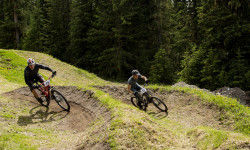
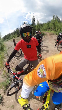
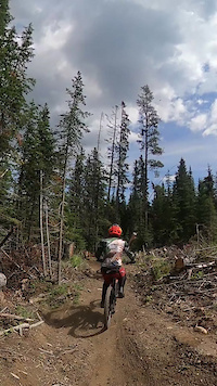
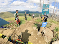
SaveIn 2016 Nordegg was voted one of Canada's best adventure towns by Explore magazine with its largely unspoiled countryside, crisp mountain air, and crystal blue waters. The trail network is shared by hikers, bikers, ATVers, and horseback riders alike, so pay attention to the trail type. You'll find a little bit of everything -- from rugged alpine singletrack, to high-speed gravel paths, steep cutlines, and loamy flow trails.
Links
Activities Click to view
- Mountain Bike
165 trails
- E-Bike
169 trails
- Gravel Bike
0 trails
- Adaptive Bike
0 trails
- Winter Fat Bike
0 trails
- Horse
23 trails
- Hike
142 trails
- Trail Running
160 trails
- Dirtbike/Moto
54 trails
- ATV/ORV/OHV
56 trails
- Snowmobile
14 trails
- Snowshoe
42 trails
- Backcountry Ski
20 trails
- Nordic Ski
31 trails
Region Details
- 5
- 64
- 70
- 16
- 1
Region Status
Open as of 2 daysStats
- Avg Trail Rating
- Trails (view details)
- 165
- Trails Mountain Bike
- 174
- Trails E-Bike
- 169
- Trails Horse
- 23
- Trails Hike
- 161
- Trails Trail Running
- 160
- Trails Dirtbike/Moto
- 55
- Trails ATV/ORV/OHV
- 56
- Trails Snowmobile
- 14
- Trails Snowshoe
- 42
- Trails Backcountry Ski
- 20
- Trails Nordic Ski
- 31
- Total Distance
- 154 miles
- Total Descent
- 23,590 ft
- Total Vertical
- 3,011 ft
- Highest Trailhead
- 6,918 ft
- Reports
- 899
- Photos
- 601
- Ridden Counter
- 10,371
Articles
Video & Event Report: Frontier Lodge's Fat Tire Fest 2019 - Nordegg, Alberta
Jul 17, 2019 from pinkbike.com
An epic weekend of riding bikes, racing, camping, catching up with friends, and making new ones at Frontier Lodge in Nordegg, Alberta.
Sub Regions
-
Black Mountain Trail Network
- 5
- 9
- 4
-
Coliseum Mountain
- 4
- 13
- 2
- 1
-
Fish Lake
- 13
- 16
- 1
-
Goldeye Lake
- 5
-
North Nordegg
- 5
- 7
-
Shunda Meadows
- 1
- 14
- 1
-
South Nordegg
- 27
- 17
- 9
Popular Nordegg Mountain Biking Trails
• 100 ★ 5.0 • 1 mile • 281 ft • 302 •
is a green rated (easier), dual-direction climbing trail. is the Stoney word for ‘Hawk,’ and is inspired by the hawks noticed during wildlife sweeps. These birds are often seen soaring above the network, and trails were arranged to...
• 100 ★ 4.4 • 3,225 ft • 2 ft • 281 •
is a blue rated (more difficult), machine groomed flow style trail. Notable trail features include: berms, jumps, and gap jumps. Named after the longline buckets helicopter pilots used to scoop and dump water onto the Black Mountain...
• 100 ★ 5.0 • 4 miles • 1,545 ft • 256 •
is a blue rated (more difficult), dual-direction climbing trail. Notable trail features include: berms, optional jumps and drops, & road crossings. When riding downhill, please yield to uphill bikers and hikers. is the Stoney word...
• 100 ★ 3.7 • 938 ft • 0 ft • 206 •
! is a green rated (easier), smooth natural surface trail. Notable trail features include: rollers, optional skinnies, and bridges. The trail connects the end of the jump line to the Staging Area. For a family and kid-friendly loop,...
• 100 ★ 4.5 • 837 ft • 0 ft • 189 •
is a blue and black rated (more difficult and most difficult) jump trail. Notable trail features include: tables, gap jumps, log cannons, lily pad, and shark fin jumps. Jumping skills are required. is Black Mountain’s lapable jump...
• 100 ★ 4.5 • 2,034 ft • 0 ft • 189 •
Following along a ridgeline next to a gully this trail is a true black singletrack. More old school in style along with a few new school berms to keep up the tempo. Be ready to enjoy the fast, flowing and technical feel of . Go right at...
• 95 ★ 4.2 • 2,858 ft • 3 ft • 181 •
means ‘bear’ in Cree, in honor of the bears who call Black Mountain home. This machine groomed, flow-style trail is built with all riders in mind. It flows through the beautiful lower network mixed forest which inspires quick and...
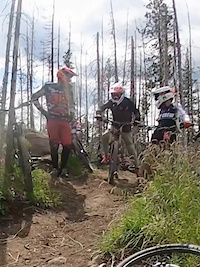
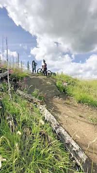
Photos of Nordegg Mountain Bike
Videos of Nordegg Mountain Bike
trail: North Corner
3:41 |
63 |
Jan 23, 2026
trail: North Corner
2:18 |
25 |
Jan 22, 2026
trail: Evacuation Order
0:35 |
206 |
Aug 13, 2025
trail: Evacuation Order
0:27 |
92 |
Aug 11, 2025
trail: Evacuation Order
0:07 |
63 |
Aug 11, 2025
trail: The Degg
0:10 |
54 |
Nov 7, 2024
trail: Evacuation Order
0:10 |
|
Sep 2, 2024
trail: 12th Level
4:42 |
1066 |
Dec 26, 2015
Current Trail Warnings
| status | trail | date | condition | user | info |
|---|---|---|---|---|---|
| North Corner | Jun 5, 2026 @ 7:34am (America/Edmonton) Jun 5, 2026 | Prevalent Mud | Macvidal19 NORCA | The section around the boardwalk has a... |
Recent Trail Reports
| status | trail | date | condition | info | user |
|---|---|---|---|---|---|
| Skimmer | Jun 20, 2026 @ 12:41pm (America/Edmonton) 2 days | Unknown | SQUIRREL40 | ||
| TPOC | Jun 20, 2026 @ 11:21am (America/Edmonton) 2 days | Unknown | SQUIRREL40 | ||
| Westview DH | Jun 6, 2026 @ 3:47pm (America/Edmonton) Jun 6, 2026 | Ideal | noshift97 | ||
| Happy Nordegg | May 29, 2026 @ 12:54pm (America/Edmonton) May 29, 2026 | Variable | Macvidal19 NORCA | ||
| Châska | May 29, 2026 @ 12:44pm (America/Edmonton) May 29, 2026 | Variable | Macvidal19 NORCA | ||
| Evacuation Order | May 29, 2026 @ 12:43pm (America/Edmonton) May 29, 2026 | Variable | Macvidal19 NORCA | ||
| Lower Châska | May 22, 2026 @ 11:04am (America/Edmonton) May 22, 2026 | Ideal | chainslap | ||
| Razor Shades | May 15, 2026 @ 6:47pm (America/Edmonton) May 15, 2026 | Variable | Macvidal19 NORCA | ||
| Black Like Velvet | May 15, 2026 @ 6:47pm (America/Edmonton) May 15, 2026 | Variable | Macvidal19 NORCA | ||
| Oh Deer! | May 14, 2026 @ 11:44am (America/Edmonton) May 14, 2026 | Variable | Macvidal19 NORCA |
Activity Feed
| username | action | type | title | date |
|---|---|---|---|---|
| SQUIRREL40 | add | report | activity #97410068 and 1 more | Jun 20, 2026 @ 10:21am 2 days |
| NVM2681 | add | photo | activity #97021376 | Jun 14, 2026 @ 8:41pm Jun 14, 2026 |
| caitlinbickford | wishlist | region | activity #96966846 | Jun 14, 2026 @ 7:33am Jun 14, 2026 |
| garrettmeunier1 | wishlist | region | activity #96961667 | Jun 14, 2026 @ 6:24am Jun 14, 2026 |
| trailforks | add | video | activity #96937497 | Jun 13, 2026 @ 9:00pm Jun 13, 2026 |
Recent Comments
| username | type | title | comment | date |
|---|---|---|---|---|
| trail | This trail is fun but it could be categorized... | May 9, 2026 @ 6:56am May 9, 2026 | ||
| report | Many trees down on the last third of the loop.... | Nov 1, 2025 @ 4:02pm Nov 1, 2025 | ||
| trail | There is a bridge to cross Spreading Creek ,... | Sep 18, 2025 @ 5:14pm Sep 18, 2025 | ||
| trail | Super fun. High speed jumps and berms.... | Sep 15, 2025 @ 5:28pm Sep 15, 2025 | ||
| trail | Good trail but the up is not worth the down.... | Sep 1, 2025 @ 10:46pm Sep 1, 2025 |
Local Badges
-

Top 10 Trails1 awarded -

Descent 100k Badge0 awarded -

Big Ride 30k189 awarded -

Epic Ride 50k91 awarded -

Completionist0 awarded -
Completionist0 awarded
Bike & Skill Parks
| name | type | city | rating |
|---|---|---|---|
| Nordegg Pump Track | skill park | Nordegg |
Activity Type Stats
| activitytype | trails | distance | descent | descent distance | total vertical | rating | global rank | state rank | photos | reports | routes | ridelogs |
|---|---|---|---|---|---|---|---|---|---|---|---|---|
| Mountain Bike | 165 | 135 miles | 22,182 ft | 67 miles | 2,861 ft | #1,098 | #12 | 578 | 897 | 1 | 3,153 | |
| E-Bike | 169 | 38 miles | 4,665 ft | 15 miles | 2,343 ft | #1,798 | #15 | 2 | 790 | 262 | ||
| Horse | 23 | 21 miles | 1,834 ft | 12 miles | 1,178 ft | #1,161 | #14 | 110 | 1 | |||
| Hike | 142 | 124 miles | 20,387 ft | 61 miles | 3,012 ft | #975 | #11 | 24 | 772 | 1,707 | ||
| Trail Running | 160 | 123 miles | 20,190 ft | 61 miles | 3,012 ft | #1,082 | #14 | 771 | 179 | |||
| Dirtbike/Moto | 54 | 54 miles | 5,738 ft | 23 miles | 2,861 ft | #349 | #7 | 1 | 122 | 71 | ||
| ATV/ORV/OHV | 56 | 51 miles | 4,075 ft | 20 miles | 2,861 ft | #89 | #4 | 113 | 43 | |||
| Snowmobile | 14 | 8 miles | 1,086 ft | 4 miles | 1,512 ft | #178 | #3 | |||||
| Snowshoe | 42 | 42 miles | 4,173 ft | 19 miles | 2,572 ft | #409 | #13 | 195 | 29 | |||
| Backcountry Ski | 20 | 12 miles | 1,686 ft | 6 miles | 1,178 ft | #408 | #13 | 1 | 148 | |||
| Nordic Ski | 31 | 27 miles | 2,530 ft | 15 miles | 1,178 ft | #532 | #14 | 158 | 59 |
Frequently Asked Questions About Nordegg
▼
What are the best places to ride in Nordegg?
Nordegg has 9 areas to explore for mountain biking. The top rated areas are:
▼
What are the highest rated mountain biking trails in Nordegg?
The highest rated mountain biking trails in Nordegg are:
- Châska (4.5/5)
- Skimmer (4.4/5)
- Evacuation Order (4.4/5)
- Where's The Beef? (4.3/5)
- North Corner (4.3/5)
▼
What is the best time of the year to ride in Nordegg?
Based on ride log data, the most popular months to ride in Nordegg are:
- July (115 activities)
- August (76 activities)
- June (33 activities)
▼
Where can I park to ride in Nordegg?
There are 17 parking locations listed in Nordegg. The most popular parking spots are: View all parking and trailhead locations on the map to plan your visit.
Activities
- Nordegg Mountain Biking Trails
- Nordegg E-Biking Trails
- Nordegg Horseback Trails
- Nordegg Hiking Trails
- Nordegg Trail Running Trails
- Nordegg Dirtbiking Trails
- Nordegg ATVing/Offroading Trails
- Nordegg Snowmobiling Trails
- Nordegg Snowshoeing Trails
- Nordegg Backcountry Skiing Trails
- Nordegg Nordic Skiing Trails
Trails
Points of Interest
- Shunda Creek Viewpoint
- Waterfall Sight
- Crescent Falls Sight
- Southesk Campground (Backcountry #97) Camping
- Cairn River Campground (Backcountry #96) Camping
- Pondview Viewpoint
- Pump House Viewpoint
- Upper Shunda Creek Campground Camping
- Nordegg Sign Viewpoint
- West Nordegg Trout Pond Other
- Mount Cline (10,686 ft)
- Mount Murchison (10,669 ft)
- Mount Wilson (10,554 ft)
- nordegg activity log | embed map of Nordegg mountain bike trails | nordegg mountain biking points of interest
Downloading of trail gps tracks in kml & gpx formats is enabled for Nordegg.
You must login to download files.