close
-
Layers w
- Weather Layers
- Pro
- Pro
- Pro
- Pro
- Pro
- Pro
- More Layers
- Pro
- Pro
- Pro
- Pro
-
Upgrade to

3D
Trail Conditions
- Unknown
- Snow Groomed
- Snow Packed
- Snow Covered
- Snow Cover Partial
- Freeze/thaw Cycle
- Icy
- Prevalent Mud
- Wet
- Variable
- Ideal
- Dry
- Very Dry
Trail Flow (Ridden Direction)
Trailforks scans users ridelogs to determine the most popular direction each trail is ridden. A good flowing trail network will have most trails flowing in a single direction according to their intension.
The colour categories are based on what percentage of riders are riding a trail in its intended direction.
The colour categories are based on what percentage of riders are riding a trail in its intended direction.
- > 96%
- > 90%
- > 80%
- > 70%
- > 50%
- < 50%
- bi-directional trail
- no data
Trail Last Ridden
Trailforks scans ridelogs to determine the last time a trail was ridden.
- < 2 days
- < 1 week
- < 2 weeks
- < 1 month
- < 6 months
- > 6 months
Trail Ridden Direction
The intended direction a trail should be ridden.
- Downhill Only
- Downhill Primary
- Both Directions
- Uphill Primary
- Uphill Only
- One Direction
Contribute Details
Colors indicate trail is missing specified detail.
- Description
- Photos
- Description & Photos
- Videos
Trail Popularity ?
Trailforks scans ridelogs to determine which trails are ridden the most in the last 9 months.
Trails are compared with nearby trails in the same city region with a possible 25 colour shades.
Think of this as a heatmap, more rides = more kinetic energy = warmer colors.
- most popular
- popular
- less popular
- not popular
ATV/ORV/OHV Filter
Max Vehicle Width
inches
US Cell Coverage
Legend

Radar Time
Activity Recordings
Trailforks uses anonymized public activity data.
?
Activity Recordings
Trailforks uses anonymized public activity data.
?
Personal Heatmap
▶
Activity Types
all
/
none
▶
Options
2
Date range
month
–
Winter Trails
Warning
A routing network for winter maps does not exist. Selecting trails using the winter trails layer has been disabled.
Missing Trails
Most Popular
Least Popular
Trails are colored based on popularity. The more popular a trail is, the more red. Less popular trails trend towards green.
Jump Magnitude Heatmap
Heatmap of where riders jump on trails. Zoom in to see individual jumps, click circles to view jump details.
BC Backroad Status
![map legend]()
Service Road Atlas is a free to use, community-driven service for viewing and creating reports on the numerous back-country service roads around B.C. and Alberta.

Slope Aspect
Direction the slope faces
Trails Deemphasized
Trails are shown in grey.
Only show trails with no bike usage.
Suggested Layers
Based on selected activity type
Save the current map location and zoom level as your default home location whenever this page is loaded.
Save
No description for Norfolk has been added yet!
Login or register to submit one.
This region uses the Uk/Euro style trail grading system.
Activities Click to view
- Mountain Bike
64 trails
- E-Bike
9 trails
- Hike
131 trails
- Trail Running
132 trails
Region Details
- 24
- 4
- 26
- 6
- 2
Stats
- Avg Trail Rating
- Trails (view details)
- 152
- Trails Mountain Bike
- 64
- Trails E-Bike
- 9
- Trails Horse
- 1
- Trails Hike
- 131
- Trails Trail Running
- 132
- Total Distance
- 69 miles
- Total Descent
- 2,772 ft
- Total Vertical
- 322 ft
- Highest Trailhead
- 362 ft
- Reports
- 220
- Photos
- 81
- Ridden Counter
- 13,073
Sub Regions
- Kings Lynn (1)
- Shouldham Warren (0)
- Sheringham (11)
- Weybourne Trails (9)
- Thetford (49)
Popular Norfolk Mountain Biking Trails
• 70 ★ 3.9 • 2,142 ft • 0 ft • 576 •
One of the better bits of the marked trails. Expect twisty dips with a little bit of root.
• 100 ★ 3.8 • 2,083 ft • 0 ft • 564 •
Popular red difficulty singletrack. This mountain bike primary trail can be used downhill primary. On average it takes 1 minutes to complete this trail.
• 100 ★ 4.2 • 866 ft • 0 ft • 550 •
A nice new bit of trail. Slightly loose surface. Currently new n smooth.
• 85 ★ 0.0 • 3,842 ft • 29 ft • 490 •
Popular blue difficulty singletrack. This mountain bike primary trail can be used one direction. Trail visibility is always easy to follow. On average it takes 4 minutes to complete this trail.
• 80 ★ 0.0 • 3,747 ft • 15 ft • 476 •
Popular blue difficulty singletrack. This mountain bike primary trail can be used one direction. On average it takes 4 minutes to complete this trail.
• 95 ★ 0.0 • 988 ft • 27 ft • 471 •
Popular blue difficulty singletrack. This mountain bike primary trail can be used one direction. On average it takes 1 minutes to complete this trail.
• 80 ★ 0.0 • 2,375 ft • 51 ft • 470 •
Popular blue difficulty singletrack. This mountain bike primary trail can be used one direction. On average it takes 2 minutes to complete this trail.
• 100 ★ 3.0 • 1,378 ft • 0 ft • 470 •
Popular red difficulty singletrack. This mountain bike primary trail can be used one direction. On average it takes 1 minutes to complete this trail.
Norfolk Mountain Bike Routes
7 miles • 432 ft • 6 • Loop •
The at Thetford Forest (Formerly known as the Black cycle route) is for experienced riders only. This...
6 miles • 328 ft • 0 •
Mostly singletrack winding between the trees. More challenging than Shepherd or Poacher. For aspiring...
• 12 miles • 841 ft • 23 •
• 13 miles • 864 ft • 20 •
• 10 miles • 787 ft • 15 •
• 8 miles • 526 ft • 15 •
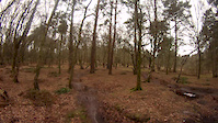
Photos of Norfolk Mountain Bike
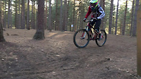
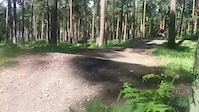
Videos of Norfolk Mountain Bike

trail: Pump Track
2:51 |
302 |
Sep 2, 2019

trail: Pump Track
0:37 |
1377 |
Dec 18, 2018

trail: Pump Track
2:14 |
1258 |
May 22, 2018

trail: Pump Track
0:36 |
11055 |
Feb 1, 2018
trail: Pump Track
0:30 |
110 |
Mar 10, 2016
trail: Pump Track
0:36 |
210 |
Feb 25, 2016
trail: Pump Track
0:05 |
128 |
Jul 25, 2015

trail: Pump Track
5:32 |
215 |
Jun 13, 2015
Recent Trail Reports
Activity Feed
| username | action | type | title | date |
|---|---|---|---|---|
| RosssC1TYJ | wishlist | trail | activity #96317871 | Jun 5, 2026 @ 1:25pm Jun 5, 2026 |
| Kevlar1986 | wishlist | region | activity #95727855 | May 28, 2026 @ 12:53pm May 28, 2026 |
| Andre83pnB7 | wishlist | trail | activity #95624880 | May 27, 2026 @ 4:30am May 27, 2026 |
| joshKo | vote | trail | activity #94804193 | May 16, 2026 @ 5:11am May 16, 2026 |
| joshKo | difficultyvote | trail | activity #94804121 | May 16, 2026 @ 5:09am May 16, 2026 |
Recent Comments
| username | type | title | comment | date |
|---|---|---|---|---|
| trail | If anyone's willing to update this with me at... | Oct 27, 2024 @ 4:32am Oct 27, 2024 | ||
| trail | Temper your expectations, pretty basic | Aug 27, 2024 @ 12:31pm Aug 27, 2024 | ||
| trail | Nice and easy flat as a pancake and good for... | Aug 27, 2024 @ 12:30pm Aug 27, 2024 | ||
| trail | Flat spin through nice woods.good for a bit of... | Aug 27, 2024 @ 12:29pm Aug 27, 2024 | ||
| trail | A bit overgrown at the top. Still rideable. | Dec 30, 2023 @ 1:34am Dec 30, 2023 |
Local Badges
-

Descent 100k Badge0 awarded -

Climbing 10k Badge14 awarded -

Mountain Biking 100k Badge0 awarded -

Epic Ride Descent 2k2 awarded -

Descent 10k Badge14 awarded -

Top 10 Trails140 awarded
Bike & Skill Parks
| name | type | city | rating |
|---|---|---|---|
| Barnham Broom Pumptrack | skill park | norwich | |
| Pump Track | skill park | norwich |
Local Mountain Biking Directory
-
Bike Art
-
Madgetts CyclesBike Shop
-
Surf 55Bike Shop
-
Cycle Medic NorwichBike Shop
Activity Type Stats
| activitytype | trails | distance | descent | descent distance | total vertical | rating | global rank | state rank | photos | reports | routes | ridelogs |
|---|---|---|---|---|---|---|---|---|---|---|---|---|
| Mountain Bike | 64 | 34 miles | 1,991 ft | 15 miles | 276 ft | 82 | 241 | 2 | 8,827 | |||
| E-Bike | 9 | 3 miles | 92 ft | 1 mile | 49 ft | 188 | 1 | 719 | ||||
| Horse | 1 | 535 ft | 10 ft | 38 | ||||||||
| Hike | 131 | 62 miles | 2,500 ft | 28 miles | 322 ft | 220 | 237 | |||||
| Trail Running | 132 | 62 miles | 2,500 ft | 28 miles | 322 ft | 219 | 105 |
Frequently Asked Questions About Norfolk
▼
What are the best places to ride in Norfolk?
Norfolk has 3 areas to explore for mountain biking. The top rated areas are:
▼
What are the highest rated mountain biking trails in Norfolk?
The highest rated mountain biking trails in Norfolk are:
- Beater Trail - long loop (4.2/5)
- The Downhill - Lime Burner Trail (4.1/5)
- The Homemade Run (4/5)
- Pump Track (4/5)
- Mousehold A-Line (4/5)
▼
What is the best time of the year to ride in Norfolk?
Based on ride log data, the most popular months to ride in Norfolk are:
- May (48 activities)
- June (37 activities)
- August (37 activities)
▼
What is the longest trail in Norfolk?
The longest trail in Norfolk is Beater Trail - Short Route at 9.9 km. View all trails sorted by distance.
Activities
Trails
Points of Interest
- By brenthillier
 NSMBA TRAILFORKS & contributors
 - Admins: UKTP, 20twenty-p, wisey, MathieuC, cemoorelife
- #6787 - 20,990 views
- norfolk activity log | embed map of Norfolk mountain bike trails | norfolk mountain biking points of interest polygons
Downloading of trail gps tracks in kml & gpx formats is enabled for Norfolk.
You must login to download files.