close
-
Layers w
- Weather Layers
- Pro
- Pro
- Pro
- Pro
- Pro
- Pro
- More Layers
- Pro
- Pro
- Pro
- Pro
-
Upgrade to

3D
Trail Conditions
- Unknown
- Snow Groomed
- Snow Packed
- Snow Covered
- Snow Cover Partial
- Freeze/thaw Cycle
- Icy
- Prevalent Mud
- Wet
- Variable
- Ideal
- Dry
- Very Dry
Trail Flow (Ridden Direction)
Trailforks scans users ridelogs to determine the most popular direction each trail is ridden. A good flowing trail network will have most trails flowing in a single direction according to their intension.
The colour categories are based on what percentage of riders are riding a trail in its intended direction.
The colour categories are based on what percentage of riders are riding a trail in its intended direction.
- > 96%
- > 90%
- > 80%
- > 70%
- > 50%
- < 50%
- bi-directional trail
- no data
Trail Last Ridden
Trailforks scans ridelogs to determine the last time a trail was ridden.
- < 2 days
- < 1 week
- < 2 weeks
- < 1 month
- < 6 months
- > 6 months
Trail Ridden Direction
The intended direction a trail should be ridden.
- Downhill Only
- Downhill Primary
- Both Directions
- Uphill Primary
- Uphill Only
- One Direction
Contribute Details
Colors indicate trail is missing specified detail.
- Description
- Photos
- Description & Photos
- Videos
Trail Popularity ?
Trailforks scans ridelogs to determine which trails are ridden the most in the last 9 months.
Trails are compared with nearby trails in the same city region with a possible 25 colour shades.
Think of this as a heatmap, more rides = more kinetic energy = warmer colors.
- most popular
- popular
- less popular
- not popular
ATV/ORV/OHV Filter
Max Vehicle Width
inches
US Cell Coverage
Legend

Radar Time
Activity Recordings
Trailforks uses anonymized public activity data.
?
Activity Recordings
Trailforks uses anonymized public activity data.
?
Personal Heatmap
▶
Activity Types
all
/
none
▶
Options
2
Date range
month
–
Winter Trails
Warning
A routing network for winter maps does not exist. Selecting trails using the winter trails layer has been disabled.
Missing Trails
Most Popular
Least Popular
Trails are colored based on popularity. The more popular a trail is, the more red. Less popular trails trend towards green.
Jump Magnitude Heatmap
Heatmap of where riders jump on trails. Zoom in to see individual jumps, click circles to view jump details.
BC Backroad Status
![map legend]()
Service Road Atlas is a free to use, community-driven service for viewing and creating reports on the numerous back-country service roads around B.C. and Alberta.

Slope Aspect
Direction the slope faces
Trails Deemphasized
Trails are shown in grey.
Only show trails with no bike usage.
Suggested Layers
Based on selected activity type
Save the current map location and zoom level as your default home location whenever this page is loaded.
SaveThe City of Norris watershed provides a collection of jeep roads and single track for offroad vehicles (no ATVs), bicyclists, equestrians, and hikers. The City does a super job grading and maintaining the dirt roads in this 2,300 acre wilderness. The trails/roads are over a hilly, karstic terrain (sinkholes and caves) through hardwood forests. The Appalachian Mountain Bike Club and many other volunteers have helped with trail development, maintenance, and signs.
From the pumping station (890'), the High Point jeep road climbs 1.8 miles to High Point (1460'). Ridgecrest trail, Freeway, and Longmire offer steep (300'+) single track to the west of High Point. Red Hill and Raccoon Run are more moderate double track. The Lakeside loop trail descends 300' to the edge of Norris Lake (1020'). The trail passes above a large sink hole that is full of water when the lake is at full pool. Easier loops can be found in the vicinity of the rifle range (1100') on Upper Clear Creek Rd.
Trails south of Clear Creek include East Trail, Reservoir Hill Trail (0.6), Reservoir Hill Loop (2.0), and it's about 0.9 miles to Observation Point from Reservoir Hill. Another 2.5 mile loop, south of Obersvation Point, includes Deer Ridge Rd and Eagle Trail. This loop passes through the small park next to the City building and can be accessed from mile post 8 on US 441.
The watershed is closed for various periods each fall for hunting. For 2016, the watershed will be closed for hunting Sep 24 - Oct 2, Nov 19-27. Trails south of Clear Creek and the Park trails west of the dam remain open during the hunts. Some trails are designated for foot traffic only. Cliff trail and Grist Mill Trail are closed to cyclists. Trails are closed at dark -- no night riding.
Activities Click to view
- Mountain Bike
66 trails
- E-Bike
66 trails
- Gravel Bike
5 trails
- Adaptive Bike
19 trails
- Horse
13 trails
- Hike
91 trails
- Trail Running
91 trails
- ATV/ORV/OHV
7 trails
Region Details
- 10
- 15
- 36
- 5
Region Status
Caution as of May 9, 2026Stats
- Avg Trail Rating
- Trails (view details)
- 93
- Trails Mountain Bike
- 66
- Trails E-Bike
- 66
- Trails Gravel Bike
- 5
- Trails Adaptive Bike
- 19
- Trails Horse
- 13
- Trails Hike
- 91
- Trails Trail Running
- 91
- Trails Observed Trials
- 2
- Trails ATV/ORV/OHV
- 7
- Total Distance
- 100 miles
- Total Descent
- 14,096 ft
- Total Vertical
- 726 ft
- Highest Trailhead
- 1,545 ft
- Reports
- 747
- Photos
- 150
- Ridden Counter
- 5,015
Sub Regions
-
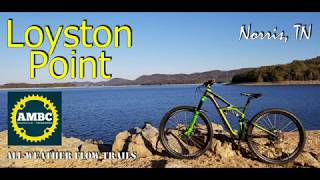
Loyston Point
- 3
- 5
-
Norris Dam State Park
- 12
- 31
- 5
Popular Norris Mountain Biking Trails
• 100 ★ 4.9 • 7 miles • 695 ft • 557 •
The 7.3 mile loop, more challenging than the , is geared toward intermediate trail users. There are more dramatic features that will allow maximum biking fun while remaining pedestrian friendly.
• 95 ★ 4.7 • 5 miles • 475 ft • 552 •
This 5.4 mile loop winds through the shoreline and ridges of Norris reservoir. Slope is gentle and trail was built to 48’’ wide to accommodate beginner bikers/hikers while still being very fun for advanced bikers/hikers. Trail...
• 100 ★ 5.0 • 1,821 ft • 45 ft • 526 •
Popular green difficulty singletrack. This multi-use trail can be used both directions and has a easy overall physical rating with a 45 ft green climb. It features roller coaster. Adaptive MTB rating: amtb blue. On average it takes 3 minutes to complete this trail.
• 100 ★ 4.3 • 4 miles • 292 ft • 411 •
New school trail design meets old school feel. While you will experience a level of bike optimized design, this trail offers some of that twisty tight singletrack and exposed rocks/roots from days gone by. Expect the climbs to be a bit...
• 100 ★ 3.0 • 1 mile • 99 ft • 371 •
New school trail design meets old school feel. While you will experience a level of bike optimized design, this trail offers some of that twisty tight singletrack and exposed rocks/roots from days gone by. Expect the climbs to be a bit...
• 95 ★ 4.0 • 2 miles • 577 ft • 209 •
Popular green difficulty doubletrack. This multi-use trail can be used both directions and has a moderate overall physical rating with a 577 ft blue climb. On average it takes 22 minutes to complete this trail.
• 90 ★ 4.4 • 1 mile • 0 ft • 187 •
Popular black diamond difficulty singletrack. This multi-use trail can be used both directions. On average it takes 10 minutes to complete this trail.
• 85 ★ 5.0 • 3,911 ft • 7 ft • 157 •
Popular black diamond difficulty singletrack. This multi-use trail can be used both directions and has a hard overall physical rating with a 7 ft black diamond climb. On average it takes 4 minutes to complete this trail.
Norris Mountain Bike Routes
★ 5.0 • 6 miles • 887 ft • 3 • Loop •
A backcountry gem with a good mix of flow downhill and moderate climbs. Altogether if ridden as plotted...
12 miles • 1,854 ft • 6 •
A fun tour of the intermediate trails in Norris. Start by pedaling HWY 441 and taking a left on Lower...
18 miles • 3,018 ft • 8 •
Start this advanced tour of Norris by climbing up - don't worry about missing out on the fun, you'll come...
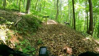
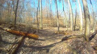
Photos of Norris Mountain Bike
Videos of Norris Mountain Bike
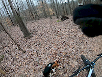
trail: Ridgecrest
4:27 |
141 |
Mar 3, 2019
trail: Lakeview
19:37 |
265 |
Jul 5, 2023 , Norris
trail: Loyston Loop
8:49 |
567 |
Nov 13, 2019 , Norris

trail: Mill Creek Loop
8:49 |
610 |
Nov 13, 2019 , Norris
trail: Lakeview
1325 |
Dec 22, 2017 , Norris
Recent Trail Reports
| status | trail | date | condition | info | user |
|---|---|---|---|---|---|
| Reservoir Hill Trail | May 9, 2026 @ 9:03am (America/New_York) May 9, 2026 | Ideal | GarretteRCTKb CVTA | ||
| Deer Ridge | May 9, 2026 @ 9:03am (America/New_York) May 9, 2026 | Ideal | GarretteRCTKb CVTA | ||
| Deer Ridge Road | May 9, 2026 @ 9:03am (America/New_York) May 9, 2026 | Ideal | GarretteRCTKb CVTA | ||
| Eric Harold Access Trail | May 9, 2026 @ 9:03am (America/New_York) May 9, 2026 | Ideal | GarretteRCTKb CVTA | ||
| Eagle | May 9, 2026 @ 9:03am (America/New_York) May 9, 2026 | Dry | GarretteRCTKb CVTA | ||
| Reservoir Hill Circle | May 9, 2026 @ 9:03am (America/New_York) May 9, 2026 | Ideal | GarretteRCTKb CVTA | ||
| Ridgecrest | May 9, 2026 @ 9:03am (America/New_York) May 9, 2026 | Ideal | GarretteRCTKb CVTA | ||
| White Pine | May 9, 2026 @ 9:03am (America/New_York) May 9, 2026 | Ideal | GarretteRCTKb CVTA | ||
| Scenic Cove | May 9, 2026 @ 9:03am (America/New_York) May 9, 2026 | Ideal | GarretteRCTKb CVTA | ||
| Sequoyah | May 9, 2026 @ 9:03am (America/New_York) May 9, 2026 | Ideal | GarretteRCTKb CVTA |
Activity Feed
| username | action | type | title | date |
|---|---|---|---|---|
| gregslion | wishlist | region | activity #96105748 | Jun 2, 2026 @ 1:14pm Jun 2, 2026 |
| BulletMmZAbK | wishlist | route | activity #95977004 | May 31, 2026 @ 2:12pm May 31, 2026 |
| Tbullet77 | wishlist | route | activity #95971158 | May 31, 2026 @ 1:03pm May 31, 2026 |
| teragambill00 | vote | trail | activity #95666988 and 2 more | May 27, 2026 @ 4:01pm May 27, 2026 |
| Eve606 | add | route | activity #95587046 | May 26, 2026 @ 1:31pm May 26, 2026 |
Recent Comments
| username | type | title | comment | date |
|---|---|---|---|---|
| trail | Several huge trees down | Oct 7, 2025 @ 4:09am Oct 7, 2025 | ||
| report | Large tree and a few more loyston loop | Sep 6, 2025 @ 4:27pm Sep 6, 2025 | ||
| report | Large trees down on the main trail up and the spur | May 20, 2025 @ 7:40am May 20, 2025 | ||
| trail | This trail is marked "No Bikes" | Oct 14, 2024 @ 5:40pm Oct 14, 2024 | ||
| trail | Downhill is a blast! Fast, well maintained,... | Sep 25, 2024 @ 3:09am Sep 25, 2024 |
Local Badges
-

Completionist0 awarded -

10 Blue Trails64 awarded -

Epic Mountain Bike Climb 2k2 awarded -

Climbing 10k Badge20 awarded -

Mountain Biking 100k Badge0 awarded -

Epic Ride Descent 2k2 awarded
Activity Type Stats
| activitytype | trails | distance | descent | descent distance | total vertical | rating | global rank | state rank | photos | reports | routes | ridelogs |
|---|---|---|---|---|---|---|---|---|---|---|---|---|
| Mountain Bike | 66 | 79 miles | 11,811 ft | 35 miles | 719 ft | #2,483 | #889 | 139 | 744 | 17 | 5,943 | |
| E-Bike | 66 | 79 miles | 11,811 ft | 35 miles | 719 ft | #2,194 | #951 | 4 | 676 | 3 | 691 | |
| Gravel Bike | 5 | 5 miles | 30 ft | 1,227 ft | 604 ft | #628 | #1,153 | 93 | 2 | 10 | ||
| Adaptive Bike | 19 | 23 miles | 2,762 ft | 8 miles | 604 ft | #418 | #1,763 | 223 | ||||
| Horse | 13 | 6 miles | 791 ft | 3 miles | 548 ft | #2,385 | #1,319 | 118 | 3 | |||
| Hike | 91 | 98 miles | 13,734 ft | 41 miles | 725 ft | #2,411 | #955 | 7 | 745 | 3 | 199 | |
| Trail Running | 91 | 98 miles | 13,734 ft | 41 miles | 725 ft | #2,338 | #716 | 745 | 2 | 174 | ||
| Observed Trials | 2 | 3 miles | 348 ft | 1 mile | 318 ft | 13 | ||||||
| ATV/ORV/OHV | 7 | 2 miles | 82 ft | 3,268 ft | 502 ft | #982 | #457 | 63 | 2 |
Frequently Asked Questions About Norris
▼
What are the best places to ride in Norris?
Norris has 3 areas to explore for mountain biking. The top rated areas are:
▼
What are the highest rated mountain biking trails in Norris?
The highest rated mountain biking trails in Norris are:
- Mill Creek Loop (4.4/5)
- Loyston Loop (4.4/5)
- Eagle (4.4/5)
- White Pine (4.3/5)
- Reservoir Hill Trail (4.3/5)
▼
What is the best time of the year to ride in Norris?
Based on ride log data, the most popular months to ride in Norris are:
- July (84 activities)
- August (59 activities)
- May (48 activities)
▼
Where can I park to ride in Norris?
There are 11 parking locations listed in Norris. The most popular parking spots are: View all parking and trailhead locations on the map to plan your visit.
Activities
Trails
- By Berralac
 & contributors
 - Admins: apply
- #35051 - 4,433 views
- norris activity log | embed map of Norris mountain bike trails | norris mountain biking points of interest
Downloading of trail gps tracks in kml & gpx formats is enabled for Norris.
You must login to download files.